@arcgis/core 5.1.0-next.18 → 5.1.0-next.19
This diff represents the content of publicly available package versions that have been released to one of the supported registries. The information contained in this diff is provided for informational purposes only and reflects changes between package versions as they appear in their respective public registries.
- package/Camera.d.ts +1 -1
- package/Ground.d.ts +7 -7
- package/PopupTemplate.d.ts +6 -6
- package/WebScene.d.ts +1 -1
- package/analysis/AreaMeasurementAnalysis.d.ts +1 -1
- package/analysis/DirectLineMeasurementAnalysis.d.ts +1 -1
- package/analysis/LengthDimension.d.ts +4 -4
- package/analysis/ShadowCastAnalysis.d.ts +3 -3
- package/analysis/SliceAnalysis.d.ts +1 -1
- package/analysis/SlicePlane.d.ts +1 -1
- package/analysis/VolumeMeasurement/VolumeMeasurementCutFillOptions.d.ts +1 -1
- package/analysis/VolumeMeasurementAnalysis.d.ts +1 -1
- package/applications/Components/applySetUtils.d.ts +1 -1
- package/applications/WebEditor/geometryUtils.d.ts +26 -0
- package/applications/WebEditor/geometryUtils.js +2 -0
- package/assets/esri/core/workers/RemoteClient.js +1 -1
- package/assets/esri/core/workers/chunks/045e4e520d6dffe06ba7.js +1 -0
- package/assets/esri/core/workers/chunks/05d6cd51ca970705e46a.js +1 -0
- package/assets/esri/core/workers/chunks/{fd125618f513bc2f5206.js → 08d73543c713984f6ecf.js} +1 -1
- package/assets/esri/core/workers/chunks/{982e709d2cef971ecd82.js → 0d9d33f29124d464a4cb.js} +1 -1
- package/assets/esri/core/workers/chunks/{07317f6b57c1314db442.js → 0e1d559d05229ef92e35.js} +1 -1
- package/assets/esri/core/workers/chunks/{2762149a922275136171.js → 112227b862b935123ddf.js} +2 -2
- package/assets/esri/core/workers/chunks/128cdb4a02549abc68b5.js +1 -0
- package/assets/esri/core/workers/chunks/1336f685bae5f1251558.js +1 -0
- package/assets/esri/core/workers/chunks/{b71e4f48377fefe2537d.js → 15d46482ec096e3ce161.js} +1 -1
- package/assets/esri/core/workers/chunks/1794db88a2006711eff3.js +1 -0
- package/assets/esri/core/workers/chunks/{a327f36561f093dc0fab.js → 19fcc74d34cbbaa56a41.js} +1 -1
- package/assets/esri/core/workers/chunks/{d0d1378e714ff0e43e26.js → 1cfa8d404d42b9eccf78.js} +1 -1
- package/assets/esri/core/workers/chunks/1e916e552ce7d53692d2.js +1 -0
- package/assets/esri/core/workers/chunks/2011da6dfc4bb89829c6.js +1 -0
- package/assets/esri/core/workers/chunks/{1e29a114c1cfe21121c4.js → 203ef5459fc5dde12851.js} +1 -1
- package/assets/esri/core/workers/chunks/215c54520d0da638fe57.js +1 -0
- package/assets/esri/core/workers/chunks/22045f85e503ae0ec8f4.js +1 -0
- package/assets/esri/core/workers/chunks/{78fc7ef00cc4931ef47d.js → 2351b713ba3d05de0728.js} +1 -1
- package/assets/esri/core/workers/chunks/{0a4ebb5dca630a4ab0dd.js → 236f8137ae505c8f0764.js} +1 -1
- package/assets/esri/core/workers/chunks/249630af2fb01257eb75.js +1 -0
- package/assets/esri/core/workers/chunks/{1f30558e3ad6ac68bdb8.js → 25d34552bfb255af9467.js} +1 -1
- package/assets/esri/core/workers/chunks/{7cd4280d24b24045bd7e.js → 27e14277128446e76b45.js} +1 -1
- package/assets/esri/core/workers/chunks/3214763f268622f09986.js +1 -0
- package/assets/esri/core/workers/chunks/32a1ccc145c9f6091e13.js +1 -0
- package/assets/esri/core/workers/chunks/34691b147318b2cfdd45.js +1 -0
- package/assets/esri/core/workers/chunks/{18c05353d6d8950d1491.js → 36215b2c0b1020743458.js} +1 -1
- package/assets/esri/core/workers/chunks/3d3b1ce112be6ea31d93.js +1 -0
- package/assets/esri/core/workers/chunks/{2badadf8032e166b34ec.js → 3f3c63420644f9522ab1.js} +1 -1
- package/assets/esri/core/workers/chunks/41108f58f0f439ebba3f.js +1 -0
- package/assets/esri/core/workers/chunks/{bc9997d15ec0a86793c6.js → 415957a42e45eb21aa84.js} +1 -1
- package/assets/esri/core/workers/chunks/43c797bfc2191b51875b.js +1 -0
- package/assets/esri/core/workers/chunks/460a82f3e4838b13e3b4.js +1 -0
- package/assets/esri/core/workers/chunks/4ad6f80488aa218b95e3.js +1 -0
- package/assets/esri/core/workers/chunks/4e9863a11d09900baf30.js +1 -0
- package/assets/esri/core/workers/chunks/4fe210314813ea1f7a26.js +1 -0
- package/assets/esri/core/workers/chunks/5028de543cc1b8e60e65.js +1 -0
- package/assets/esri/core/workers/chunks/52705ccbb452a3edb064.js +1 -0
- package/assets/esri/core/workers/chunks/{17b39b88547968048113.js → 531c55f3b8e708ccf767.js} +1 -1
- package/assets/esri/core/workers/chunks/{72acfb74fd9ab9bae923.js → 53e348f5585fa8c53fe8.js} +2 -2
- package/assets/esri/core/workers/chunks/54c545f44b7ce21fb604.js +1 -0
- package/assets/esri/core/workers/chunks/558e9fed2e58cbbf9947.js +1 -0
- package/assets/esri/core/workers/chunks/{b50d2d3379654de1f2f3.js → 58134617fb7530836b81.js} +1 -1
- package/assets/esri/core/workers/chunks/58c4be467a922fe37f01.js +1 -0
- package/assets/esri/core/workers/chunks/{ec4e2f18453e1cb68fed.js → 5f10f39835cb40179000.js} +1 -1
- package/assets/esri/core/workers/chunks/{7b1964255722e756eba3.js → 5f9eeab833a6c08c76c4.js} +1 -1
- package/assets/esri/core/workers/chunks/651b46aeabf22ff53a38.js +1 -0
- package/assets/esri/core/workers/chunks/65f86594c42ff82095fe.js +1 -0
- package/assets/esri/core/workers/chunks/{90316fb569389d48920f.js → 666f201d222c50ab8428.js} +1 -1
- package/assets/esri/core/workers/chunks/677f5e444ff588ab670f.js +1 -0
- package/assets/esri/core/workers/chunks/{323f6077a659416c4cee.js → 6a9a96aa811c1d3b6edb.js} +1 -1
- package/assets/esri/core/workers/chunks/6bf7d8de86b9eb76f920.js +1 -0
- package/assets/esri/core/workers/chunks/6c0b7890c8eec7febe28.js +1 -0
- package/assets/esri/core/workers/chunks/{25c189e894927099c239.js → 6c85396c90941a042c33.js} +1 -1
- package/assets/esri/core/workers/chunks/{18b0776aef1536867ab8.js → 6f337c3ccd84d90a35e5.js} +1 -1
- package/assets/esri/core/workers/chunks/711bec78dc00fad0f78d.js +1 -0
- package/assets/esri/core/workers/chunks/7382c9882525101eddad.js +1 -0
- package/assets/esri/core/workers/chunks/778ab9e4c3928b0d7d74.js +1 -0
- package/assets/esri/core/workers/chunks/{a3e8b7185d63a0f85931.js → 79c69ae86a1f4a56f7c7.js} +1 -1
- package/assets/esri/core/workers/chunks/{0420fb4b3592f8a26b1f.js → 7d2b1e5402a88b6bee85.js} +1 -1
- package/assets/esri/core/workers/chunks/7ec83fc059325e207825.js +1 -0
- package/assets/esri/core/workers/chunks/7f385e9c88df3395e678.js +1 -0
- package/assets/esri/core/workers/chunks/{66ed527cd8ad11d008be.js → 80d51d58db09b9f96cb5.js} +1 -1
- package/assets/esri/core/workers/chunks/81a45d7e9dadf678b584.js +1 -0
- package/assets/esri/core/workers/chunks/81c758bdc07ed9d9a132.js +1 -0
- package/assets/esri/core/workers/chunks/{8670d9d11950f3c61b79.js → 83711695e16912e9b9c5.js} +1 -1
- package/assets/esri/core/workers/chunks/8c3bf66f8543cedc72ef.js +1 -0
- package/assets/esri/core/workers/chunks/8cade3af17a8bb6d4e37.js +1 -0
- package/assets/esri/core/workers/chunks/920d6330df72e2f01d19.js +1 -0
- package/assets/esri/core/workers/chunks/9dc7abca1d1eb9ba5b58.js +1 -0
- package/assets/esri/core/workers/chunks/9e054c264b17f04b7efa.js +1 -0
- package/assets/esri/core/workers/chunks/a143a6f8e2f21548b244.js +1 -0
- package/assets/esri/core/workers/chunks/a48a6232fa33084cb686.js +1 -0
- package/assets/esri/core/workers/chunks/a4947d5d2fa6b7bd399b.js +1 -0
- package/assets/esri/core/workers/chunks/a49f1172b17c14527acf.js +1 -0
- package/assets/esri/core/workers/chunks/{6af14a0217077d9ab47f.js → aaf3ed508d30ed583915.js} +1 -1
- package/assets/esri/core/workers/chunks/{ab9156be67332338bbe4.js → aceec85ce64a3e6d8761.js} +1 -1
- package/assets/esri/core/workers/chunks/b10b3eb8c2ed9be14ab2.js +1 -0
- package/assets/esri/core/workers/chunks/b315b3771d0d19681aa5.js +1 -0
- package/assets/esri/core/workers/chunks/{91858b02da40ff251ab2.js → b397a9f87082705301a4.js} +2 -2
- package/assets/esri/core/workers/chunks/b40e4ed067da65c3d7ce.js +1 -0
- package/assets/esri/core/workers/chunks/b4b16914950792c46bd3.js +1 -0
- package/assets/esri/core/workers/chunks/{360b3499e2a671c309ce.js → b6969a42602517a6ef1c.js} +1 -1
- package/assets/esri/core/workers/chunks/baad696d84ab78b3d00e.js +2 -0
- package/assets/esri/core/workers/chunks/{2e7d4a437717606bc39c.js → bc2dcbdc414d157ab727.js} +1 -1
- package/assets/esri/core/workers/chunks/{1aa2187597f7c4adb67f.js → bcb254cb7297fec88679.js} +1 -1
- package/assets/esri/core/workers/chunks/{2d1a772abd730b61854f.js → bd2125e0a68378533641.js} +1 -1
- package/assets/esri/core/workers/chunks/{6bd910e0480451a8d6aa.js → bde2c3199f667b63dbe8.js} +1 -1
- package/assets/esri/core/workers/chunks/bf595eb10f99b8a96baa.js +1 -0
- package/assets/esri/core/workers/chunks/c0b6706f86665cec85f8.js +1 -0
- package/assets/esri/core/workers/chunks/{12fd2e26e949d90abfbd.js → c3c6d337ff53e5d921e8.js} +1 -1
- package/assets/esri/core/workers/chunks/c461c19e4fdbdd2e94d4.js +1 -0
- package/assets/esri/core/workers/chunks/{4214f46bee613dea72f3.js → c66aa57b6360963bd938.js} +1 -1
- package/assets/esri/core/workers/chunks/c873ac660e7d5dc88781.js +1 -0
- package/assets/esri/core/workers/chunks/c99f36159b5ed6f9267e.js +1 -0
- package/assets/esri/core/workers/chunks/cb5f4820277f3fc7ff2f.js +1 -0
- package/assets/esri/core/workers/chunks/cbcb3530375e280bfeac.js +1 -0
- package/assets/esri/core/workers/chunks/cf4202ad468501ef24cf.js +1 -0
- package/assets/esri/core/workers/chunks/d03d50f3247327257d8b.js +1 -0
- package/assets/esri/core/workers/chunks/{a5af20f3d484d2d3bafe.js → d2017b0b27b9e4ada922.js} +1 -1
- package/assets/esri/core/workers/chunks/d2d9c1f32a75befe168b.js +1 -0
- package/assets/esri/core/workers/chunks/{5c12a9b0db317620dce2.js → d39f5d57f7e35c00ca16.js} +1 -1
- package/assets/esri/core/workers/chunks/d5b4487a983921572e58.js +1 -0
- package/assets/esri/core/workers/chunks/d78b2f85ec9212a973e8.js +1 -0
- package/assets/esri/core/workers/chunks/d9dc8d9fc8ab2706f96b.js +1 -0
- package/assets/esri/core/workers/chunks/{09cf8aed89a1ea1f8b28.js → da42da04a9df651b06cc.js} +1 -1
- package/assets/esri/core/workers/chunks/{a82587f69c4bbcac7e0b.js → dc7df2072c0ebed5602c.js} +1 -1
- package/assets/esri/core/workers/chunks/dd24cddc406f610d2483.js +1 -0
- package/assets/esri/core/workers/chunks/dd3789e71270a4640551.js +1 -0
- package/assets/esri/core/workers/chunks/de5719ef663224860af5.js +1 -0
- package/assets/esri/core/workers/chunks/de6438fdbe38d32c4ad5.js +1 -0
- package/assets/esri/core/workers/chunks/ded71a656e2626a411f9.js +1 -0
- package/assets/esri/core/workers/chunks/df1fa0f7e8f7e2bcc2e6.js +1 -0
- package/assets/esri/core/workers/chunks/{b705f837caa76cee81fc.js → e09722903e63f6cc2540.js} +1 -1
- package/assets/esri/core/workers/chunks/e2e03622936d2b35afc0.js +1 -0
- package/assets/esri/core/workers/chunks/e33f5780fb45ac7ca889.js +1 -0
- package/assets/esri/core/workers/chunks/{eb9e913fe0dfcc71cf92.js → e4611ebd7dba7692a914.js} +1 -1
- package/assets/esri/core/workers/chunks/e52793690dff1a199647.js +1 -0
- package/assets/esri/core/workers/chunks/{c13efb74aa4602f6a1ee.js → e56a10a475ce128b5fce.js} +1 -1
- package/assets/esri/core/workers/chunks/{9531f17cecd50431cce2.js → e8ae71e482b8d5f54a72.js} +1 -1
- package/assets/esri/core/workers/chunks/ea633a6a3b9ea8ce965d.js +1 -0
- package/assets/esri/core/workers/chunks/eae1c098c16e2faaf90d.js +1 -0
- package/assets/esri/core/workers/chunks/{f7e25a85a79c4e3c1c9f.js → ec63c0fa21cd3c872633.js} +1 -1
- package/assets/esri/core/workers/chunks/ece363681bb09072f379.js +1 -0
- package/assets/esri/core/workers/chunks/edaae0fc63d16b0f675d.js +2 -0
- package/assets/esri/core/workers/chunks/{8650fbe1db55b7280c00.js → ef4237dc7b67c9039826.js} +1 -1
- package/assets/esri/core/workers/chunks/ef9106ee818ec732b670.js +1 -0
- package/assets/esri/core/workers/chunks/f121a0bf33c03abfa0b6.js +1 -0
- package/assets/esri/core/workers/chunks/{a2f38e86acf45272dbc2.js → f7506c9d57b2ae0c5fd3.js} +1 -1
- package/assets/esri/core/workers/chunks/fab7e3e07d700d7bb651.js +1 -0
- package/assets/esri/core/workers/chunks/fcc8d0b60f7c2397e550.js +1 -0
- package/assets/esri/core/workers/chunks/fe5aec7e2da4465422b4.js +1 -0
- package/assets/esri/themes/base/widgets/_BasemapGallery.scss +1 -0
- package/assets/esri/themes/base/widgets/_Editor.scss +1 -0
- package/assets/esri/themes/dark/main.css +1 -1
- package/assets/esri/themes/light/main.css +1 -1
- package/assets/esri/themes/light/view.css +1 -1
- package/chunks/Envelope.js +1 -1
- package/chunks/GeodeticDistanceCalculator-Ce-woMPw.js +1 -1
- package/chunks/GeodeticUtils.js +1 -1
- package/chunks/Geometry.js +1 -1
- package/chunks/MultiPathImpl.js +1 -1
- package/chunks/OperatorGeodesicBuffer.js +1 -1
- package/chunks/OperatorGeodeticArea.js +1 -1
- package/chunks/OperatorGeodeticDensifyByLength.js +1 -1
- package/chunks/OperatorGeodeticLength.js +1 -1
- package/chunks/OperatorIntegrate.js +2 -0
- package/chunks/OperatorMultiPartToSinglePart.js +1 -1
- package/chunks/OperatorProximityGeodesic.js +1 -1
- package/chunks/OperatorShapePreservingLength.js +1 -1
- package/chunks/OperatorShapePreservingProject.js +1 -1
- package/chunks/Point2D.js +1 -1
- package/chunks/SpatialReference.js +1 -1
- package/chunks/containsOperator.js +1 -1
- package/chunks/disjointOperator.js +1 -1
- package/chunks/relateOperator.js +1 -1
- package/config.js +1 -1
- package/core/has.js +1 -1
- package/editing/sharedTemplates/SharedTemplateMetadata.d.ts +0 -31
- package/{layers/graphics/editingSupport.d.ts → editing/types.d.ts} +8 -8
- package/editing/types.js +2 -0
- package/effects/FocusAreas.d.ts +1 -1
- package/form/elements/FieldElement.d.ts +1 -1
- package/form/elements/GroupElement.d.ts +1 -1
- package/form/elements/TextElement.d.ts +1 -1
- package/form/elements/inputs/ComboBoxInput.d.ts +1 -1
- package/form/elements/inputs/RadioButtonsInput.d.ts +1 -1
- package/form/elements/inputs/SwitchInput.d.ts +1 -1
- package/geometry/Mesh.d.ts +7 -7
- package/geometry/operators/alphaShapeOperator.d.ts +1 -1
- package/geometry/operators/areaOperator.d.ts +1 -1
- package/geometry/operators/bufferOperator.d.ts +1 -1
- package/geometry/operators/centroidOperator.d.ts +1 -1
- package/geometry/operators/clipOperator.d.ts +1 -1
- package/geometry/operators/containsOperator.d.ts +1 -1
- package/geometry/operators/convexHullOperator.d.ts +1 -1
- package/geometry/operators/crossesOperator.d.ts +1 -1
- package/geometry/operators/cutOperator.d.ts +1 -1
- package/geometry/operators/densifyOperator.d.ts +1 -1
- package/geometry/operators/differenceOperator.d.ts +1 -1
- package/geometry/operators/disjointOperator.d.ts +1 -1
- package/geometry/operators/distanceOperator.d.ts +1 -1
- package/geometry/operators/extendOperator.js +1 -1
- package/geometry/operators/generalizeOperator.d.ts +1 -1
- package/geometry/operators/geodesicProximityOperator.d.ts +1 -1
- package/geometry/operators/geodeticDistanceOperator.d.ts +1 -1
- package/geometry/operators/geodeticUtilsOperator.d.ts +2 -2
- package/geometry/operators/graphicBufferOperator.d.ts +1 -1
- package/geometry/operators/gx/operatorAlphaShape.js +1 -1
- package/geometry/operators/gx/operatorAutoComplete.js +1 -1
- package/geometry/operators/gx/operatorConvexHull.js +1 -1
- package/geometry/operators/gx/operatorIntegrate.js +1 -1
- package/geometry/operators/gx/operatorIntersection.js +1 -1
- package/geometry/operators/gx/operatorLabelPoint.js +1 -1
- package/geometry/operators/gx/operatorMinimumBoundingCircle.js +1 -1
- package/geometry/operators/gx/operatorPolygonOverlay.js +1 -1
- package/geometry/operators/gx/operatorSymmetricDifference.js +1 -1
- package/geometry/operators/intersectionOperator.d.ts +1 -1
- package/geometry/operators/intersectsOperator.d.ts +1 -1
- package/geometry/operators/isNearOperator.d.ts +1 -1
- package/geometry/operators/json/containsOperator.js +1 -1
- package/geometry/operators/json/disjointOperator.js +1 -1
- package/geometry/operators/lengthOperator.d.ts +1 -1
- package/geometry/operators/locateBetweenOperator.d.ts +1 -1
- package/geometry/operators/multiPartToSinglePartOperator.d.ts +1 -1
- package/geometry/operators/offsetOperator.d.ts +5 -5
- package/geometry/operators/overlapsOperator.d.ts +1 -1
- package/geometry/operators/proximityOperator.d.ts +1 -1
- package/geometry/operators/reshapeOperator.js +1 -1
- package/geometry/operators/simplifyOGCOperator.d.ts +1 -1
- package/geometry/operators/simplifyOperator.d.ts +1 -1
- package/geometry/operators/support/GeographicTransformation.d.ts +6 -4
- package/geometry/operators/support/GeographicTransformation.js +1 -1
- package/geometry/operators/support/GeographicTransformationStep.d.ts +5 -3
- package/geometry/operators/support/GeographicTransformationStep.js +1 -1
- package/geometry/operators/support/Transformation.d.ts +6 -6
- package/geometry/operators/support/jsonConverter.js +1 -1
- package/geometry/operators/support/projectionTransformation.js +1 -1
- package/geometry/operators/symmetricDifferenceOperator.d.ts +1 -1
- package/geometry/operators/touchesOperator.d.ts +1 -1
- package/geometry/operators/unionOperator.d.ts +1 -1
- package/geometry/operators/withinOperator.d.ts +1 -1
- package/geometry/support/MeshMaterialMetallicRoughness.d.ts +1 -1
- package/geometry/support/zscale.js +1 -1
- package/graphic/KnowledgeGraphGraphicOrigin.d.ts +0 -1
- package/graphic/LinkChartGraphicOrigin.js +1 -1
- package/interfaces.d.ts +60 -60
- package/kernel.js +1 -1
- package/layers/BuildingSceneLayer.d.ts +4 -4
- package/layers/CSVLayer.d.ts +319 -542
- package/layers/CSVLayer.js +1 -1
- package/layers/CatalogLayer.d.ts +2 -2
- package/layers/ElevationLayer.d.ts +1 -1
- package/layers/FeatureLayer.d.ts +15 -15
- package/layers/FeatureLayer.js +1 -1
- package/layers/GeoJSONLayer.d.ts +6 -6
- package/layers/GeoRSSLayer.d.ts +1 -1
- package/layers/GraphicsLayer.d.ts +2 -2
- package/layers/ImageryLayer.d.ts +3 -3
- package/layers/ImageryTileLayer.d.ts +2 -2
- package/layers/IntegratedMesh3DTilesLayer.d.ts +6 -6
- package/layers/IntegratedMeshLayer.d.ts +7 -7
- package/layers/MapImageLayer.d.ts +1 -1
- package/layers/MediaLayer.d.ts +1 -1
- package/layers/OGCFeatureLayer.d.ts +2 -2
- package/layers/OrientedImageryLayer.d.ts +6 -6
- package/layers/OrientedImageryLayer.js +1 -1
- package/layers/PointCloudLayer.d.ts +1 -1
- package/layers/SceneLayer.d.ts +7 -7
- package/layers/StreamLayer.d.ts +2 -2
- package/layers/SubtypeGroupLayer.d.ts +5 -5
- package/layers/VectorTileLayer.d.ts +2 -2
- package/layers/VideoLayer.d.ts +1 -1
- package/layers/VoxelLayer.d.ts +8 -8
- package/layers/WFSLayer.d.ts +6 -6
- package/layers/catalog/CatalogFootprintLayer.d.ts +1 -1
- package/layers/graphics/applyEditsUtils.js +1 -1
- package/layers/graphics/data/QueryEngineCapabilities.js +1 -1
- package/layers/graphics/data/QueryEngineResult.js +1 -1
- package/layers/graphics/editingSupport.js +1 -1
- package/layers/graphics/sources/FeatureLayerSource.js +1 -1
- package/layers/graphics/sources/OGCFeatureSource.js +1 -1
- package/layers/graphics/sources/support/CSVSourceWorker.js +1 -1
- package/layers/graphics/sources/support/ParquetSourceWorker.js +1 -1
- package/layers/graphics/sources/support/QueryTask.js +1 -1
- package/layers/mixins/ArcGISImageService.js +1 -1
- package/layers/mixins/BlendLayer.d.ts +6 -6
- package/layers/mixins/EditBusLayer.d.ts +1 -1
- package/layers/orientedImagery/core/ExposurePoint.js +1 -1
- package/layers/orientedImagery/transformations/utils.js +1 -1
- package/layers/pointCloudFilters/PointCloudReturnFilter.d.ts +1 -1
- package/layers/pointCloudFilters/PointCloudValueFilter.d.ts +1 -1
- package/layers/raster/datasets/ImageServerRaster.js +1 -1
- package/layers/raster/functions/ExtractBandFunction.js +1 -1
- package/layers/support/DimensionalDefinition.d.ts +2 -2
- package/layers/support/FeatureEffect.d.ts +4 -4
- package/layers/support/FeatureFilter.d.ts +17 -17
- package/layers/support/FeatureReductionBinning.d.ts +1 -1
- package/layers/support/FeatureReductionCluster.d.ts +9 -9
- package/layers/support/LabelClass.d.ts +2 -2
- package/layers/support/RasterFunction.d.ts +1 -1
- package/layers/support/SceneFilter.d.ts +2 -2
- package/layers/support/SceneModification.d.ts +3 -3
- package/layers/support/SubtypeSublayer.d.ts +5 -5
- package/layers/support/arcgisLayerUrl.js +1 -1
- package/layers/support/capabilities.js +1 -1
- package/layers/support/featurePopupQueryUtils.js +1 -1
- package/layers/support/serviceCapabilitiesUtils.js +1 -1
- package/networks/support/Circuit.d.ts +11 -2
- package/networks/support/CircuitSection.d.ts +3 -2
- package/networks/support/TraceConfiguration.d.ts +5 -4
- package/networks/support/UNTraceConfiguration.d.ts +6 -5
- package/networks/support/jsonTypes.d.ts +305 -0
- package/package.json +3 -3
- package/popup/content/AttachmentsContent.d.ts +1 -1
- package/popup/content/BarChartMediaInfo.d.ts +1 -1
- package/popup/content/ColumnChartMediaInfo.d.ts +1 -1
- package/popup/content/FieldsContent.d.ts +1 -1
- package/popup/content/ImageMediaInfo.d.ts +1 -1
- package/popup/content/LineChartMediaInfo.d.ts +1 -1
- package/popup/content/MediaContent.d.ts +1 -1
- package/popup/content/PieChartMediaInfo.d.ts +1 -1
- package/popup/content/RelationshipContent.d.ts +1 -1
- package/popup/content/TextContent.d.ts +1 -1
- package/portal/schemas/definitions.js +1 -1
- package/portal/support/urlUtils.js +1 -1
- package/renderers/DotDensityRenderer.d.ts +3 -3
- package/renderers/FlowRenderer.d.ts +6 -6
- package/renderers/HeatmapRenderer.d.ts +3 -3
- package/renderers/PieChartRenderer.d.ts +1 -1
- package/renderers/RasterShadedReliefRenderer.d.ts +1 -1
- package/renderers/Renderer.d.ts +2 -2
- package/renderers/SimpleRenderer.d.ts +1 -1
- package/renderers/VectorFieldRenderer.d.ts +1 -1
- package/renderers/mixins/VisualVariablesMixin.d.ts +8 -8
- package/rest/featureService/FeatureService.js +1 -1
- package/rest/featureService/types.d.ts +7 -1
- package/rest/query/operations/editsZScale.js +1 -1
- package/rest/query/operations/pbfFlatFeatureSet.js +1 -1
- package/rest/query/support/AttachmentInfo.d.ts +1 -1
- package/rest/support/AutoIntervalBinParameters.d.ts +1 -1
- package/rest/support/DateBinParameters.d.ts +1 -1
- package/rest/support/FixedBoundariesBinParameters.d.ts +1 -1
- package/rest/support/FixedIntervalBinParameters.d.ts +1 -1
- package/rest/support/Query.d.ts +3 -2
- package/rest/types.d.ts +1 -3
- package/smartMapping/labels/clusters.d.ts +1 -1
- package/smartMapping/popup/clusters.d.ts +2 -2
- package/smartMapping/popup/templates.d.ts +1 -1
- package/smartMapping/raster/renderers/flow.d.ts +2 -2
- package/smartMapping/renderers/color.d.ts +12 -12
- package/smartMapping/renderers/predominance.d.ts +3 -3
- package/smartMapping/renderers/relationship.d.ts +15 -15
- package/smartMapping/renderers/univariateColorSize.d.ts +4 -4
- package/smartMapping/support/adapters/FeatureLayerAdapter.js +1 -1
- package/smartMapping/support/adapters/InMemoryLayerAdapter.js +1 -1
- package/smartMapping/support/utils.js +1 -1
- package/smartMapping/symbology/color.d.ts +4 -4
- package/smartMapping/symbology/flow.d.ts +2 -2
- package/smartMapping/symbology/types.d.ts +18 -18
- package/support/revision.js +1 -1
- package/symbols/CIMSymbol.d.ts +1 -1
- package/symbols/FillSymbol3DLayer.d.ts +3 -3
- package/symbols/IconSymbol3DLayer.d.ts +1 -1
- package/symbols/LabelSymbol3D.d.ts +2 -2
- package/symbols/LineStyleMarker3D.d.ts +7 -7
- package/symbols/LineSymbol3D.d.ts +2 -2
- package/symbols/LineSymbol3DLayer.d.ts +7 -7
- package/symbols/LineSymbolMarker.d.ts +6 -6
- package/symbols/MarkerSymbol.d.ts +1 -1
- package/symbols/MeshSymbol3D.d.ts +2 -2
- package/symbols/ObjectSymbol3DLayer.d.ts +1 -1
- package/symbols/PathSymbol3DLayer.d.ts +14 -14
- package/symbols/PictureFillSymbol.d.ts +1 -1
- package/symbols/PictureMarkerSymbol.d.ts +1 -1
- package/symbols/PointSymbol3D.d.ts +3 -3
- package/symbols/PolygonSymbol3D.d.ts +8 -26
- package/symbols/PolygonSymbol3D.js +1 -1
- package/symbols/SimpleFillSymbol.d.ts +8 -8
- package/symbols/SimpleLineSymbol.d.ts +20 -20
- package/symbols/SimpleMarkerSymbol.d.ts +7 -7
- package/symbols/Symbol3DLayer.d.ts +16 -16
- package/symbols/TextSymbol.d.ts +1 -1
- package/symbols/TextSymbol3DLayer.d.ts +1 -1
- package/symbols/WaterSymbol3DLayer.d.ts +3 -3
- package/symbols/WebStyleSymbol.d.ts +1 -1
- package/symbols/callouts/Callout3D.d.ts +1 -1
- package/symbols/callouts/LineCallout3D.d.ts +3 -3
- package/symbols/cim/CIMCursor.js +1 -1
- package/symbols/cim/CIMSymbolHelper.js +1 -1
- package/symbols/cim/cimAnalyzer.js +1 -1
- package/symbols/cim/placements/PlacementAlongLineSameSize.js +1 -1
- package/symbols/cim/placements/PlacementAtExtremities.js +1 -1
- package/symbols/cim/placements/PlacementAtMeasuredUnits.js +1 -1
- package/symbols/cim/placements/PlacementAtRatioPositions.js +1 -1
- package/symbols/cim/placements/PlacementOnLine.js +1 -1
- package/symbols/cim/placements/PlacementOnVertices.js +1 -1
- package/symbols/cim/types.d.ts +30 -23
- package/symbols/edges/Edges3D.d.ts +1 -1
- package/symbols/edges/SolidEdges3D.d.ts +1 -1
- package/symbols/patterns/LineStylePattern3D.d.ts +11 -11
- package/symbols/patterns/StylePattern3D.d.ts +8 -8
- package/symbols/support/ElevationInfo.d.ts +2 -2
- package/symbols/support/IconSymbol3DLayerResource.d.ts +6 -6
- package/symbols/support/ObjectSymbol3DLayerResource.d.ts +7 -7
- package/symbols/support/Symbol3DEmissive.d.ts +24 -13
- package/symbols/support/Symbol3DVerticalOffset.d.ts +2 -2
- package/symbols/support/previewSymbol3D.js +1 -1
- package/versionManagement/VersionManagementService.d.ts +3 -2
- package/views/2d/analysis/DistanceMeasurement/utils.js +1 -1
- package/views/2d/engine/webgl/shaderGraph/techniques/GraphicInstanceStore.js +1 -1
- package/views/2d/engine/webgl/shaderGraph/techniques/animated/AAnimatedPolyShader.js +1 -1
- package/views/2d/engine/webgl/shaderGraph/techniques/animated/AnimatedFillShader.js +1 -1
- package/views/2d/engine/webgl/shaderGraph/techniques/animated/AnimatedPolyMeshWriters.js +1 -1
- package/views/2d/engine/webgl/shaderGraph/techniques/animated/attributes.js +1 -1
- package/views/2d/engine/webgl/shaders/sources/shaderRepository.js +1 -1
- package/views/2d/layers/BaseLayerViewGL2D.d.ts +1 -1
- package/views/2d/layers/features/schema/processor/symbols/ComplexSymbolSchema.js +1 -1
- package/views/2d/layers/imagery/BaseImageryTileSubView2D.js +1 -1
- package/views/2d/types.d.ts +3 -3
- package/views/3d/environment/CloudyWeather.d.ts +1 -1
- package/views/3d/environment/Environment.d.ts +4 -4
- package/views/3d/environment/FoggyWeather.d.ts +1 -1
- package/views/3d/environment/RainyWeather.d.ts +1 -1
- package/views/3d/environment/SnowyWeather.d.ts +1 -1
- package/views/3d/environment/SunLighting.d.ts +1 -1
- package/views/3d/environment/SunnyWeather.d.ts +1 -1
- package/views/3d/environment/VirtualLighting.d.ts +1 -1
- package/views/3d/layers/graphics/Deconflictor.js +1 -1
- package/views/3d/layers/i3s/I3SViewportQueries.js +1 -1
- package/views/3d/support/MemoryController.js +1 -1
- package/views/3d/support/orientedBoundingBox.js +1 -1
- package/views/3d/webgl/RenderNode.d.ts +46 -57
- package/views/3d/webgl-engine/collections/Component/Material/ComponentMaterial.js +1 -1
- package/views/3d/webgl-engine/lib/Viewshed.js +1 -1
- package/views/3d/webgl.d.ts +8 -5
- package/views/DOMContainer.js +1 -1
- package/views/Magnifier.d.ts +3 -3
- package/views/MapView.d.ts +7 -7
- package/views/SceneView.d.ts +34 -37
- package/views/View.d.ts +2 -2
- package/views/analysis/ElevationProfile/ElevationProfileChart.js +1 -1
- package/views/draw/DrawOperation.js +1 -1
- package/views/draw/DrawTool.js +1 -1
- package/views/draw/plugins/BezierSegmentPlugin.js +1 -1
- package/views/draw/plugins/CircularArcSegmentPlugin.js +1 -1
- package/views/draw/plugins/FreehandSegmentPlugin.js +1 -1
- package/views/draw/plugins/MultipointPlugin.js +1 -1
- package/views/draw/plugins/PointPlugin.js +1 -1
- package/views/draw/plugins/PolygonPlugin.js +1 -1
- package/views/draw/plugins/PolylinePlugin.js +1 -1
- package/views/draw/plugins/ShapePlugin.js +1 -1
- package/views/draw/support/managers/TooltipManager.js +1 -1
- package/views/interactive/sketch/SketchLabelOptions.d.ts +1 -1
- package/views/interactive/sketch/SketchTooltipOptions.d.ts +1 -1
- package/views/interactive/snapping/RightAngleSnapper.js +1 -1
- package/views/interactive/snapping/RightAngleTriangleSnapper.js +1 -1
- package/views/interactive/snapping/SnappingOptions.d.ts +7 -7
- package/views/interactive/snapping/featureSources/featureServiceSource/FeatureServiceTiledFetcher.js +1 -1
- package/views/interactive/tooltip/content/TooltipContentDynamic.js +1 -1
- package/views/interactive/tooltip/infos/DynamicTooltipInfo.js +1 -1
- package/views/layers/FeatureLikeLayerView.js +1 -1
- package/views/support/HighlightOptions.d.ts +1 -1
- package/views/support/flow/dataUtils.js +1 -1
- package/views/ui/DefaultUI.d.ts +2 -2
- package/webscene/Environment.d.ts +10 -10
- package/webscene/Glow.d.ts +13 -2
- package/webscene/background/ColorBackground.d.ts +1 -1
- package/webscene/spec-certification/spec.js +1 -1
- package/widgets/AreaMeasurement2D.d.ts +1 -1
- package/widgets/AreaMeasurement3D.d.ts +2 -2
- package/widgets/Attachments.d.ts +1 -1
- package/widgets/Attribution.d.ts +1 -1
- package/widgets/BasemapGallery.d.ts +1 -1
- package/widgets/BasemapLayerList.d.ts +3 -3
- package/widgets/BasemapToggle.d.ts +1 -1
- package/widgets/Bookmarks/BookmarksVisibleElements.d.ts +1 -1
- package/widgets/Bookmarks.d.ts +2 -2
- package/widgets/BuildingExplorer.d.ts +1 -1
- package/widgets/CatalogLayerList.d.ts +3 -3
- package/widgets/Compass.d.ts +2 -2
- package/widgets/CoordinateConversion.d.ts +1 -1
- package/widgets/Daylight.d.ts +5 -5
- package/widgets/DirectLineMeasurement3D.d.ts +2 -2
- package/widgets/Directions/DirectionsViewModel.d.ts +12 -0
- package/widgets/Directions/DirectionsViewModel.js +1 -1
- package/widgets/Directions.d.ts +4 -4
- package/widgets/Directions.js +1 -1
- package/widgets/DistanceMeasurement2D.d.ts +1 -1
- package/widgets/Editor/CreateFeaturesWorkflow.d.ts +1 -1
- package/widgets/Editor/CreateFeaturesWorkflow.js +1 -1
- package/widgets/Editor/SplitFeatureWorkflow.js +1 -1
- package/widgets/Editor.d.ts +2 -2
- package/widgets/ElevationProfile/ElevationProfileLineGround.d.ts +1 -1
- package/widgets/ElevationProfile/ElevationProfileLineInput.d.ts +1 -1
- package/widgets/ElevationProfile/ElevationProfileLineView.d.ts +1 -1
- package/widgets/ElevationProfile.d.ts +3 -3
- package/widgets/Expand.d.ts +1 -1
- package/widgets/FeatureForm.d.ts +1 -1
- package/widgets/FeatureTable/ActionColumn.d.ts +1 -1
- package/widgets/FeatureTable/AttachmentsColumn.d.ts +1 -1
- package/widgets/FeatureTable/FeatureTableViewModel.d.ts +3 -3
- package/widgets/FeatureTable/Grid/GroupColumn.d.ts +1 -1
- package/widgets/FeatureTable/RelationshipColumn.d.ts +1 -1
- package/widgets/FeatureTable/VisibleElements.d.ts +1 -1
- package/widgets/FeatureTable.d.ts +9 -9
- package/widgets/FeatureTemplates/FeatureTemplatesViewModel.d.ts +5 -5
- package/widgets/FeatureTemplates.d.ts +8 -8
- package/widgets/Features/FeaturesViewModel.d.ts +2 -2
- package/widgets/Features/FeaturesVisibleElements.d.ts +2 -2
- package/widgets/Features.d.ts +1 -1
- package/widgets/FloorFilter/FloorFilterViewModel.js +1 -1
- package/widgets/Histogram.d.ts +2 -2
- package/widgets/HistogramRangeSlider.d.ts +1 -1
- package/widgets/Home/HomeViewModel.d.ts +2 -1
- package/widgets/Home/HomeViewModel.js +1 -1
- package/widgets/Home.d.ts +1 -1
- package/widgets/Home.js +1 -1
- package/widgets/LayerList.d.ts +4 -4
- package/widgets/Legend.d.ts +8 -8
- package/widgets/LineOfSight.d.ts +1 -1
- package/widgets/Locate.d.ts +2 -2
- package/widgets/Measurement.d.ts +1 -1
- package/widgets/NavigationToggle/NavigationToggleViewModel.d.ts +1 -1
- package/widgets/NavigationToggle.d.ts +3 -3
- package/widgets/OrientedImageryViewer/OrientedImageryViewerViewModel.js +1 -1
- package/widgets/OrientedImageryViewer/adapters/sketch/MeasurementAdapter.js +1 -1
- package/widgets/OrientedImageryViewer/adapters/sketch/TriangulatedMeasurementAdapter.js +1 -1
- package/widgets/OrientedImageryViewer/components/ImageLocationViewModel.js +1 -1
- package/widgets/OrientedImageryViewer/components/OrientedImageryVideoViewModel.js +1 -1
- package/widgets/OrientedImageryViewer/constants.js +1 -1
- package/widgets/OrientedImageryViewer/imageMeasurementUtils.js +1 -1
- package/widgets/OrientedImageryViewer/navigation/NavigationManager.js +1 -1
- package/widgets/OrientedImageryViewer/navigation/queries.js +1 -1
- package/widgets/OrientedImageryViewer/navigation/utils.js +1 -1
- package/widgets/OrientedImageryViewer/services/ImageMeasurementService.js +1 -1
- package/widgets/OrientedImageryViewer/services/TransformationService.js +1 -1
- package/widgets/OrientedImageryViewer/types.js +1 -1
- package/widgets/OrientedImageryViewer/videoViewerUtils.js +1 -1
- package/widgets/OrientedImageryViewer.js +1 -1
- package/widgets/Popup/PopupVisibleElements.d.ts +2 -2
- package/widgets/Popup.d.ts +5 -5
- package/widgets/Print/CustomTemplate.d.ts +1 -1
- package/widgets/Print/TemplateOptions.d.ts +4 -4
- package/widgets/ScaleRangeSlider.d.ts +1 -1
- package/widgets/Search/SearchViewModel.d.ts +4 -4
- package/widgets/Search.d.ts +5 -5
- package/widgets/ShadowCast.d.ts +3 -3
- package/widgets/Sketch/SketchViewModel.d.ts +39 -39
- package/widgets/Sketch/SketchViewModel.js +1 -1
- package/widgets/Sketch/support/PluginManager.js +1 -1
- package/widgets/Sketch.d.ts +43 -43
- package/widgets/Slice.d.ts +2 -2
- package/widgets/Slider/SliderViewModel.d.ts +2 -2
- package/widgets/Slider.d.ts +9 -9
- package/widgets/Swipe/SwipeViewModel.d.ts +1 -1
- package/widgets/Swipe.d.ts +2 -2
- package/widgets/TableList.d.ts +1 -1
- package/widgets/TimeSlider/TimeSliderViewModel.d.ts +8 -8
- package/widgets/TimeSlider/types.d.ts +1 -1
- package/widgets/TimeSlider.d.ts +11 -11
- package/widgets/Track.d.ts +2 -2
- package/widgets/UtilityNetworkAssociations.d.ts +3 -3
- package/widgets/UtilityNetworkTrace.d.ts +4 -4
- package/widgets/UtilityNetworkValidateTopology.d.ts +1 -1
- package/widgets/ValuePicker.d.ts +5 -5
- package/widgets/VideoPlayer.d.ts +1 -1
- package/widgets/smartMapping/ClassedColorSlider.d.ts +1 -1
- package/widgets/smartMapping/ClassedSizeSlider.d.ts +1 -1
- package/widgets/smartMapping/ColorSizeSlider.d.ts +2 -2
- package/widgets/smartMapping/ColorSlider.d.ts +1 -1
- package/widgets/smartMapping/HeatmapSlider.d.ts +1 -1
- package/widgets/smartMapping/OpacitySlider.d.ts +1 -1
- package/widgets/smartMapping/SizeSlider.d.ts +1 -1
- package/widgets/smartMapping/SmartMappingSliderBase.d.ts +4 -4
- package/widgets/smartMapping/SmartMappingSliderViewModel.d.ts +6 -6
- package/widgets/support/GridControls.d.ts +1 -1
- package/widgets/support/SnappingControls/VisibleElements.d.ts +1 -1
- package/widgets/support/SnappingControls.d.ts +6 -6
- package/assets/esri/core/workers/chunks/0184b4c0c92c76c60ab2.js +0 -1
- package/assets/esri/core/workers/chunks/08616877b58b518e7461.js +0 -1
- package/assets/esri/core/workers/chunks/089cef7124173a5cd5f9.js +0 -1
- package/assets/esri/core/workers/chunks/0baa0d66003d23cc76a7.js +0 -1
- package/assets/esri/core/workers/chunks/0baf2cf9d8998045a605.js +0 -1
- package/assets/esri/core/workers/chunks/0bf742d48f434c4c575f.js +0 -1
- package/assets/esri/core/workers/chunks/0cc68540194bd9f7aa3c.js +0 -1
- package/assets/esri/core/workers/chunks/0e216f0075fd531c3a2b.js +0 -1
- package/assets/esri/core/workers/chunks/1219b588f983b4f35033.js +0 -1
- package/assets/esri/core/workers/chunks/13e913aa5f5113fceb16.js +0 -1
- package/assets/esri/core/workers/chunks/15ba0296403dd4152b88.js +0 -1
- package/assets/esri/core/workers/chunks/15e5471277a48f482383.js +0 -1
- package/assets/esri/core/workers/chunks/16abc548724e428c325a.js +0 -1
- package/assets/esri/core/workers/chunks/1d124a55f6804be19e09.js +0 -1
- package/assets/esri/core/workers/chunks/1ede5fa7a16839ed9444.js +0 -1
- package/assets/esri/core/workers/chunks/25267253ba578eba38cf.js +0 -1
- package/assets/esri/core/workers/chunks/27aa21da934ecaca381a.js +0 -1
- package/assets/esri/core/workers/chunks/27d1f8279df34d8b15b5.js +0 -1
- package/assets/esri/core/workers/chunks/2907e9a7216b5a29729b.js +0 -1
- package/assets/esri/core/workers/chunks/2b0891ba57ba66b913ce.js +0 -1
- package/assets/esri/core/workers/chunks/2bb7bb7901bd343201fc.js +0 -1
- package/assets/esri/core/workers/chunks/2c7e5b78d94e5850537b.js +0 -1
- package/assets/esri/core/workers/chunks/2d52b137ee64469a46b2.js +0 -1
- package/assets/esri/core/workers/chunks/2eb7df99170b7bb2a914.js +0 -1
- package/assets/esri/core/workers/chunks/36b8dd092697ef544f40.js +0 -1
- package/assets/esri/core/workers/chunks/395ee51a863757ea8124.js +0 -1
- package/assets/esri/core/workers/chunks/3b0cfe3db8d90e02d6c6.js +0 -1
- package/assets/esri/core/workers/chunks/454150571b5b664b576a.js +0 -1
- package/assets/esri/core/workers/chunks/4740d319f233b7f528fe.js +0 -1
- package/assets/esri/core/workers/chunks/4742a8c19b86a5f859f0.js +0 -1
- package/assets/esri/core/workers/chunks/49d58bacb5b397246978.js +0 -1
- package/assets/esri/core/workers/chunks/4ba4aa6c75e3f8950e65.js +0 -1
- package/assets/esri/core/workers/chunks/59f955c7d6b0589e7cc6.js +0 -1
- package/assets/esri/core/workers/chunks/5a347b1d87eb6f710136.js +0 -1
- package/assets/esri/core/workers/chunks/5b97cdeb5949822fbef3.js +0 -1
- package/assets/esri/core/workers/chunks/5cd614f50e8925eeeaf4.js +0 -1
- package/assets/esri/core/workers/chunks/620d7cd0b0885122aa0f.js +0 -1
- package/assets/esri/core/workers/chunks/6321680c8070dffa3b6c.js +0 -1
- package/assets/esri/core/workers/chunks/7017c2e621236c7a7da4.js +0 -1
- package/assets/esri/core/workers/chunks/731e6eaad319865fb780.js +0 -1
- package/assets/esri/core/workers/chunks/7407a1e0cef508116a0b.js +0 -1
- package/assets/esri/core/workers/chunks/752c43cdd38dfde912d2.js +0 -1
- package/assets/esri/core/workers/chunks/78936c591fd49ff955a9.js +0 -1
- package/assets/esri/core/workers/chunks/796f5265747ce8be910e.js +0 -1
- package/assets/esri/core/workers/chunks/7b7288c431933a75daca.js +0 -1
- package/assets/esri/core/workers/chunks/7e6309bfed6692e8d2d7.js +0 -2
- package/assets/esri/core/workers/chunks/7f60309d211c49721265.js +0 -1
- package/assets/esri/core/workers/chunks/7f9b0ef7f9b3f3fd3df9.js +0 -1
- package/assets/esri/core/workers/chunks/8177e95596b71bf020aa.js +0 -1
- package/assets/esri/core/workers/chunks/9bb04d5f2e6f6e4585a0.js +0 -1
- package/assets/esri/core/workers/chunks/a03196e6579d738251fc.js +0 -1
- package/assets/esri/core/workers/chunks/a0b715cf03895082b773.js +0 -1
- package/assets/esri/core/workers/chunks/a115984b794a7f90b2c0.js +0 -1
- package/assets/esri/core/workers/chunks/a5e91cf150f6cf6a5d2a.js +0 -1
- package/assets/esri/core/workers/chunks/a60a84c8c45f6d03443f.js +0 -1
- package/assets/esri/core/workers/chunks/aec827b50df6edc54808.js +0 -1
- package/assets/esri/core/workers/chunks/aef2832902b270f1a594.js +0 -1
- package/assets/esri/core/workers/chunks/b0b24fb60a21b995b348.js +0 -1
- package/assets/esri/core/workers/chunks/bb830d93e97dceac350f.js +0 -1
- package/assets/esri/core/workers/chunks/bd05e68b00b9878d0266.js +0 -1
- package/assets/esri/core/workers/chunks/bd12ca39198e6efbefbb.js +0 -1
- package/assets/esri/core/workers/chunks/bdd246cc50ccd5c10987.js +0 -1
- package/assets/esri/core/workers/chunks/c080e189764d8bb9cf25.js +0 -1
- package/assets/esri/core/workers/chunks/c15f0769a64863cccef0.js +0 -1
- package/assets/esri/core/workers/chunks/c516b185b099bf69c0ed.js +0 -1
- package/assets/esri/core/workers/chunks/c53048b0f153b251d792.js +0 -1
- package/assets/esri/core/workers/chunks/c693e8eb96ab8a4b9cbe.js +0 -1
- package/assets/esri/core/workers/chunks/c9babe86c00ae69e63ee.js +0 -2
- package/assets/esri/core/workers/chunks/cf09408cb7729126caae.js +0 -1
- package/assets/esri/core/workers/chunks/d9c1e1ec5c56f09fb82f.js +0 -1
- package/assets/esri/core/workers/chunks/e0565849281ffbe8269e.js +0 -1
- package/assets/esri/core/workers/chunks/e1ba6f857ca12f154e77.js +0 -1
- package/assets/esri/core/workers/chunks/e4f1e584f89ffb86206b.js +0 -1
- package/assets/esri/core/workers/chunks/e60684918100666bb892.js +0 -1
- package/assets/esri/core/workers/chunks/e94448b371cd17d7a472.js +0 -1
- package/assets/esri/core/workers/chunks/ed78e19b1e400c0db309.js +0 -1
- package/assets/esri/core/workers/chunks/ede1d1cc2f315a34f4ca.js +0 -1
- package/assets/esri/core/workers/chunks/f17a301516f008abef3a.js +0 -1
- package/assets/esri/core/workers/chunks/fc98b8351be567d3eb62.js +0 -1
- package/assets/esri/core/workers/chunks/fd5a5b05a1551cdb8c87.js +0 -1
- package/assets/esri/core/workers/chunks/fda0f4469d9cda637af4.js +0 -1
- package/assets/esri/core/workers/chunks/fe52117fe6982046c9e3.js +0 -1
- package/assets/esri/core/workers/chunks/ff961bb6d29ab3fe129d.js +0 -1
- /package/assets/esri/core/workers/chunks/{2762149a922275136171.js.LICENSE.txt → 112227b862b935123ddf.js.LICENSE.txt} +0 -0
- /package/assets/esri/core/workers/chunks/{72acfb74fd9ab9bae923.js.LICENSE.txt → 53e348f5585fa8c53fe8.js.LICENSE.txt} +0 -0
- /package/assets/esri/core/workers/chunks/{7e6309bfed6692e8d2d7.js.LICENSE.txt → b397a9f87082705301a4.js.LICENSE.txt} +0 -0
- /package/assets/esri/core/workers/chunks/{91858b02da40ff251ab2.js.LICENSE.txt → baad696d84ab78b3d00e.js.LICENSE.txt} +0 -0
- /package/assets/esri/core/workers/chunks/{c9babe86c00ae69e63ee.js.LICENSE.txt → edaae0fc63d16b0f675d.js.LICENSE.txt} +0 -0
|
@@ -48,8 +48,8 @@ export interface RenderNodeProperties extends Partial<Pick<RenderNode, "produces
|
|
|
48
48
|
* ```js
|
|
49
49
|
* new LuminanceRenderNode({ view });
|
|
50
50
|
* ```
|
|
51
|
-
* A RenderNode subclass is created using [Accessor.createSubclass()](https://developers.arcgis.com/javascript/latest/references/core/core/Accessor/#createSubclass). This example
|
|
52
|
-
*
|
|
51
|
+
* A RenderNode subclass is created using [Accessor.createSubclass()](https://developers.arcgis.com/javascript/latest/references/core/core/Accessor/#createSubclass). This example node modifies the "composite-color"
|
|
52
|
+
* output of the render pipeline:
|
|
53
53
|
* ```js
|
|
54
54
|
* const LuminanceRenderNode = RenderNode.createSubclass({
|
|
55
55
|
* consumes: { required: ["composite-color"] }
|
|
@@ -67,9 +67,9 @@ export interface RenderNodeProperties extends Partial<Pick<RenderNode, "produces
|
|
|
67
67
|
* [SceneView](https://developers.arcgis.com/javascript/latest/references/core/views/SceneView/). Every time a node is traversed, the render engine will modify or create
|
|
68
68
|
* framebuffers.
|
|
69
69
|
* For example, the render graph in the images shown
|
|
70
|
-
* [below](https://developers.arcgis.com/javascript/latest/references/core/views/3d/webgl/RenderNode/#render-node-input-images)
|
|
71
|
-
* one transparent cube, the terrain with textures, atmosphere effects, and post
|
|
72
|
-
* antialiasing.
|
|
70
|
+
* [below](https://developers.arcgis.com/javascript/latest/references/core/views/3d/webgl/RenderNode/#render-node-input-images)
|
|
71
|
+
* contains nodes which render buildings, one transparent cube, the terrain with textures, atmosphere effects, and post
|
|
72
|
+
* processing effects such as antialiasing.
|
|
73
73
|
*
|
|
74
74
|
* Depending on the [SceneView](https://developers.arcgis.com/javascript/latest/references/core/views/SceneView/) properties and layer configuration, the rendering engine
|
|
75
75
|
* modifies the render graph to traverse the nodes which are required to produce the configured rendering. The
|
|
@@ -78,13 +78,13 @@ export interface RenderNodeProperties extends Partial<Pick<RenderNode, "produces
|
|
|
78
78
|
*
|
|
79
79
|
* The [RenderNode](https://developers.arcgis.com/javascript/latest/references/core/views/3d/webgl/RenderNode/) class offers a way to inject custom render code to this render
|
|
80
80
|
* pipeline. Currently the following outputs can be modified by custom render nodes:
|
|
81
|
-
* * **opaque-color**
|
|
82
|
-
* * **transparent-color**
|
|
83
|
-
* * **composite-color**
|
|
84
|
-
* * **final-color**
|
|
85
81
|
*
|
|
86
|
-
*
|
|
87
|
-
*
|
|
82
|
+
* | [RenderNodeOutput](https://developers.arcgis.com/javascript/latest/references/core/views/3d/webgl/#RenderNodeOutput) | Description |
|
|
83
|
+
* |---------- | ----------- |
|
|
84
|
+
* | opaque-color | Contains the rendered image after all opaque geometries have been drawn. |
|
|
85
|
+
* | transparent-color | Contains the rendered image after all opaque and transparent geometries have been drawn |
|
|
86
|
+
* | composite-color | Contains the rendered image without any post processes applied. |
|
|
87
|
+
* | final-color | Contains the rendered image including post processes. |
|
|
88
88
|
*
|
|
89
89
|
* Important to note is that the chronological order for traversing the render graph does not correspond to the
|
|
90
90
|
* object location in the frame. For example, all opaque objects are rendered first even if they are behind transparent
|
|
@@ -92,58 +92,49 @@ export interface RenderNodeProperties extends Partial<Pick<RenderNode, "produces
|
|
|
92
92
|
* [alpha blending](https://developer.mozilla.org/en-US/docs/Web/API/WebGLRenderingContext/blendFunc) will
|
|
93
93
|
* create the correct visibility.
|
|
94
94
|
*
|
|
95
|
-
* Once the injection point is declared with [produces](https://developers.arcgis.com/javascript/latest/references/core/views/3d/webgl/RenderNode/#produces), the
|
|
96
|
-
* [
|
|
97
|
-
*
|
|
98
|
-
*
|
|
99
|
-
* output.
|
|
95
|
+
* Once the injection point is declared with [produces](https://developers.arcgis.com/javascript/latest/references/core/views/3d/webgl/RenderNode/#produces), the [render()](https://developers.arcgis.com/javascript/latest/references/core/views/3d/webgl/RenderNode/#render)
|
|
96
|
+
* function needs to return this output in a [ManagedFBO](https://developers.arcgis.com/javascript/latest/references/core/views/3d/webgl/ManagedFBO/) for the RenderNode to be correctly
|
|
97
|
+
* traversed. The output is also provided as an input, and typically this input is read as a texture or bound as the
|
|
98
|
+
* framebuffer to create the output.
|
|
100
99
|
*
|
|
101
|
-
* See [produces](https://developers.arcgis.com/javascript/latest/references/core/views/3d/webgl/RenderNode/#produces) and
|
|
102
|
-
* [RenderNodeOutput](https://developers.arcgis.com/javascript/latest/references/core/views/3d/webgl/#RenderNodeOutput) for details.
|
|
100
|
+
* See [produces](https://developers.arcgis.com/javascript/latest/references/core/views/3d/webgl/RenderNode/#produces) and [RenderNodeOutput](https://developers.arcgis.com/javascript/latest/references/core/views/3d/webgl/#RenderNodeOutput) for details.
|
|
103
101
|
*
|
|
104
102
|
* #### RenderNode inputs
|
|
105
103
|
*
|
|
106
|
-
* Every [RenderNode](https://developers.arcgis.com/javascript/latest/references/core/views/3d/webgl/RenderNode/) requires some input
|
|
107
|
-
* [framebuffer objects](https://developer.mozilla.org/en-US/docs/Web/API/WebGLRenderingContext/createFramebuffer).
|
|
104
|
+
* Every [RenderNode](https://developers.arcgis.com/javascript/latest/references/core/views/3d/webgl/RenderNode/) requires some input [framebuffer objects](https://developer.mozilla.org/en-US/docs/Web/API/WebGLRenderingContext/createFramebuffer).
|
|
108
105
|
* Typically a node will modify the state of a framebuffer, using its output also as a required input. The
|
|
109
|
-
* [RenderNode](https://developers.arcgis.com/javascript/latest/references/core/views/3d/webgl/RenderNode/) offers additional input targets to be used as inputs for a rendering
|
|
110
|
-
*
|
|
106
|
+
* [RenderNode](https://developers.arcgis.com/javascript/latest/references/core/views/3d/webgl/RenderNode/) offers additional input targets to be used as inputs for a rendering code. These are
|
|
107
|
+
* used for advanced graphics effects. The following additional inputs are available:
|
|
111
108
|
*
|
|
112
109
|
* <span id="render-node-input-images"></span>
|
|
113
|
-
* |
|
|
114
|
-
* |
|
|
115
|
-
* |
|
|
110
|
+
* | <img src="https://developers.arcgis.com/javascript/latest/assets/references/core/views/3d/rendernodeCompositeColor.png" style="width:200px;"/> | <img src="https://developers.arcgis.com/javascript/latest/assets/references/core/views/3d/rendernodeCompositeColorDepth.png" style="width:200px;"/> | <img src="https://developers.arcgis.com/javascript/latest/assets/references/core/views/3d/rendernodeCompositeEmissive.png" style="width:200px;"/> | <img src="https://developers.arcgis.com/javascript/latest/assets/references/core/views/3d/rendernodeHighlight.png" style="width:200px;"/> | <img src="https://developers.arcgis.com/javascript/latest/assets/references/core/views/3d/rendernodeNormals.png" style="width:200px;"/> |
|
|
111
|
+
* | ---------- | ---------- | ---------- | ---------- | ---------- |
|
|
112
|
+
* | composite-color | composite-color depth attachment | composite-color emissive attachment | highlights | normals |
|
|
116
113
|
*
|
|
117
|
-
* If one of the required inputs is not available then this [RenderNode](https://developers.arcgis.com/javascript/latest/references/core/views/3d/webgl/RenderNode/) will be
|
|
118
|
-
*
|
|
119
|
-
*
|
|
120
|
-
*
|
|
121
|
-
* of the render function.
|
|
114
|
+
* If one of the required inputs is not available then this [RenderNode](https://developers.arcgis.com/javascript/latest/references/core/views/3d/webgl/RenderNode/) will be skipped during the
|
|
115
|
+
* frame. For example, a custom [RenderNode](https://developers.arcgis.com/javascript/latest/references/core/views/3d/webgl/RenderNode/) using highlights as required input will only render if
|
|
116
|
+
* highlights are present in the scene. Optional inputs do not cause the render node to be skipped while rendering. If
|
|
117
|
+
* optional inputs are not available they will not be present in the input parameter of the render function.
|
|
122
118
|
*
|
|
123
|
-
* Note that there are restrictions in availability due to the implicit ordering of the render graph as well. For
|
|
124
|
-
*
|
|
125
|
-
* [RenderNodeInput](https://developers.arcgis.com/javascript/latest/references/core/views/3d/webgl/#RenderNodeInput).
|
|
119
|
+
* Note that there are restrictions in availability due to the implicit ordering of the render graph as well. For example,
|
|
120
|
+
* opaque-color cannot require composite-color. See details in [RenderNodeInput](https://developers.arcgis.com/javascript/latest/references/core/views/3d/webgl/#RenderNodeInput).
|
|
126
121
|
*
|
|
127
122
|
* #### Managed framebuffer objects and attachments
|
|
128
123
|
*
|
|
129
|
-
* All render nodes have in common that they alter the state of a
|
|
130
|
-
*
|
|
131
|
-
*
|
|
132
|
-
*
|
|
133
|
-
* with the concept of
|
|
134
|
-
* [framebuffer objects](https://developer.mozilla.org/en-US/docs/Web/API/WebGLRenderingContext/createFramebuffer).
|
|
124
|
+
* All render nodes have in common that they alter the state of a [framebuffer object](https://developer.mozilla.org/en-US/docs/Web/API/WebGLRenderingContext/createFramebuffer).
|
|
125
|
+
* This happens either by simply drawing additional geometry "on top" of the input framebuffer, or by using the input as
|
|
126
|
+
* a Texture, e.g. to apply a post processing effect. See WebGL tutorials or the WebGL documentation to get familiar with
|
|
127
|
+
* the concept of [framebuffer objects](https://developer.mozilla.org/en-US/docs/Web/API/WebGLRenderingContext/createFramebuffer).
|
|
135
128
|
*
|
|
136
|
-
* The [ManagedFBO](https://developers.arcgis.com/javascript/latest/references/core/views/3d/webgl/ManagedFBO/) is a wrapper interface to request and provide framebuffer content
|
|
137
|
-
*
|
|
138
|
-
*
|
|
139
|
-
* See [ManagedFBO](https://developers.arcgis.com/javascript/latest/references/core/views/3d/webgl/ManagedFBO/) for details.
|
|
129
|
+
* The [ManagedFBO](https://developers.arcgis.com/javascript/latest/references/core/views/3d/webgl/ManagedFBO/) is a wrapper interface to request and provide framebuffer content to the render
|
|
130
|
+
* engine of the [SceneView](https://developers.arcgis.com/javascript/latest/references/core/views/SceneView/).The ManagedFBO exposes the necessary interface to reference count these
|
|
131
|
+
* framebuffer and attached textures to render nodes. See [ManagedFBO](https://developers.arcgis.com/javascript/latest/references/core/views/3d/webgl/ManagedFBO/) for details.
|
|
140
132
|
*
|
|
141
133
|
* <span id="coordinate-systems"></span>
|
|
142
134
|
* #### Coordinate systems
|
|
143
135
|
*
|
|
144
136
|
* When working with custom render nodes, coordinates have to be specified in the internal rendering coordinate system
|
|
145
|
-
* of SceneView. This coordinate system depends on the [SceneView.viewingMode](https://developers.arcgis.com/javascript/latest/references/core/views/SceneView/#viewingMode) of
|
|
146
|
-
* the view:
|
|
137
|
+
* of SceneView. This coordinate system depends on the [SceneView.viewingMode](https://developers.arcgis.com/javascript/latest/references/core/views/SceneView/#viewingMode) of the view:
|
|
147
138
|
*
|
|
148
139
|
* * In `local` viewing mode, it is equal to the coordinate system defined by the spatial reference of the view.
|
|
149
140
|
* * In `global` viewing mode, it is an [ECEF](https://en.wikipedia.org/wiki/ECEF) coordinate system where the X-axis
|
|
@@ -151,12 +142,11 @@ export interface RenderNodeProperties extends Partial<Pick<RenderNode, "produces
|
|
|
151
142
|
* drawn as a perfect sphere with a radius of 6378137, so the unit of the coordinate system should be considered
|
|
152
143
|
* meters.
|
|
153
144
|
*
|
|
154
|
-
* 
|
|
155
146
|
*
|
|
156
|
-
* You can use [toRenderCoordinates()](https://developers.arcgis.com/javascript/latest/references/core/views/3d/webgl/#toRenderCoordinates)
|
|
157
|
-
* and
|
|
158
|
-
*
|
|
159
|
-
* system definition.
|
|
147
|
+
* You can use [toRenderCoordinates()](https://developers.arcgis.com/javascript/latest/references/core/views/3d/webgl/#toRenderCoordinates) and [fromRenderCoordinates()](https://developers.arcgis.com/javascript/latest/references/core/views/3d/webgl/#fromRenderCoordinates) to transform to
|
|
148
|
+
* and from the rendering coordinate system without having to worry about viewingMode and the exact coordinate system
|
|
149
|
+
* definition.
|
|
160
150
|
*
|
|
161
151
|
* #### Precision and local origins
|
|
162
152
|
*
|
|
@@ -235,10 +225,8 @@ export default abstract class RenderNode extends Accessor {
|
|
|
235
225
|
*
|
|
236
226
|
* The returned FBO has only a color0 attachment. The render function is however expected to return a ManagedFBO
|
|
237
227
|
* with the same attachments as the input framebuffer. Any additionally needed attachments can be allocated using
|
|
238
|
-
* [ManagedFBO.acquireDepth()](https://developers.arcgis.com/javascript/latest/references/core/views/3d/webgl/ManagedFBO/#acquireDepth) and
|
|
239
|
-
* [ManagedFBO.
|
|
240
|
-
* using [ManagedFBO.attachDepth()](https://developers.arcgis.com/javascript/latest/references/core/views/3d/webgl/ManagedFBO/#attachDepth) and
|
|
241
|
-
* [ManagedFBO.attachColor()](https://developers.arcgis.com/javascript/latest/references/core/views/3d/webgl/ManagedFBO/#attachColor).
|
|
228
|
+
* [ManagedFBO.acquireDepth()](https://developers.arcgis.com/javascript/latest/references/core/views/3d/webgl/ManagedFBO/#acquireDepth) and [ManagedFBO.acquireColor()](https://developers.arcgis.com/javascript/latest/references/core/views/3d/webgl/ManagedFBO/#acquireColor), or reused from
|
|
229
|
+
* an input framebuffer using [ManagedFBO.attachDepth()](https://developers.arcgis.com/javascript/latest/references/core/views/3d/webgl/ManagedFBO/#attachDepth) and [ManagedFBO.attachColor()](https://developers.arcgis.com/javascript/latest/references/core/views/3d/webgl/ManagedFBO/#attachColor).
|
|
242
230
|
*
|
|
243
231
|
* @returns The requested framebuffer object.
|
|
244
232
|
* @example
|
|
@@ -273,9 +261,10 @@ export default abstract class RenderNode extends Accessor {
|
|
|
273
261
|
/**
|
|
274
262
|
* The render function is called whenever a frame is rendered.
|
|
275
263
|
*
|
|
276
|
-
* It has to return a framebuffer with the same attachments as the input "produces" framebuffer.
|
|
277
|
-
*
|
|
278
|
-
*
|
|
264
|
+
* It has to return a framebuffer with the same attachments as the input "produces" framebuffer. A render node producing
|
|
265
|
+
* "composite-color" is expected to produce a "composite-color" framebuffer with one color and depth attachment. If the
|
|
266
|
+
* "composite-color" framebuffer contains an additional color attachment, e.g. for emissive rendering, the render node
|
|
267
|
+
* is expected to return a framebuffer with two attachments and a depth attachment.
|
|
279
268
|
*
|
|
280
269
|
* Typically the render function either uses bindRenderTarget() to render into this framebuffer, or
|
|
281
270
|
* acquireOutputFramebuffer() to get a new output framebuffer.
|
|
@@ -1,2 +1,2 @@
|
|
|
1
1
|
/* COPYRIGHT Esri - https://js.arcgis.com/5.1/LICENSE.txt */
|
|
2
|
-
import{exactEquals as e}from"../../../../../../core/libs/gl-matrix-2/math/vec3.js";import{ZEROS as r}from"../../../../../../core/libs/gl-matrix-2/factories/vec3f64.js";import{ComponentTechnique as t}from"./ComponentTechnique.js";import{ComponentTechniqueConfiguration as s}from"./ComponentTechniqueConfiguration.js";import{MaterialBase as i}from"../../../core/material/MaterialBase.js";import{isColor as o}from"../../../core/shaderLibrary/ShaderOutput.js";class a extends i{constructor(e,r,t,i,o){super(),this.parameters=e,this.key=o,this.usePBR=e.usePBR,this.hasParametersFromSource=e.hasParametersFromSource,this.isGround=e.isGround,this.slicePlaneEnabled=e.slicePlaneEnabled,this.isIntegratedMesh=e.isIntegratedMesh,this.applySSAO=e.applySSAO,this.hasEmissions=u(e,t,i),this.materialPass=n(e,t),this._configuration=new s(i.sphericalSR),this._initializeMaterialConfiguration(e,r,t,i)}destroy(){}acquireTechnique(e,r,s,i){const o=this._updateConfiguration(r,s);return e.get(t,o,i.layout)}_initializeMaterialConfiguration(e,r,t,s){const i=this._configuration;i.hasMetallicRoughnessTexture=null!=e.metallicRoughnessTexture,i.hasOcclusionTexture=null!=e.occlusionTexture,i.hasNormalTexture=null!=e.normalTexture,i.sphereDepthInterpolate=e.sphereDepthInterpolate&&i.spherical,i.ellipsoidMode=e.ellipsoidMode,i.doubleSidedMode=e.doubleSided?1:0,i.hasColorTexture=null!=e.baseColorTexture,i.cullFace=e.cullFace,i.alphaDiscardMode=e.alphaDiscardMode,i.hasVertexColors=r.hasVertexColors,i.textureCoordinateType=r.textureCoordinateType,i.shadeNormals=r.shadeNormals,i.normalType=r.hasNormals?1:2,i.hasPolygonOffset=e.polygonOffsetEnabled,i.hasModelRotationScale=r.hasModelRotationScale,i.componentDataType=t.componentDataType,i.emissionSource=c(e,t,s)}_updateConfiguration(e,r){const t=this._configuration,{identifier:s,output:i}=e,a=0===s;t.output=i,t.hasEmission=r.hasEmission&&a,t.renderOccluded=10===r.slot,t.oitPass=a?r.oitPass:0,t.terrainDepthTest=a&&r.terrainDepthTest,t.cullAboveTerrain=!!a&&r.cullAboveTerrain;const n=this.isIntegratedMesh?d(r)?h(r)?3:2:1:0;t.integratedMeshMode=n,t.pbrMode=3===n?4:this.usePBR?this.hasParametersFromSource?0!==t.shadeNormals&&this.isIntegratedMesh?0:2:1:0,t.hasSlicePlane=null!=r.slicePlane&&this.slicePlaneEnabled,t.isGroundSlice=t.hasSlicePlane&&this.isGround;const{materialPass:l}=this;t.blendingEnabled=a&&(1===l||2===l&&e.transparent||4===l)||t.isGroundSlice,t.hasHighlightMixTexture=2===s&&null!=r.highlightMixTexture,t.snowCover=a&&r.snowCover>0,t.vertexDiscardMode=a&&2===l?e.transparent?2:1:0;const u=a&&o(i);return t.receiveAmbientOcclusion=u&&this.applySSAO&&null!=r.ssao?.getTexture(),t.hasOccludees=u&&r.hasOccludees,t.receiveShadows=u&&r.shadowMap.ready,t.screenSpaceReflections=u&&null!=r.ssr.lastFrameColor,t.cloudReflections=u&&null!=r.clouds.data?.cubeMap?.colorTexture,t}}function n(e,r){const{alphaDiscardMode:t,isIntegratedMesh:s,slicePlaneEnabled:i}=e,{transparent:o,opaqueOverride:a}=r,n=e.opacity<1,l=e.baseColor[3]<1;if(s)return n||i?4:3;if(n)return 1;if(0===a)return 0;if(l||0===t||3===t)return 1;switch(o){case 2:return 0;case 0:return 1;case 1:return 2}}function l(t){return null!=t.emissionTexture||!e(t.emissiveBaseColor,r)}function u(e,r,t){const s=l(e);return t.floatBufferBlendSupported&&2!==r.emissiveOverride&&(s||2!==r.emissiveSourceOverride)}function c(e,r,t){const s=null!=e.emissionTexture,{emissiveSourceOverride:i}=r,o=1===i,a=2===i,n=u(e,r,t),c=l(e);return n?c?a?s?4:2:o?s?5:7:6:o?7:6:0}function h(e){return null!=e.overlay?.getTexture(3)}function d(e){return null!=e.overlay?.getTexture(1)}export{a as ComponentMaterial,c as calculateEmissionSource,u as calculateHasEmissions,l as calculateHasEmissiveBase,n as computeMaterialPass};
|
|
2
|
+
import{exactEquals as e}from"../../../../../../core/libs/gl-matrix-2/math/vec3.js";import{ZEROS as r}from"../../../../../../core/libs/gl-matrix-2/factories/vec3f64.js";import{ComponentTechnique as t}from"./ComponentTechnique.js";import{ComponentTechniqueConfiguration as s}from"./ComponentTechniqueConfiguration.js";import{MaterialBase as i}from"../../../core/material/MaterialBase.js";import{isColor as o}from"../../../core/shaderLibrary/ShaderOutput.js";class a extends i{constructor(e,r,t,i,o){super(),this.parameters=e,this.key=o,this.usePBR=e.usePBR,this.hasParametersFromSource=e.hasParametersFromSource,this.isGround=e.isGround,this.slicePlaneEnabled=e.slicePlaneEnabled,this.isIntegratedMesh=e.isIntegratedMesh,this.applySSAO=e.applySSAO,this.hasEmissions=u(e,t,i),this.materialPass=n(e,t),this._configuration=new s(i.sphericalSR),this._initializeMaterialConfiguration(e,r,t,i)}destroy(){}acquireTechnique(e,r,s,i){const o=this._updateConfiguration(r,s);return e.get(t,o,i.layout)}_initializeMaterialConfiguration(e,r,t,s){const i=this._configuration;i.hasMetallicRoughnessTexture=null!=e.metallicRoughnessTexture,i.hasOcclusionTexture=null!=e.occlusionTexture,i.hasNormalTexture=null!=e.normalTexture,i.sphereDepthInterpolate=e.sphereDepthInterpolate&&i.spherical,i.ellipsoidMode=e.ellipsoidMode,i.doubleSidedMode=e.doubleSided?1:0,i.hasColorTexture=null!=e.baseColorTexture,i.cullFace=e.cullFace,i.alphaDiscardMode=e.alphaDiscardMode,i.hasVertexColors=r.hasVertexColors,i.textureCoordinateType=r.textureCoordinateType,i.shadeNormals=r.shadeNormals,i.normalType=r.hasNormals?1:2,i.hasPolygonOffset=e.polygonOffsetEnabled,i.hasModelRotationScale=r.hasModelRotationScale,i.componentDataType=t.componentDataType,i.emissionSource=c(e,t,s)}_updateConfiguration(e,r){const t=this._configuration,{identifier:s,output:i}=e,a=0===s;t.output=i,t.hasEmission=r.hasEmission&&a,t.renderOccluded=10===r.slot,t.oitPass=a?r.oitPass:0,t.terrainDepthTest=a&&r.terrainDepthTest,t.cullAboveTerrain=!!a&&r.cullAboveTerrain;const n=this.isIntegratedMesh?d(r)?h(r)?3:2:1:0;t.integratedMeshMode=n,t.pbrMode=3===n?4:this.usePBR?this.hasParametersFromSource?0!==t.shadeNormals&&this.isIntegratedMesh?0:2:1:0,t.hasSlicePlane=null!=r.slicePlane&&this.slicePlaneEnabled,t.isGroundSlice=t.hasSlicePlane&&this.isGround;const{materialPass:l}=this;t.blendingEnabled=a&&(1===l||2===l&&e.transparent||4===l)||t.isGroundSlice,t.hasHighlightMixTexture=2===s&&null!=r.highlightMixTexture,t.snowCover=a&&r.snowCover>0,t.vertexDiscardMode=a&&2===l?e.transparent?2:1:0;const u=a&&o(i);return t.receiveAmbientOcclusion=u&&this.applySSAO&&!t.renderOccluded&&null!=r.ssao?.getTexture(),t.hasOccludees=u&&r.hasOccludees,t.receiveShadows=u&&r.shadowMap.ready,t.screenSpaceReflections=u&&null!=r.ssr.lastFrameColor,t.cloudReflections=u&&null!=r.clouds.data?.cubeMap?.colorTexture,t}}function n(e,r){const{alphaDiscardMode:t,isIntegratedMesh:s,slicePlaneEnabled:i}=e,{transparent:o,opaqueOverride:a}=r,n=e.opacity<1,l=e.baseColor[3]<1;if(s)return n||i?4:3;if(n)return 1;if(0===a)return 0;if(l||0===t||3===t)return 1;switch(o){case 2:return 0;case 0:return 1;case 1:return 2}}function l(t){return null!=t.emissionTexture||!e(t.emissiveBaseColor,r)}function u(e,r,t){const s=l(e);return t.floatBufferBlendSupported&&2!==r.emissiveOverride&&(s||2!==r.emissiveSourceOverride)}function c(e,r,t){const s=null!=e.emissionTexture,{emissiveSourceOverride:i}=r,o=1===i,a=2===i,n=u(e,r,t),c=l(e);return n?c?a?s?4:2:o?s?5:7:6:o?7:6:0}function h(e){return null!=e.overlay?.getTexture(3)}function d(e){return null!=e.overlay?.getTexture(1)}export{a as ComponentMaterial,c as calculateEmissionSource,u as calculateHasEmissions,l as calculateHasEmissiveBase,n as computeMaterialPass};
|
|
@@ -1,2 +1,2 @@
|
|
|
1
1
|
/* COPYRIGHT Esri - https://js.arcgis.com/5.1/LICENSE.txt */
|
|
2
|
-
import{__decorate as e}from"tslib";import s from"../../../../core/Collection.js";import{deg2rad as t}from"../../../../core/mathUtils.js";import{disposeMaybe as r}from"../../../../core/maybe.js";import{watch as i,initial as o,when as a,sync as n}from"../../../../core/reactiveUtils.js";import{property as h,subclass as d}from"../../../../core/accessorSupport/decorators.js";import{translate as c,fromTranslation as p,scale as w,mul as l}from"../../../../core/libs/gl-matrix-2/math/mat4.js";import{create as m}from"../../../../core/libs/gl-matrix-2/factories/mat4f64.js";import{sub as f,distance as u}from"../../../../core/libs/gl-matrix-2/math/vec3.js";import{create as v,fromValues as _}from"../../../../core/libs/gl-matrix-2/factories/vec3f64.js";import{Sphere as V}from"../../../../geometry/support/sphere.js";import{InternalRenderCategory as g}from"../../webgl.js";import M from"../../webgl/RenderNode.js";import{ViewshedShadowMap as b}from"./ViewshedShadowMap.js";import{V as y}from"../../../../chunks/Viewshed.glsl.js";import{ViewshedTechnique as S}from"../shaders/ViewshedTechnique.js";let j=class extends M{get shadowMap(){return this._shadowMap}get hasViewsheds(){return this._viewsheds.length>0}get _contentPixelRatio(){return this.view.state.contentPixelRatio}get _viewshedsInView(){return this._viewsheds.items.filter(e=>P(this.view,e))}constructor(e){super(e),this.isDecoration=!1,this._passParameters=new y,this._viewsheds=new s,this._shadowMap=null,this.consumes={required:[g.VIEWSHED,"normals"]},this.produces=g.VIEWSHED,this.requireGeometryDepth=!0}initialize(){this._shadowMap=new b(this.fboCache),this.addHandles([i(()=>this.view.resolutionScale,e=>{const s=this._shadowMap;s&&(s.settings.textureSizeQuality=e)},o),a(()=>!this.hasViewsheds,()=>this._shadowMap?.dispose()),i(()=>this._viewshedsInView.map(e=>[e.observerRenderSpace,e.heading,e.tilt,e.farDistance,e.horizontalFieldOfView,e.verticalFieldOfView]),()=>this.requestRender(1),n)])}destroy(){this._shadowMap=r(this._shadowMap)}precompile(){if(this.hasViewsheds){this.techniques.precompile(S);for(const e of this._viewshedsInView)if(this._shadowMap?.isActive(e))return void this.view.stage.renderer.precompileViewshedShadowMap()}}render(e){const s=this.bindParameters,t=this.renderingContext,r=e.find(({name:e})=>e===g.VIEWSHED);if(!this.hasViewsheds||!s.depth||this.isDecoration&&!s.decorations)return r;this._passParameters.shadowMap=this._shadowMap??this._passParameters.shadowMap,this._passParameters.normals=e.find(({name:e})=>"normals"===e)?.getTexture();const i=this.techniques.get(S);if(!i?.compiled)return this.requestRender(1),r;const o=this.view.stage.renderer.isFeatureEnabled(8);for(const a of this._viewshedsInView){if(!this._renderShadowCubeMap(s,a,o)||!this._shadowMap?.ready)continue;const e=this._setupViewshedParameters(a,s.camera);t.bindTechnique(i,s,e),t.
|
|
2
|
+
import{__decorate as e}from"tslib";import s from"../../../../core/Collection.js";import{deg2rad as t}from"../../../../core/mathUtils.js";import{disposeMaybe as r}from"../../../../core/maybe.js";import{watch as i,initial as o,when as a,sync as n}from"../../../../core/reactiveUtils.js";import{property as h,subclass as d}from"../../../../core/accessorSupport/decorators.js";import{translate as c,fromTranslation as p,scale as w,mul as l}from"../../../../core/libs/gl-matrix-2/math/mat4.js";import{create as m}from"../../../../core/libs/gl-matrix-2/factories/mat4f64.js";import{sub as f,distance as u}from"../../../../core/libs/gl-matrix-2/math/vec3.js";import{create as v,fromValues as _}from"../../../../core/libs/gl-matrix-2/factories/vec3f64.js";import{Sphere as V}from"../../../../geometry/support/sphere.js";import{InternalRenderCategory as g}from"../../webgl.js";import M from"../../webgl/RenderNode.js";import{ViewshedShadowMap as b}from"./ViewshedShadowMap.js";import{V as y}from"../../../../chunks/Viewshed.glsl.js";import{ViewshedTechnique as S}from"../shaders/ViewshedTechnique.js";let j=class extends M{get shadowMap(){return this._shadowMap}get hasViewsheds(){return this._viewsheds.length>0}get _contentPixelRatio(){return this.view.state.contentPixelRatio}get _viewshedsInView(){return this._viewsheds.items.filter(e=>P(this.view,e))}constructor(e){super(e),this.isDecoration=!1,this._passParameters=new y,this._viewsheds=new s,this._shadowMap=null,this.consumes={required:[g.VIEWSHED,"normals"]},this.produces=g.VIEWSHED,this.requireGeometryDepth=!0}initialize(){this._shadowMap=new b(this.fboCache),this.addHandles([i(()=>this.view.resolutionScale,e=>{const s=this._shadowMap;s&&(s.settings.textureSizeQuality=e)},o),a(()=>!this.hasViewsheds,()=>this._shadowMap?.dispose()),i(()=>this._viewshedsInView.map(e=>[e.observerRenderSpace,e.heading,e.tilt,e.farDistance,e.horizontalFieldOfView,e.verticalFieldOfView]),()=>this.requestRender(1),n)])}destroy(){this._shadowMap=r(this._shadowMap)}precompile(){if(this.hasViewsheds){this.techniques.precompile(S);for(const e of this._viewshedsInView)if(this._shadowMap?.isActive(e))return void this.view.stage.renderer.precompileViewshedShadowMap()}}render(e){const s=this.bindParameters,t=this.renderingContext,r=e.find(({name:e})=>e===g.VIEWSHED);if(!this.hasViewsheds||!s.depth||this.isDecoration&&!s.decorations)return r;this._passParameters.shadowMap=this._shadowMap??this._passParameters.shadowMap,this._passParameters.normals=e.find(({name:e})=>"normals"===e)?.getTexture();const i=this.techniques.get(S);if(!i?.compiled)return this.requestRender(1),r;const o=this.view.stage.renderer.isFeatureEnabled(8);for(const a of this._viewshedsInView){if(!this._renderShadowCubeMap(s,a,o)||!this._shadowMap?.ready)continue;const e=this._setupViewshedParameters(a,s.camera);t.bindFramebuffer(r.fbo),t.bindTechnique(i,s,e),t.screen.draw()}return this.shadowMap?.dispose(),r}updateViewsheds(e){const s=this._viewsheds,{removes:t,adds:r}=e;if(t&&(Array.isArray(t)?s.removeMany(t):s.remove(t)),r)if(Array.isArray(r)){const e=r.filter(e=>!s.includes(e));s.addMany(e)}else s.includes(r)||s.add(r)}_renderShadowCubeMap(e,s,t){const r=this._shadowMap;if(!r)return!1;const i=this.view.basemapTerrain.hasStencilEnabledExtents,o=r.start(e.camera,s,t,this._contentPixelRatio,i);return o&&r.faces.forEach(e=>this.view.stage.renderer.renderViewshedShadowMap(e)),r.finish(),o}_setupViewshedParameters(e,s){const r=this._shadowMap;if(!r)return this._passParameters;const i=this._passParameters,o=e.effectiveObserverRenderSpace;i.localOrigin=o,i.observerOffset=f(E,e.observerRenderSpace,e.effectiveObserverRenderSpace),i.fovs=[t(e.horizontalFieldOfView),t(e.verticalFieldOfView)],i.headingAndTilt=[t(e.heading),t(e.tiltParallelToSurface)],i.upVector=e.tiltedUpVector;const a=R(e.targetRenderSpace,o);i.targetVector=a;const n=new Array,h=new Array;for(let t=0;t<r.numActiveFaces;t++)c(I,r.viewshedViewMatrices[t],o),n.push(...I),x(r.viewshedProjectionMatrices[t],I,D),h.push(...D);return i.viewMatrices=n,i.projectionMatrices=h,i.volumeOffset=this.selectedViewshed?.()===e.viewshed?A(e,this.view,s.eye):0,i}get test(){return{viewsheds:this._viewsheds,shadowMap:this._shadowMap,viewshedsInView:this._viewshedsInView}}};function R(e,s){const t=v();return f(t,e,s)}function x(e,s,t){const r=_(.5,.5,.5);return p(t,r),w(t,t,r),l(t,t,e),l(t,t,s),t}function P(e,s){const t=new V(s.observerRenderSpace,s.farDistanceRenderSpace);return!!e.ready&&e.frustum.intersectsSphere(t)}function A(e,s,t){if(null==e)return 0;const{observerRenderSpace:r,targetRenderSpace:i}=e,o=u(t,r)>u(t,i)?e.observer:e.target;return s.pixelSizeAt(o)}e([h()],j.prototype,"selectedViewshed",void 0),e([h()],j.prototype,"isDecoration",void 0),e([h()],j.prototype,"shadowMap",null),e([h()],j.prototype,"hasViewsheds",null),e([h()],j.prototype,"_contentPixelRatio",null),e([h()],j.prototype,"_viewshedsInView",null),e([h()],j.prototype,"consumes",void 0),e([h()],j.prototype,"produces",void 0),j=e([d("esri.views.3d.webgl-engine.lib.Viewshed")],j);const E=v(),I=m(),D=m();export{j as Viewshed,A as computeOffsetScale};
|
package/views/3d/webgl.d.ts
CHANGED
|
@@ -14,10 +14,13 @@ import type RenderCamera from "./webgl/RenderCamera.js";
|
|
|
14
14
|
*
|
|
15
15
|
* RenderNodeOutput | Description | Available RenderNodeInput FBOs | FBO attachments
|
|
16
16
|
* ---------------- | ----------- | ------------------------------ | --------------- |
|
|
17
|
-
* opaque-color | Contains the rendered image after all opaque geometries have been drawn. | opaque-color, normals | color0, depth
|
|
18
|
-
* transparent-color| Contains the rendered image after all opaque and transparent geometries have been drawn. | transparent-color, normals | color0, depth
|
|
19
|
-
* composite-color | Contains the rendered image without any post processes applied. | composite-color, normals, highlights (if scene has highlights) | color0, depth
|
|
20
|
-
* final-color | Contains the rendered image including post processes. | final-color, normals, highlights (if scene has highlights) | color0, depth
|
|
17
|
+
* opaque-color | Contains the rendered image after all opaque geometries have been drawn. | opaque-color, normals | color0, depth, color1(emissive)
|
|
18
|
+
* transparent-color| Contains the rendered image after all opaque and transparent geometries have been drawn. | transparent-color, normals | color0, depth, color1(emissive)
|
|
19
|
+
* composite-color | Contains the rendered image without any post processes applied. | composite-color, normals, highlights (if scene has highlights) | color0, depth, color1(emissive)
|
|
20
|
+
* final-color | Contains the rendered image including post processes. | final-color, normals, highlights (if scene has highlights) | color0, depth, color1(emissive)
|
|
21
|
+
*
|
|
22
|
+
* Emissive attachments are only available when at least one object with [Symbol3DEmissive](https://developers.arcgis.com/javascript/latest/references/core/symbols/support/Symbol3DEmissive/) is
|
|
23
|
+
* added to the [SceneView](https://developers.arcgis.com/javascript/latest/references/core/views/SceneView/).
|
|
21
24
|
*
|
|
22
25
|
* @since 5.0
|
|
23
26
|
*/
|
|
@@ -161,7 +164,7 @@ export function fromRenderCoordinates<T1 extends ArrayLike<number>, T2 extends A
|
|
|
161
164
|
* * Y: Northing
|
|
162
165
|
* * Z: Elevation
|
|
163
166
|
*
|
|
164
|
-
* 
|
|
165
168
|
*
|
|
166
169
|
* When [view.viewingMode](https://developers.arcgis.com/javascript/latest/references/core/views/SceneView/#viewingMode) is `global`, a linear
|
|
167
170
|
* transformation does not take the curvature of the globe or other non-linear projection aspects into account. Thus,
|
package/views/DOMContainer.js
CHANGED
|
@@ -1,2 +1,2 @@
|
|
|
1
1
|
/* COPYRIGHT Esri - https://js.arcgis.com/5.1/LICENSE.txt */
|
|
2
|
-
import{__decorate as t}from"tslib";import{byId as e,reparent as i}from"../core/domUtils.js";import{on as s}from"../core/events.js";import{makeHandle as r}from"../core/handleUtils.js";import n from"../core/Logger.js";import{destroyMaybe as o,removeMaybe as a}from"../core/maybe.js";import{watch as h,initial as
|
|
2
|
+
import{__decorate as t}from"tslib";import{byId as e,reparent as i}from"../core/domUtils.js";import{on as s}from"../core/events.js";import{makeHandle as r}from"../core/handleUtils.js";import n from"../core/Logger.js";import{destroyMaybe as o,removeMaybe as a}from"../core/maybe.js";import{watch as h,initial as l,syncAndInitial as d}from"../core/reactiveUtils.js";import{addFrameTask as u}from"../core/scheduling.js";import{property as c,subclass as p}from"../core/accessorSupport/decorators.js";import{Attribution as m}from"./Attribution.js";import f from"./overlay/ViewOverlay.js";const _=[0,0];function y(t){const e=(t.ownerDocument||window.document).defaultView,i=t.getBoundingClientRect();return _[0]=i.left+(e?.pageXOffset??0),_[1]=i.top+(e?.pageYOffset??0),_}function g(t){t&&(t.textContent="",t.parentNode&&t.parentNode.removeChild(t))}const v="test"===process.env.NODE_ENV,b=v?0:16,w=v?0:750,C=v?0:512,H=2,O=_=>{const v=_;let O=class extends v{constructor(...t){super(...t),this._freqInfo={freq:b,time:w},this._overlayRenderTaskHandle=null,this.aria={},this.attributionMode=null,this.height=0,this.messagesCommon=null,this.overlay=null,this.position=null,this.resizing=!1,this.root=null,this.surface=null,this.suspended=!0,this.userContent=null,this.width=0,this.widthBreakpoint=null,this.addHandles([h(()=>this.cursor,t=>{const{surface:e}=this;e&&e.setAttribute("data-cursor",t)}),h(()=>this.navigating,t=>{const{surface:e}=this;e&&e.setAttribute("data-navigating",t.toString())}),h(()=>[this.aria,this.surface],()=>this._updateAria(),{initial:!0})])}initialize(){const t=this;this.addHandles([h(()=>this.ui,(t,e)=>this._handleUIChange(t,e),l),t.on("focus",()=>this.notifyChange("focused")),t.on("blur",()=>this.notifyChange("focused"))])}destroy(){this.destroyed||(this.ui?.destroy(),this.container=null)}get attributionHeight(){return this._attribution?.height??0}get container(){return this._get("container")??null}set container(t){const s=this._get("container"),r=e(t);if(r||"string"!=typeof t||n.getLogger(this).error("#container",`element with id '${t}' not found`),s===r)return;if(this._stopMeasuring(),this.removeHandles("container"),s&&(s.classList.remove("esri-view"),this._overlayRenderTaskHandle&&(this._overlayRenderTaskHandle.remove(),this._overlayRenderTaskHandle=null),this.overlay&&(this.overlay.destroy(),this._set("overlay",null)),this._attribution=o(this._attribution),this.root&&(g(this.root),this._set("root",null)),this.userContent&&(i(this.userContent,s),g(this.userContent),this._set("userContent",null))),!r)return this._set("width",0),this._set("height",0),this._set("position",null),this._set("suspended",!0),this._set("surface",null),void this._set("container",null);r.classList.add("esri-view");const l=document.createElement("div");l.className="esri-view-user-storage",i(r,l),r.appendChild(l),this._set("userContent",l);const c=document.createElement("div");c.className="esri-view-root",r.insertBefore(c,r.firstChild),this._set("root",c);const p=document.createElement("div");p.className="esri-view-surface",p.setAttribute("role","application"),p.tabIndex=0,c.appendChild(p),this._set("surface",p);const _=new f;c.appendChild(_.surface),this._set("overlay",_),this.addHandles(h(()=>_.needsRender,t=>{t&&!this._overlayRenderTaskHandle?this._overlayRenderTaskHandle=u({render:()=>this.overlay?.render()}):this._overlayRenderTaskHandle=a(this._overlayRenderTaskHandle)}),"container"),this.addHandles([h(()=>({visible:this.attributionVisible,items:this.attributionItems,mode:this.attributionMode}),({visible:t,items:e,mode:i})=>{t?(this._attribution||(this._attribution=new m({attributionItems:this.attributionItems,mode:this.attributionMode})),this._attribution.appendBefore(c,this.ui?.container??null),this._attribution.attributionItems=e,this._attribution.mode=i):this._attribution=o(this._attribution)},d)],"container"),this.forceDOMReadyCycle(),this._set("container",r),this._startMeasuring()}get focused(){const t=document.activeElement===this.surface;return document.hasFocus()&&t}get size(){return[this.width,this.height]}get ui(){return this._get("ui")}set ui(t){const e=this._get("ui");e!==t&&e?.destroy(),this._set("ui",t)}blur(){this.surface?.blur()}focus(){this.surface?.focus()}pageToContainer(t,e,i){const s=this.position;return t-=s?s[0]:0,e-=s?s[1]:0,i?(i[0]=t,i[1]=e):i=[t,e],i}containerToPage(t,e,i){const s=this.position;return t+=s?s[0]:0,e+=s?s[1]:0,i?(i[0]=t,i[1]=e):i=[t,e],i}_updateAria(){const{surface:t,aria:e}=this;t&&(t.ariaLabelledByElements=e?.labelledByElements??null,t.ariaDescribedByElements=e?.describedByElements??null,t.ariaLabel=e?.label??null,t.ariaDescription=e?.description??null)}_handleUIChange(t,e){this.removeHandles("ui"),e&&e!==t&&e.destroy(),t&&(t.view=this,this.addHandles(h(()=>this.root,e=>{if(e){const i=document.createElement("div");e.insertBefore(i,this._attribution?.surface??null),t.container=i}else t.container=null},l),"ui")),this._set("ui",t)}_stopMeasuring(){this.removeHandles("measuring"),this._get("resizing")&&this._set("resizing",!1)}_startMeasuring(){const t=this._freqInfo;t.freq=b,t.time=w;const e=u({prepare:t=>{const i=this._measure(),s=this._freqInfo;if(s.time+=t.deltaTime,i&&(s.freq=b,this._get("resizing")||this._set("resizing",!0)),s.time<s.freq)return;s.time=0;const r=this._position();s.freq=r||i?b:Math.min(w,s.freq*H),!i&&s.freq>=C&&(e.pause(),this._get("resizing")&&this._set("resizing",!1))}}),i=new ResizeObserver(i=>{t.freq=b,t.time=w,e.resume()});null!=this.container&&i.observe(this.container);const n=r(()=>i.disconnect());this.addHandles([s(window,"resize",()=>{t.freq=b,t.time=w,e.resume()}),n,e],"measuring"),this._measure(),this._position()}_measure(){const t=this.container,e=t?t.clientWidth:0,i=t?t.clientHeight:0;if(0===e||0===i)return this.suspended||this._set("suspended",!0),!1;const s=this.width,r=this.height;if(e===s&&i===r)return this.suspended&&this._set("suspended",!1),!1;this._set("width",e),this._set("height",i),this.suspended&&this._set("suspended",!1);return this.emit("resize",{oldWidth:s,oldHeight:r,width:e,height:i}),!0}_position(){const t=this.container,e=this.position,i=t&&y(t);return!!i&&((!e||i[0]!==e[0]||i[1]!==e[1])&&(this._set("position",[i[0],i[1]]),!0))}forceDOMReadyCycle(){}};return t([c()],O.prototype,"_attribution",void 0),t([c()],O.prototype,"aria",void 0),t([c()],O.prototype,"attributionHeight",null),t([c()],O.prototype,"attributionMode",void 0),t([c()],O.prototype,"container",null),t([c({readOnly:!0})],O.prototype,"focused",null),t([c({readOnly:!0})],O.prototype,"height",void 0),t([c()],O.prototype,"messagesCommon",void 0),t([c({type:f})],O.prototype,"overlay",void 0),t([c({readOnly:!0})],O.prototype,"position",void 0),t([c({readOnly:!0})],O.prototype,"resizing",void 0),t([c({readOnly:!0})],O.prototype,"root",void 0),t([c({value:null,readOnly:!0})],O.prototype,"size",null),t([c({readOnly:!0})],O.prototype,"surface",void 0),t([c({readOnly:!0})],O.prototype,"suspended",void 0),t([c({nonNullable:!0})],O.prototype,"ui",null),t([c({readOnly:!0})],O.prototype,"userContent",void 0),t([c({readOnly:!0})],O.prototype,"width",void 0),t([c()],O.prototype,"widthBreakpoint",void 0),O=t([p("esri.views.DOMContainer")],O),O};export{O as DOMContainer};
|
package/views/Magnifier.d.ts
CHANGED
|
@@ -8,19 +8,19 @@ export interface MagnifierProperties extends Partial<Pick<Magnifier, "factor" |
|
|
|
8
8
|
* as a magnified image. An instance of this class can be accessed through
|
|
9
9
|
* either [MapView.magnifier](https://developers.arcgis.com/javascript/latest/references/core/views/MapView/#magnifier) or [SceneView.magnifier](https://developers.arcgis.com/javascript/latest/references/core/views/SceneView/#magnifier).
|
|
10
10
|
*
|
|
11
|
-
* 
|
|
12
12
|
*
|
|
13
13
|
* As you can see in the screenshot above, the Magnifier utilizes a default overlay image of a magnifier
|
|
14
14
|
* glass. The overlay image is set using the [overlayUrl](https://developers.arcgis.com/javascript/latest/references/core/views/Magnifier/#overlayUrl) property. You can disable the overlay image by setting the [overlayEnabled](https://developers.arcgis.com/javascript/latest/references/core/views/Magnifier/#overlayEnabled) to `false`. The following
|
|
15
15
|
* demonstrates using a Magnifier without an overlay image.
|
|
16
16
|
*
|
|
17
|
-
* 
|
|
18
18
|
*
|
|
19
19
|
* The Magnifier contains a default mask image, which is set using the [maskUrl](https://developers.arcgis.com/javascript/latest/references/core/views/Magnifier/#maskUrl), and determines the visible area of the magnified image. Be default, the magnified area
|
|
20
20
|
* is in the shape of a circle. The following demonstrates an example of a mask image set in the shape of a square. Note that the `overlayEnabled` was set
|
|
21
21
|
* to `false` in this example as well to hide the overlay image, and only display the magnified area.
|
|
22
22
|
*
|
|
23
|
-
* 
|
|
24
24
|
*
|
|
25
25
|
* @since 4.19
|
|
26
26
|
* @see [MapView.magnifier](https://developers.arcgis.com/javascript/latest/references/core/views/MapView/#magnifier)
|
package/views/MapView.d.ts
CHANGED
|
@@ -247,7 +247,7 @@ export interface MapViewProperties extends View2DProperties {}
|
|
|
247
247
|
* is set to `true` (default). To enable zooming in MapView, `view.constraints.snapToZoom` must be set to `false` (default is `true`).
|
|
248
248
|
* Please see [GamepadInputDevice](https://developers.arcgis.com/javascript/latest/references/core/views/input/gamepad/GamepadInputDevice/) for supported devices.
|
|
249
249
|
*
|
|
250
|
-
* 
|
|
251
251
|
*
|
|
252
252
|
* Gamepad Action | MapView behavior
|
|
253
253
|
* ------|------------
|
|
@@ -258,11 +258,11 @@ export interface MapViewProperties extends View2DProperties {}
|
|
|
258
258
|
*
|
|
259
259
|
* Action Image | SpaceMouse Action | MapView behavior
|
|
260
260
|
* ------|------|------------
|
|
261
|
-
*  | Push (left/right/forward/backward) | Pan the view
|
|
262
|
+
*  | Pull up | Zoom out
|
|
263
|
+
*  | Push down | Zoom in
|
|
264
|
+
*  | Rotate clockwise | Rotate the view clockwise
|
|
265
|
+
*  | Rotate counterclockwise | Rotate the view counterclockwise
|
|
266
266
|
*
|
|
267
267
|
* To disable gamepad navigation, you can set `view.navigation.gamepad.enabled` to `false`.
|
|
268
268
|
*
|
|
@@ -295,7 +295,7 @@ export interface MapViewProperties extends View2DProperties {}
|
|
|
295
295
|
* to user interaction without delay. The [@click](https://developers.arcgis.com/javascript/latest/references/core/views/MapView/#event-click) event is only triggered after making sure that the
|
|
296
296
|
* user doesn't click a second time (in which case it would trigger a [@double-click](https://developers.arcgis.com/javascript/latest/references/core/views/MapView/#event-double-click) event).
|
|
297
297
|
*
|
|
298
|
-
* 
|
|
299
299
|
*
|
|
300
300
|
* In the case of a double-click, the same event chain is repeated after the first click. However, if the user clicks
|
|
301
301
|
* a second time within a close time range, then the [@click](https://developers.arcgis.com/javascript/latest/references/core/views/MapView/#event-click) event is not emitted anymore, but the
|
package/views/SceneView.d.ts
CHANGED
|
@@ -180,7 +180,7 @@ export interface SceneViewProperties extends ViewProperties, DOMContainerPropert
|
|
|
180
180
|
*
|
|
181
181
|
* The `clippingArea` property only applies to [local](https://developers.arcgis.com/javascript/latest/references/core/views/SceneView/#viewingMode) scenes.
|
|
182
182
|
*
|
|
183
|
-
* 
|
|
184
184
|
*
|
|
185
185
|
* The clippingArea property contains an internal reference which may be modified in the future. To persist or
|
|
186
186
|
* modify the clippingArea, create a clone using [clippingArea.clone()](https://developers.arcgis.com/javascript/latest/references/core/geometry/Extent/#clone).
|
|
@@ -328,8 +328,8 @@ export interface SceneViewProperties extends ViewProperties, DOMContainerPropert
|
|
|
328
328
|
*
|
|
329
329
|
* Value | Example | Description
|
|
330
330
|
* ------|-------|------------
|
|
331
|
-
* global |  | Global scenes allow the entire globe to render in the view, showing the curvature of the earth.
|
|
332
|
+
* local | 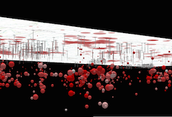 | Local scenes render the earth on a flat surface. They can be constrained to only show a "local" area by setting the [clippingArea](https://developers.arcgis.com/javascript/latest/references/core/views/SceneView/#clippingArea) property. Local scenes also allow for displaying and exploring data that would otherwise be hidden by the surface of the earth.
|
|
333
333
|
*
|
|
334
334
|
* Depending on the viewing mode different [supported coordinate systems](https://developers.arcgis.com/javascript/latest/references/core/views/SceneView/#supported-coordinate-systems) are available.
|
|
335
335
|
*
|
|
@@ -377,7 +377,7 @@ export interface SceneViewProperties extends ViewProperties, DOMContainerPropert
|
|
|
377
377
|
* for [MapView](https://developers.arcgis.com/javascript/latest/references/core/views/MapView/). For a general overview of views,
|
|
378
378
|
* see [View](https://developers.arcgis.com/javascript/latest/references/core/views/View/).
|
|
379
379
|
*
|
|
380
|
-
* 
|
|
381
381
|
*
|
|
382
382
|
* For a map to be visible to the user in the DOM, a SceneView must have both a
|
|
383
383
|
* valid [Map instance](https://developers.arcgis.com/javascript/latest/references/core/views/SceneView/#map) and a [DOM element](https://developers.arcgis.com/javascript/latest/references/core/views/SceneView/#container) with a non-zero
|
|
@@ -502,7 +502,7 @@ export interface SceneViewProperties extends ViewProperties, DOMContainerPropert
|
|
|
502
502
|
* <details>
|
|
503
503
|
* <summary>Read More</summary>
|
|
504
504
|
*
|
|
505
|
-
* 
|
|
506
506
|
*
|
|
507
507
|
* Gamepad Action | SceneView behavior
|
|
508
508
|
* ------|------------
|
|
@@ -513,12 +513,12 @@ export interface SceneViewProperties extends ViewProperties, DOMContainerPropert
|
|
|
513
513
|
*
|
|
514
514
|
* Action Image | SpaceMouse Action | SceneView behavior
|
|
515
515
|
* -------|------|------------
|
|
516
|
-
*  | Push (left/right/forward/backward)| Pan
|
|
517
|
+
*  | Pull up | Ascend
|
|
518
|
+
*  | Push down | Descend
|
|
519
|
+
*  | Rotate clockwise | Rotate the view clockwise
|
|
520
|
+
*  | Rotate counterclockwise | Rotate the view counterclockwise
|
|
521
|
+
*  | Tilt | Tilt the scene
|
|
522
522
|
*
|
|
523
523
|
* To disable gamepad navigation, you can set `view.navigation.gamepad.enabled` to `false`.
|
|
524
524
|
*
|
|
@@ -625,7 +625,7 @@ export interface SceneViewProperties extends ViewProperties, DOMContainerPropert
|
|
|
625
625
|
* <span id="viewing-modes"></span>
|
|
626
626
|
* ## Viewing modes
|
|
627
627
|
*
|
|
628
|
-
* 
|
|
629
629
|
*
|
|
630
630
|
* The SceneView supports two different viewing modes, `global` (left picture above) and `local` (right picture above),
|
|
631
631
|
* specified by the [viewingMode](https://developers.arcgis.com/javascript/latest/references/core/views/SceneView/#viewingMode) property. Global scenes render the
|
|
@@ -722,7 +722,7 @@ export interface SceneViewProperties extends ViewProperties, DOMContainerPropert
|
|
|
722
722
|
* to user interaction without delay. The [@click](https://developers.arcgis.com/javascript/latest/references/core/views/SceneView/#event-click) event is only triggered after making sure that the
|
|
723
723
|
* user doesn't click a second time (in which case it would trigger a [@double-click](https://developers.arcgis.com/javascript/latest/references/core/views/SceneView/#event-double-click) event).
|
|
724
724
|
*
|
|
725
|
-
* 
|
|
726
726
|
*
|
|
727
727
|
* In the case of a double-click, the same event chain is repeated after the first click. However, if the user clicks
|
|
728
728
|
* a second time within a close time range, then the [@click](https://developers.arcgis.com/javascript/latest/references/core/views/SceneView/#event-click) event is not emitted anymore, but the
|
|
@@ -966,7 +966,7 @@ export default class SceneView extends SceneViewSuperclass {
|
|
|
966
966
|
*
|
|
967
967
|
* The `clippingArea` property only applies to [local](https://developers.arcgis.com/javascript/latest/references/core/views/SceneView/#viewingMode) scenes.
|
|
968
968
|
*
|
|
969
|
-
* 
|
|
970
970
|
*
|
|
971
971
|
* The clippingArea property contains an internal reference which may be modified in the future. To persist or
|
|
972
972
|
* modify the clippingArea, create a clone using [clippingArea.clone()](https://developers.arcgis.com/javascript/latest/references/core/geometry/Extent/#clone).
|
|
@@ -1113,41 +1113,38 @@ export default class SceneView extends SceneViewSuperclass {
|
|
|
1113
1113
|
* > [!WARNING]
|
|
1114
1114
|
* >
|
|
1115
1115
|
* > `qualityProfile` is evaluated and set automatically when SceneView loads depending on the detected device,
|
|
1116
|
-
* >
|
|
1117
|
-
* > In most scenarios it is
|
|
1116
|
+
* > to optimize stability and performance across different hardware and browsers.
|
|
1117
|
+
* > In most scenarios it is recommended to not set qualityProfile, but let it be evaluated automatically.
|
|
1118
1118
|
* > `qualityProfile` should only be set when the target devices and their capabilities that the application runs on
|
|
1119
1119
|
* > are clear, and are known to work well with the chosen profile.
|
|
1120
|
-
* > Applications should also consider providing an option to change the quality profile, such that users can select
|
|
1121
|
-
* > profile that works best with their specific devices.
|
|
1120
|
+
* > Applications should also consider providing an option to change the quality profile, such that users can select
|
|
1121
|
+
* > the profile that works best with their specific devices.
|
|
1122
1122
|
*
|
|
1123
|
-
* The
|
|
1124
|
-
* memory limit. The memory limit impacts the [SceneLayer's](https://developers.arcgis.com/javascript/latest/references/core/layers/SceneLayer/) levels of detail and
|
|
1125
|
-
* the number of features that are displayed in a [FeatureLayer](https://developers.arcgis.com/javascript/latest/references/core/layers/FeatureLayer/). Furthermore, low quality
|
|
1126
|
-
* profile impacts visual quality by reducing map resolution, simplifying atmospheric effects and disabling
|
|
1127
|
-
* anti-aliasing (edge smoothing).
|
|
1123
|
+
* The quality profiles have increasingly higher settings for the memory limit and rendering quality.
|
|
1128
1124
|
*
|
|
1129
|
-
* The
|
|
1130
|
-
*
|
|
1131
|
-
*
|
|
1125
|
+
* The memory limit defines the maximum amount of memory which the view is allowed to use. Complex web scenes
|
|
1126
|
+
* with many layers will hit the memory limit. When this happens, the view will reduce the level of detail and the
|
|
1127
|
+
* number of features that are loaded, as well as the rendering resolution of the view and of draped content. This
|
|
1128
|
+
* will make the application less likely crash due to out of memory errors.
|
|
1132
1129
|
*
|
|
1133
|
-
*
|
|
1134
|
-
*
|
|
1135
|
-
*
|
|
1136
|
-
*
|
|
1137
|
-
* quality modes.
|
|
1130
|
+
* The rendering quality settings impacts the level of detail and the maximum number of features that are loaded
|
|
1131
|
+
* by all layers. A higher quality profile also enables more rendering features, providing better visuals.
|
|
1132
|
+
* Furthermor, it increases the resolution of shadows, rasterized content such as icons and text, as well as the
|
|
1133
|
+
* overall rendering resolution on HiDPI displays.
|
|
1138
1134
|
*
|
|
1139
|
-
*
|
|
1140
|
-
*
|
|
1135
|
+
* A higher quality profile improves visual quality and detail, but can have a negative impact on drawing performance
|
|
1136
|
+
* and stability.
|
|
1141
1137
|
*
|
|
1142
1138
|
* SceneView performance depends on the amount of data being displayed, the quality profile and the device type.
|
|
1143
1139
|
* [performanceInfo](https://developers.arcgis.com/javascript/latest/references/core/views/SceneView/#performanceInfo) can be used to inspect the memory consumption and the number
|
|
1144
1140
|
* of features that are displayed for a specific scene. The
|
|
1145
|
-
* [SceneView memory resources](https://developers.arcgis.com/javascript/latest/sample-code/sceneview-memory/)
|
|
1141
|
+
* [SceneView memory resources](https://developers.arcgis.com/javascript/latest/sample-code/sceneview-memory/)
|
|
1142
|
+
* sample shows how this property can be used.
|
|
1146
1143
|
*
|
|
1147
1144
|
* The default value is based on the detected browser:
|
|
1148
1145
|
*
|
|
1149
1146
|
* * `low` for all browsers on iPhones
|
|
1150
|
-
* * `medium` for any other browser
|
|
1147
|
+
* * `medium` for any other browser and device
|
|
1151
1148
|
*
|
|
1152
1149
|
* @example
|
|
1153
1150
|
* let view = new SceneView({
|
|
@@ -1207,8 +1204,8 @@ export default class SceneView extends SceneViewSuperclass {
|
|
|
1207
1204
|
*
|
|
1208
1205
|
* Value | Example | Description
|
|
1209
1206
|
* ------|-------|------------
|
|
1210
|
-
* global |  | Global scenes allow the entire globe to render in the view, showing the curvature of the earth.
|
|
1208
|
+
* local |  | Local scenes render the earth on a flat surface. They can be constrained to only show a "local" area by setting the [clippingArea](https://developers.arcgis.com/javascript/latest/references/core/views/SceneView/#clippingArea) property. Local scenes also allow for displaying and exploring data that would otherwise be hidden by the surface of the earth.
|
|
1212
1209
|
*
|
|
1213
1210
|
* Depending on the viewing mode different [supported coordinate systems](https://developers.arcgis.com/javascript/latest/references/core/views/SceneView/#supported-coordinate-systems) are available.
|
|
1214
1211
|
*
|
package/views/View.d.ts
CHANGED
|
@@ -221,7 +221,7 @@ export type ViewEvents = SceneViewEventTypes;
|
|
|
221
221
|
*
|
|
222
222
|
* | MapView (2D) | SceneView (3D) |
|
|
223
223
|
* |--------------|----------------|
|
|
224
|
-
* | [](https://developers.arcgis.com/javascript/latest/sample-code/intro-mapview/) | [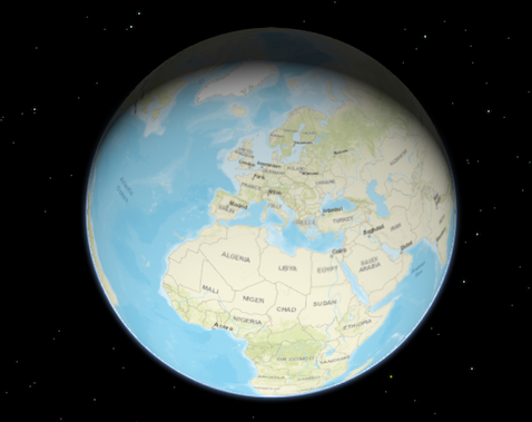](https://developers.arcgis.com/javascript/latest/sample-code/intro-sceneview/) |
|
|
225
225
|
*
|
|
226
226
|
* To associate a view with a map, you must set the [map](https://developers.arcgis.com/javascript/latest/references/core/views/View/#map) property to an instance of [Map](https://developers.arcgis.com/javascript/latest/references/core/Map/).
|
|
227
227
|
*
|
|
@@ -319,7 +319,7 @@ export default abstract class View<TLayerView extends LayerView = LayerView> ext
|
|
|
319
319
|
/**
|
|
320
320
|
* The array of attribution items to be displayed in the view's attribution.
|
|
321
321
|
*
|
|
322
|
-
* 
|
|
323
323
|
*
|
|
324
324
|
* @since 5.0
|
|
325
325
|
*/
|