@vertigis/arcgis-extensions 54.10.2 → 54.12.0
This diff represents the content of publicly available package versions that have been released to one of the supported registries. The information contained in this diff is provided for informational purposes only and reflects changes between package versions as they appear in their respective public registries.
- package/AppConfig.schema.json +33 -39
- package/data/_TableExtension.d.ts +1 -1
- package/data/convert.js +1 -1
- package/docs/html/assets/hierarchy.js +1 -1
- package/docs/html/classes/data__TableExtension.TableSchema.html +3 -3
- package/docs/html/classes/layer-preset_LayerPreset.LayerPreset.html +1 -1
- package/docs/html/classes/layer-preset_LayerPresetSettings.LayerPresetSetting.html +1 -1
- package/docs/html/classes/mapping_ArcGISSublayerExtension.ArcGISSublayerExtension.html +1 -1
- package/docs/html/classes/mapping_ArcGISSublayerExtension.ArcGISSublayerRelationshipCollection.html +1 -1
- package/docs/html/classes/mapping_BasemapExtension.BasemapExtension.html +1 -1
- package/docs/html/classes/mapping_Bookmark.Bookmark.html +1 -1
- package/docs/html/classes/mapping_BuildingComponentSublayerExtension.BuildingComponentSublayerExtension.html +1 -1
- package/docs/html/classes/mapping_BuildingComponentSublayerExtension.BuildingComponentSublayerSchema.html +1 -1
- package/docs/html/classes/mapping_BuildingGroupSublayerExtension.BuildingGroupSublayerExtension.html +1 -1
- package/docs/html/classes/mapping_BuildingGroupSublayerExtension.BuildingGroupSublayerSchema.html +1 -1
- package/docs/html/classes/mapping_BuildingSceneLayerExtension.BuildingSceneLayerExtension.html +1 -1
- package/docs/html/classes/mapping_BuildingSceneLayerExtension.BuildingSceneLayerReadOnlySchema.html +1 -1
- package/docs/html/classes/mapping_BuildingSublayerExtension.BuildingSublayerExtension.html +1 -1
- package/docs/html/classes/mapping_BuildingSublayerExtension.BuildingSublayerSchema.html +1 -1
- package/docs/html/classes/mapping_CSVLayerExtension.CSVLayerExtension.html +1 -1
- package/docs/html/classes/mapping_ElevationLayerExtension.ElevationLayerExtension.html +1 -1
- package/docs/html/classes/mapping_FeatureCollectionLayerExtension.FeatureCollectionLayerExtension.html +1 -1
- package/docs/html/classes/mapping_FeatureLayerExtension.FeatureLayerExtension.html +1 -1
- package/docs/html/classes/mapping_FeatureLayerExtensionBase.FeatureLayerExtensionBase.html +1 -1
- package/docs/html/classes/mapping_FeatureLayerExtensionBase.FeatureLayerReadOnlySchema.html +1 -1
- package/docs/html/classes/mapping_FeatureLayerExtensionBase.FeatureLayerSchema.html +1 -1
- package/docs/html/classes/mapping_GeoJSONLayerExtension.GeoJSONLayerExtension.html +1 -1
- package/docs/html/classes/mapping_GeoRSSLayerExtension.GeoRSSLayerExtension.html +1 -1
- package/docs/html/classes/mapping_GraphicsLayerExtension.GraphicsLayerExtension.html +1 -1
- package/docs/html/classes/mapping_GroundExtension.GroundExtension.html +1 -1
- package/docs/html/classes/mapping_GroupLayerExtension.GroupLayerExtension.html +1 -1
- package/docs/html/classes/mapping_GroupLayerExtension.GroupLayerExtensionCollection.html +1 -1
- package/docs/html/classes/mapping_ImageryLayerExtension.ImageryLayerExtension.html +1 -1
- package/docs/html/classes/mapping_ImageryTileLayerExtension.ImageryTileLayerExtension.html +1 -1
- package/docs/html/classes/mapping_IntegratedMeshLayerExtension.IntegratedMeshLayerExtension.html +1 -1
- package/docs/html/classes/mapping_KMLLayerExtension.KMLLayerExtension.html +1 -1
- package/docs/html/classes/mapping_KMLSublayerExtension.KMLSublayerExtension.html +1 -1
- package/docs/html/classes/mapping_MapConstraints.MapConstraints.html +1 -1
- package/docs/html/classes/mapping_MapExtension.MapExtension.html +1 -1
- package/docs/html/classes/mapping_MapImageLayerExtension.MapImageLayerExtension.html +1 -1
- package/docs/html/classes/mapping_MapImageSublayerExtension.MapImageSublayerExtension.html +1 -1
- package/docs/html/classes/mapping_MapNotesLayerExtension.MapNotesLayerExtension.html +1 -1
- package/docs/html/classes/mapping_MapNotesSublayerExtension.MapNotesSublayerExtension.html +1 -1
- package/docs/html/classes/mapping_MapNotesSublayerExtension.MapNotesSublayerExtensionSchema.html +1 -1
- package/docs/html/classes/mapping_MediaLayerExtension.MediaLayerExtension.html +1 -1
- package/docs/html/classes/mapping_OpenStreetMapLayerExtension.OpenStreetMapLayerExtension.html +1 -1
- package/docs/html/classes/mapping_PointCloudLayerExtension.PointCloudLayerExtension.html +1 -1
- package/docs/html/classes/mapping_RouteLayerExtension.RouteLayerExtension.html +1 -1
- package/docs/html/classes/mapping_RouteLayerExtension.RouteLayerExtensionSchema.html +1 -1
- package/docs/html/classes/mapping_SceneLayerExtension.SceneLayerExtension.html +1 -1
- package/docs/html/classes/mapping_StreamLayerExtension.StreamLayerExtension.html +1 -1
- package/docs/html/classes/mapping_StreamLayerExtension.StreamLayerSchema.html +1 -1
- package/docs/html/classes/mapping_SubtypeGroupLayerExtension.SubtypeGroupLayerExtension.html +1 -1
- package/docs/html/classes/mapping_SubtypeGroupLayerExtension.SubtypeGroupLayerRelationshipCollection.html +1 -1
- package/docs/html/classes/mapping_SubtypeGroupLayerExtension.SubtypeGroupLayerSchema.html +1 -1
- package/docs/html/classes/mapping_SubtypeSublayerExtension.SubtypeSublayerExtension.html +1 -1
- package/docs/html/classes/mapping_SubtypeSublayerExtension.SubtypeSublayerRelationshipCollection.html +1 -1
- package/docs/html/classes/mapping_SubtypeSublayerExtension.SubtypeSublayerSchema.html +1 -1
- package/docs/html/classes/mapping_TileLayerExtension.TileLayerExtension.html +1 -1
- package/docs/html/classes/mapping_TileSublayerExtension.TileSublayerExtension.html +1 -1
- package/docs/html/classes/mapping_UnsupportedLayerExtension.UnsupportedLayerExtension.html +1 -1
- package/docs/html/classes/mapping_VectorTileLayerExtension.VectorTileLayerExtension.html +1 -1
- package/docs/html/classes/mapping_WFSLayerExtension.WFSLayerExtension.html +1 -1
- package/docs/html/classes/mapping_WMSLayerExtension.WMSLayerExtension.html +1 -1
- package/docs/html/classes/mapping_WMSSublayerExtension.WMSSublayerExtension.html +1 -1
- package/docs/html/classes/mapping_WMTSLayerExtension.WMTSLayerExtension.html +1 -1
- package/docs/html/classes/mapping_WebTileLayerExtension.WebTileLayerExtension.html +1 -1
- package/docs/html/classes/mapping__LayerExtension.LayerExtension.html +1 -1
- package/docs/html/classes/mapping__LayerExtension.LayerExtensionReadOnlySchema.html +1 -1
- package/docs/html/classes/mapping__LayerExtension.LayerExtensionSchema.html +1 -1
- package/docs/html/classes/mapping__LayerExtensionCollectionImpl.LayerExtensionCollectionImpl.html +1 -1
- package/docs/html/classes/mapping__SublayerExtension.SubSublayerExtensionCollection.html +1 -1
- package/docs/html/classes/mapping__SublayerExtension.SublayerExtension.html +1 -1
- package/docs/html/classes/mapping__SublayerExtension.SublayerSchema.html +1 -1
- package/docs/html/classes/mapping_support_ArrayWrappedCollection.ArrayWrappedCollection.html +1 -1
- package/docs/html/classes/mapping_support_LayerListSettings.ExtensionBaseLayerListSettings.html +1 -1
- package/docs/html/classes/mapping_support_LayerListSettings.LayerListSettings.html +1 -1
- package/docs/html/classes/mapping_support__LayerExtensionCollection.LayerExtensionCollectionBase.html +1 -1
- package/docs/html/classes/mapping_support__SublayerExtensionCollection.SublayerExtensionCollectionBase.html +1 -1
- package/docs/html/classes/menus_Menu.Menu.html +1 -1
- package/docs/html/classes/menus_MenuItem.MenuItem.html +1 -1
- package/docs/html/classes/support_FormatSettings.FormatSettings.html +1 -1
- package/docs/html/classes/support_InitializableBase.InitializableBase.html +1 -1
- package/docs/html/classes/support_InitializableCollectionProxy.InitializableCollectionProxy.html +1 -1
- package/docs/html/classes/support_InitializeError.InitializeError.html +1 -1
- package/docs/html/classes/support_ReadOnlyInitializableCollection.ReadOnlyInitializableCollection.html +1 -1
- package/docs/html/classes/support_Serializable.SerializableBase.html +1 -1
- package/docs/html/classes/support_Settings.Settings.html +1 -1
- package/docs/html/classes/support__ArcGISRelationshipCollection.ArcGISRelationshipCollection.html +1 -1
- package/docs/html/classes/support_observableUtils.ObservableMixin.html +1 -1
- package/docs/html/classes/tasks_geocoding_ArcGISGeocoder.ArcGISGeocoder.html +1 -1
- package/docs/html/classes/tasks_geocoding_Geocoder.Geocoder.html +1 -1
- package/docs/html/classes/tasks_identify_ArcGISSublayerIdentifyProvider.ArcGISSublayerIdentifyProvider.html +1 -1
- package/docs/html/classes/tasks_identify_ArcGISSublayerQueryIdentifyProvider.ArcGISSublayerQueryIdentifyProvider.html +1 -1
- package/docs/html/classes/tasks_identify_BuildingComponentSublayerClientSideIdentifyProvider.BuildingComponentSublayerClientSideIdentifyProvider.html +1 -1
- package/docs/html/classes/tasks_identify_BuildingComponentSublayerHitTestIdentifyProvider.BuildingComponentSublayerHitTestIdentifyProvider.html +1 -1
- package/docs/html/classes/tasks_identify_CSVLayer3DHitTestIdentifyProvider.CSVLayer3DHitTestIdentifyProvider.html +1 -1
- package/docs/html/classes/tasks_identify_CSVLayerClientSideQueryIdentifyProvider.CSVLayerClientSideQueryIdentifyProvider.html +1 -1
- package/docs/html/classes/tasks_identify_ClientSideIdentifyProvider.ClientSideIdentifyProvider.html +1 -1
- package/docs/html/classes/tasks_identify_FeatureLayer3DHitTestIdentifyProvider.FeatureLayer3DHitTestIdentifyProvider.html +1 -1
- package/docs/html/classes/tasks_identify_FeatureLayerClientSideIdentifyProvider.FeatureLayerClientSideIdentifyProvider.html +1 -1
- package/docs/html/classes/tasks_identify_FeatureLayerQueryIdentifyProvider.FeatureLayerQueryIdentifyProvider.html +1 -1
- package/docs/html/classes/tasks_identify_GeoJSONLayer3DHitTestIdentifyProvider.GeoJSONLayer3DHitTestIdentifyProvider.html +1 -1
- package/docs/html/classes/tasks_identify_GeoJSONLayerClientSideQueryIdentifyProvider.GeoJSONLayerClientSideQueryIdentifyProvider.html +1 -1
- package/docs/html/classes/tasks_identify_GeoRSSLayerIdentifyProvider.GeoRSSLayerIdentifyProvider.html +1 -1
- package/docs/html/classes/tasks_identify_GraphicsLayerQueryIdentifyProvider.GraphicsLayerQueryIdentifyProvider.html +1 -1
- package/docs/html/classes/tasks_identify_HitTestIdentifyProvider.HitTestIdentifyProvider.html +1 -1
- package/docs/html/classes/tasks_identify_IdentifyError.IdentifyError.html +1 -1
- package/docs/html/classes/tasks_identify_IdentifyProviderBase.IdentifyProviderBase.html +1 -1
- package/docs/html/classes/tasks_identify_IdentifyService.IdentifyService.html +1 -1
- package/docs/html/classes/tasks_identify_ImageryLayerIdentifyProvider.ImageryLayerIdentifyProvider.html +1 -1
- package/docs/html/classes/tasks_identify_KMLLayerQueryIdentifyProvider.KMLLayerQueryIdentifyProvider.html +1 -1
- package/docs/html/classes/tasks_identify_MapNotesSublayerQueryIdentifyProvider.MapNotesSublayerQueryIdentifyProvider.html +1 -1
- package/docs/html/classes/tasks_identify_PointCloudLayerHitTestIdentifyProvider.PointCloudLayerHitTestIdentifyProvider.html +1 -1
- package/docs/html/classes/tasks_identify_RouteLayerQueryIdentifyProvider.RouteLayerQueryIdentifyProvider.html +1 -1
- package/docs/html/classes/tasks_identify_SceneLayerClientSideIdentifyProvider.SceneLayerClientSideIdentifyProvider.html +1 -1
- package/docs/html/classes/tasks_identify_SceneLayerHitTestIdentifyProvider.SceneLayerHitTestIdentifyProvider.html +1 -1
- package/docs/html/classes/tasks_identify_SceneLayerQueryIdentifyProvider.SceneLayerQueryIdentifyProvider.html +1 -1
- package/docs/html/classes/tasks_identify_StreamLayerClientSideQueryIdentifyProvider.StreamLayerClientSideQueryIdentifyProvider.html +1 -1
- package/docs/html/classes/tasks_identify_SubtypeSublayerClientSideIdentifyProvider.SubtypeSublayerClientSideIdentifyProvider.html +1 -1
- package/docs/html/classes/tasks_identify_SubtypeSublayerQueryIdentifyProvider.SubtypeSublayerQueryIdentifyProvider.html +1 -1
- package/docs/html/classes/tasks_identify_WFSLayerClientSideIdentifyProvider.WFSLayerClientSideIdentifyProvider.html +1 -1
- package/docs/html/classes/tasks_identify_WFSLayerQueryIdentifyProvider.WFSLayerQueryIdentifyProvider.html +1 -1
- package/docs/html/classes/tasks_identify_WMSLayerFeatureInfoIdentifyProvider.WMSLayerFeatureInfoIdentifyProvider.html +1 -1
- package/docs/html/classes/tasks_identify_WMSSublayerIdentifyProvider.WMSSublayerIdentifyProvider.html +1 -1
- package/docs/html/classes/tasks_query_ArcGISRelationship.ArcGISRelationship.html +1 -1
- package/docs/html/classes/tasks_query_ArcGISServiceTableQueryProvider.ArcGISServiceTableQueryProvider.html +1 -1
- package/docs/html/classes/tasks_query_ArcGISSublayerQueryProvider.ArcGISSublayerQueryProvider.html +1 -1
- package/docs/html/classes/tasks_query_BuildingComponentSublayerClientSideQueryProvider.BuildingComponentSublayerClientSideQueryProvider.html +1 -1
- package/docs/html/classes/tasks_query_CSVLayerClientSideQueryProvider.CSVLayerClientSideQueryProvider.html +1 -1
- package/docs/html/classes/tasks_query_ClientSideQueryProvider.ClientSideQueryProvider.html +1 -1
- package/docs/html/classes/tasks_query_FeatureLayerQueryProvider.FeatureLayerQueryProvider.html +1 -1
- package/docs/html/classes/tasks_query_GeoJSONLayerClientSideQueryProvider.GeoJSONLayerClientSideQueryProvider.html +1 -1
- package/docs/html/classes/tasks_query_GeoRSSLayerQueryProvider.GeoRSSLayerQueryProvider.html +1 -1
- package/docs/html/classes/tasks_query_GraphicsLayerQueryProvider.GraphicsLayerQueryProvider.html +1 -1
- package/docs/html/classes/tasks_query_ImageryLayerQueryProvider.ImageryLayerQueryProvider.html +1 -1
- package/docs/html/classes/tasks_query_KMLLayerQueryProvider.KMLLayerQueryProvider.html +1 -1
- package/docs/html/classes/tasks_query_MapNotesSublayerQueryProvider.MapNotesSublayerQueryProvider.html +1 -1
- package/docs/html/classes/tasks_query_QueryBasedRelationship.QueryBasedRelationship.html +1 -1
- package/docs/html/classes/tasks_query_QueryError.QueryError.html +1 -1
- package/docs/html/classes/tasks_query_QueryProviderBase.QueryProviderBase.html +1 -1
- package/docs/html/classes/tasks_query_QueryService.QueryService.html +1 -1
- package/docs/html/classes/tasks_query_RouteLayerQueryProvider.RouteLayerQueryProvider.html +1 -1
- package/docs/html/classes/tasks_query_SceneLayerClientSideQueryProvider.SceneLayerClientSideQueryProvider.html +1 -1
- package/docs/html/classes/tasks_query_SceneLayerQueryProvider.SceneLayerQueryProvider.html +1 -1
- package/docs/html/classes/tasks_query_StreamLayerClientSideQueryProvider.StreamLayerClientSideQueryProvider.html +1 -1
- package/docs/html/classes/tasks_query_SubtypeSublayerQueryProvider.SubtypeSublayerQueryProvider.html +1 -1
- package/docs/html/classes/tasks_query_WFSLayerQueryProvider.WFSLayerQueryProvider.html +1 -1
- package/docs/html/classes/tasks_search_ArcGISGeocoderSearchProvider.ArcGISGeocoderSearchProvider.html +1 -1
- package/docs/html/classes/tasks_search_GeocoderSearchProvider.GeocoderSearchProvider.html +1 -1
- package/docs/html/classes/tasks_search_QuerySearchProvider.QuerySearchProvider.html +1 -1
- package/docs/html/classes/tasks_search_SearchError.SearchError.html +1 -1
- package/docs/html/classes/tasks_search_SearchProviderBase.SearchProviderBase.html +1 -1
- package/docs/html/classes/tasks_search_SearchService.SearchService.html +1 -1
- package/docs/html/classes/tasks_search_SubtypeSublayerQuerySearchProvider.SubtypeSublayerQuerySearchProvider.html +1 -1
- package/docs/html/classes/utilities_CaseInsensitiveObservableMap.CaseInsensitiveObservableMap.html +1 -1
- package/docs/html/classes/utilities_CollectionProxy.CollectionProxy.html +1 -1
- package/docs/html/classes/utilities_CopyOnWriteCollection.CopyOnWriteCollection.html +1 -1
- package/docs/html/classes/utilities_GeometryServiceError.GeometryServiceError.html +1 -1
- package/docs/html/classes/utilities_MapTransformCollection.MapTransformCollection.html +1 -1
- package/docs/html/classes/utilities_ObservableMap.ObservableMap.html +1 -1
- package/docs/html/classes/utilities_ObservableSet.ObservableSet.html +1 -1
- package/docs/html/classes/utilities_ReadOnlyCollection.ReadOnlyCollection.html +1 -1
- package/docs/html/classes/utilities_ReadOnlyMap.ReadOnlyMap.html +1 -1
- package/docs/html/classes/utilities_format_date.DateFormatter.html +1 -1
- package/docs/html/classes/utilities_format_number.NumberFormatter.html +1 -1
- package/docs/html/classes/utilities_format_time.TimeFormatter.html +1 -1
- package/docs/html/classes/utilities_log.ConsoleLogger.html +1 -1
- package/docs/html/classes/utilities_log.LoggerBase.html +1 -1
- package/docs/html/hierarchy.html +1 -1
- package/docs/html/interfaces/data_support_attachments.AttachmentEnabledLayer.html +7 -5
- package/docs/html/interfaces/json_AnnotationLayerJson.AnnotationLayerJson.html +1 -1
- package/docs/html/interfaces/json_BasemapJson.BasemapJson.html +1 -1
- package/docs/html/interfaces/json_BasemapLayerJson.BasemapLayerJsonBase.html +1 -1
- package/docs/html/interfaces/json_BingLayerJson.BingLayerJson.html +1 -1
- package/docs/html/interfaces/json_BuildingSceneLayerJson.BuildingSceneLayerJson.html +1 -1
- package/docs/html/interfaces/json_BuildingSceneSublayerJson.BuildingSceneSublayerJson.html +1 -1
- package/docs/html/interfaces/json_CSVLayerJson.CSVLayerJson.html +1 -1
- package/docs/html/interfaces/json_DomainJson.CodedValueDomainJson.html +1 -1
- package/docs/html/interfaces/json_DomainJson.DomainJsonBase.html +1 -1
- package/docs/html/interfaces/json_DomainJson.InheritedDomainJson.html +1 -1
- package/docs/html/interfaces/json_DomainJson.RangeDomainJson.html +1 -1
- package/docs/html/interfaces/json_FeatureLayerJson.FeatureLayerJson.html +1 -1
- package/docs/html/interfaces/json_GeoJSONLayerJson.GeoJSONLayerJson.html +1 -1
- package/docs/html/interfaces/json_GeoRSSLayerJson.GeoRSSLayerJson.html +1 -1
- package/docs/html/interfaces/json_GeometryJson.ExtentJson.html +1 -1
- package/docs/html/interfaces/json_GeometryJson.GeometryJsonBase.html +1 -1
- package/docs/html/interfaces/json_GeometryJson.MultipointJson.html +1 -1
- package/docs/html/interfaces/json_GeometryJson.PointJson.html +1 -1
- package/docs/html/interfaces/json_GeometryJson.PolygonJson.html +1 -1
- package/docs/html/interfaces/json_GeometryJson.PolylineJson.html +1 -1
- package/docs/html/interfaces/json_GroundJson.GroundJson.html +1 -1
- package/docs/html/interfaces/json_GroupLayerJson.GroupLayerJson.html +1 -1
- package/docs/html/interfaces/json_ImageServiceLayerJson.ImageServiceLayerJson.html +1 -1
- package/docs/html/interfaces/json_ImageServiceVectorLayerJson.ImageServiceVectorLayerJson.html +1 -1
- package/docs/html/interfaces/json_IntegratedMeshLayerJson.IntegratedMeshLayerJson.html +1 -1
- package/docs/html/interfaces/json_KMLLayerJson.KMLLayerJson.html +1 -1
- package/docs/html/interfaces/json_LayerDefinitionJson.DataSourceJsonBase.html +1 -1
- package/docs/html/interfaces/json_LayerDefinitionJson.JoinTableDataSourceJson.html +1 -1
- package/docs/html/interfaces/json_LayerDefinitionJson.QueryTableDataSourceJson.html +1 -1
- package/docs/html/interfaces/json_LayerDefinitionJson.RasterDataSourceJson.html +1 -1
- package/docs/html/interfaces/json_LayerDefinitionJson.TableDataSourceJson.html +1 -1
- package/docs/html/interfaces/json_LayerJson.BrightnessEffectFunctionJson.html +1 -1
- package/docs/html/interfaces/json_LayerJson.ContrastEffectFunctionJson.html +1 -1
- package/docs/html/interfaces/json_LayerJson.GrayscaleEffectFunctionJson.html +1 -1
- package/docs/html/interfaces/json_LayerJson.InvertEffectFunctionJson.html +1 -1
- package/docs/html/interfaces/json_LayerJson.LayerJsonBase.html +1 -1
- package/docs/html/interfaces/json_LayerJson.OpacityEffectFunctionJson.html +1 -1
- package/docs/html/interfaces/json_LayerJson.SaturateEffectFunctionJson.html +1 -1
- package/docs/html/interfaces/json_LayerJson.SepiaEffectFunctionJson.html +1 -1
- package/docs/html/interfaces/json_MapServiceLayerJson.MapServiceLayerJson.html +1 -1
- package/docs/html/interfaces/json_MediaLayerJson.MediaLayerJson.html +1 -1
- package/docs/html/interfaces/json_OpenStreetMapLayerJson.OpenStreetMapLayerJson.html +1 -1
- package/docs/html/interfaces/json_OperationalLayerJson.OperationalLayerJsonBase.html +1 -1
- package/docs/html/interfaces/json_PointCloudLayerJson.PointCloudLayerJson.html +1 -1
- package/docs/html/interfaces/json_PopupInfoJson.PopupElementJson.html +1 -1
- package/docs/html/interfaces/json_RasterDataElevationLayerJson.RasterDataElevationLayerJson.html +1 -1
- package/docs/html/interfaces/json_RendererJson.ClassBreaksRendererJson.html +1 -1
- package/docs/html/interfaces/json_RendererJson.ColorInfoJson.html +1 -1
- package/docs/html/interfaces/json_RendererJson.HeatmapRendererJson.html +1 -1
- package/docs/html/interfaces/json_RendererJson.PointCloudClassBreaksRendererJson.html +1 -1
- package/docs/html/interfaces/json_RendererJson.PointCloudRGBRendererJson.html +1 -1
- package/docs/html/interfaces/json_RendererJson.PointCloudRendererJsonBase.html +1 -1
- package/docs/html/interfaces/json_RendererJson.PointCloudStretchRendererJson.html +1 -1
- package/docs/html/interfaces/json_RendererJson.PointCloudUniqueValueRendererJson.html +1 -1
- package/docs/html/interfaces/json_RendererJson.PredominanceRendererJson.html +1 -1
- package/docs/html/interfaces/json_RendererJson.RendererJsonBase.html +1 -1
- package/docs/html/interfaces/json_RendererJson.RotationInfoJson.html +1 -1
- package/docs/html/interfaces/json_RendererJson.SimpleRendererJson.html +1 -1
- package/docs/html/interfaces/json_RendererJson.SizeInfoJson.html +1 -1
- package/docs/html/interfaces/json_RendererJson.TemporalRendererJson.html +1 -1
- package/docs/html/interfaces/json_RendererJson.TransparencyInfoJson.html +1 -1
- package/docs/html/interfaces/json_RendererJson.UniqueValueFromStyleRendererJson.html +1 -1
- package/docs/html/interfaces/json_RendererJson.UniqueValueRendererJson.html +1 -1
- package/docs/html/interfaces/json_RendererJson.VectorFieldRendererJson.html +1 -1
- package/docs/html/interfaces/json_RendererJson.VisualVariableJsonBase.html +1 -1
- package/docs/html/interfaces/json_SceneLayerJson.SceneLayerJson.html +1 -1
- package/docs/html/interfaces/json_StreamLayerJson.StreamLayerJson.html +1 -1
- package/docs/html/interfaces/json_SublayerJson.SublayerJson.html +1 -1
- package/docs/html/interfaces/json_SubtypeGroupLayerJson.SubtypeGroupLayerJson.html +1 -1
- package/docs/html/interfaces/json_SubtypeGroupLayerJson.SubtypeSubtypeGroupLayerJson.html +1 -1
- package/docs/html/interfaces/json_SubtypeSublayerJson.SubtypeSublayerJson.html +1 -1
- package/docs/html/interfaces/json_SymbolJson.CIMSymbolJson.html +1 -1
- package/docs/html/interfaces/json_SymbolJson.CIMSymbolReferenceJson.html +1 -1
- package/docs/html/interfaces/json_SymbolJson.ExtrudeSymbol3DLayerJson.html +1 -1
- package/docs/html/interfaces/json_SymbolJson.FillSymbol3DLayerJson.html +1 -1
- package/docs/html/interfaces/json_SymbolJson.IconSymbol3DLayerJson.html +1 -1
- package/docs/html/interfaces/json_SymbolJson.LabelSymbol3DJson.html +1 -1
- package/docs/html/interfaces/json_SymbolJson.LineSymbol3DJson.html +1 -1
- package/docs/html/interfaces/json_SymbolJson.LineSymbol3DLayerJson.html +1 -1
- package/docs/html/interfaces/json_SymbolJson.MeshSymbol3DJson.html +1 -1
- package/docs/html/interfaces/json_SymbolJson.ObjectSymbol3DLayerJson.html +1 -1
- package/docs/html/interfaces/json_SymbolJson.PathSymbol3DLayerJson.html +1 -1
- package/docs/html/interfaces/json_SymbolJson.PictureFillSymbolJson.html +1 -1
- package/docs/html/interfaces/json_SymbolJson.PictureMarkerSymbolJson.html +1 -1
- package/docs/html/interfaces/json_SymbolJson.PointSymbol3DJson.html +1 -1
- package/docs/html/interfaces/json_SymbolJson.PolygonSymbol3DJson.html +1 -1
- package/docs/html/interfaces/json_SymbolJson.SimpleFillSymbolJson.html +1 -1
- package/docs/html/interfaces/json_SymbolJson.SimpleLineSymbolJson.html +1 -1
- package/docs/html/interfaces/json_SymbolJson.SimpleMarkerSymbolJson.html +1 -1
- package/docs/html/interfaces/json_SymbolJson.SketchEdgesJson.html +1 -1
- package/docs/html/interfaces/json_SymbolJson.SolidEdgesJson.html +1 -1
- package/docs/html/interfaces/json_SymbolJson.Symbol3DJsonBase.html +1 -1
- package/docs/html/interfaces/json_SymbolJson.Symbol3DLayerJsonBase.html +1 -1
- package/docs/html/interfaces/json_SymbolJson.SymbolJsonBase.html +1 -1
- package/docs/html/interfaces/json_SymbolJson.TextSymbol3DLayerJson.html +1 -1
- package/docs/html/interfaces/json_SymbolJson.TextSymbolJson.html +1 -1
- package/docs/html/interfaces/json_TableJson.TableJson.html +1 -1
- package/docs/html/interfaces/json_TiledElevationServiceLayerJson.TiledElevationServiceLayerJson.html +1 -1
- package/docs/html/interfaces/json_TiledImageServiceLayerJson.TiledImageServiceLayerJson.html +1 -1
- package/docs/html/interfaces/json_TiledMapServiceLayerJson.TiledMapServiceLayerJson.html +1 -1
- package/docs/html/interfaces/json_VectorTileLayerJson.VectorTileLayerJson.html +1 -1
- package/docs/html/interfaces/json_WFSLayerJson.WFSLayerJson.html +1 -1
- package/docs/html/interfaces/json_WMSLayerJson.WMSLayerJson.html +1 -1
- package/docs/html/interfaces/json_WMSSublayerJson.WMSSublayerJson.html +1 -1
- package/docs/html/interfaces/json_WebMapJson.WebMapJson.html +1 -1
- package/docs/html/interfaces/json_WebMapJson.WebMapJsonBase.html +1 -1
- package/docs/html/interfaces/json_WebSceneJson.WebSceneJson.html +1 -1
- package/docs/html/interfaces/json_WebTileLayerJson.WebTileLayerJson.html +1 -1
- package/docs/html/interfaces/layer-preset_LayerPreset.LayerPresetProperties.html +1 -1
- package/docs/html/interfaces/mapping_ArcGISSublayerExtension.ArcGISSublayerExtensionCollection.html +1 -1
- package/docs/html/interfaces/mapping_ArcGISSublayerExtension.ArcGISSublayerExtensionProperties.html +1 -1
- package/docs/html/interfaces/mapping_ArcGISSublayerExtension.ArcGISSublayerProperties.html +1 -1
- package/docs/html/interfaces/mapping_BasemapExtension.BasemapExtensionProperties.html +1 -1
- package/docs/html/interfaces/mapping_BasemapExtension.BasemapProperties.html +1 -1
- package/docs/html/interfaces/mapping_Bookmark.BookmarkProperties.html +1 -1
- package/docs/html/interfaces/mapping_BuildingComponentSublayerExtension.BuildingComponentSublayerExtensionProperties.html +1 -1
- package/docs/html/interfaces/mapping_BuildingGroupSublayerExtension.BuildingGroupSublayerExtensionProperties.html +1 -1
- package/docs/html/interfaces/mapping_BuildingSceneLayerExtension.BuildingSceneLayerExtensionProperties.html +1 -1
- package/docs/html/interfaces/mapping_BuildingSceneLayerExtension.BuildingSceneLayerProperties.html +1 -1
- package/docs/html/interfaces/mapping_BuildingSceneLayerExtension.BuildingSublayerExtensionCollection.html +1 -1
- package/docs/html/interfaces/mapping_BuildingSublayerExtension.BuildingSublayerExtensionProperties.html +1 -1
- package/docs/html/interfaces/mapping_BuildingSublayerExtension.BuildingSublayerProperties.html +1 -1
- package/docs/html/interfaces/mapping_CSVLayerExtension.CSVLayerExtensionProperties.html +1 -1
- package/docs/html/interfaces/mapping_ElevationLayerExtension.ElevationLayerExtensionProperties.html +1 -1
- package/docs/html/interfaces/mapping_FeatureLayerExtension.FeatureLayerExtensionProperties.html +1 -1
- package/docs/html/interfaces/mapping_FeatureLayerExtension.FeatureLayerProperties.html +1 -1
- package/docs/html/interfaces/mapping_FeatureLayerExtensionBase.FeatureLayerBaseProperties.html +1 -1
- package/docs/html/interfaces/mapping_FeatureLayerExtensionBase.FeatureLayerExtensionBaseProperties.html +1 -1
- package/docs/html/interfaces/mapping_GeoJSONLayerExtension.GeoJSONLayerExtensionProperties.html +1 -1
- package/docs/html/interfaces/mapping_GeoRSSLayerExtension.GeoRSSLayerExtensionProperties.html +1 -1
- package/docs/html/interfaces/mapping_GraphicsLayerExtension.GraphicsLayerExtensionProperties.html +1 -1
- package/docs/html/interfaces/mapping_GroundExtension.GroundExtensionProperties.html +1 -1
- package/docs/html/interfaces/mapping_GroundExtension.GroundProperties.html +1 -1
- package/docs/html/interfaces/mapping_GroupLayerExtension.GroupLayerExtensionProperties.html +1 -1
- package/docs/html/interfaces/mapping_ImageryLayerExtension.ImageryLayerExtensionProperties.html +1 -1
- package/docs/html/interfaces/mapping_ImageryTileLayerExtension.ImageryTileLayerExtensionProperties.html +1 -1
- package/docs/html/interfaces/mapping_IntegratedMeshLayerExtension.IntegratedMeshLayerExtensionProperties.html +1 -1
- package/docs/html/interfaces/mapping_KMLLayerExtension.KMLLayerExtensionProperties.html +1 -1
- package/docs/html/interfaces/mapping_KMLSublayerExtension.KMLSublayerExtensionCollection.html +1 -1
- package/docs/html/interfaces/mapping_KMLSublayerExtension.KMLSublayerExtensionProperties.html +1 -1
- package/docs/html/interfaces/mapping_MapExtension.MapExtensionEvents.html +1 -1
- package/docs/html/interfaces/mapping_MapExtension.MapExtensionProperties.html +1 -1
- package/docs/html/interfaces/mapping_MapExtension.TableExtensionCollection.html +1 -1
- package/docs/html/interfaces/mapping_MapImageLayerExtension.MapImageLayerExtensionProperties.html +1 -1
- package/docs/html/interfaces/mapping_MapImageSublayerExtension.MapImageSublayerExtensionProperties.html +1 -1
- package/docs/html/interfaces/mapping_MapImageSublayerExtension.MapImageSublayerProperties.html +1 -1
- package/docs/html/interfaces/mapping_MapNotesLayerExtension.MapNotesLayerExtensionProperties.html +1 -1
- package/docs/html/interfaces/mapping_MapNotesSublayerExtension.MapNotesSublayerExtensionCollection.html +1 -1
- package/docs/html/interfaces/mapping_MapNotesSublayerExtension.MapNotesSublayerExtensionProperties.html +1 -1
- package/docs/html/interfaces/mapping_MediaLayerExtension.MediaLayerExtensionProperties.html +1 -1
- package/docs/html/interfaces/mapping_OpenStreetMapLayerExtension.OpenStreetMapLayerExtensionProperties.html +1 -1
- package/docs/html/interfaces/mapping_PointCloudLayerExtension.PointCloudLayerExtensionProperties.html +1 -1
- package/docs/html/interfaces/mapping_PointCloudLayerExtension.PointCloudLayerProperties.html +1 -1
- package/docs/html/interfaces/mapping_RouteLayerExtension.RouteLayerExtensionProperties.html +1 -1
- package/docs/html/interfaces/mapping_SceneLayerExtension.SceneLayerExtensionProperties.html +1 -1
- package/docs/html/interfaces/mapping_StreamLayerExtension.StreamLayerExtensionProperties.html +1 -1
- package/docs/html/interfaces/mapping_SubtypeGroupLayerExtension.SubtypeGroupLayerExtensionProperties.html +1 -1
- package/docs/html/interfaces/mapping_SubtypeSublayerExtension.SubtypeSublayerExtensionCollection.html +1 -1
- package/docs/html/interfaces/mapping_SubtypeSublayerExtension.SubtypeSublayerExtensionProperties.html +1 -1
- package/docs/html/interfaces/mapping_SubtypeSublayerExtension.SubtypeSublayerProperties.html +1 -1
- package/docs/html/interfaces/mapping_TileLayerExtension.TileLayerExtensionProperties.html +1 -1
- package/docs/html/interfaces/mapping_TileSublayerExtension.TileSublayerExtensionProperties.html +1 -1
- package/docs/html/interfaces/mapping_TileSublayerExtension.TileSublayerProperties.html +1 -1
- package/docs/html/interfaces/mapping_VectorTileLayerExtension.VectorTileLayerExtensionProperties.html +1 -1
- package/docs/html/interfaces/mapping_WFSLayerExtension.WFSLayerExtensionProperties.html +1 -1
- package/docs/html/interfaces/mapping_WMSLayerExtension.WMSLayerExtensionProperties.html +1 -1
- package/docs/html/interfaces/mapping_WMSSublayerExtension.WMSSublayerExtensionCollection.html +1 -1
- package/docs/html/interfaces/mapping_WMSSublayerExtension.WMSSublayerExtensionProperties.html +1 -1
- package/docs/html/interfaces/mapping_WMSSublayerExtension.WMSSublayerProperties.html +1 -1
- package/docs/html/interfaces/mapping_WMTSLayerExtension.WMTSLayerExtensionProperties.html +1 -1
- package/docs/html/interfaces/mapping_WebTileLayerExtension.WebTileLayerExtensionProperties.html +1 -1
- package/docs/html/interfaces/mapping__LayerExtension.LayerExtensionProperties.html +1 -1
- package/docs/html/interfaces/mapping__SublayerExtension.SublayerExtensionProperties.html +1 -1
- package/docs/html/interfaces/mapping__SublayerExtension.SublayerProperties.html +1 -1
- package/docs/html/interfaces/mapping_support__LayerExtensionCollection.LayerExtensionCollection.html +1 -1
- package/docs/html/interfaces/mapping_support__SublayerExtensionCollection.SublayerExtensionCollection.html +1 -1
- package/docs/html/interfaces/menus_Menu.MenuProperties.html +1 -1
- package/docs/html/interfaces/menus_MenuItem.MenuItemProperties.html +1 -1
- package/docs/html/interfaces/support_ArcGISRequestHelper.ArcGISRequestHelperResponse.html +1 -1
- package/docs/html/interfaces/support_InitializableBase.Initializable.html +1 -1
- package/docs/html/interfaces/support_InitializableBase.InitializableBaseEvents.html +1 -1
- package/docs/html/interfaces/support_InitializableBase.InitializableBaseProperties.html +1 -1
- package/docs/html/interfaces/support_InitializableCollectionProxy.InitializableCollection.html +1 -1
- package/docs/html/interfaces/support_Serializable.Serializable.html +1 -1
- package/docs/html/interfaces/support_Settings.SettingsEvents.html +1 -1
- package/docs/html/interfaces/support__restApiJson.RestApiMapServiceTimeInfo.html +1 -1
- package/docs/html/interfaces/support__restApiJson.RestApiServiceTimeInfo.html +1 -1
- package/docs/html/interfaces/support_esri.LayerWithSublayers.html +1 -1
- package/docs/html/interfaces/support_esri.SublayerLike.html +1 -1
- package/docs/html/interfaces/support_observableUtils.WatchEachOptions.html +1 -1
- package/docs/html/interfaces/support_observableUtils.WatchOptions.html +1 -1
- package/docs/html/interfaces/tasks_geocoding_ArcGISGeocoder.ArcGISGeocoderProperties.html +1 -1
- package/docs/html/interfaces/tasks_geocoding_Geocoder.GeocoderCapabilities.html +1 -1
- package/docs/html/interfaces/tasks_geocoding_Geocoder.GeocoderProperties.html +1 -1
- package/docs/html/interfaces/tasks_query_ArcGISRelationship.ArcGISRelationshipProperties.html +1 -1
- package/docs/html/interfaces/tasks_query_QueryBasedRelationship.QueryBasedRelationshipProperties.html +1 -1
- package/docs/html/interfaces/utilities_ObservableMap.MapAfterItemEvent.html +1 -1
- package/docs/html/interfaces/utilities_ObservableSet.SetAfterItemEvent.html +1 -1
- package/docs/html/interfaces/utilities__layers.LayerWithLegendEnabledProperty.html +1 -1
- package/docs/html/interfaces/utilities__layers.TimeAwareLayer.html +1 -1
- package/docs/html/interfaces/utilities_collection.AfterItemChangeEvent.html +1 -1
- package/docs/html/interfaces/utilities_format_FormatSettings.FormatSettings.html +1 -1
- package/docs/html/interfaces/utilities_format_date.DateFormatterProperties.html +1 -1
- package/docs/html/interfaces/utilities_format_date.DateSettings.html +1 -1
- package/docs/html/interfaces/utilities_format_number.NumberFormatterProperties.html +1 -1
- package/docs/html/interfaces/utilities_format_number.NumberSettings.html +1 -1
- package/docs/html/interfaces/utilities_format_string.FormatOptions.html +1 -1
- package/docs/html/interfaces/utilities_format_time.TimeFormatterProperties.html +1 -1
- package/docs/html/interfaces/utilities_format_time.TimeSettings.html +1 -1
- package/docs/html/interfaces/utilities_log.LogMessageOptions.html +1 -1
- package/docs/html/interfaces/utilities_log.LogMessageResourceOptions.html +1 -1
- package/docs/html/variables/version.version.html +1 -1
- package/package.json +2 -2
- package/portal/DrawingInfo.js +1 -1
- package/version.d.ts +1 -1
- package/version.js +1 -1
package/AppConfig.schema.json
CHANGED
|
@@ -7,28 +7,25 @@
|
|
|
7
7
|
"description": "A Graphic is a vector representation of real world geographic phenomena.\nIt can contain [geometry](https://developers.arcgis.com/javascript/latest/references/core/Graphic/#geometry), a [symbol](https://developers.arcgis.com/javascript/latest/references/core/Graphic/#symbol), and [attributes](https://developers.arcgis.com/javascript/latest/references/core/Graphic/#attributes).\nA Graphic is displayed in the [GraphicsLayer](https://developers.arcgis.com/javascript/latest/references/core/layers/GraphicsLayer/).\n\nTo learn how to work with graphics, see the\n[Intro to graphics](https://developers.arcgis.com/javascript/latest/sample-code/intro-graphics/) tutorial.\n\n```js\nlet polyline = {\n type: \"polyline\", // autocasts as new Polyline()\n paths: [\n [-111.30, 52.68],\n [-98, 49.5],\n [-93.94, 29.89]\n ]\n};\n\nlet polylineSymbol = {\n type: \"simple-line\", // autocasts as SimpleLineSymbol()\n color: [226, 119, 40],\n width: 4\n};\n\nlet polylineAtt = {\n Name: \"Keystone Pipeline\",\n Owner: \"TransCanada\"\n};\n\nlet polylineGraphic = new Graphic({\n geometry: polyline,\n symbol: polylineSymbol,\n attributes: polylineAtt\n});\n\nview.graphics.add(polylineGraphic);\n```"
|
|
8
8
|
},
|
|
9
9
|
"@arcgis.core.Ground.Ground": {
|
|
10
|
-
"description": "The Ground class contains properties that specify how the ground surface is\ndisplayed in a [SceneView](https://developers.arcgis.com/javascript/latest/references/core/views/SceneView/). It contains a [layers](https://developers.arcgis.com/javascript/latest/references/core/Ground/#layers)\nproperty, which is a collection of [ElevationLayer](https://developers.arcgis.com/javascript/latest/references/core/layers/ElevationLayer/) that\ndefines the elevation or terrain of the map's surface.\n\nOn a [Map](https://developers.arcgis.com/javascript/latest/references/core/Map/) instance, a default ground surface using the\n[World Elevation Service](https://www.arcgis.com/home/item.html?id=7029fb60158543ad845c7e1527af11e4)\ncan conveniently be initialized through the [Map.ground](https://developers.arcgis.com/javascript/latest/references/core/Map/#ground) property:\n```js\nlet map = new Map({\n basemap: \"topo-vector\",\n ground: \"world-elevation\"\n});\n```\n\nWhen terrain and bathymetry values are needed, the\n[TopoBathy 3D Service](https://www.arcgis.com/home/item.html?id=0c69ba5a5d254118841d43f03aa3e97d) can be used:\n\n```js\nlet map = new Map({\n basemap: \"topo-vector\",\n ground: \"world-topobathymetry\"\n});\n```\n\nWhen no basemap is available, the Ground displays a grid by default:\n\n. It contains a [layers](https://developers.arcgis.com/javascript/latest/references/core/Ground/#layers)\nproperty, which is a collection of [ElevationLayer](https://developers.arcgis.com/javascript/latest/references/core/layers/ElevationLayer/) that\ndefines the elevation or terrain of the map's surface.\n\nOn a [Map](https://developers.arcgis.com/javascript/latest/references/core/Map/) instance, a default ground surface using the\n[World Elevation Service](https://www.arcgis.com/home/item.html?id=7029fb60158543ad845c7e1527af11e4)\ncan conveniently be initialized through the [Map.ground](https://developers.arcgis.com/javascript/latest/references/core/Map/#ground) property:\n```js\nlet map = new Map({\n basemap: \"topo-vector\",\n ground: \"world-elevation\"\n});\n```\n\nWhen terrain and bathymetry values are needed, the\n[TopoBathy 3D Service](https://www.arcgis.com/home/item.html?id=0c69ba5a5d254118841d43f03aa3e97d) can be used:\n\n```js\nlet map = new Map({\n basemap: \"topo-vector\",\n ground: \"world-topobathymetry\"\n});\n```\n\nWhen no basemap is available, the Ground displays a grid by default:\n\n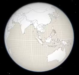\n\nThat can be changed by setting a color on the [surfaceColor](https://developers.arcgis.com/javascript/latest/references/core/Ground/#surfaceColor) property:\n\n```js\nmap.ground.surfaceColor = '#004c73';\n```\n\n\n\nIf the scene contains underground data, reduce the [opacity](https://developers.arcgis.com/javascript/latest/references/core/Ground/#opacity) of the ground to be able to see through the ground:\n\n```js\nmap.ground.opacity = 0.4;\n```\n\n[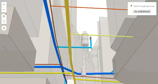](https://developers.arcgis.com/javascript/latest/sample-code/sceneview-underground/)"
|
|
11
11
|
},
|
|
12
12
|
"@arcgis.core.Map.Map": {
|
|
13
13
|
"description": "The Map class contains properties and methods for storing, managing, and overlaying [layers](https://developers.arcgis.com/javascript/latest/references/core/Map/#layers)\ncommon to both 2D and 3D viewing.\nLayers can be added and removed from the map, but are rendered via a\n[MapView](https://developers.arcgis.com/javascript/latest/references/core/views/MapView/) (for viewing data in 2D) or a\n[SceneView](https://developers.arcgis.com/javascript/latest/references/core/views/SceneView/) (for viewing data in 3D). Thus a map instance is a simple container\nthat holds the layers, while the [View](https://developers.arcgis.com/javascript/latest/references/core/views/View/) is the means of displaying and\ninteracting with a map's layers and basemap.\n\nA single map may be referenced by multiple views. [This sample](https://developers.arcgis.com/javascript/latest/sample-code/views-synchronize/)\nfor example, contains a single Map that is visible in two separate views - one in [2D](https://developers.arcgis.com/javascript/latest/references/core/views/MapView/)\nand the other in [3D](https://developers.arcgis.com/javascript/latest/references/core/views/SceneView/). Because one map may be accessed by multiple views\nin the same application, all user interaction with a map's layers is handled on the\n[View](https://developers.arcgis.com/javascript/latest/references/core/views/View/), not the Map.\n\nAn instance of Map is an essential component of the [MapView](https://developers.arcgis.com/javascript/latest/references/core/views/MapView/)\nand [SceneView](https://developers.arcgis.com/javascript/latest/references/core/views/SceneView/). A Map object should be created prior to a\nview so it can be passed into the `map` property of that view\n(e.g. [MapView.map](https://developers.arcgis.com/javascript/latest/references/core/views/MapView/#map), [SceneView.map](https://developers.arcgis.com/javascript/latest/references/core/views/SceneView/#map)).\n\n```js\n// Load the Map and MapView modules\nconst [Map, MapView] = await $arcgis.import([\"@arcgis/core/Map.js\", \"@arcgis/core/views/MapView.js\"]);\n// Create a Map instance\nconst myMap = new Map({\n basemap: \"streets-vector\"\n});\n// Create a MapView instance (for 2D viewing) and reference the map instance\nconst view = new MapView({\n map: myMap\n});\n```"
|
|
14
14
|
},
|
|
15
15
|
"@arcgis.core.PopupTemplate.PopupTemplate": {
|
|
16
|
-
"description": "A PopupTemplate formats and defines the content of a [Popup](https://developers.arcgis.com/javascript/latest/references/core/widgets/Popup/) for\na specific [Layer](https://developers.arcgis.com/javascript/latest/references/core/layers/Layer/) or [Graphic](https://developers.arcgis.com/javascript/latest/references/core/Graphic/). The user can also use\nthe PopupTemplate to access values from feature attributes and values returned\nfrom [Arcade](https://developers.arcgis.com/javascript/latest/arcade/) expressions when a feature in the\nview is selected.\n\nThe PopupTemplate contains [title](https://developers.arcgis.com/javascript/latest/references/core/PopupTemplate/#title) and [content](https://developers.arcgis.com/javascript/latest/references/core/PopupTemplate/#content) properties\nthat act as a template used to transform a feature's\n[Graphic.attributes](https://developers.arcgis.com/javascript/latest/references/core/Graphic/#attributes) into an HTML representation.\nThe syntax `{fieldName}` or `{expression/expressionName}` performs parameter\nsubstitution. The default behavior on a [Graphic](https://developers.arcgis.com/javascript/latest/references/core/Graphic/) is to show the\nview's Popup after a\nclick on the [Graphic](https://developers.arcgis.com/javascript/latest/references/core/Graphic/). A PopupTemplate is required for this\ndefault behavior.\n\nPopupTemplate also allows you to format the `Number` and `Date` field values and\noverride field aliases with\nthe [fieldInfos](https://developers.arcgis.com/javascript/latest/references/core/PopupTemplate/#fieldInfos) property. [actions](https://developers.arcgis.com/javascript/latest/references/core/PopupTemplate/#actions) may also be added\nto the template to give users\nthe ability to perform actions related to the feature, such as zooming to it or performing a Query based on\nthe feature's location or attributes.\n\n[ for\na specific [Layer](https://developers.arcgis.com/javascript/latest/references/core/layers/Layer/) or [Graphic](https://developers.arcgis.com/javascript/latest/references/core/Graphic/). The user can also use\nthe PopupTemplate to access values from feature attributes and values returned\nfrom [Arcade](https://developers.arcgis.com/javascript/latest/arcade/) expressions when a feature in the\nview is selected.\n\nThe PopupTemplate contains [title](https://developers.arcgis.com/javascript/latest/references/core/PopupTemplate/#title) and [content](https://developers.arcgis.com/javascript/latest/references/core/PopupTemplate/#content) properties\nthat act as a template used to transform a feature's\n[Graphic.attributes](https://developers.arcgis.com/javascript/latest/references/core/Graphic/#attributes) into an HTML representation.\nThe syntax `{fieldName}` or `{expression/expressionName}` performs parameter\nsubstitution. The default behavior on a [Graphic](https://developers.arcgis.com/javascript/latest/references/core/Graphic/) is to show the\nview's Popup after a\nclick on the [Graphic](https://developers.arcgis.com/javascript/latest/references/core/Graphic/). A PopupTemplate is required for this\ndefault behavior.\n\nPopupTemplate also allows you to format the `Number` and `Date` field values and\noverride field aliases with\nthe [fieldInfos](https://developers.arcgis.com/javascript/latest/references/core/PopupTemplate/#fieldInfos) property. [actions](https://developers.arcgis.com/javascript/latest/references/core/PopupTemplate/#actions) may also be added\nto the template to give users\nthe ability to perform actions related to the feature, such as zooming to it or performing a Query based on\nthe feature's location or attributes.\n\n[](https://developers.arcgis.com/javascript/latest/sample-code/sandbox/?sample=intro-popuptemplate)\n\nIn the image above, the initial text **Marriage in Nassau County Census Tract 5177.01** is set in the [title](https://developers.arcgis.com/javascript/latest/references/core/PopupTemplate/#title)\nproperty of the PopupTemplate where `CENSUS_TRACT` is the name of the field containing census tract numbers.\n\n```\npopupTemplate.title = \"Marriage in {COUNTY} County {CENSUS_TRACT}\",\n```\n\nThe rest of the content is defined in the [content](https://developers.arcgis.com/javascript/latest/references/core/PopupTemplate/#content) property where\n`MARRIEDRATE`, `NEVMARR_CY`, `MARRIED_CY`, and `DIVORCD_CY` are all field names that contain\nvalues to be used in the popup.\n\n```\npopupTemplate.content = \"<p>From 2017 to 2021, <b>{MARRIEDRATE}%</b> of the\" +\n\" population in {CENSUS_TRACT} were married.</p>\" +\n\"<ul><li>{MARRIED_CY} people were married.</li>\" +\n\"<li>{NEVMARR_CY} people had never married.</li>\" +\n\"<li>{DIVORCD_CY} people were divorced.</li><ul>\";\n```\nThe above example demonstrates how to format the content directly with a custom\ntext string. This is one way to format the template, it is also possible to\nadd additional elements in the content such as `fields`, `media`, and `attachments`.\nThese elements can be added individually or combined. More information on working\nwith these various elements can be found in [content](https://developers.arcgis.com/javascript/latest/references/core/PopupTemplate/#content).\n\nPopupTemplates may also contain custom [actions](https://developers.arcgis.com/javascript/latest/references/core/PopupTemplate/#actions). When clicked, these actions execute custom code\ndefined by the developer. See the [actions](https://developers.arcgis.com/javascript/latest/references/core/PopupTemplate/#actions) property for more details."
|
|
17
17
|
},
|
|
18
18
|
"@arcgis.core.PopupTemplate.PopupTemplateProperties": {
|
|
19
19
|
"properties": {
|
|
20
20
|
"actions": {
|
|
21
21
|
"$ref": "#/definitions/ReadonlyArrayOrCollection<(ActionButtonProperties&{type:\"button\";})|(ActionToggleProperties&{type:\"toggle\";})>",
|
|
22
|
-
"description": "A [Collection](https://developers.arcgis.com/javascript/latest/references/core/core/Collection/) of [action](https://developers.arcgis.com/javascript/latest/references/core/support/actions/ActionButton/) or [action toggle](https://developers.arcgis.com/javascript/latest/references/core/support/actions/ActionToggle/) objects.\nEach object represents an action or function that may be executed by clicking the icon\nor image symbolizing them in the [Popup](https://developers.arcgis.com/javascript/latest/references/core/widgets/Popup/). By default, every\n[Popup](https://developers.arcgis.com/javascript/latest/references/core/widgets/Popup/) has a `zoom-to` action styled with a magnifying glass icon\n of [action](https://developers.arcgis.com/javascript/latest/references/core/support/actions/ActionButton/) or [action toggle](https://developers.arcgis.com/javascript/latest/references/core/support/actions/ActionToggle/) objects.\nEach object represents an action or function that may be executed by clicking the icon\nor image symbolizing them in the [Popup](https://developers.arcgis.com/javascript/latest/references/core/widgets/Popup/). By default, every\n[Popup](https://developers.arcgis.com/javascript/latest/references/core/widgets/Popup/) has a `zoom-to` action styled with a magnifying glass icon\n.\nWhen this icon is clicked, the view zooms in four LODs and centers on the selected feature.\n\nPopupTemplates do not have default actions. To override actions on the\n[Popup](https://developers.arcgis.com/javascript/latest/references/core/widgets/Popup/) using PopupTemplate see [overwriteActions](https://developers.arcgis.com/javascript/latest/references/core/PopupTemplate/#overwriteActions).\nActions defined in a PopupTemplate will only appear in the [Popup](https://developers.arcgis.com/javascript/latest/references/core/widgets/Popup/) for\nfeatures or layers that apply that particular PopupTemplate.\n\nThe order of each action in the popup is the same order in which they appear in\nthe actions [Collection](https://developers.arcgis.com/javascript/latest/references/core/core/Collection/).\n\nThe [Popup.@trigger-action](https://developers.arcgis.com/javascript/latest/references/core/widgets/Popup/#event-trigger-action) event in\n[Popup](https://developers.arcgis.com/javascript/latest/references/core/widgets/Popup/) fires each time an action in the popup is clicked.\nThis event should be used to execute custom code for each action clicked. For example, if you would\nlike to add a `zoom-out` action to the PopupTemplate that zooms the view out several LODs, you would\ndefine the zoom-out code in a separate function. Then you would call the custom `zoom-out` function\nin the [Popup.@trigger-action](https://developers.arcgis.com/javascript/latest/references/core/widgets/Popup/#event-trigger-action) event handler. See the sample code\nsnippet below for more details on how this works.\n\nActions are defined with the properties listed in the [ActionButton](https://developers.arcgis.com/javascript/latest/references/core/support/actions/ActionButton/) or [ActionToggle](https://developers.arcgis.com/javascript/latest/references/core/support/actions/ActionToggle/) class."
|
|
23
23
|
},
|
|
24
24
|
"content": {
|
|
25
25
|
"anyOf": [
|
|
26
26
|
{
|
|
27
27
|
"$ref": "#/definitions/HTMLElement"
|
|
28
28
|
},
|
|
29
|
-
{
|
|
30
|
-
"$ref": "#/definitions/@arcgis.core.widgets.Widget.Widget"
|
|
31
|
-
},
|
|
32
29
|
{
|
|
33
30
|
"items": {
|
|
34
31
|
"$ref": "#/definitions/@arcgis.core.popup.content.Content.ContentProperties"
|
|
@@ -45,7 +42,7 @@
|
|
|
45
42
|
"type": "string"
|
|
46
43
|
}
|
|
47
44
|
],
|
|
48
|
-
"description": "The template for defining and formatting a popup's content.\n\n* **String** - A popup's content can be a simple text or string value referencing field\n values or [Arcade](https://developers.arcgis.com/javascript/latest/arcade/) expressions. Expressions must be defined in\n the [expressionInfos](https://developers.arcgis.com/javascript/latest/references/core/PopupTemplate/#expressionInfos) property.\n* **Popup elements** - You can also display content as popup elements. There are various types of\n elements which can be used individually or combined. The order in which they are set determines\n how they display within the popup. See the items below describing each element.\n - **text** - A [text content element](https://developers.arcgis.com/javascript/latest/references/core/popup/content/TextContent/)\n that provides descriptive text as content.\n - **media** - A [media content element](https://developers.arcgis.com/javascript/latest/references/core/popup/content/MediaContent/)\n that is used to display media such as charts/images.\n - **fields** - A [fields content element](https://developers.arcgis.com/javascript/latest/references/core/popup/content/FieldsContent/)
|
|
45
|
+
"description": "The template for defining and formatting a popup's content.\n\n* **String** - A popup's content can be a simple text or string value referencing field\n values or [Arcade](https://developers.arcgis.com/javascript/latest/arcade/) expressions. Expressions must be defined in\n the [expressionInfos](https://developers.arcgis.com/javascript/latest/references/core/PopupTemplate/#expressionInfos) property.\n* **Popup elements** - You can also display content as popup elements. There are various types of\n elements which can be used individually or combined. The order in which they are set determines\n how they display within the popup. See the items below describing each element.\n - **text** - A [text content element](https://developers.arcgis.com/javascript/latest/references/core/popup/content/TextContent/)\n that provides descriptive text as content.\n - **media** - A [media content element](https://developers.arcgis.com/javascript/latest/references/core/popup/content/MediaContent/)\n that is used to display media such as charts/images.\n - **fields** - A [fields content element](https://developers.arcgis.com/javascript/latest/references/core/popup/content/FieldsContent/)\n that contains the fields to display within the content. If this is not set\n directly within the `content` property, the popup will display whatever is set in the\n [fieldInfos](https://developers.arcgis.com/javascript/latest/references/core/PopupTemplate/#fieldInfos) property.\n - **attachments** - An [attachments content element](https://developers.arcgis.com/javascript/latest/references/core/popup/content/AttachmentsContent/)\n that contains attachments associated with the feature.\n - **expression** - An [expression content element](https://developers.arcgis.com/javascript/latest/references/core/popup/content/ExpressionContent/) that contains an [Arcade](https://developers.arcgis.com/javascript/latest/arcade/)\n expression evaluating to a dictionary representing a [TextContent](https://developers.arcgis.com/javascript/latest/references/core/popup/content/TextContent/),\n [FieldsContent](https://developers.arcgis.com/javascript/latest/references/core/popup/content/FieldsContent/), or a [MediaContent](https://developers.arcgis.com/javascript/latest/references/core/popup/content/MediaContent/) popup element as\n defined in the [Popup Element web map specification](https://developers.arcgis.com/web-map-specification/objects/popupElement/).\n - **relationship** - A [relationship content element](https://developers.arcgis.com/javascript/latest/references/core/popup/content/RelationshipContent/) associated with a feature.\n - **custom** - A [custom content element](https://developers.arcgis.com/javascript/latest/references/core/popup/content/CustomContent/)\n that contains custom content.\n* **promise** - The PopupTemplate's content may also be defined with a promise that resolves to any of the\n above-mentioned elements. This is useful for cases when you call a method or execute a query and want\n to display the results in the popup. Simply pass the promise to the popupTemplate's content and ensure\n that it resolves to a string or other popup element.\n* **function** - Content may be defined with a JavaScript function that returns any of the above-mentioned\n elements. This is useful when your popup requires additional processing or functionality than what is\n provided with the content types listed above. For example, assume that you would like to\n display charts using third-party JavaScript libraries or categorize information into separate tabs.\n In these cases, you can use a function that returns either a string, a reference to an\n HTML element, a popup element, or a promise.\n When the feature is clicked, the feature is passed as an argument to the function and provides\n access to the feature's graphic and attributes. Set the [outFields](https://developers.arcgis.com/javascript/latest/references/core/PopupTemplate/#outFields) property to\n specify any fields needed for rendering the popup and set the [returnGeometry](https://developers.arcgis.com/javascript/latest/references/core/PopupTemplate/#returnGeometry) property\n to `true` if needing access to the associated feature's geometry.\n The function then executes and returns a value to display in the popup template.\n\n> [!CAUTION]\n>\n> **Note:** Autocasting does not apply when creating content via a function or promise."
|
|
49
46
|
},
|
|
50
47
|
"expressionInfos": {
|
|
51
48
|
"description": "An array of objects or [ExpressionInfo[]](https://developers.arcgis.com/javascript/latest/references/core/popup/ExpressionInfo/) that reference\n[Arcade](https://developers.arcgis.com/javascript/latest/arcade/) expressions following\nthe specification defined by the [Arcade Popup Profile](https://developers.arcgis.com/javascript/latest/arcade/#popup).",
|
|
@@ -55,7 +52,7 @@
|
|
|
55
52
|
"type": "array"
|
|
56
53
|
},
|
|
57
54
|
"fieldInfos": {
|
|
58
|
-
"description": "An array of [FieldInfo](https://developers.arcgis.com/javascript/latest/references/core/popup/FieldInfo/) that defines how fields in the dataset\nor values from [Arcade](https://developers.arcgis.com/javascript/latest/arcade/) expressions participate\nin a popup. If no [FieldInfo](https://developers.arcgis.com/javascript/latest/references/core/popup/FieldInfo/) are specified, nothing will display since\nthe popup will only display the fields that are defined by this array.\nEach [FieldInfo](https://developers.arcgis.com/javascript/latest/references/core/popup/FieldInfo/) contains properties for a single field\nor expression. This property can be set directly within the PopupTemplate or\nwithin the [fields content element](https://developers.arcgis.com/javascript/latest/references/core/popup/content/FieldsContent/).\nIf this is not set within the [fields content element](https://developers.arcgis.com/javascript/latest/references/core/popup/content/FieldsContent/),\nit will default to whatever is specified directly within the `PopupTemplate.fieldInfos`.\n\n> [!WARNING]\n>\n> Use this `fieldInfos` property to display fields from related tables in chart or text elements.\n> `FieldInfos` set within the template's [fields content element](https://developers.arcgis.com/javascript/latest/references/core/popup/content/FieldsContent/) take precedence over the `PopupTemplate.fieldInfos`.\n\nThe image on the left is a result of using the first example snippet below, whereas the image on the right is a result of the second snippet.\n\n| **Content set using 'fields' type** | **Content referenced from fields set within fieldInfo** |\n| -------------------------- | --------------------------- |\n|  that defines how fields in the dataset\nor values from [Arcade](https://developers.arcgis.com/javascript/latest/arcade/) expressions participate\nin a popup. If no [FieldInfo](https://developers.arcgis.com/javascript/latest/references/core/popup/FieldInfo/) are specified, nothing will display since\nthe popup will only display the fields that are defined by this array.\nEach [FieldInfo](https://developers.arcgis.com/javascript/latest/references/core/popup/FieldInfo/) contains properties for a single field\nor expression. This property can be set directly within the PopupTemplate or\nwithin the [fields content element](https://developers.arcgis.com/javascript/latest/references/core/popup/content/FieldsContent/).\nIf this is not set within the [fields content element](https://developers.arcgis.com/javascript/latest/references/core/popup/content/FieldsContent/),\nit will default to whatever is specified directly within the `PopupTemplate.fieldInfos`.\n\n> [!WARNING]\n>\n> Use this `fieldInfos` property to display fields from related tables in chart or text elements.\n> `FieldInfos` set within the template's [fields content element](https://developers.arcgis.com/javascript/latest/references/core/popup/content/FieldsContent/) take precedence over the `PopupTemplate.fieldInfos`.\n\nThe image on the left is a result of using the first example snippet below, whereas the image on the right is a result of the second snippet.\n\n| **Content set using 'fields' type** | **Content referenced from fields set within fieldInfo** |\n| -------------------------- | --------------------------- |\n| 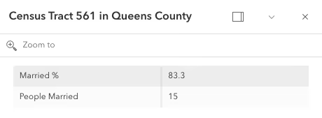 |  |",
|
|
59
56
|
"items": {
|
|
60
57
|
"$ref": "#/definitions/@arcgis.core.popup.FieldInfo.FieldInfoProperties"
|
|
61
58
|
},
|
|
@@ -63,7 +60,7 @@
|
|
|
63
60
|
},
|
|
64
61
|
"lastEditInfoEnabled": {
|
|
65
62
|
"default": true,
|
|
66
|
-
"description": "Indicates whether or not editor tracking should display.\n\n",
|
|
67
64
|
"type": "boolean"
|
|
68
65
|
},
|
|
69
66
|
"layerOptions": {
|
|
@@ -99,11 +96,11 @@
|
|
|
99
96
|
"description": "Describes a point of view for a 2D or 3D view. In a 2D view, the viewpoint is\ndetermined using a center point and scale value. In a 3D view, it is determined\nusing a [Camera](https://developers.arcgis.com/javascript/latest/references/core/Camera/) position. The Viewpoint can be\nbookmarked for later use, or used for navigation purposes."
|
|
100
97
|
},
|
|
101
98
|
"@arcgis.core.core.Collection.Collection": {
|
|
102
|
-
"description": "Collection stores an array of items of the same type.\nIt provides useful utility methods for working with items in the Collection, including\n[filter()](https://developers.arcgis.com/javascript/latest/references/core/core/Collection/#filter), [find()](https://developers.arcgis.com/javascript/latest/references/core/core/Collection/#find), and [reduce()](https://developers.arcgis.com/javascript/latest/references/core/core/Collection/#reduce).\n\nA Collection can be of any type. For example, [GraphicsLayer.graphics](https://developers.arcgis.com/javascript/latest/references/core/layers/GraphicsLayer/#graphics)\nis a collection of graphics that are stored in the GraphicsLayer. You can use the methods found in the Collection class\nto add, remove, re-order, or manipulate graphics in a GraphicsLayer.\n\nAnother example of a Collection is [Map.layers](https://developers.arcgis.com/javascript/latest/references/core/Map/#layers), which is a Collection of operational layers included in\nthe [Map](https://developers.arcgis.com/javascript/latest/references/core/Map/).\n\n```js\n// Removes a layer from the map using Collection.remove();\nmap.layers.remove(layer);\n```\n\nThe [change event](https://developers.arcgis.com/javascript/latest/references/core/core/Collection/#event-change) fires each time an item is [added](https://developers.arcgis.com/javascript/latest/references/core/core/Collection/#add), [moved](https://developers.arcgis.com/javascript/latest/references/core/core/Collection/#reorder), or [removed](https://developers.arcgis.com/javascript/latest/references/core/core/Collection/#remove)\nfrom the Collection.\n\nAs of version 4.18, you can iterate through the items of a Collection using [for...of](https://developer.mozilla.org/
|
|
99
|
+
"description": "Collection stores an array of items of the same type.\nIt provides useful utility methods for working with items in the Collection, including\n[filter()](https://developers.arcgis.com/javascript/latest/references/core/core/Collection/#filter), [find()](https://developers.arcgis.com/javascript/latest/references/core/core/Collection/#find), and [reduce()](https://developers.arcgis.com/javascript/latest/references/core/core/Collection/#reduce).\n\nA Collection can be of any type. For example, [GraphicsLayer.graphics](https://developers.arcgis.com/javascript/latest/references/core/layers/GraphicsLayer/#graphics)\nis a collection of graphics that are stored in the GraphicsLayer. You can use the methods found in the Collection class\nto add, remove, re-order, or manipulate graphics in a GraphicsLayer.\n\nAnother example of a Collection is [Map.layers](https://developers.arcgis.com/javascript/latest/references/core/Map/#layers), which is a Collection of operational layers included in\nthe [Map](https://developers.arcgis.com/javascript/latest/references/core/Map/).\n\n```js\n// Removes a layer from the map using Collection.remove();\nmap.layers.remove(layer);\n```\n\nThe [change event](https://developers.arcgis.com/javascript/latest/references/core/core/Collection/#event-change) fires each time an item is [added](https://developers.arcgis.com/javascript/latest/references/core/core/Collection/#add), [moved](https://developers.arcgis.com/javascript/latest/references/core/core/Collection/#reorder), or [removed](https://developers.arcgis.com/javascript/latest/references/core/core/Collection/#remove)\nfrom the Collection.\n\nAs of version 4.18, you can iterate through the items of a Collection using [for...of](https://developer.mozilla.org/docs/Web/JavaScript/Reference/Statements/for...of).\n\n```js\n// a collection of graphics displayed in the view\nconst graphics = view.graphics;\n\nfor (const graphic of graphics){\n // do something with each view graphic\n}\n```\nAs of version 4.23, [reactiveUtils](https://developers.arcgis.com/javascript/latest/references/core/core/reactiveUtils/) can be utilized to watch for property changes on items in a Collection.\n\n```js\n// reactiveUtils watch method can be used to watch the visible\n// property of each layer within the map.allLayer's collection\nconst handle = reactiveUtils.watch(\n () => view.map.allLayers.every((layer) => layer.visible),\n (allVisible) => {\n console.log(`All layers are visible = ${allVisible}`);\n }\n);\n```"
|
|
103
100
|
},
|
|
104
101
|
"@arcgis.core.core.Collection.ReadonlyCollection": {},
|
|
105
102
|
"@arcgis.core.core.Error.Error": {
|
|
106
|
-
"description": "Error is a class that enhances the debugging and error handling process. Rather than returning a generic\n[JavaScript error](https://developer.mozilla.org/
|
|
103
|
+
"description": "Error is a class that enhances the debugging and error handling process. Rather than returning a generic\n[JavaScript error](https://developer.mozilla.org/docs/Web/JavaScript/Reference/Global_Objects/Error),\nthis Error returns a standardized error object with several properties. The error class can be useful\nin many scenarios, such as working with promises, the [esriRequest](https://developers.arcgis.com/javascript/latest/references/core/request/) module, and many different layers and widgets."
|
|
107
104
|
},
|
|
108
105
|
"@arcgis.core.core.Handles.Handles": {
|
|
109
106
|
"description": "This class helps manage a group of handles."
|
|
@@ -118,12 +115,12 @@
|
|
|
118
115
|
"properties": {
|
|
119
116
|
"hasM": {
|
|
120
117
|
"default": false,
|
|
121
|
-
"description": "Indicates if the geometry has M values.",
|
|
118
|
+
"description": "Indicates if the geometry has m-values (measure). M-values allow attribute values to be stored with the geometry.\n- `true`: The geometry is m aware. M-values are part of the geometry coordinates.\n- `false`: The geometry is not m aware. M-values are not part of the coordinates.",
|
|
122
119
|
"type": "boolean"
|
|
123
120
|
},
|
|
124
121
|
"hasZ": {
|
|
125
122
|
"default": false,
|
|
126
|
-
"description": "Indicates if the geometry has z-values (elevation).\n
|
|
123
|
+
"description": "Indicates if the geometry has z-values (elevation).\n- `true`: The geometry is z aware. Z-values are part of the geometry coordinates.\n- `false`: The geometry is not z aware. Z-values are not part of the coordinates.",
|
|
127
124
|
"type": "boolean"
|
|
128
125
|
},
|
|
129
126
|
"mmax": {
|
|
@@ -170,13 +167,13 @@
|
|
|
170
167
|
"type": "object"
|
|
171
168
|
},
|
|
172
169
|
"@arcgis.core.geometry.Mesh.Mesh": {
|
|
173
|
-
"description": "A mesh is a general, client-side 3D [Geometry](https://developers.arcgis.com/javascript/latest/references/core/geometry/Geometry/) type\ncomposed of [vertices with attributes](https://developers.arcgis.com/javascript/latest/references/core/geometry/Mesh/#vertexAttributes). The vertices include\ngeographic position, normals that affect lighting/shading and UV coordinates that\ncan be used to map images to the mesh. Vertices are combined into 3D primitives\nto render the mesh in the scene (only triangle primitives are currently supported).\n\nMesh geometries can have an intrinsic material that determines how it is being\ndisplayed. Similar to 3D objects in scene layers, mesh geometries are symbolized with a\n[MeshSymbol3D](https://developers.arcgis.com/javascript/latest/references/core/symbols/MeshSymbol3D/) symbol containing a\n[FillSymbol3DLayer](https://developers.arcgis.com/javascript/latest/references/core/symbols/FillSymbol3DLayer/).\n\nTo support multiple materials (as is often the case for complex 3D models), meshes\nmay define [components](https://developers.arcgis.com/javascript/latest/references/core/geometry/Mesh/#components) that define a material for a specific region\nin the mesh. In addition to supporting multiple materials, components can also\nreuse vertices that would otherwise be duplicated to form triangles.\n\nMeshes are loadable since 4.27. In particular when meshes come from remote services like\nthrough [SceneLayer.queryFeatures()](https://developers.arcgis.com/javascript/latest/references/core/layers/SceneLayer/#queryFeatures), then\nthe contents of the mesh needs to be loaded asynchronously through the\n[load()](https://developers.arcgis.com/javascript/latest/references/core/geometry/Mesh/#load) method before\n[vertexAttributes](https://developers.arcgis.com/javascript/latest/references/core/geometry/Mesh/#vertexAttributes),\n[extent](https://developers.arcgis.com/javascript/latest/references/core/geometry/Mesh/#extent),\n[components](https://developers.arcgis.com/javascript/latest/references/core/geometry/Mesh/#components), etc. are available.\n\nMeshes represent fully georeferenced 3D geometry and care needs to be taken when importing mesh data.\n<details>\n<summary>Read More</summary>\n\nIt is typical for modern 3D GIS workflows that 3D geometry data be represented by 3D models, which can be stored in different file formats like glTF, OBJ, FBX, IFC, etc. These models can come from different sources, such as 3D modeling software like SketchUp or Blender, CAD software like Revit, or even custom mesh generation code.\n\nWhile some of the software may work in a georeferenced space and some of the file formats, such as IFC, may be georeferenced, much of the software and most of the model file formats are not georeferenced. This presents the challenge of expressing different georeferencing scenarios while maintaining a fast and efficient experience when displaying and editing 3D model content. In the Maps SDK we strive to strike a good balance between allowing our users to work with different scenarios while preventing situations in which good display and editing experience cannot be provided.\n\n<span id=\"mesh-api\"></span>\n## Mesh API\n\nThe entry point for representing 3D models in the Maps SDK is the [Mesh](https://developers.arcgis.com/javascript/latest/references/core/geometry/Mesh/). We refer to the API reference for details on mesh [components](https://developers.arcgis.com/javascript/latest/references/core/geometry/Mesh/#components), [MeshComponent.material](https://developers.arcgis.com/javascript/latest/references/core/geometry/support/MeshComponent/#material) and how to create meshes. This guide is concerned with georeferencing meshes.\n\nA mesh represents a georeferenced 3D model in the Maps SDK. In order to fully georeference meshes three things are needed:\n1. Spatial reference\n2. Location of the mesh in that spatial reference. We call this the origin.\n3. The coordinate system in which mesh vertices are provided. We call it the vertex space.\n\nGiven these three things, meshes can be fully georeferenced. However, for certain configurations of spatial reference, mesh vertex space and viewing mode, costly projection may be required. Because that would greatly affect display and editing performance, we decided to not display or allow editing in those cases. Please see the [limitations](https://developers.arcgis.com/javascript/latest/references/core/geometry/Mesh/#limitations) section for an overview of these restrictions.\n\nThe [spatial reference](https://developers.arcgis.com/javascript/latest/references/core/geometry/SpatialReference/) of the mesh is provided with its construction. When using one of the create functions, such as\n[createFromGLTF()](https://developers.arcgis.com/javascript/latest/references/core/geometry/Mesh/#createFromGLTF), the spatial reference will be taken from the provided location.\n\n### Mesh vertex spaces\n\nThe origin and spatial reference of a mesh provide georeferencing, but only for the origin. A mesh is composed of vertices, and they may exist in different coordinate systems depending on the data source. Hence, to fully georeference the mesh, it's crucial to define the coordinate system associated with the mesh vertices. The [mesh vertex space property](https://developers.arcgis.com/javascript/latest/references/core/geometry/Mesh/#vertexSpace) was introduced to address this need. This property specifies the meaning of the mesh vertex coordinates, ensuring that the entire mesh can be correctly georeferenced.\n\n#### Mesh local vertex space\n\nMost popular 3D model formats, such as glTF, are not georeferenced and represent the mesh vertex coordinates in a plain **local cartesian** space with some length unit (e.g. `meters` for glTF). The coordinate (0,0,0) is the origin. We call this coordinate system \"local\" and represent it using the [MeshLocalVertexSpace](https://developers.arcgis.com/javascript/latest/references/core/geometry/support/MeshLocalVertexSpace/). The units in this vertex space are always \"meters\".\n\n<img src=\"https://developers.arcgis.com/javascript/latest/assets/references/core/geometry/mesh-local-vertex-space.png\" style=\"width:300px;\"/>\n\n*local vertex space*\n\nGeoreferencing local coordinates is done by \"putting them on the map\" using a georeferenced cartesian reference frame. This frame is found by using the [local tangent plane](https://en.wikipedia.org/wiki/Local_tangent_plane_coordinates) at the georeferenced origin of the mesh. When the spatial reference uses a geographic coordinate system (GCS) or Web Mercator, the tangent plane is aligned such that the local Y tangent vector is always pointing to the north pole resulting in the east, north, up (ENU) frame.\n\nCurrently we use the tangent plane of the sphere even for ellipsoidal geographic coordinate systems. This is a simplification we use as we render on a perfect sphere in global viewing mode.\n\n<img src=\"https://developers.arcgis.com/javascript/latest/assets/references/core/geometry/mesh-local-vertex-space-on-GCS-or-WM.png\" style=\"width:300px;\"/>\n\n*local vertex space on GCS or Web Mercator (ENU)*\n\nA [local vertex space](https://developers.arcgis.com/javascript/latest/references/core/geometry/support/MeshLocalVertexSpace/) with a spatial reference which is a GCS or Web Mercator is efficient to work with as the tangent plane is easy to find and we can simply move the vertices to its georeferenced location using efficient linear transformations. This comes at the cost of an approximation error between the tangent plane and the actual surface. Consequently for larger models, this error increases while it decreases as the models get smaller.\n\nThere is an important element to consider when a mesh is created with a [local vertex space](https://developers.arcgis.com/javascript/latest/references/core/geometry/support/MeshLocalVertexSpace/) (e.g. by creating it from a glTF) and displayed in local viewing mode where a projected coordinate system (PCS) is used:\n\nThe projection introduces a warping and distortion of the space in order to allow mapping of surface coordinates to a plane. This produces a mismatch between the linear coordinates of the local vertex space and the warped, non-linear coordinates of the underlying spatial reference. While steps along a line in the local vertex space are of same length, steps along a line in the underlying spatial reference are not. This means that measuring the same line in local space and the underlying spatial reference will produce different measurements. This difference further depends on the origin location of the mesh. It is important to realize that this scenario cannot be used when correct georeferencing is required.\n\n#### Mesh georeferenced vertex spaces\n\nThe [georeferenced vertex space](https://developers.arcgis.com/javascript/latest/references/core/geometry/support/MeshGeoreferencedVertexSpace/) indicates that mesh vertices are already projected and that their coordinates are in the spatial reference of the mesh. If an [MeshGeoreferencedVertexSpace.origin](https://developers.arcgis.com/javascript/latest/references/core/geometry/support/MeshGeoreferencedVertexSpace/#origin) is provided, those vertex coordinates are interpreted as offsets relative to the origin. Otherwise, the coordinates are interpreted as absolute.\n\n<img src=\"https://developers.arcgis.com/javascript/latest/assets/references/core/geometry/mesh-georeferenced-vertex-space-on-PCS.png\" style=\"width:300px;\"/>\n\n*georeferenced vertex space on PCS*\n\nDisplay and editing are efficient for meshes with a georeferenced vertex space and when the spatial reference is a projected coordinate system and matches the spatial reference of the view. This is because in those cases, manipulations like moving a mesh can be expressed as linear transformations.\n\n## The effect of viewing modes\n\nWe will not display or allow edits for configurations where efficient display or editing is not possible due to costly reprojections being required. It is important to realize that the [SceneView.viewingMode](https://developers.arcgis.com/javascript/latest/references/core/views/SceneView/#viewingMode) defines the spatial reference in which the data is displayed and hence has a direct effect on which vertex space and spatial reference combination of meshes can be done efficiently. This means that, depending on the viewing mode, display and editing of meshes with certain combinations of vertex space and spatial reference are not supported. See [limitations](https://developers.arcgis.com/javascript/latest/references/core/geometry/Mesh/#limitations) for an overview.\n\nWe established that for mesh spatial references which use a geographic coordinate system (or Web Mercator) and a local vertex space, display and editing can be done efficiently. That is true for `\"global\"` viewing mode, where the view uses a geographic coordinate system (or Web Mercator) for display.\n\nMeshes with a georeferenced vertex space and a spatial reference using a projected coordinate system (PCS) can be displayed and edited efficiently in a view using the `\"local\"` viewing mode and when the view has the same spatial reference as the mesh.\n\n## Web Mercator\n\nWeb Mercator is a spatial reference with a projected coordinate system and the de facto standard for web mapping applications. This is due to its suitability for efficient map tiling. Even though it uses a projected coordinate system, we still support using Web Mercator in global viewing mode. This is because of its importance for web mapping and also because projecting Web Mercator on the globe cancels out the strong distortions near the poles. It is the only PCS based spatial reference we support in global viewing mode.\n\nWeb Mercator support for global viewing mode naturally extends to supporting efficient display and editing for meshes with a Web Mercator spatial reference and a local vertex space, even though it is based on a projected coordinate system. Since Web Mercator is a spatial reference based on a PCS, we also support efficient display and editing for Web Mercator with meshes using a georeferenced vertex space. Web Mercator is the only exception to the rule of only meshes with a spatial reference with a geographic coordinate system can be supported in global viewing mode.\n\n<span id=\"limitations\"></span>\n## Limitations\n\n- See [Scene Layers](https://developers.arcgis.com/javascript/latest/references/core/layers/SceneLayer/) in regards to limitations on display and editing for mesh features.\n\n## Troubleshooting mesh georeferencing\n\nIf meshes are not being displayed, then chances are that this is due to a configuration which the API does not support for display and editing.\n\n- First check the [SceneView.viewingMode](https://developers.arcgis.com/javascript/latest/references/core/views/SceneView/#viewingMode), [spatial reference](https://developers.arcgis.com/javascript/latest/references/core/geometry/Mesh/#spatialReference) and [vertex space](https://developers.arcgis.com/javascript/latest/references/core/geometry/Mesh/#vertexSpace) of the problematic mesh and consult the console of the JavaScript debugger. If the API rejects display of meshes, a warning message is printed.\n- If it is determined that an unsupported configuration is used, consider switching the [SceneView.viewingMode](https://developers.arcgis.com/javascript/latest/references/core/views/SceneView/#viewingMode) in your application.\n- If there is no other option, consider changing the data by switching to a supported spatial reference for the required [SceneView.viewingMode](https://developers.arcgis.com/javascript/latest/references/core/views/SceneView/#viewingMode) or by converting the mesh vertex data between local and georeferenced vertex space.\n- If meshes are displayed wrongly, then this could also be due to the vertex space not being correct. If applications export geometry with georeferenced coordinates as OBJ file for example, then one would need to use the `\"georeferenced\"` vertex space.\n\n</details>\n\n## Create simple mesh geometry primitives\n\nThe mesh geometry class has a number of convenience functions to create simple\nprimitive shapes. These shapes can help you get started with understanding\nmesh geometries.\n\n```js\n// Create a box mesh geometry\nlet mesh = Mesh.createBox(location, {\n size: {\n width: 100,\n height: 50,\n depth: 50\n },\n material: {\n color: \"red\"\n }\n});\n\n// Create a graphic and add it to the view\nlet graphic = new Graphic({\n geometry: mesh,\n symbol: {\n type: \"mesh-3d\",\n symbolLayers: [ { type: \"fill\" } ]\n }\n});\n\nview.graphics.add(graphic);\n```\n\n## Create mesh geometries manually\n\nMesh geometries can be manually created by specifying [vertexAttributes](https://developers.arcgis.com/javascript/latest/references/core/geometry/Mesh/#vertexAttributes) and\n[components](https://developers.arcgis.com/javascript/latest/references/core/geometry/Mesh/#components) like in the following example:\n\n```js\n// Create a mesh geometry representing a pyramid\nlet pyramidMesh = new Mesh({\n vertexAttributes: {\n // vertex positions for the Louvre pyramid, Paris\n position: [\n // vertex 0 - base of the pyramid, south\n 2.336006, 48.860818, 0,\n\n // vertex 1 - base of the pyramid, east\n 2.336172, 48.861114, 0,\n\n // vertex 2 - base of the pyramid, north\n 2.335724, 48.861229, 0,\n\n // vertex 3 - base of the pyramid, west\n 2.335563, 48.860922, 0,\n\n // vertex 4 - top of the pyramid\n 2.335896, 48.861024, 21\n ]\n },\n // Add a single component with faces that index the vertices\n // so we only need to define them once\n components: [\n {\n faces: [\n 0, 4, 3,\n 0, 1, 4,\n 1, 2, 4,\n 2, 3, 4\n ]\n }\n ],\n // specify a spatial reference if the position of the vertices is not in WGS84\n});\n\n// add the mesh geometry to a graphic\nlet graphic = new Graphic({\n geometry: pyramidMesh,\n symbol: {\n type: \"mesh-3d\",\n symbolLayers: [ { type: \"fill\" } ]\n }\n});\n\nview.graphics.add(graphic);\n```\n\n**Note:** Starting with version 4.11 autocasting is no longer supported for Mesh geometry."
|
|
170
|
+
"description": "## Overview\n\nIn general 3D terminology, a mesh is a set of vertices connected into faces that define the shape and surface of a\n3D object. In the Maps SDK, a Mesh instance is a [Geometry](https://developers.arcgis.com/javascript/latest/references/core/geometry/Geometry/) that stores those vertices in\n[vertexAttributes](https://developers.arcgis.com/javascript/latest/references/core/geometry/Mesh/#vertexAttributes).\n\nThe [position](https://developers.arcgis.com/javascript/latest/references/core/geometry/support/MeshVertexAttributes/#position) values define the shape of the 3D object,\n[normals](https://developers.arcgis.com/javascript/latest/references/core/geometry/support/MeshVertexAttributes/#normal) affect lighting and shading, and\n[UV coordinates](https://developers.arcgis.com/javascript/latest/references/core/geometry/support/MeshVertexAttributes/#uv) can be used to map images to the surface.\n[Mesh components](https://developers.arcgis.com/javascript/latest/references/core/geometry/support/MeshComponent/) define triangle faces and can assign materials to different\nregions of the Mesh geometry. Because faces index into the vertex attributes, components can reuse the same vertices\ninstead of duplicating them for every triangle.\n\nMesh geometries can define intrinsic materials. Similar to 3D objects in scene layers, they are symbolized with a\n[MeshSymbol3D](https://developers.arcgis.com/javascript/latest/references/core/symbols/MeshSymbol3D/) symbol containing a [FillSymbol3DLayer](https://developers.arcgis.com/javascript/latest/references/core/symbols/FillSymbol3DLayer/). The fill symbol layer renders\nthe mesh surface and can define visual overrides such as material, color, and edges.\n\nMeshes returned from remote services, such as through [SceneLayer.queryFeatures()](https://developers.arcgis.com/javascript/latest/references/core/layers/SceneLayer/#queryFeatures), may need to load\ntheir content asynchronously. When a Mesh is added to a view through a [Graphic](https://developers.arcgis.com/javascript/latest/references/core/Graphic/), the API loads it as needed\nfor display. Call [load()](https://developers.arcgis.com/javascript/latest/references/core/geometry/Mesh/#load) before accessing properties such as\n[vertexAttributes](https://developers.arcgis.com/javascript/latest/references/core/geometry/Mesh/#vertexAttributes), [extent](https://developers.arcgis.com/javascript/latest/references/core/geometry/Mesh/#extent), and [components](https://developers.arcgis.com/javascript/latest/references/core/geometry/Mesh/#components) directly\nwhen the mesh is not yet loaded.\n\n## Mesh georeferencing\n\nA source 3D model file, imported model, or custom vertex buffer often stores vertex positions as plain x, y, z\nnumbers. Those numbers do not, by themselves, say whether [10, 0, 0] means ten meters east of the source model's\nown [0, 0, 0], ten map units east of a provided placement point in a projected coordinate system (PCS), or an absolute\ncoordinate on a map. Some formats (e.g., IFC4) and workflows include georeferencing metadata, but a Mesh instance still needs\nan explicit interpretation of the position values stored in [MeshVertexAttributes.position](https://developers.arcgis.com/javascript/latest/references/core/geometry/support/MeshVertexAttributes/#position).\n\nThe [vertexSpace](https://developers.arcgis.com/javascript/latest/references/core/geometry/Mesh/#vertexSpace) property provides this interpretation. It specifies whether\nthe position values are coordinates relative to the model's own origin, offsets from an specific origin you provide,\nor absolute map coordinates.\n\nTo georeference a Mesh geometry:\n\n1. Note the [SceneView.viewingMode](https://developers.arcgis.com/javascript/latest/references/core/views/SceneView/#viewingMode) you are using. A \"global\" scene and a\n \"local\" scene require different Mesh configurations to work correctly and efficiently.\n2. Set [Mesh.spatialReference](https://developers.arcgis.com/javascript/latest/references/core/geometry/Mesh/#spatialReference) to a coordinate system compatible with that\n [viewingMode](https://developers.arcgis.com/javascript/latest/references/core/views/SceneView/#viewingMode).\n3. Choose [Mesh.vertexSpace](https://developers.arcgis.com/javascript/latest/references/core/geometry/Mesh/#vertexSpace) based on both the\n [viewingMode](https://developers.arcgis.com/javascript/latest/references/core/views/SceneView/#viewingMode) and what the source x, y, z values mean.\n4. Provide an origin only when the source x, y, z values are offsets from a placement point, such as the source model's\n own [0, 0, 0] or an insertion point. The origin is stored on the selected vertex space:\n [local](https://developers.arcgis.com/javascript/latest/references/core/geometry/support/MeshLocalVertexSpace/#origin) or\n [georeferenced](https://developers.arcgis.com/javascript/latest/references/core/geometry/support/MeshGeoreferencedVertexSpace/#origin).\n\n### Common georeferencing workflows\n\nThe common workflows below show how to choose a vertex space for source values that are measured from [0, 0, 0],\noffsets from a placement point, or absolute map coordinates.\n\n- In a [global](https://developers.arcgis.com/javascript/latest/references/core/views/SceneView/#viewingMode) view, use [MeshLocalVertexSpace](https://developers.arcgis.com/javascript/latest/references/core/geometry/support/MeshLocalVertexSpace/).\n This is common for models whose x, y, z positions describe the object relative to the model's own [0, 0, 0],\n such as models from 3D modeling or CAD tools. Set [Mesh.spatialReference](https://developers.arcgis.com/javascript/latest/references/core/geometry/Mesh/#spatialReference)\n to a geographic coordinate system, such as WGS84 or CGCS2000, or to Web Mercator, and set\n [MeshLocalVertexSpace.origin](https://developers.arcgis.com/javascript/latest/references/core/geometry/support/MeshLocalVertexSpace/#origin) to the coordinate where the model's [0, 0, 0] should land.\n- In a [local](https://developers.arcgis.com/javascript/latest/references/core/views/SceneView/#viewingMode) view, use [MeshGeoreferencedVertexSpace](https://developers.arcgis.com/javascript/latest/references/core/geometry/support/MeshGeoreferencedVertexSpace/) with\n an [MeshGeoreferencedVertexSpace.origin](https://developers.arcgis.com/javascript/latest/references/core/geometry/support/MeshGeoreferencedVertexSpace/#origin). This works for both source data whose x, y, z\n values are offsets from a placement point, and for models whose x, y, z positions describe the object relative to\n the model's own [0, 0, 0]. Set [Mesh.spatialReference](https://developers.arcgis.com/javascript/latest/references/core/geometry/Mesh/#spatialReference) to the same projected\n coordinate system as [SceneView.spatialReference](https://developers.arcgis.com/javascript/latest/references/core/views/SceneView/#spatialReference). The SDK then treats each x, y, z position as an\n offset from the origin in the projected coordinate system used by the view.\n- To use source data whose x, y, z positions were already exported as coordinates in a projected coordinate system,\n use [MeshGeoreferencedVertexSpace](https://developers.arcgis.com/javascript/latest/references/core/geometry/support/MeshGeoreferencedVertexSpace/) without an origin. Set\n [Mesh.spatialReference](https://developers.arcgis.com/javascript/latest/references/core/geometry/Mesh/#spatialReference) to that projected coordinate system. Each x, y, z\n position is then interpreted as an absolute coordinate in that coordinate system.\n- When you create primitives or import glTF with [meshUtils](https://developers.arcgis.com/javascript/latest/references/core/geometry/support/meshUtils/) create functions and do not\n provide a vertex space, the SDK chooses one from the provided location. It chooses\n [MeshLocalVertexSpace](https://developers.arcgis.com/javascript/latest/references/core/geometry/support/MeshLocalVertexSpace/) when the location's spatial reference is geographic, such as WGS84\n or CGCS2000, or when it is Web Mercator. It chooses [MeshGeoreferencedVertexSpace](https://developers.arcgis.com/javascript/latest/references/core/geometry/support/MeshGeoreferencedVertexSpace/) for\n other projected coordinate systems. This is a helpful default; choose the vertex space explicitly when your view\n setup or data workflow requires a different interpretation.\n\n<details>\n<summary>Read More</summary>\n\n<span id=\"mesh-api\"></span>\n\n### Local vertex space\n\nIn a [local vertex space](https://developers.arcgis.com/javascript/latest/references/core/geometry/support/MeshLocalVertexSpace/), the\n[MeshVertexAttributes.position](https://developers.arcgis.com/javascript/latest/references/core/geometry/support/MeshVertexAttributes/#position) values are model coordinates in meters, measured from the\nsource model's local [0, 0, 0]. The [MeshLocalVertexSpace.origin](https://developers.arcgis.com/javascript/latest/references/core/geometry/support/MeshLocalVertexSpace/#origin) places that local origin\nat an [x, y, z] coordinate in the coordinate system identified by\n[Mesh.spatialReference](https://developers.arcgis.com/javascript/latest/references/core/geometry/Mesh/#spatialReference).\n\n<img src=\"https://developers.arcgis.com/javascript/latest/assets/references/core/geometry/mesh-local-vertex-space.avif\" style=\"width:300px;\"/>\n\n*local vertex space*\n\nWhen a Mesh geometry with [MeshLocalVertexSpace](https://developers.arcgis.com/javascript/latest/references/core/geometry/support/MeshLocalVertexSpace/) is displayed in a global scene and\n[Mesh.spatialReference](https://developers.arcgis.com/javascript/latest/references/core/geometry/Mesh/#spatialReference) is WGS84, CGCS2000, or Web Mercator, the SDK places the\nlocal coordinate frame on the globe at [MeshLocalVertexSpace.origin](https://developers.arcgis.com/javascript/latest/references/core/geometry/support/MeshLocalVertexSpace/#origin). The frame is aligned to\nthe [local tangent plane](https://en.wikipedia.org/wiki/Local_tangent_plane_coordinates): X points east, Y points\nnorth, and Z points up. This is commonly called an east, north, up (ENU) frame.\n\n<img src=\"https://developers.arcgis.com/javascript/latest/assets/references/core/geometry/mesh-local-vertex-space-on-GCS-or-WM.avif\" style=\"width:300px;\"/>\n\n*local vertex space aligned to the sphere's tangent plane at the origin point*\n\nThis reference-frame approach is an approximation: it uses a spherical tangent plane matching how global scenes\nare rendered. The farther a vertex is from\n[MeshLocalVertexSpace.origin](https://developers.arcgis.com/javascript/latest/references/core/geometry/support/MeshLocalVertexSpace/#origin), the more the local tangent plane diverges from the curved\nsurface. This is usually acceptable for buildings and other models that occupy a limited area, but it is not\nappropriate for long objects that must follow the earth's curvature.\n\nThe word \"local\" in [MeshLocalVertexSpace](https://developers.arcgis.com/javascript/latest/references/core/geometry/support/MeshLocalVertexSpace/) refers to coordinates from the source model\nmeasured from that model's own [0, 0, 0]. It does not mean that this vertex space is the right choice for a\n[local](https://developers.arcgis.com/javascript/latest/references/core/views/SceneView/#viewingMode) view. For mesh graphics in a local view, use\n[MeshGeoreferencedVertexSpace](https://developers.arcgis.com/javascript/latest/references/core/geometry/support/MeshGeoreferencedVertexSpace/) in the view's projected coordinate system.\n\n### Georeferenced vertex space\n\n[Mesh.vertexSpace](https://developers.arcgis.com/javascript/latest/references/core/geometry/Mesh/#vertexSpace) gives meaning to the source x, y, z values stored in\n[MeshVertexAttributes.position](https://developers.arcgis.com/javascript/latest/references/core/geometry/support/MeshVertexAttributes/#position). A\n[georeferenced vertex space](https://developers.arcgis.com/javascript/latest/references/core/geometry/support/MeshGeoreferencedVertexSpace/) interprets those numbers in relation\nto [Mesh.spatialReference](https://developers.arcgis.com/javascript/latest/references/core/geometry/Mesh/#spatialReference), either as offsets from a placement point or as\nabsolute map coordinates.\n\n- When the [origin](https://developers.arcgis.com/javascript/latest/references/core/geometry/support/MeshGeoreferencedVertexSpace/#origin) is set, the mesh's vertex coordinates\n are interpreted as offsets from that origin. This works well for 3D models created by CAD software whose x, y and z\n values are measured from the source model's own [0, 0, 0], and for those measured from a specific insertion point.\n The origin is the [x, y, z] coordinate, in the Mesh's\n [spatialReference](https://developers.arcgis.com/javascript/latest/references/core/geometry/Mesh/#spatialReference), where that local [0, 0, 0] or insertion point lands.\n The offset directions and units come from [Mesh.spatialReference](https://developers.arcgis.com/javascript/latest/references/core/geometry/Mesh/#spatialReference). In a\n projected coordinate system, these are usually map units such as meters.\n- Without an [origin](https://developers.arcgis.com/javascript/latest/references/core/geometry/support/MeshGeoreferencedVertexSpace/#origin), use this vertex space\n when the source x, y, z values are already absolute map coordinates, for example a mesh produced from a LiDAR scan,\n photogrammetry reconstruction, or surveyed surface and exported in a projected coordinate system. Each source\n position is used directly in [Mesh.spatialReference](https://developers.arcgis.com/javascript/latest/references/core/geometry/Mesh/#spatialReference).\n\n<img src=\"https://developers.arcgis.com/javascript/latest/assets/references/core/geometry/mesh-georeferenced-vertex-space-on-PCS.avif\" style=\"width:300px;\"/>\n\n*georeferenced vertex space on a projected coordinate system*\n\nA georeferenced vertex space is the usual choice for mesh graphics in local scenes. Use it when the\n[view spatial reference](https://developers.arcgis.com/javascript/latest/references/core/views/SceneView/#spatialReference) is a projected coordinate system and\n[Mesh.spatialReference](https://developers.arcgis.com/javascript/latest/references/core/geometry/Mesh/#spatialReference) uses the same projected coordinate system. In that\nconfiguration, the position values and the view use the same projected coordinate space, so display and editing can\nbe efficient and predictable.\n\n> [!WARNING]\n> Do not use a georeferenced vertex space with a\n> [vertex space origin](https://developers.arcgis.com/javascript/latest/references/core/geometry/support/MeshGeoreferencedVertexSpace/#origin) in WGS84 or CGCS2000 for source\n> models whose x, y, z values are measured in meters. In those geographic coordinate systems, longitude and latitude\n> are angular coordinates, so an offset such as [10, 0, 0] means ten degrees of longitude, not ten meters east.\n> A building model can appear at the wrong size or far from the intended location. If the source model is measured in\n> meters and should be placed on the globe, use [MeshLocalVertexSpace](https://developers.arcgis.com/javascript/latest/references/core/geometry/support/MeshLocalVertexSpace/) instead.\n\n### Web Mercator\n\nWeb Mercator is a projected coordinate system, but it is treated specially in global scenes because of its central\nrole in web mapping. A Mesh geometry whose [Mesh.spatialReference](https://developers.arcgis.com/javascript/latest/references/core/geometry/Mesh/#spatialReference) is Web\nMercator can use\n[MeshLocalVertexSpace](https://developers.arcgis.com/javascript/latest/references/core/geometry/support/MeshLocalVertexSpace/) in a global [SceneView](https://developers.arcgis.com/javascript/latest/references/core/views/SceneView/). Other projected coordinate\nsystems should use a local [SceneView](https://developers.arcgis.com/javascript/latest/references/core/views/SceneView/) and [MeshGeoreferencedVertexSpace](https://developers.arcgis.com/javascript/latest/references/core/geometry/support/MeshGeoreferencedVertexSpace/).\n\nWeb Mercator is not recommended as the spatial reference for local scenes or for publishing 3D object layers that\nrequire accurate local dimensions. Web Mercator map units are distorted: one Web Mercator meter equals one ground\nmeter only near the equator, and the scale variation increases with latitude. For local scenes and 3D object layer\nworkflows, prefer a projected coordinate system designed for the area of interest.\n\n### Troubleshooting mesh georeferencing\n\nIf a mesh graphic is not displayed, or is displayed in the wrong place or at the wrong size, first check the browser\nconsole for warnings. Then narrow the problem in this order:\n\n1. Start with [SceneView.viewingMode](https://developers.arcgis.com/javascript/latest/references/core/views/SceneView/#viewingMode). In a global SceneView, the usual choice for model files whose\n positions are measured from the model's own [0, 0, 0] is [MeshLocalVertexSpace](https://developers.arcgis.com/javascript/latest/references/core/geometry/support/MeshLocalVertexSpace/). In a\n local SceneView, the usual choice is [MeshGeoreferencedVertexSpace](https://developers.arcgis.com/javascript/latest/references/core/geometry/support/MeshGeoreferencedVertexSpace/) with a projected\n [Mesh.spatialReference](https://developers.arcgis.com/javascript/latest/references/core/geometry/Mesh/#spatialReference) that matches\n [SceneView.spatialReference](https://developers.arcgis.com/javascript/latest/references/core/views/SceneView/#spatialReference).\n2. Identify what the source model's x, y, z values mean. They may be local model coordinates measured from\n [0, 0, 0], offsets from an insertion point, or absolute coordinates exported by a georeferenced workflow.\n3. Check the vertex space's origin when it has one. The origin should be the [x, y, z] coordinate where the source\n model's [0, 0, 0] or insertion point should land, using the coordinate system identified by\n [Mesh.spatialReference](https://developers.arcgis.com/javascript/latest/references/core/geometry/Mesh/#spatialReference).\n4. Check units. [MeshLocalVertexSpace](https://developers.arcgis.com/javascript/latest/references/core/geometry/support/MeshLocalVertexSpace/) interprets position values as meters.\n [MeshGeoreferencedVertexSpace](https://developers.arcgis.com/javascript/latest/references/core/geometry/support/MeshGeoreferencedVertexSpace/) with a vertex space origin interprets offsets in the units\n of [Mesh.spatialReference](https://developers.arcgis.com/javascript/latest/references/core/geometry/Mesh/#spatialReference).\n\n<span id=\"limitations\"></span>\n### Limitations\n\n- [MeshLocalVertexSpace](https://developers.arcgis.com/javascript/latest/references/core/geometry/support/MeshLocalVertexSpace/) is not supported for mesh graphics displayed in a local\n [SceneView](https://developers.arcgis.com/javascript/latest/references/core/views/SceneView/).\n- Displaying or editing a Mesh geometry can be unsupported when\n [Mesh.spatialReference](https://developers.arcgis.com/javascript/latest/references/core/geometry/Mesh/#spatialReference),\n [SceneView.spatialReference](https://developers.arcgis.com/javascript/latest/references/core/views/SceneView/#spatialReference), and\n [Mesh.vertexSpace](https://developers.arcgis.com/javascript/latest/references/core/geometry/Mesh/#vertexSpace) would require costly or unavailable per-vertex projection.\n- For 3D object feature editing workflows that use Mesh geometry, see the\n [SceneLayer](https://developers.arcgis.com/javascript/latest/references/core/layers/SceneLayer/) editing documentation and\n [3D object workflows in the SDK](https://developers.arcgis.com/javascript/latest/3d-object-workflows/#essential-aspects-of-the-editing-workflow).\n\n</details>\n\n---\n\n## Create simple mesh geometry primitives\n\nThere are a couple of convenience functions in [meshUtils](https://developers.arcgis.com/javascript/latest/references/core/geometry/support/meshUtils/) to create simple\nprimitive shapes. These shapes can help you get started with understanding\nmesh geometries.\n\n```js\n// Create a box mesh geometry\nlet mesh = meshUtils.createBox(location, {\n size: {\n width: 100,\n height: 50,\n depth: 50\n },\n material: {\n color: \"red\"\n }\n});\n\n// Create a graphic and add it to the view\nlet graphic = new Graphic({\n geometry: mesh,\n symbol: {\n type: \"mesh-3d\",\n symbolLayers: [ { type: \"fill\" } ]\n }\n});\n\nview.graphics.add(graphic);\n```\n\n---\n\n## Create mesh geometries manually\n\nMesh geometries can be manually created by specifying [vertexAttributes](https://developers.arcgis.com/javascript/latest/references/core/geometry/Mesh/#vertexAttributes) and\n[components](https://developers.arcgis.com/javascript/latest/references/core/geometry/Mesh/#components) like in the following example:\n\n```js\n// Create a mesh geometry representing a pyramid\nlet pyramidMesh = new Mesh({\n vertexAttributes: {\n // vertex positions for the Louvre pyramid, Paris\n position: [\n // vertex 0 - base of the pyramid, south\n 2.336006, 48.860818, 0,\n\n // vertex 1 - base of the pyramid, east\n 2.336172, 48.861114, 0,\n\n // vertex 2 - base of the pyramid, north\n 2.335724, 48.861229, 0,\n\n // vertex 3 - base of the pyramid, west\n 2.335563, 48.860922, 0,\n\n // vertex 4 - top of the pyramid\n 2.335896, 48.861024, 21\n ]\n },\n // Add a single component with faces that index the vertices\n // so we only need to define them once\n components: [\n {\n faces: [\n 0, 4, 3,\n 0, 1, 4,\n 1, 2, 4,\n 2, 3, 4\n ]\n }\n ],\n // specify a spatial reference if the position of the vertices is not in WGS84\n});\n\n// add the mesh geometry to a graphic\nlet graphic = new Graphic({\n geometry: pyramidMesh,\n symbol: {\n type: \"mesh-3d\",\n symbolLayers: [ { type: \"fill\" } ]\n }\n});\n\nview.graphics.add(graphic);\n```\n\n**Note:** Starting with version 4.11 autocasting is no longer supported for Mesh geometry."
|
|
174
171
|
},
|
|
175
172
|
"@arcgis.core.geometry.Multipoint.Multipoint": {
|
|
176
173
|
"description": "An ordered collection of points.\n\n> [!WARNING]\n>\n> **Known Limitations**\n>\n> There is currently no support for rendering multipoint geometries in scenes (3D)."
|
|
177
174
|
},
|
|
178
175
|
"@arcgis.core.geometry.Point.Point": {
|
|
179
|
-
"description": "A location defined by
|
|
176
|
+
"description": "A location defined by [x](https://developers.arcgis.com/javascript/latest/references/core/geometry/Point/#x) and [y](https://developers.arcgis.com/javascript/latest/references/core/geometry/Point/#y) coordinates, with optional [z](https://developers.arcgis.com/javascript/latest/references/core/geometry/Point/#z) (elevation) and [m](https://developers.arcgis.com/javascript/latest/references/core/geometry/Point/#m) (measure) values."
|
|
180
177
|
},
|
|
181
178
|
"@arcgis.core.geometry.Polygon.Polygon": {
|
|
182
179
|
"description": "A polygon contains an array of [rings](https://developers.arcgis.com/javascript/latest/references/core/geometry/Polygon/#rings) and a [spatialReference](https://developers.arcgis.com/javascript/latest/references/core/geometry/Polygon/#spatialReference).\nEach ring is represented as an array of points. The first and last points of a ring must be the same.\nA polygon also has boolean-valued [hasM](https://developers.arcgis.com/javascript/latest/references/core/geometry/Polygon/#hasM) and [hasZ](https://developers.arcgis.com/javascript/latest/references/core/geometry/Polygon/#hasZ) fields.\n\n> [!WARNING]\n>\n> **Known Limitations**\n>\n> The polygon geometries must be simple when added to the following layers:\n> * [View.graphics](https://developers.arcgis.com/javascript/latest/references/core/views/View/#graphics)\n> * [GraphicsLayer](https://developers.arcgis.com/javascript/latest/references/core/layers/GraphicsLayer/)\n> * Feature collections added through [FeatureLayer.source](https://developers.arcgis.com/javascript/latest/references/core/layers/FeatureLayer/#source)\n>\n> Polygon geometries can be inspected and simplified before they are added to those layers.\n> Use the [simplifyOperator](https://developers.arcgis.com/javascript/latest/references/core/geometry/operators/simplifyOperator/)\n> to make sure that polygons display correctly on the client-side."
|
|
@@ -266,10 +263,10 @@
|
|
|
266
263
|
"description": "Units for linear measurements.\nUse one of the string values below or a numerical value from\n[here](https://resources.arcgis.com/en/help/arcobjects-cpp/componenthelp/index.html#/esriSRUnitType_Constants/000w00000042000000/)\nor\n[here](https://resources.arcgis.com/en/help/arcobjects-cpp/componenthelp/index.html#/esriSRUnit2Type_Constants/000w00000041000000/)."
|
|
267
264
|
},
|
|
268
265
|
"@arcgis.core.layers.FeatureLayer.FeatureLayer": {
|
|
269
|
-
"description": "* [Overview](https://developers.arcgis.com/javascript/latest/references/core/layers/FeatureLayer/#overview)\n* [Creating a FeatureLayer](https://developers.arcgis.com/javascript/latest/references/core/layers/FeatureLayer/#creating-a-featurelayer)\n* [Querying](https://developers.arcgis.com/javascript/latest/references/core/layers/FeatureLayer/#querying)\n* [Data Visualization](https://developers.arcgis.com/javascript/latest/references/core/layers/FeatureLayer/#data-visualization)\n* [Known limitations](https://developers.arcgis.com/javascript/latest/references/core/layers/FeatureLayer/#limits)\n\n<span id=\"overview\"></span>\n## Overview\n\nA FeatureLayer is a single layer that can be created from a\n[Map Service](https://enterprise.arcgis.com/en/server/latest/publish-services/windows/what-is-a-map-service.htm)\nor [Feature Service](https://enterprise.arcgis.com/en/server/latest/publish-services/windows/what-is-a-feature-service-.htm);\nArcGIS Online or ArcGIS Enterprise portal items; or from an array of client-side features. The layer can be either a\nspatial (has geographic features) or non-spatial (table).\n\nSpatial layer is composed of discrete features, each of which has a [Geometry](https://developers.arcgis.com/javascript/latest/references/core/geometry/Geometry/)\nthat allows it to be rendered in either a 2D [MapView](https://developers.arcgis.com/javascript/latest/references/core/views/MapView/) or\n3D [SceneView](https://developers.arcgis.com/javascript/latest/references/core/views/SceneView/) as a\n[Graphic](https://developers.arcgis.com/javascript/latest/references/core/Graphic/) with spatial context. Features also contain data\n[Graphic.attributes](https://developers.arcgis.com/javascript/latest/references/core/Graphic/#attributes) that provide additional information about\nthe real-world feature it represents; attributes may be viewed in [popup](https://developers.arcgis.com/javascript/latest/references/core/layers/FeatureLayer/#popupTemplate) windows\nand used for [rendering](https://developers.arcgis.com/javascript/latest/references/core/renderers/Renderer/) the layer.\nFeatureLayers may be [queried](https://developers.arcgis.com/javascript/latest/references/core/layers/FeatureLayer/#queryFeatures), [analyzed](https://developers.arcgis.com/javascript/latest/spatial-analysis/intro-geometry-operators/),\nand [rendered](https://developers.arcgis.com/javascript/latest/references/core/layers/FeatureLayer/#renderer) to visualize data in a spatial context.\n\nNon-spatial layer is a table which does not have a spatial column representing geographic features.\n\n\n<span id=\"creating-a-featurelayer\"></span>\n## Creating a FeatureLayer\n\nFeatureLayers may be created in one of three ways: from a [service URL](https://developers.arcgis.com/javascript/latest/references/core/layers/FeatureLayer/#url), an ArcGIS portal [item ID](https://developers.arcgis.com/javascript/latest/references/core/layers/FeatureLayer/#portalItem),\nor from an [array of client-side features](https://developers.arcgis.com/javascript/latest/references/core/layers/FeatureLayer/#source).\n\n<details>\n<summary>Read More</summary>\n\n### Reference a service URL\n\nTo create a FeatureLayer instance from a service, you must set the [url](https://developers.arcgis.com/javascript/latest/references/core/layers/FeatureLayer/#url) property\nto the REST endpoint of a layer in either a Feature Service\nor a Map Service. For a layer to be visible in a view, it must be added to the [Map](https://developers.arcgis.com/javascript/latest/references/core/Map/)\nreferenced by the view. See [Map.add()](https://developers.arcgis.com/javascript/latest/references/core/Map/#add) for information about adding layers to a map.\n\n```js\nconst FeatureLayer = await $arcgis.import(\"@arcgis/core/layers/FeatureLayer.js\");\n// points to the states layer in a service storing U.S. census data\nconst fl = new FeatureLayer({\n url: \"https://sampleserver6.arcgisonline.com/arcgis/rest/services/Census/MapServer/3\"\n});\nmap.add(fl); // adds the layer to the map\n```\n\nNon-spatial table instance can be created from the table [url](https://developers.arcgis.com/javascript/latest/references/core/layers/FeatureLayer/#url) in a service and the table must be loaded by calling [load()](https://developers.arcgis.com/javascript/latest/references/core/layers/FeatureLayer/#load)\nmethod.\n\n```js\n// Add a non-spatial table.\nconst FeatureLayer = await $arcgis.import(\"@arcgis/core/layers/FeatureLayer.js\");\n// points to the non-spatial table in a service storing San Francisco crime incidents.\nconst table = new FeatureLayer({\n url: \"https://sampleserver6.arcgisonline.com/arcgis/rest/services/SF311/FeatureServer/1\"\n});\ntable.load().then(function() {\n // table is loaded. ready to be queried on the server.\n});\n```\n\nIf the service is requested from a different domain, a [CORS enabled server](https://developers.arcgis.com/javascript/latest/cors/) or a [proxy](https://developers.arcgis.com/javascript/latest/proxies/) is required.\n\n### Reference an ArcGIS portal Item ID\n\nYou can also create a FeatureLayer from its ID if it exists as an item in ArcGIS Online or ArcGIS Enterprise.\nFor example, the following snippet shows how to add a new FeatureLayer instance to a map using the\n[portalItem](https://developers.arcgis.com/javascript/latest/references/core/layers/FeatureLayer/#portalItem) property.\n\n```js\n// points to a hosted Feature Layer in ArcGIS Online\nconst fl = new FeatureLayer({\n portalItem: { // autocasts as esri/portal/PortalItem\n id: \"8444e275037549c1acab02d2626daaee\"\n }\n});\nmap.add(fl); // adds the layer to the map\n```\n\nThe following snippet shows how to create a FeatureLayer referencing a table using the\n[portalItem](https://developers.arcgis.com/javascript/latest/references/core/layers/FeatureLayer/#portalItem) property.\n\n```js\n// points to a hosted table in ArcGIS Online\nconst table = new FeatureLayer({\n portalItem: { // autocasts as esri/portal/PortalItem\n id: \"123f4410054b43d7a0bacc1533ceb8dc\"\n }\n});\n\n// Before adding the table to the map, it must first be loaded and confirm it is the right type.\ntable.load().then(function() {\n if (table.isTable) {\n map.tables.add(table);\n }\n});\n```\n\n<span id=\"client-side\"></span>\n### Add an array of client-side features\n\nA FeatureLayer can be created from client-side features such as an array of [graphics](https://developers.arcgis.com/javascript/latest/references/core/Graphic/).\nThese graphics may have [geometries](https://developers.arcgis.com/javascript/latest/references/core/Graphic/#geometry) for spatial layers or may be non-spatial.\nIf the graphics do not include geometries and the [geometryType](https://developers.arcgis.com/javascript/latest/references/core/layers/FeatureLayer/#geometryType) is `null`, the resulting layer will be a non-spatial FeatureLayer.\nSince a FeatureLayer requires a defined schema, several properties must be specified when initializing a layer with client-side data.\n\n**Automatic property inference:** If required properties are not explicitly set, the API attempts to infer values from the provided parameters or features\nin the [source](https://developers.arcgis.com/javascript/latest/references/core/layers/FeatureLayer/#source). For example, the [spatialReference](https://developers.arcgis.com/javascript/latest/references/core/layers/FeatureLayer/#spatialReference), [geometryType](https://developers.arcgis.com/javascript/latest/references/core/layers/FeatureLayer/#geometryType), [hasZ](https://developers.arcgis.com/javascript/latest/references/core/layers/FeatureLayer/#hasZ)\nand [hasM](https://developers.arcgis.com/javascript/latest/references/core/layers/FeatureLayer/#hasM) properties can be derived from the features provided in the [source](https://developers.arcgis.com/javascript/latest/references/core/layers/FeatureLayer/#source). However, if the source is an empty array at the time of\ninitialization, the [geometryType](https://developers.arcgis.com/javascript/latest/references/core/layers/FeatureLayer/#geometryType) cannot be inferred, and the layer will fail to initialize when the layer is added to the map.\n\n**Geometry type and spatial reference:** For spatial data, the [geometryType](https://developers.arcgis.com/javascript/latest/references/core/layers/FeatureLayer/#geometryType) must be defined explicitly, if the [source](https://developers.arcgis.com/javascript/latest/references/core/layers/FeatureLayer/#source)\nis empty at the time layer's initialization. A valid [spatialReference](https://developers.arcgis.com/javascript/latest/references/core/layers/FeatureLayer/#spatialReference) is also required.\n\n**Field schema:** Both spatial and non-spatial feature collections must include an [objectIdField](https://developers.arcgis.com/javascript/latest/references/core/layers/FeatureLayer/#objectIdField), which provides a unique identifier\nfor each feature. This must be indicated along with an array of [field](https://developers.arcgis.com/javascript/latest/references/core/layers/FeatureLayer/#fields) objects, providing the schema of each field.\nCertain characters are not supported in field names. See [field naming guidelines](https://support.esri.com/en-us/knowledge-base/what-characters-should-not-be-used-in-arcgis-for-field--000005588)\nfor details. If the data includes date fields with values recorded in a time zone other than `UTC`, the [dateFieldsTimeZone](https://developers.arcgis.com/javascript/latest/references/core/layers/FeatureLayer/#dateFieldsTimeZone) property should be set to\nensure correct results in [date-based queries](https://developers.arcgis.com/javascript/latest/references/core/rest/support/Query/#date-query).\n\nOnce all required properties are configured, the array of features must be assigned to the [source](https://developers.arcgis.com/javascript/latest/references/core/layers/FeatureLayer/#source) property. See\n[create a FeatureLayer with client-side graphics sample](https://developers.arcgis.com/javascript/latest/sample-code/layers-featurelayer-collection/).\n\n**Runtime updates:** FeatureLayer's [source](https://developers.arcgis.com/javascript/latest/references/core/layers/FeatureLayer/#source) is not updated after the FeatureLayer is initialized. If features are added, removed or updated at runtime,\nthen use [applyEdits()](https://developers.arcgis.com/javascript/latest/references/core/layers/FeatureLayer/#applyEdits) to update the features then use [queryFeatures()](https://developers.arcgis.com/javascript/latest/references/core/layers/FeatureLayer/#queryFeatures) to return updated features. Check out\n[Working with large feature collections](https://developers.arcgis.com/javascript/latest/sample-code/layers-featurelayer-large-collection/)\nto see this in action.\n\nAttribute values used in attribute queries executed against client-side feature layer, and layer views are case sensitive.\n\n```js\nconst layer = new FeatureLayer({\n // create an instance of esri/layers/support/Field for each field object\n fields: [\n {\n name: \"ObjectID\",\n alias: \"ObjectID\",\n type: \"oid\"\n }, {\n name: \"type\",\n alias: \"Type\",\n type: \"string\"\n }, {\n name: \"place\",\n alias: \"Place\",\n type: \"string\"\n },{\n name: \"recordedDate\",\n alias: \"recordedDate\",\n type: \"date\"\n }],\n dateFieldsTimeZone: \"America/New_York\", // date field values in are eastern time zone\n objectIdField: \"ObjectID\", // inferred from fields array if not specified\n geometryType: \"point\", // geometryType and spatialReference are inferred from the first feature\n // in the source array if they are not specified.\n spatialReference: { wkid: 4326 },\n source: graphics, // an array of graphics with geometry and attributes\n // popupTemplate and symbol are not required in each feature\n // since those are handled with the popupTemplate and\n // renderer properties of the layer\n popupTemplate: popupTemplate,\n // a default simple renderer will be applied if not set.\n renderer: uvRenderer // UniqueValueRenderer based on `type` attribute\n});\nmap.add(layer);\n```\n\nA client-side non-spatial table can be created by setting the layer's [geometryType](https://developers.arcgis.com/javascript/latest/references/core/layers/FeatureLayer/#geometryType) property to `null`,\nthen the table must be loaded by calling the [load()](https://developers.arcgis.com/javascript/latest/references/core/layers/FeatureLayer/#load) method.\n\n```js\n// Create an empty non-spatial feature layer\n// Set geometryType property to null when creating non-spatial feature layer\nconst layer = new FeatureLayer({\n source: [],\n objectIdField: \"OBJECTID\",\n fields: [{\n name: \"OBJECTID\",\n type: \"oid\"\n },\n {\n name: \"type\",\n type: \"string\",\n }],\n geometryType: null\n});\nlayer.load().then(() => console.log(layer.isTable))\n```\n\n</details>\n\n<span id=\"querying\"></span>\n## Querying\n\nFeatures within a FeatureLayer are rendered as [features](https://developers.arcgis.com/javascript/latest/references/core/Graphic/) inside a\n[FeatureLayerView](https://developers.arcgis.com/javascript/latest/references/core/views/layers/FeatureLayerView/). A FeatureLayerView may or may not have all features from the associated FeatureLayer.\nTo determine this, check the [FeatureLayerView.hasAllFeatures](https://developers.arcgis.com/javascript/latest/references/core/views/layers/FeatureLayerView/#hasAllFeatures) property on the FeatureLayerView.\nIf `hasAllFeatures` is `true`, the FeatureLayerView has all features from the layer, not just those visible in the view extent.\n\nWhen `hasAllFeatures` is `true`, calling [FeatureLayerView.queryFeatures()](https://developers.arcgis.com/javascript/latest/references/core/views/layers/FeatureLayerView/#queryFeatures) on the FeatureLayerView\nruns against all features in the layer. Otherwise, the `FeatureLayerView.queryFeatures()` runs only against features available for drawing in the FeatureLayerView.\nTo limit the query to features currently visible in the view when `hasAllFeatures` is `true`, set the query’s [Query.geometry](https://developers.arcgis.com/javascript/latest/references/core/rest/support/Query/#geometry)\nproperty to the View's [View2D.extent](https://developers.arcgis.com/javascript/latest/references/core/views/View2D/#extent).\n\n<details>\n<summary>Read More</summary>\n\n```js\n// returns all the graphics from the layer view\nview.whenLayerView(layer).then((layerView) => {\n reactiveUtils.when(\n () => !layerView.updating,\n (val) => {\n const query = layerView.createQuery();\n // check if layerView has all features in the layer\n // if true, set query.geoemtry to view.extent to run\n // the query against features visible in the view\n if (layerView.hasAllFeatures) {\n query.geometry = view.extent;\n }\n\n layerView.queryFeatures(query).then((results) =>{\n console.log(results);\n });\n }\n );\n});\n```\n\nWhen accessing features from a query on the [FeatureLayerView](https://developers.arcgis.com/javascript/latest/references/core/views/layers/FeatureLayerView/), note that\nfeatures are returned as they are displayed in the view, including any generalization that may have been\napplied to the features to enhance performance. To obtain feature geometries at full resolution, first check the FeatureLayerView’s\n[FeatureLayerView.hasFullGeometries](https://developers.arcgis.com/javascript/latest/references/core/views/layers/FeatureLayerView/#hasFullGeometries) property; if it is `true`, use the\n[FeatureLayerView.queryFeatures()](https://developers.arcgis.com/javascript/latest/references/core/views/layers/FeatureLayerView/#queryFeatures) method on the FeatureLayerView;\notherwise, use the [queryFeatures()](https://developers.arcgis.com/javascript/latest/references/core/layers/FeatureLayer/#queryFeatures) method on the FeatureLayer.\n\nThe [query methods](https://developers.arcgis.com/javascript/latest/references/core/layers/FeatureLayer/#queryFeatures) in the FeatureLayer class query features directly from the service.\nFor example, the following snippet returns all features from the service, not just the features drawn in the\n[FeatureLayerView](https://developers.arcgis.com/javascript/latest/references/core/views/layers/FeatureLayerView/).\n\n```js\n// Queries for all the features in the service (not the graphics in the view)\nlayer.queryFeatures().then((results) => {\n // prints an array of all the features in the service to the console\n console.log(results.features);\n});\n```\n\nFor information regarding how to create a LayerView\nfor a particular layer, see [View.whenLayerView()](https://developers.arcgis.com/javascript/latest/references/core/views/View/#whenLayerView).\n\n</details>\n\n<span id=\"data-visualization\"></span>\n## Data Visualization\n\nFeatures in a FeatureLayer are visualized by setting a [Renderer](https://developers.arcgis.com/javascript/latest/references/core/renderers/Renderer/) to the\n[renderer](https://developers.arcgis.com/javascript/latest/references/core/layers/FeatureLayer/#renderer) property of the layer. See the [Styles and data visualization](https://developers.arcgis.com/javascript/latest/visualization/) guide for\na comprehensive set of examples of how to visualize data in a FeatureLayer.\n\nFeatureLayer supports [FeatureLayerView.highlight()](https://developers.arcgis.com/javascript/latest/references/core/views/layers/FeatureLayerView/#highlight), which is enabled by default when users click or tap features to view the popup. You can also call the\n[FeatureLayerView.highlight()](https://developers.arcgis.com/javascript/latest/references/core/views/layers/FeatureLayerView/#highlight) method on the\n[FeatureLayerView](https://developers.arcgis.com/javascript/latest/references/core/views/layers/FeatureLayerView/) to highlight features in other workflows.\n\n> [!WARNING]\n>\n> <span id=\"limits\"></span>\n> **Known Limitations**\n>\n> Locations with a very high density of features may not display all available features at small scales.\n> Very large datasets may require potentially long initial load times, particularly at small scales.\n> FeatureLayers are not optimized for high-frequency, dynamic data, or real-time streaming use cases. As a result, they may not perform efficiently with rapidly updating data streams.\n> For real-time or dynamic data updates, use [StreamLayers](https://developers.arcgis.com/javascript/latest/references/core/layers/StreamLayer/), which are designed for efficient handling of high-frequency streaming data and dynamic features.\n> Server-side and client-side feature tile caching allow features to load much faster after the initial data download.\n> We are continuously improving our feature fetching strategy and load time efficiency in each release.\n> The [big-integer](https://developers.arcgis.com/javascript/latest/references/core/layers/support/Field/#type) field type is still in beta and may not be fully supported in the JavaScript SDK. Console\n> warnings will be thrown when a layer has a `big-integer` field. To disable the warnings use the following flag:\n> ```js\n> <script>\n> var esriConfig = {\n> has: {\n> \"big-integer-warning-enabled\": false\n> }\n> }\n> </script>\n> ```"
|
|
266
|
+
"description": "* [Overview](https://developers.arcgis.com/javascript/latest/references/core/layers/FeatureLayer/#overview)\n* [Creating a FeatureLayer](https://developers.arcgis.com/javascript/latest/references/core/layers/FeatureLayer/#creating-a-featurelayer)\n* [Querying](https://developers.arcgis.com/javascript/latest/references/core/layers/FeatureLayer/#querying)\n* [Data Visualization](https://developers.arcgis.com/javascript/latest/references/core/layers/FeatureLayer/#data-visualization)\n* [Known limitations](https://developers.arcgis.com/javascript/latest/references/core/layers/FeatureLayer/#limits)\n\n<span id=\"overview\"></span>\n## Overview\n\nA FeatureLayer is a single layer that can be created from a\n[Map Service](https://doc.esri.com/en/arcgis-enterprise/latest/administer/what-is-a-map-service.html)\nor [Feature Service](https://doc.esri.com/en/arcgis-enterprise/latest/administer/what-is-a-feature-service-.html);\nArcGIS Online or ArcGIS Enterprise portal items; or from an array of client-side features. The layer can be either a\nspatial (has geographic features) or non-spatial (table).\n\nSpatial layer is composed of discrete features, each of which has a [Geometry](https://developers.arcgis.com/javascript/latest/references/core/geometry/Geometry/)\nthat allows it to be rendered in either a 2D [MapView](https://developers.arcgis.com/javascript/latest/references/core/views/MapView/) or\n3D [SceneView](https://developers.arcgis.com/javascript/latest/references/core/views/SceneView/) as a\n[Graphic](https://developers.arcgis.com/javascript/latest/references/core/Graphic/) with spatial context. Features also contain data\n[Graphic.attributes](https://developers.arcgis.com/javascript/latest/references/core/Graphic/#attributes) that provide additional information about\nthe real-world feature it represents; attributes may be viewed in [popup](https://developers.arcgis.com/javascript/latest/references/core/layers/FeatureLayer/#popupTemplate) windows\nand used for [rendering](https://developers.arcgis.com/javascript/latest/references/core/renderers/Renderer/) the layer.\nFeatureLayers may be [queried](https://developers.arcgis.com/javascript/latest/references/core/layers/FeatureLayer/#queryFeatures), [analyzed](https://developers.arcgis.com/javascript/latest/spatial-analysis/intro-geometry-operators/),\nand [rendered](https://developers.arcgis.com/javascript/latest/references/core/layers/FeatureLayer/#renderer) to visualize data in a spatial context.\n\nNon-spatial layer is a table which does not have a spatial column representing geographic features.\n\n\n<span id=\"creating-a-featurelayer\"></span>\n## Creating a FeatureLayer\n\nFeatureLayers may be created in one of three ways: from a [service URL](https://developers.arcgis.com/javascript/latest/references/core/layers/FeatureLayer/#url), an ArcGIS portal [item ID](https://developers.arcgis.com/javascript/latest/references/core/layers/FeatureLayer/#portalItem),\nor from an [array of client-side features](https://developers.arcgis.com/javascript/latest/references/core/layers/FeatureLayer/#source).\n\n<details>\n<summary>Read More</summary>\n\n### Reference a service URL\n\nTo create a FeatureLayer instance from a service, you must set the [url](https://developers.arcgis.com/javascript/latest/references/core/layers/FeatureLayer/#url) property\nto the REST endpoint of a layer in either a Feature Service\nor a Map Service. For a layer to be visible in a view, it must be added to the [Map](https://developers.arcgis.com/javascript/latest/references/core/Map/)\nreferenced by the view. See [Map.add()](https://developers.arcgis.com/javascript/latest/references/core/Map/#add) for information about adding layers to a map.\n\n```js\nconst FeatureLayer = await $arcgis.import(\"@arcgis/core/layers/FeatureLayer.js\");\n// points to the states layer in a service storing U.S. census data\nconst fl = new FeatureLayer({\n url: \"https://sampleserver6.arcgisonline.com/arcgis/rest/services/Census/MapServer/3\"\n});\nmap.add(fl); // adds the layer to the map\n```\n\nNon-spatial table instance can be created from the table [url](https://developers.arcgis.com/javascript/latest/references/core/layers/FeatureLayer/#url) in a service and the table must be loaded by calling [load()](https://developers.arcgis.com/javascript/latest/references/core/layers/FeatureLayer/#load)\nmethod.\n\n```js\n// Add a non-spatial table.\nconst FeatureLayer = await $arcgis.import(\"@arcgis/core/layers/FeatureLayer.js\");\n// points to the non-spatial table in a service storing San Francisco crime incidents.\nconst table = new FeatureLayer({\n url: \"https://sampleserver6.arcgisonline.com/arcgis/rest/services/SF311/FeatureServer/1\"\n});\ntable.load().then(function() {\n // table is loaded. ready to be queried on the server.\n});\n```\n\nIf the service is requested from a different domain, a [CORS enabled server](https://developers.arcgis.com/javascript/latest/cors/) or a [proxy](https://developers.arcgis.com/javascript/latest/proxies/) is required.\n\n### Reference an ArcGIS portal Item ID\n\nYou can also create a FeatureLayer from its ID if it exists as an item in ArcGIS Online or ArcGIS Enterprise.\nFor example, the following snippet shows how to add a new FeatureLayer instance to a map using the\n[portalItem](https://developers.arcgis.com/javascript/latest/references/core/layers/FeatureLayer/#portalItem) property.\n\n```js\n// points to a hosted Feature Layer in ArcGIS Online\nconst fl = new FeatureLayer({\n portalItem: { // autocasts as esri/portal/PortalItem\n id: \"8444e275037549c1acab02d2626daaee\"\n }\n});\nmap.add(fl); // adds the layer to the map\n```\n\nThe following snippet shows how to create a FeatureLayer referencing a table using the\n[portalItem](https://developers.arcgis.com/javascript/latest/references/core/layers/FeatureLayer/#portalItem) property.\n\n```js\n// points to a hosted table in ArcGIS Online\nconst table = new FeatureLayer({\n portalItem: { // autocasts as esri/portal/PortalItem\n id: \"123f4410054b43d7a0bacc1533ceb8dc\"\n }\n});\n\n// Before adding the table to the map, it must first be loaded and confirm it is the right type.\ntable.load().then(function() {\n if (table.isTable) {\n map.tables.add(table);\n }\n});\n```\n\n<span id=\"client-side\"></span>\n### Add an array of client-side features\n\nA FeatureLayer can be created from client-side features such as an array of [graphics](https://developers.arcgis.com/javascript/latest/references/core/Graphic/).\nThese graphics may have [geometries](https://developers.arcgis.com/javascript/latest/references/core/Graphic/#geometry) for spatial layers or may be non-spatial.\nIf the graphics do not include geometries and the [geometryType](https://developers.arcgis.com/javascript/latest/references/core/layers/FeatureLayer/#geometryType) is `null`, the resulting layer will be a non-spatial FeatureLayer.\nSince a FeatureLayer requires a defined schema, several properties must be specified when initializing a layer with client-side data.\n\n**Automatic property inference:** If required properties are not explicitly set, the API attempts to infer values from the provided parameters or features\nin the [source](https://developers.arcgis.com/javascript/latest/references/core/layers/FeatureLayer/#source). For example, the [spatialReference](https://developers.arcgis.com/javascript/latest/references/core/layers/FeatureLayer/#spatialReference), [geometryType](https://developers.arcgis.com/javascript/latest/references/core/layers/FeatureLayer/#geometryType), [hasZ](https://developers.arcgis.com/javascript/latest/references/core/layers/FeatureLayer/#hasZ)\nand [hasM](https://developers.arcgis.com/javascript/latest/references/core/layers/FeatureLayer/#hasM) properties can be derived from the features provided in the [source](https://developers.arcgis.com/javascript/latest/references/core/layers/FeatureLayer/#source). However, if the source is an empty array at the time of\ninitialization, the [geometryType](https://developers.arcgis.com/javascript/latest/references/core/layers/FeatureLayer/#geometryType) cannot be inferred, and the layer will fail to initialize when the layer is added to the map.\n\n**Geometry type and spatial reference:** For spatial data, the [geometryType](https://developers.arcgis.com/javascript/latest/references/core/layers/FeatureLayer/#geometryType) must be defined explicitly, if the [source](https://developers.arcgis.com/javascript/latest/references/core/layers/FeatureLayer/#source)\nis empty at the time layer's initialization. A valid [spatialReference](https://developers.arcgis.com/javascript/latest/references/core/layers/FeatureLayer/#spatialReference) is also required.\n\n**Field schema:** Both spatial and non-spatial feature collections must include an [objectIdField](https://developers.arcgis.com/javascript/latest/references/core/layers/FeatureLayer/#objectIdField), which provides a unique identifier\nfor each feature. This must be indicated along with an array of [field](https://developers.arcgis.com/javascript/latest/references/core/layers/FeatureLayer/#fields) objects, providing the schema of each field.\nCertain characters are not supported in field names. See [field naming guidelines](https://support.esri.com/en-us/knowledge-base/what-characters-should-not-be-used-in-arcgis-for-field--000005588)\nfor details. If the data includes date fields with values recorded in a time zone other than `UTC`, the [dateFieldsTimeZone](https://developers.arcgis.com/javascript/latest/references/core/layers/FeatureLayer/#dateFieldsTimeZone) property should be set to\nensure correct results in [date-based queries](https://developers.arcgis.com/javascript/latest/references/core/rest/support/Query/#date-query).\n\nOnce all required properties are configured, the array of features must be assigned to the [source](https://developers.arcgis.com/javascript/latest/references/core/layers/FeatureLayer/#source) property. See\n[create a FeatureLayer with client-side graphics sample](https://developers.arcgis.com/javascript/latest/sample-code/layers-featurelayer-collection/).\n\n**Runtime updates:** FeatureLayer's [source](https://developers.arcgis.com/javascript/latest/references/core/layers/FeatureLayer/#source) is not updated after the FeatureLayer is initialized. If features are added, removed or updated at runtime,\nthen use [applyEdits()](https://developers.arcgis.com/javascript/latest/references/core/layers/FeatureLayer/#applyEdits) to update the features then use [queryFeatures()](https://developers.arcgis.com/javascript/latest/references/core/layers/FeatureLayer/#queryFeatures) to return updated features. Check out\n[Working with large feature collections](https://developers.arcgis.com/javascript/latest/sample-code/layers-featurelayer-large-collection/)\nto see this in action.\n\nAttribute values used in attribute queries executed against client-side feature layer, and layer views are case sensitive.\n\n```js\nconst layer = new FeatureLayer({\n // create an instance of esri/layers/support/Field for each field object\n fields: [\n {\n name: \"ObjectID\",\n alias: \"ObjectID\",\n type: \"oid\"\n }, {\n name: \"type\",\n alias: \"Type\",\n type: \"string\"\n }, {\n name: \"place\",\n alias: \"Place\",\n type: \"string\"\n },{\n name: \"recordedDate\",\n alias: \"recordedDate\",\n type: \"date\"\n }],\n dateFieldsTimeZone: \"America/New_York\", // date field values in are eastern time zone\n objectIdField: \"ObjectID\", // inferred from fields array if not specified\n geometryType: \"point\", // geometryType and spatialReference are inferred from the first feature\n // in the source array if they are not specified.\n spatialReference: { wkid: 4326 },\n source: graphics, // an array of graphics with geometry and attributes\n // popupTemplate and symbol are not required in each feature\n // since those are handled with the popupTemplate and\n // renderer properties of the layer\n popupTemplate: popupTemplate,\n // a default simple renderer will be applied if not set.\n renderer: uvRenderer // UniqueValueRenderer based on `type` attribute\n});\nmap.add(layer);\n```\n\nA client-side non-spatial table can be created by setting the layer's [geometryType](https://developers.arcgis.com/javascript/latest/references/core/layers/FeatureLayer/#geometryType) property to `null`,\nthen the table must be loaded by calling the [load()](https://developers.arcgis.com/javascript/latest/references/core/layers/FeatureLayer/#load) method.\n\n```js\n// Create an empty non-spatial feature layer\n// Set geometryType property to null when creating non-spatial feature layer\nconst layer = new FeatureLayer({\n source: [],\n objectIdField: \"OBJECTID\",\n fields: [{\n name: \"OBJECTID\",\n type: \"oid\"\n },\n {\n name: \"type\",\n type: \"string\",\n }],\n geometryType: null\n});\nlayer.load().then(() => console.log(layer.isTable))\n```\n\n</details>\n\n<span id=\"querying\"></span>\n## Querying\n\nFeatures within a FeatureLayer are rendered as [features](https://developers.arcgis.com/javascript/latest/references/core/Graphic/) inside a\n[FeatureLayerView](https://developers.arcgis.com/javascript/latest/references/core/views/layers/FeatureLayerView/). A FeatureLayerView may or may not have all features from the associated FeatureLayer.\nTo determine this, check the [FeatureLayerView.hasAllFeatures](https://developers.arcgis.com/javascript/latest/references/core/views/layers/FeatureLayerView/#hasAllFeatures) property on the FeatureLayerView.\nIf `hasAllFeatures` is `true`, the FeatureLayerView has all features from the layer, not just those visible in the view extent.\n\nWhen `hasAllFeatures` is `true`, calling [FeatureLayerView.queryFeatures()](https://developers.arcgis.com/javascript/latest/references/core/views/layers/FeatureLayerView/#queryFeatures) on the FeatureLayerView\nruns against all features in the layer. Otherwise, the `FeatureLayerView.queryFeatures()` runs only against features available for drawing in the FeatureLayerView.\nTo limit the query to features currently visible in the view when `hasAllFeatures` is `true`, set the query’s [Query.geometry](https://developers.arcgis.com/javascript/latest/references/core/rest/support/Query/#geometry)\nproperty to the View's [View2D.extent](https://developers.arcgis.com/javascript/latest/references/core/views/View2D/#extent).\n\n<details>\n<summary>Read More</summary>\n\n```js\n// returns all the graphics from the layer view\nview.whenLayerView(layer).then((layerView) => {\n reactiveUtils.when(\n () => !layerView.updating,\n (val) => {\n const query = layerView.createQuery();\n // check if layerView has all features in the layer\n // if true, set query.geoemtry to view.extent to run\n // the query against features visible in the view\n if (layerView.hasAllFeatures) {\n query.geometry = view.extent;\n }\n\n layerView.queryFeatures(query).then((results) =>{\n console.log(results);\n });\n }\n );\n});\n```\n\nWhen accessing features from a query on the [FeatureLayerView](https://developers.arcgis.com/javascript/latest/references/core/views/layers/FeatureLayerView/), note that\nfeatures are returned as they are displayed in the view, including any generalization that may have been\napplied to the features to enhance performance. To obtain feature geometries at full resolution, first check the FeatureLayerView’s\n[FeatureLayerView.hasFullGeometries](https://developers.arcgis.com/javascript/latest/references/core/views/layers/FeatureLayerView/#hasFullGeometries) property; if it is `true`, use the\n[FeatureLayerView.queryFeatures()](https://developers.arcgis.com/javascript/latest/references/core/views/layers/FeatureLayerView/#queryFeatures) method on the FeatureLayerView;\notherwise, use the [queryFeatures()](https://developers.arcgis.com/javascript/latest/references/core/layers/FeatureLayer/#queryFeatures) method on the FeatureLayer.\n\nThe [query methods](https://developers.arcgis.com/javascript/latest/references/core/layers/FeatureLayer/#queryFeatures) in the FeatureLayer class query features directly from the service.\nFor example, the following snippet returns all features from the service, not just the features drawn in the\n[FeatureLayerView](https://developers.arcgis.com/javascript/latest/references/core/views/layers/FeatureLayerView/).\n\n```js\n// Queries for all the features in the service (not the graphics in the view)\nlayer.queryFeatures().then((results) => {\n // prints an array of all the features in the service to the console\n console.log(results.features);\n});\n```\n\nFor information regarding how to create a LayerView\nfor a particular layer, see [View.whenLayerView()](https://developers.arcgis.com/javascript/latest/references/core/views/View/#whenLayerView).\n\n</details>\n\n<span id=\"data-visualization\"></span>\n## Data Visualization\n\nFeatures in a FeatureLayer are visualized by setting a [Renderer](https://developers.arcgis.com/javascript/latest/references/core/renderers/Renderer/) to the\n[renderer](https://developers.arcgis.com/javascript/latest/references/core/layers/FeatureLayer/#renderer) property of the layer. See the [Styles and data visualization](https://developers.arcgis.com/javascript/latest/visualization/) guide for\na comprehensive set of examples of how to visualize data in a FeatureLayer.\n\nFeatureLayer supports [FeatureLayerView.highlight()](https://developers.arcgis.com/javascript/latest/references/core/views/layers/FeatureLayerView/#highlight), which is enabled by default when users click or tap features to view the popup. You can also call the\n[FeatureLayerView.highlight()](https://developers.arcgis.com/javascript/latest/references/core/views/layers/FeatureLayerView/#highlight) method on the\n[FeatureLayerView](https://developers.arcgis.com/javascript/latest/references/core/views/layers/FeatureLayerView/) to highlight features in other workflows.\n\n> [!WARNING]\n>\n> <span id=\"limits\"></span>\n> **Known Limitations**\n>\n> Locations with a very high density of features may not display all available features at small scales.\n> Very large datasets may require potentially long initial load times, particularly at small scales.\n> FeatureLayers are not optimized for high-frequency, dynamic data, or real-time streaming use cases. As a result, they may not perform efficiently with rapidly updating data streams.\n> For real-time or dynamic data updates, use [StreamLayers](https://developers.arcgis.com/javascript/latest/references/core/layers/StreamLayer/), which are designed for efficient handling of high-frequency streaming data and dynamic features.\n> Server-side and client-side feature tile caching allow features to load much faster after the initial data download.\n> We are continuously improving our feature fetching strategy and load time efficiency in each release.\n> The [big-integer](https://developers.arcgis.com/javascript/latest/references/core/layers/support/Field/#type) field type is still in beta and may not be fully supported in the JavaScript SDK. Console\n> warnings will be thrown when a layer has a `big-integer` field. To disable the warnings use the following flag:\n> ```js\n> <script>\n> var esriConfig = {\n> has: {\n> \"big-integer-warning-enabled\": false\n> }\n> }\n> </script>\n> ```"
|
|
270
267
|
},
|
|
271
268
|
"@arcgis.core.layers.Layer.Layer": {
|
|
272
|
-
"description": "The layer is the most fundamental component of a [Map](https://developers.arcgis.com/javascript/latest/references/core/Map/). It is a collection of spatial data\nin the form of vector graphics, raster images, or 3D objects that represent real-world phenomena. Layers may contain\ndiscrete features that store vector data or continuous cells/pixels that store raster data.\n\nIn the case of vector-based layers, such as [FeatureLayer](https://developers.arcgis.com/javascript/latest/references/core/layers/FeatureLayer/) and\n[GraphicsLayer](https://developers.arcgis.com/javascript/latest/references/core/layers/GraphicsLayer/), each feature\ncontained in the layer has a [Geometry](https://developers.arcgis.com/javascript/latest/references/core/geometry/Geometry/)\nthat allows it to be rendered as a [Graphic](https://developers.arcgis.com/javascript/latest/references/core/Graphic/) with spatial context on\nthe [View](https://developers.arcgis.com/javascript/latest/references/core/views/View/).\nFeatures within the layer also contain data [Graphic.attributes](https://developers.arcgis.com/javascript/latest/references/core/Graphic/#attributes) that\nprovide additional information, which may be viewed in [Popup](https://developers.arcgis.com/javascript/latest/references/core/widgets/Popup/) windows\nand used for [rendering](https://developers.arcgis.com/javascript/latest/references/core/renderers/Renderer/) the layer.\n\nTo create a layer you must use one of the subclasses of Layer or call the\n[fromPortalItem()](https://developers.arcgis.com/javascript/latest/references/core/layers/Layer/#fromPortalItem) method. A few examples\nof layers include the following:\n\n* Roads and highways may be represented using linear features in a [FeatureLayer](https://developers.arcgis.com/javascript/latest/references/core/layers/FeatureLayer/)\n* Land parcels can be displayed as polygons in a [MapImageLayer](https://developers.arcgis.com/javascript/latest/references/core/layers/MapImageLayer/)\n* Satellite imagery may be displayed as tiled images in a [TileLayer](https://developers.arcgis.com/javascript/latest/references/core/layers/TileLayer/)\n\nMultiple layers may be added to the same map and overlaid on top of one another for visualization\nand analytical purposes. See [Map](https://developers.arcgis.com/javascript/latest/references/core/Map/) for additional information regarding how to\n[add layers](https://developers.arcgis.com/javascript/latest/references/core/Map/#add) to a map. Layers are rendered in the [View](https://developers.arcgis.com/javascript/latest/references/core/views/View/) with a [LayerView](https://developers.arcgis.com/javascript/latest/references/core/views/layers/LayerView/).\n\nIn a broad sense, layers can be used for the following purposes:\n* Displaying location for geographic context\n* Querying data\n* Displaying categorical and/or numeric data\n* Analytics\n\nAll layer types inherit from Layer. To learn more about each\nlayer type, comparing and contrasting their data sources and capabilities, see the\ntable below.\n\n<span id=\"layer-types\"></span>\n\n### Layers for querying, visualizing, analyzing data\n\nLayer type | Data source | Data types | Features | Limitations\n-----------|-------------|------------|----------|------------\n[FeatureLayer](https://developers.arcgis.com/javascript/latest/references/core/layers/FeatureLayer/) | ArcGIS FeatureServer/MapServer, ArcGIS portal item, or client-side graphics | Points, polylines, polygons downloaded as vector graphics | Client-side processing, popup templates, renderers with 2D and 3D symbols, querying, editing (in a future release) | Limited number of features for display; may require large download depending on number of features\n[GraphicsLayer](https://developers.arcgis.com/javascript/latest/references/core/layers/GraphicsLayer/) | Client-side graphics | Points, polylines, polygons displayed as vector graphics | No geometry schema. Points, polylines and polygons may be stored in a single layer. | No renderer nor popup templates; visualization and popup templates are handled on a graphic-by-graphic basis.\n[MapImageLayer](https://developers.arcgis.com/javascript/latest/references/core/layers/MapImageLayer/) | ArcGIS MapServer, ArcGIS portal item | Points, polylines, polygons, rasters exported in a single image | May contain nested sublayers. Server-side processing of renderers, popup templates, opacity, and labels for fast display of many features. May be used to display, query, and join data in registered workspaces | No editing support\n[SceneLayer](https://developers.arcgis.com/javascript/latest/references/core/layers/SceneLayer/) | ArcGIS SceneServer, ArcGIS portal item | Point and multipatch geometries | Can display a large number of features on the client. Ideal for rendering 3D features | No 2D support; editing via associated feature layer\n[CSVLayer](https://developers.arcgis.com/javascript/latest/references/core/layers/CSVLayer/) | CSV file | Points downloaded as vector graphics | Client-side processing, popup templates, renderers with 2D and 3D symbols | May require large download depending on the number of features\n[KMLLayer](https://developers.arcgis.com/javascript/latest/references/core/layers/KMLLayer/) | KML file (.kml, .kmz), ArcGIS portal item | Points, polylines, polygons displayed as vector graphics | Display KML file in a map or webmap | No 3D support; requires access to utility service from ArcGIS.com or ArcGIS Enterprise\n[StreamLayer](https://developers.arcgis.com/javascript/latest/references/core/layers/StreamLayer/) | ArcGIS StreamServer | Points downloaded as vector graphics | Downloads and updates feature locations in real time | N/A\n[ImageryLayer](https://developers.arcgis.com/javascript/latest/references/core/layers/ImageryLayer/) | ArcGIS ImageServer, ArcGIS portal item | Raster data exported as a single image | Client-side and server-side pixel filtering and rendering; popup templates; querying | N/A\n[ImageryTileLayer](https://developers.arcgis.com/javascript/latest/references/core/layers/ImageryTileLayer/) | ArcGIS ImageServer, ArcGIS portal item | Raster data exported as a single image | Client-side rendering; popup templates | N/A\n[GeoJSONLayer](https://developers.arcgis.com/javascript/latest/references/core/layers/GeoJSONLayer/) | [GeoJSON](https://geojson.org/) | Points, polylines, polygons | Renderers, labels, editing, popups | Data must comply with the RFC 7946 specification which states that the coordinates are in SpatialReference WGS84\n[OGCFeatureLayer](https://developers.arcgis.com/javascript/latest/references/core/layers/OGCFeatureLayer/) | [OGC API - Features](https://ogcapi.ogc.org/features/) | Points, polylines, polygons | Renderers, labels, popups | Data must comply with the RFC 7946 specification which states that the coordinates are in SpatialReference WGS84\n[GeoRSSLayer](https://developers.arcgis.com/javascript/latest/references/core/layers/GeoRSSLayer/) | [GeoRSS feed](https://www.ogc.org/standards/georss/) | Points, polylines, polygons | No geometry schema; popup templates | No 3D support; no support for renderers\n[DimensionLayer](https://developers.arcgis.com/javascript/latest/references/core/layers/DimensionLayer/) | ArcGIS WebScene | [DimensionAnalysis](https://developers.arcgis.com/javascript/latest/references/core/analysis/DimensionAnalysis/) | Client-side length dimensions | No 2D support\n[LineOfSightLayer](https://developers.arcgis.com/javascript/latest/references/core/layers/LineOfSightLayer/) | ArcGIS WebScene | [LineOfSightAnalysis](https://developers.arcgis.com/javascript/latest/references/core/analysis/LineOfSightAnalysis/) | Client-side line of sight analysis | No 2D support\n[ViewshedLayer](https://developers.arcgis.com/javascript/latest/references/core/layers/ViewshedLayer/) | ArcGIS WebScene | [ViewshedAnalysis](https://developers.arcgis.com/javascript/latest/references/core/analysis/ViewshedAnalysis/) | Client-side viewsheds | No 2D support\n[MapNotesLayer](https://developers.arcgis.com/javascript/latest/references/core/layers/MapNotesLayer/) | ArcGIS WebMap, ArcGIS portal item | Points, polylines, polygons, text | Map Notes in a webmap | No 3D support; Read-only\n[WCSLayer](https://developers.arcgis.com/javascript/latest/references/core/layers/WCSLayer/) | WCS service | Raster data exported as a single image | OGC specification | N/A\n[WFSLayer](https://developers.arcgis.com/javascript/latest/references/core/layers/WFSLayer/) | WFS service, ArcGIS portal item | Points, multipoints, lines, polygons | OGC specification | Data must be GeoJSON format, only support version 2.0.0\n[WMSLayer](https://developers.arcgis.com/javascript/latest/references/core/layers/WMSLayer/) | WMS service, ArcGIS portal item | Data exported as a single image | OGC specification | N/A\n[BaseDynamicLayer](https://developers.arcgis.com/javascript/latest/references/core/layers/BaseDynamicLayer/) | ArcGIS MapServer, WMS service | Data exported as a single image | This class may be extended to create dynamic map layers | No 3D support; exported images cannot be cached in the browser\n[BuildingSceneLayer](https://developers.arcgis.com/javascript/latest/references/core/layers/BuildingSceneLayer/) | ArcGIS SceneServer, ArcGIS portal item | Data is organized in BuildingGroupSublayers which contain BuildingComponentSublayers | Visualize complex digital models of buildings and interact with its components | No 2D support\n[SubtypeGroupLayer](https://developers.arcgis.com/javascript/latest/references/core/layers/SubtypeGroupLayer/) | ArcGIS FeatureServer/MapServer, ArcGIS portal item | Points, polylines, polygons downloaded as vector graphics | Contains a sublayer for each subtype in the feature service; each sublayer can be configured individually with its own renderer, popup, and labels | No 3D support; no editing support at the sublayer level\n[KnowledgeGraphLayer](https://developers.arcgis.com/javascript/latest/references/core/layers/KnowledgeGraphLayer/) | ArcGIS KnowledgeGraphService| Data is organized in spatial and non-spatial sublayers. Spatial sublayers contain points, multipoints, lines and polygons | Contains a sublayer for each named type in the layer; each sublayer can be queried; spatial sublayers can be configured individually with their own renderer, popup, and labels| Can only be added to Map instance. Not a portal item, cannot be added to WebMap or MapViewer. Requires ArcGIS Enterprise 11.1\n\n### Layers for providing geographic context\n\nLayer type | Data source | Data types | Features | Limitations\n-----------|-------------|------------|----------|------------\n[TileLayer](https://developers.arcgis.com/javascript/latest/references/core/layers/TileLayer/) | ArcGIS MapServer, ArcGIS portal item | Image tiles | Better performance for large datasets; querying features | No editing, client-side rendering, or popup templates; some schema limitations in 3D views.\n[BaseTileLayer](https://developers.arcgis.com/javascript/latest/references/core/layers/BaseTileLayer/) | ArcGIS MapServer, ArcGIS portal item | Image tiles | This class may be extended to create custom tile layers | No editing, client-side rendering, or popup templates; some schema limitations in 3D views.\n[VectorTileLayer](https://developers.arcgis.com/javascript/latest/references/core/layers/VectorTileLayer/) | ArcGIS portal item | Points, polylines, and polygons rendered as vector tiles | Features may be styled client-side and used as a tiled basemap | No editing, client-side rendering, or popup templates.\n[IntegratedMeshLayer](https://developers.arcgis.com/javascript/latest/references/core/layers/IntegratedMeshLayer/) or [IntegratedMesh3DTilesLayer](https://developers.arcgis.com/javascript/latest/references/core/layers/IntegratedMesh3DTilesLayer/) | ArcGIS SceneServer, ArcGIS portal item | triangulated mesh with texture | Displays 3D objects with a high level of detail | No 2D support\n[VoxelLayer](https://developers.arcgis.com/javascript/latest/references/core/layers/VoxelLayer/) | ArcGIS SceneServer, ArcGIS portal item | multidimensional voxel cubes | Displays multidimensional volumetric phenomena (e.g. underground models) | No 2D support\n[ElevationLayer](https://developers.arcgis.com/javascript/latest/references/core/layers/ElevationLayer/) | ArcGIS ImageServer, ArcGIS portal item | Tiled elevation mesh/surface | Renders elevation surfaces in 3D views | No 2D support\n[BaseElevationLayer](https://developers.arcgis.com/javascript/latest/references/core/layers/BaseElevationLayer/) | ArcGIS ImageServer, ArcGIS portal item | Tiled elevation mesh/surface | This class may be extended to create custom elevation layers | No 2D support\n[PointCloudLayer](https://developers.arcgis.com/javascript/latest/references/core/layers/PointCloudLayer/) | ArcGIS SceneServer, ArcGIS portal item | Point clouds (e.g. collected from LiDAR) | Renderers; fast display of point clouds | No 2D support\n[OpenStreetMapLayer](https://developers.arcgis.com/javascript/latest/references/core/layers/OpenStreetMapLayer/) | OpenStreetMap tile services | Image tiles | Displays OpenStreetMap tiled content | N/A\n[WMTSLayer](https://developers.arcgis.com/javascript/latest/references/core/layers/WMTSLayer/) | WMTS tile services, ArcGIS portal item | Image tiles | OGC specification | N/A\n[WebTileLayer](https://developers.arcgis.com/javascript/latest/references/core/layers/WebTileLayer/) | non-ArcGIS, non-OGC, and non-OSM tile services | Image tiles | N/A | No editing, client-side rendering, or popup templates.\n[BingMapsLayer](https://developers.arcgis.com/javascript/latest/references/core/layers/BingMapsLayer/) | Bing Spatial Data Service data | Image tiles | Displays Microsoft's Bing tiled content | Bing Maps key is required; three map styles are supported: `road`, `aerial`, and `hybrid`\n[MediaLayer](https://developers.arcgis.com/javascript/latest/references/core/layers/MediaLayer/) | HTMLVideoElement, HTMLImageElement, or HTMLCanvasElement | Image/video element | Displays image and video elements in the map at specified geographic locations | GIF/APNG not currently\n[VideoLayer](https://developers.arcgis.com/javascript/latest/references/core/layers/VideoLayer/) | ArcGIS VideoServer, ArcGIS portal item | Video | Displays a georeferenced video in the map | No 3D support\n\n### Other layers\n\nLayer type | Data source | Data types | Features | Limitations\n-----------|-------------|------------|----------|------------\n[GroupLayer](https://developers.arcgis.com/javascript/latest/references/core/layers/GroupLayer/) | Any combination of other layer types | N/A | Combines two or more layers into a single layer | N/A"
|
|
269
|
+
"description": "The layer is the most fundamental component of a [Map](https://developers.arcgis.com/javascript/latest/references/core/Map/). It is a collection of spatial data\nin the form of vector graphics, raster images, or 3D objects that represent real-world phenomena. Layers may contain\ndiscrete features that store vector data or continuous cells/pixels that store raster data.\n\nIn the case of vector-based layers, such as [FeatureLayer](https://developers.arcgis.com/javascript/latest/references/core/layers/FeatureLayer/) and\n[GraphicsLayer](https://developers.arcgis.com/javascript/latest/references/core/layers/GraphicsLayer/), each feature\ncontained in the layer has a [Geometry](https://developers.arcgis.com/javascript/latest/references/core/geometry/Geometry/)\nthat allows it to be rendered as a [Graphic](https://developers.arcgis.com/javascript/latest/references/core/Graphic/) with spatial context on\nthe [View](https://developers.arcgis.com/javascript/latest/references/core/views/View/).\nFeatures within the layer also contain data [Graphic.attributes](https://developers.arcgis.com/javascript/latest/references/core/Graphic/#attributes) that\nprovide additional information, which may be viewed in [Popup](https://developers.arcgis.com/javascript/latest/references/core/widgets/Popup/) windows\nand used for [rendering](https://developers.arcgis.com/javascript/latest/references/core/renderers/Renderer/) the layer.\n\nTo create a layer you must use one of the subclasses of Layer or call the\n[fromPortalItem()](https://developers.arcgis.com/javascript/latest/references/core/layers/Layer/#fromPortalItem) method. A few examples\nof layers include the following:\n\n* Roads and highways may be represented using linear features in a [FeatureLayer](https://developers.arcgis.com/javascript/latest/references/core/layers/FeatureLayer/)\n* Land parcels can be displayed as polygons in a [MapImageLayer](https://developers.arcgis.com/javascript/latest/references/core/layers/MapImageLayer/)\n* Satellite imagery may be displayed as tiled images in a [TileLayer](https://developers.arcgis.com/javascript/latest/references/core/layers/TileLayer/)\n\nMultiple layers may be added to the same map and overlaid on top of one another for visualization\nand analytical purposes. See [Map](https://developers.arcgis.com/javascript/latest/references/core/Map/) for additional information regarding how to\n[add layers](https://developers.arcgis.com/javascript/latest/references/core/Map/#add) to a map. Layers are rendered in the [View](https://developers.arcgis.com/javascript/latest/references/core/views/View/) with a [LayerView](https://developers.arcgis.com/javascript/latest/references/core/views/layers/LayerView/).\n\nIn a broad sense, layers can be used for the following purposes:\n* Displaying location for geographic context\n* Querying data\n* Displaying categorical and/or numeric data\n* Analytics\n\nAll layer types inherit from Layer. To learn more about each\nlayer type, comparing and contrasting their data sources and capabilities, see the\ntable below.\n\n<span id=\"layer-types\"></span>\n\n### Layers for querying, visualizing, analyzing data\n\nLayer type | Data source | Data types | Features | Limitations\n-----------|-------------|------------|----------|------------\n[FeatureLayer](https://developers.arcgis.com/javascript/latest/references/core/layers/FeatureLayer/) | ArcGIS FeatureServer/MapServer, ArcGIS portal item, or client-side graphics | Points, polylines, polygons downloaded as vector graphics | Client-side processing, popup templates, renderers with 2D and 3D symbols, querying, editing (in a future release) | Limited number of features for display; may require large download depending on number of features\n[GraphicsLayer](https://developers.arcgis.com/javascript/latest/references/core/layers/GraphicsLayer/) | Client-side graphics | Points, polylines, polygons displayed as vector graphics | No geometry schema. Points, polylines and polygons may be stored in a single layer. | No renderer nor popup templates; visualization and popup templates are handled on a graphic-by-graphic basis.\n[MapImageLayer](https://developers.arcgis.com/javascript/latest/references/core/layers/MapImageLayer/) | ArcGIS MapServer, ArcGIS portal item | Points, polylines, polygons, rasters exported in a single image | May contain nested sublayers. Server-side processing of renderers, popup templates, opacity, and labels for fast display of many features. May be used to display, query, and join data in registered workspaces | No editing support\n[SceneLayer](https://developers.arcgis.com/javascript/latest/references/core/layers/SceneLayer/) | ArcGIS SceneServer, ArcGIS portal item | Point and multipatch geometries | Can display a large number of features on the client. Ideal for rendering 3D features | No 2D support; editing via associated feature layer\n[CSVLayer](https://developers.arcgis.com/javascript/latest/references/core/layers/CSVLayer/) | CSV file | Points downloaded as vector graphics | Client-side processing, popup templates, renderers with 2D and 3D symbols | May require large download depending on the number of features\n[KMLLayer](https://developers.arcgis.com/javascript/latest/references/core/layers/KMLLayer/) | KML file (.kml, .kmz), ArcGIS portal item | Points, polylines, polygons displayed as vector graphics | Display KML file in a map or webmap | No 3D support; requires access to utility service from ArcGIS.com or ArcGIS Enterprise\n[StreamLayer](https://developers.arcgis.com/javascript/latest/references/core/layers/StreamLayer/) | ArcGIS StreamServer | Points downloaded as vector graphics | Downloads and updates feature locations in real time | N/A\n[ImageryLayer](https://developers.arcgis.com/javascript/latest/references/core/layers/ImageryLayer/) | ArcGIS ImageServer, ArcGIS portal item | Raster data exported as a single image | Client-side and server-side pixel filtering and rendering; popup templates; querying | N/A\n[ImageryTileLayer](https://developers.arcgis.com/javascript/latest/references/core/layers/ImageryTileLayer/) | ArcGIS ImageServer, ArcGIS portal item | Raster data exported as a single image | Client-side rendering; popup templates | N/A\n[GeoJSONLayer](https://developers.arcgis.com/javascript/latest/references/core/layers/GeoJSONLayer/) | [GeoJSON](https://geojson.org/) | Points, polylines, polygons | Renderers, labels, editing, popups | Data must comply with the RFC 7946 specification which states that the coordinates are in SpatialReference WGS84\n[OGCFeatureLayer](https://developers.arcgis.com/javascript/latest/references/core/layers/OGCFeatureLayer/) | [OGC API - Features](https://ogcapi.ogc.org/features/) | Points, polylines, polygons | Renderers, labels, popups | Data must comply with the RFC 7946 specification which states that the coordinates are in SpatialReference WGS84\n[GeoRSSLayer](https://developers.arcgis.com/javascript/latest/references/core/layers/GeoRSSLayer/) | [GeoRSS feed](https://www.ogc.org/standards/georss/) | Points, polylines, polygons | No geometry schema; popup templates | No 3D support; no support for renderers\n[DimensionLayer](https://developers.arcgis.com/javascript/latest/references/core/layers/DimensionLayer/) | ArcGIS WebScene | [DimensionAnalysis](https://developers.arcgis.com/javascript/latest/references/core/analysis/DimensionAnalysis/) | Client-side length dimensions | No 2D support\n[LineOfSightLayer](https://developers.arcgis.com/javascript/latest/references/core/layers/LineOfSightLayer/) | ArcGIS WebScene | [LineOfSightAnalysis](https://developers.arcgis.com/javascript/latest/references/core/analysis/LineOfSightAnalysis/) | Client-side line of sight analysis | No 2D support\n[ViewshedLayer](https://developers.arcgis.com/javascript/latest/references/core/layers/ViewshedLayer/) | ArcGIS WebScene | [ViewshedAnalysis](https://developers.arcgis.com/javascript/latest/references/core/analysis/ViewshedAnalysis/) | Client-side viewsheds | No 2D support\n[MapNotesLayer](https://developers.arcgis.com/javascript/latest/references/core/layers/MapNotesLayer/) | ArcGIS WebMap, ArcGIS portal item | Points, polylines, polygons, text | Map Notes in a webmap | No 3D support; Read-only\n[WCSLayer](https://developers.arcgis.com/javascript/latest/references/core/layers/WCSLayer/) | WCS service | Raster data exported as a single image | OGC specification | N/A\n[WFSLayer](https://developers.arcgis.com/javascript/latest/references/core/layers/WFSLayer/) | WFS service, ArcGIS portal item | Points, multipoints, lines, polygons | OGC specification | Data must be GeoJSON format, only support version 2.0.0\n[WMSLayer](https://developers.arcgis.com/javascript/latest/references/core/layers/WMSLayer/) | WMS service, ArcGIS portal item | Data exported as a single image | OGC specification | N/A\n[BaseDynamicLayer](https://developers.arcgis.com/javascript/latest/references/core/layers/BaseDynamicLayer/) | ArcGIS MapServer, WMS service | Data exported as a single image | This class may be extended to create dynamic map layers | No 3D support; exported images cannot be cached in the browser\n[BuildingSceneLayer](https://developers.arcgis.com/javascript/latest/references/core/layers/BuildingSceneLayer/) | ArcGIS SceneServer, ArcGIS portal item | Data is organized in BuildingGroupSublayers which contain BuildingComponentSublayers | Visualize complex digital models of buildings and interact with its components | No 2D support\n[SubtypeGroupLayer](https://developers.arcgis.com/javascript/latest/references/core/layers/SubtypeGroupLayer/) | ArcGIS FeatureServer/MapServer, ArcGIS portal item | Points, polylines, polygons downloaded as vector graphics | Contains a sublayer for each subtype in the feature service; each sublayer can be configured individually with its own renderer, popup, and labels | No 3D support; no editing support at the sublayer level\n[KnowledgeGraphLayer](https://developers.arcgis.com/javascript/latest/references/core/layers/KnowledgeGraphLayer/) | ArcGIS KnowledgeGraphService| Data is organized in spatial and non-spatial sublayers. Spatial sublayers contain points, multipoints, lines and polygons | Contains a sublayer for each named type in the layer; each sublayer can be queried; spatial sublayers can be configured individually with their own renderer, popup, and labels| Can only be added to Map instance. Not a portal item, cannot be added to WebMap or MapViewer. Requires ArcGIS Enterprise 11.1\n\n### Layers for providing geographic context\n\nLayer type | Data source | Data types | Features | Limitations\n-----------|-------------|------------|----------|------------\n[TileLayer](https://developers.arcgis.com/javascript/latest/references/core/layers/TileLayer/) | ArcGIS MapServer, ArcGIS portal item | Image tiles | Better performance for large datasets; querying features | No editing, client-side rendering, or popup templates; some schema limitations in 3D views.\n[BaseTileLayer](https://developers.arcgis.com/javascript/latest/references/core/layers/BaseTileLayer/) | ArcGIS MapServer, ArcGIS portal item | Image tiles | This class may be extended to create custom tile layers | No editing, client-side rendering, or popup templates; some schema limitations in 3D views.\n[VectorTileLayer](https://developers.arcgis.com/javascript/latest/references/core/layers/VectorTileLayer/) | ArcGIS portal item | Points, polylines, and polygons rendered as vector tiles | Features may be styled client-side and used as a tiled basemap | No editing, client-side rendering, or popup templates.\n[IntegratedMeshLayer](https://developers.arcgis.com/javascript/latest/references/core/layers/IntegratedMeshLayer/) or [IntegratedMesh3DTilesLayer](https://developers.arcgis.com/javascript/latest/references/core/layers/IntegratedMesh3DTilesLayer/) | ArcGIS SceneServer, ArcGIS portal item | triangulated mesh with texture | Displays 3D objects with a high level of detail | No 2D support\n[GaussianSplatLayer](https://developers.arcgis.com/javascript/latest/references/core/layers/GaussianSplatLayer/) | ArcGIS portal item | Gaussian splats | Displays highly realistic complex geometry | No 2D support\n[VoxelLayer](https://developers.arcgis.com/javascript/latest/references/core/layers/VoxelLayer/) | ArcGIS SceneServer, ArcGIS portal item | multidimensional voxel cubes | Displays multidimensional volumetric phenomena (e.g. underground models) | No 2D support\n[ElevationLayer](https://developers.arcgis.com/javascript/latest/references/core/layers/ElevationLayer/) | ArcGIS ImageServer, ArcGIS portal item | Tiled elevation mesh/surface | Renders elevation surfaces in 3D views | No 2D support\n[BaseElevationLayer](https://developers.arcgis.com/javascript/latest/references/core/layers/BaseElevationLayer/) | ArcGIS ImageServer, ArcGIS portal item | Tiled elevation mesh/surface | This class may be extended to create custom elevation layers | No 2D support\n[PointCloudLayer](https://developers.arcgis.com/javascript/latest/references/core/layers/PointCloudLayer/) | ArcGIS SceneServer, ArcGIS portal item | Point clouds (e.g. collected from LiDAR) | Renderers; fast display of point clouds | No 2D support\n[OpenStreetMapLayer](https://developers.arcgis.com/javascript/latest/references/core/layers/OpenStreetMapLayer/) | OpenStreetMap tile services | Image tiles | Displays OpenStreetMap tiled content | N/A\n[WMTSLayer](https://developers.arcgis.com/javascript/latest/references/core/layers/WMTSLayer/) | WMTS tile services, ArcGIS portal item | Image tiles | OGC specification | N/A\n[WebTileLayer](https://developers.arcgis.com/javascript/latest/references/core/layers/WebTileLayer/) | non-ArcGIS, non-OGC, and non-OSM tile services | Image tiles | N/A | No editing, client-side rendering, or popup templates.\n[BingMapsLayer](https://developers.arcgis.com/javascript/latest/references/core/layers/BingMapsLayer/) | Bing Spatial Data Service data | Image tiles | Displays Microsoft's Bing tiled content | Bing Maps key is required; three map styles are supported: `road`, `aerial`, and `hybrid`\n[MediaLayer](https://developers.arcgis.com/javascript/latest/references/core/layers/MediaLayer/) | HTMLVideoElement, HTMLImageElement, or HTMLCanvasElement | Image/video element | Displays image and video elements in the map at specified geographic locations | GIF/APNG not currently\n[VideoLayer](https://developers.arcgis.com/javascript/latest/references/core/layers/VideoLayer/) | ArcGIS VideoServer, ArcGIS portal item | Video | Displays a georeferenced video in the map | No 3D support\n\n### Other layers\n\nLayer type | Data source | Data types | Features | Limitations\n-----------|-------------|------------|----------|------------\n[GroupLayer](https://developers.arcgis.com/javascript/latest/references/core/layers/GroupLayer/) | Any combination of other layer types | N/A | Combines two or more layers into a single layer | N/A"
|
|
273
270
|
},
|
|
274
271
|
"@arcgis.core.layers.buildingSublayers.BuildingSublayer.BuildingSublayer": {
|
|
275
272
|
"description": "BuildingSublayer is the base class for sublayers of a BuildingSceneLayer.\nIt can be either a [BuildingGroupSublayer](https://developers.arcgis.com/javascript/latest/references/core/layers/buildingSublayers/BuildingGroupSublayer/) which contains\nnested BuildingSublayers or a [BuildingComponentSublayer](https://developers.arcgis.com/javascript/latest/references/core/layers/buildingSublayers/BuildingComponentSublayer/), which is a layer similar to\na 3DObject [SceneLayer](https://developers.arcgis.com/javascript/latest/references/core/layers/SceneLayer/) for one component of the building."
|
|
@@ -280,7 +277,7 @@
|
|
|
280
277
|
"@arcgis.core.layers.support.DateTimeFieldFormat.DateTimeFieldFormatProperties": {
|
|
281
278
|
"properties": {
|
|
282
279
|
"dateStyle": {
|
|
283
|
-
"description": "Defines the date format. For more options, refer to the [MDN documentation](https://developer.mozilla.org/
|
|
280
|
+
"description": "Defines the date format. For more options, refer to the [MDN documentation](https://developer.mozilla.org/docs/Web/JavaScript/Reference/Global_Objects/DateTimeFormat#parameters).",
|
|
284
281
|
"enum": [
|
|
285
282
|
"full",
|
|
286
283
|
"long",
|
|
@@ -295,7 +292,7 @@
|
|
|
295
292
|
"description": "Determines whether to use 12-hour time (as opposed to 24-hour time). Possible values include:\n\nValue | Description\n------|------------\n always | Always use 12-hour time (e.g., 1 PM).\n auto | (_default_) Use either 12-hour or 24-hour time as based on the locale.\n never | Never use 12-hour time (e.g., 13:00)."
|
|
296
293
|
},
|
|
297
294
|
"month": {
|
|
298
|
-
"description": "Specifies how the month is displayed. For more options, refer to the [MDN documentation](https://developer.mozilla.org/
|
|
295
|
+
"description": "Specifies how the month is displayed. For more options, refer to the [MDN documentation](https://developer.mozilla.org/docs/Web/JavaScript/Reference/Global_Objects/DateTimeFormat).",
|
|
299
296
|
"enum": [
|
|
300
297
|
"long",
|
|
301
298
|
"short"
|
|
@@ -303,7 +300,7 @@
|
|
|
303
300
|
"type": "string"
|
|
304
301
|
},
|
|
305
302
|
"timeStyle": {
|
|
306
|
-
"description": "Defines the time format. For more options, refer to the [MDN documentation](https://developer.mozilla.org/
|
|
303
|
+
"description": "Defines the time format. For more options, refer to the [MDN documentation](https://developer.mozilla.org/docs/Web/JavaScript/Reference/Global_Objects/DateTimeFormat#parameters).",
|
|
307
304
|
"enum": [
|
|
308
305
|
"full",
|
|
309
306
|
"long",
|
|
@@ -314,7 +311,7 @@
|
|
|
314
311
|
},
|
|
315
312
|
"year": {
|
|
316
313
|
"const": "numeric",
|
|
317
|
-
"description": "Specifies how the year is displayed. Currently, only supports `numeric`. For more options, refer to the [MDN documentation](https://developer.mozilla.org/
|
|
314
|
+
"description": "Specifies how the year is displayed. Currently, only supports `numeric`. For more options, refer to the [MDN documentation](https://developer.mozilla.org/docs/Web/JavaScript/Reference/Global_Objects/DateTimeFormat).",
|
|
318
315
|
"type": "string"
|
|
319
316
|
}
|
|
320
317
|
},
|
|
@@ -362,7 +359,7 @@
|
|
|
362
359
|
"description": "Object that defines instructions on the visualization of nonspatial link chart data.\nLink charts can contain both spatial and nonspatial records. Spatial records are entities with geometry and relationships that\nconnect two spatial entities (both the relationship origin and destination entities have geometry). Nonspatial records are entities without\ngeometry (even if they are a member of a spatially enabled entity type) and relationships that have at least one endpoint with no geometry."
|
|
363
360
|
},
|
|
364
361
|
"@arcgis.core.networks.support.TraceConfiguration.TraceConfiguration": {
|
|
365
|
-
"description": "The TraceConfiguration class provides the ability to configure custom trace properties required to run a network trace. These properties control trace settings for [traversability](https://developers.arcgis.com/javascript/latest/references/core/networks/support/TraceConfiguration/#traversabilityScope), [functions](https://developers.arcgis.com/javascript/latest/references/core/networks/support/TraceConfiguration/#functions), filters, and [outputs](https://developers.arcgis.com/javascript/latest/references/core/networks/support/TraceConfiguration/#outputConditions). The [Configure a trace](https://
|
|
362
|
+
"description": "The TraceConfiguration class provides the ability to configure custom trace properties required to run a network trace. These properties control trace settings for [traversability](https://developers.arcgis.com/javascript/latest/references/core/networks/support/TraceConfiguration/#traversabilityScope), [functions](https://developers.arcgis.com/javascript/latest/references/core/networks/support/TraceConfiguration/#functions), filters, and [outputs](https://developers.arcgis.com/javascript/latest/references/core/networks/support/TraceConfiguration/#outputConditions). The [Configure a trace](https://doc.esri.com/en/arcgis-pro/latest/help/data/utility-network/configure-a-trace.html) and [Add Trace Configuration (Utility Network)](https://pro.arcgis.com/en/pro-app/latest/tool-reference/utility-networks/add-trace-configuration.htm) documentation is helpful to learn more about trace configuration parameters.\n\nThe Trace Configuration differs from the [NamedTraceConfiguration](https://developers.arcgis.com/javascript/latest/references/core/networks/support/NamedTraceConfiguration/). A NamedTraceConfiguration allows for configuring and storing properties on complex traces in a utility network. These configurations are created and stored within the utility network, and can be reused and shared across an organization. The named trace configurations can be referenced by a [globalID](https://developers.arcgis.com/javascript/latest/references/core/rest/networks/support/TraceParameters/#namedTraceConfigurationGlobalId).\n\nThe benefit of using a TraceConfiguration is the ability to configure custom trace properties without having to create and share a new named trace configuration within the utility network. This improves user experience because it does not require users to understand all the details that go into creating an entire named trace configuration. Users can just modify certain trace properties and then execute their own custom trace.\nIn order to achieve this, users can fetch the NamedTraceConfigurations available in the [utility network](https://developers.arcgis.com/javascript/latest/references/core/networks/UtilityNetwork/#sharedNamedTraceConfigurations) and override it. To override an existing named trace configuration, create a TraceConfiguration instance and assign it to the [NamedTraceConfiguration.traceConfiguration](https://developers.arcgis.com/javascript/latest/references/core/networks/support/NamedTraceConfiguration/#traceConfiguration) property of the NamedTraceConfiguration."
|
|
366
363
|
},
|
|
367
364
|
"@arcgis.core.networks.support.TraceConfiguration.TraceConfigurationProperties": {
|
|
368
365
|
"properties": {
|
|
@@ -429,13 +426,13 @@
|
|
|
429
426
|
"description": "Contains the [function barrier](https://pro.arcgis.com/en/pro-app/latest/help/data/utility-network/barriers.htm#ESRI_SECTION1_F224BC2C2FC3488D840952275B4FDB35) information in JSON format."
|
|
430
427
|
},
|
|
431
428
|
"@arcgis.core.networks.support.jsonTypes.FunctionJSON": {
|
|
432
|
-
"description": "Contains the [function](https://
|
|
429
|
+
"description": "Contains the [function](https://doc.esri.com/en/arcgis-pro/latest/help/data/utility-network/configure-a-trace.html#CBB) information in JSON format."
|
|
433
430
|
},
|
|
434
431
|
"@arcgis.core.networks.support.jsonTypes.OutputConditionJSON": {
|
|
435
432
|
"description": "Contains the output condition information in JSON format. Output conditions define which traced features are returned."
|
|
436
433
|
},
|
|
437
434
|
"@arcgis.core.networks.support.jsonTypes.ResultType": {
|
|
438
|
-
"description": "
|
|
435
|
+
"description": "Specifies the type of results to return after running a trace."
|
|
439
436
|
},
|
|
440
437
|
"@arcgis.core.popup.ExpressionInfo.ExpressionInfo": {
|
|
441
438
|
"description": "The `ExpressionInfo` class references [Arcade](https://developers.arcgis.com/javascript/latest/arcade/) expressions following\nthe specification defined by the [Arcade Popup Profile](https://developers.arcgis.com/javascript/latest/arcade/#popup).\nExpressions must return a string or a number and may access data values from the feature, its layer, or other layers\nin the map or datastore with the `$feature`, `$layer`, `$map`, and `$datastore` profile variables.\n\nExpression names are referenced in a layer's [PopupTemplate](https://developers.arcgis.com/javascript/latest/references/core/PopupTemplate/) and execute once a layer's popup is opened.\nThe values display within the view's popup as if they are field values. They can be displayed in a table using the\n[FieldInfo](https://developers.arcgis.com/javascript/latest/references/core/popup/FieldInfo/) of the popupTemplate's content or referenced within a simple string."
|
|
@@ -501,7 +498,7 @@
|
|
|
501
498
|
},
|
|
502
499
|
"format": {
|
|
503
500
|
"$ref": "#/definitions/@arcgis.core.popup.support.FieldInfoFormat.FieldInfoFormatProperties",
|
|
504
|
-
"description": "Class which provides formatting options for numerical or date fields and how they should display.\nSetting this property will also automatically update the [fieldFormat](https://developers.arcgis.com/javascript/latest/references/core/popup/FieldInfo/#fieldFormat) property.\n\n> [!WARNING]\n>\n> **Notes:**\n> - Use this property to format date and numerical fields in the following scenarios:\n> - Formatting fields in [Layers](https://developers.arcgis.com/javascript/latest/references/core/layers/Layer/) other than [FeatureLayer](https://developers.arcgis.com/javascript/latest/references/core/layers/FeatureLayer/) or feature collections.\n> - Formatting fields in [PopupTemplate.fieldInfos](https://developers.arcgis.com/javascript/latest/references/core/PopupTemplate/#fieldInfos) for layer types that don't support [layer level field formatting](https://developers.arcgis.com/javascript/latest/references/core/layers/FeatureLayer/#fieldConfigurations).\n> - Formatting fields that contain [field names](https://developers.arcgis.com/javascript/latest/references/core/popup/FieldInfo/#fieldName) referencing related fields or Arcade expressions.\n> - If formatting [FieldsContent](https://developers.arcgis.com/javascript/latest/references/core/popup/content/FieldsContent/) for a [FeatureLayer](https://developers.arcgis.com/javascript/latest/references/core/layers/FeatureLayer/), use the [fieldFormat](https://developers.arcgis.com/javascript/latest/references/core/popup/FieldInfo/#fieldFormat) property to format dates and numbers instead. See the [fieldFormat](https://developers.arcgis.com/javascript/latest/references/core/popup/FieldInfo/#fieldFormat) property description for limitations.\n> - If displaying a `timestamp-offset` or `date` [Field.type](https://developers.arcgis.com/javascript/latest/references/core/layers/support/Field/#type) field in a [Popup](https://developers.arcgis.com/javascript/latest/references/core/widgets/Popup/), [Features](https://developers.arcgis.com/javascript/latest/references/core/widgets/Features/), or [Feature](https://developers.arcgis.com/javascript/latest/references/core/widgets/Feature/) widget and the [MapView](https://developers.arcgis.com/javascript/latest/references/core/views/MapView/) has a [MapView.timeZone](https://developers.arcgis.com/javascript/latest/references/core/views/MapView/#timeZone) set other than `unknown`,\n> the abbreviated time zone suffix will be omitted from the attribute value. For example, the attribute value will display as `9/28/2014, 7:58 PM`. To display an abbreviated time zone suffix, see the `Read more` section.\n> <details>\n> <summary>Read More</summary>\n>\n> * If the user wants `date` fields to show a time zone suffix (e.g. `9/28/2014, 7:58 PM PST`), then the [Arcade](https://developers.arcgis.com/javascript/latest/arcade/) [Text](https://developers.arcgis.com/arcade/function-reference/text_functions/#text) function can be used to format the field value. This can be done either with [ExpressionContent](https://developers.arcgis.com/javascript/latest/references/core/popup/content/ExpressionContent/) or [attribute expressions](https://developers.arcgis.com/javascript/latest/references/core/popup/ExpressionInfo/).\n> ```js\n> // Attribute expression using expressionInfos to append the time zone suffix to a date field.\n> // Date field types will show in the MapView's current time zone.\n> layer.popupTemplate = {\n> title: \"Display time zones\",\n> fieldInfos: [{\n> fieldName: \"expression/date-with-time-zone-suffix\",\n> }],\n> expressionInfos: [{\n> expression: `Text($feature.date_Field, \"M/D/Y, h:mm A ZZZZ\")`,\n> name: \"date-with-time-zone-suffix\",\n> }],\n> content: [{\n> type: \"fields\"\n> }]\n> };\n> ```\n> ```js\n> // ExpressionContent to append the time zone suffix to a date field.\n> // Date field types will show in the MapView's current time zone by default.\n> layer.popupTemplate = {\n> title: \"Display time zones\",\n> content: [{\n> type: \"expression\",\n> expressionInfo: {\n> expression: `return {\n> type : 'text',\n> text : Text($feature.date_Field, \"M/D/Y, h:mm A ZZZZ\")\n> }`\n> }\n> }]\n> };\n> ```\n> * If the user wants `timestamp-offset` fields to display in the time zone from the server with an abbreviated time zone suffix, then the [Arcade](https://developers.arcgis.com/javascript/latest/arcade/) [Text](https://developers.arcgis.com/arcade/function-reference/text_functions/#text) function can be used to format the field value. This can be done either with [ExpressionContent](https://developers.arcgis.com/javascript/latest/references/core/popup/content/ExpressionContent/) or [attribute expressions](https://developers.arcgis.com/javascript/latest/references/core/popup/ExpressionInfo/).\n> ```js\n> // Attribute expression using expressionInfos to append the time zone suffix to a timestamp-offset field.\n> layer.popupTemplate = {\n> title: \"Display time zones\",\n> fieldInfos: [{\n> fieldName: \"expression/TSO-from-server\",\n> }],\n> expressionInfos: [{\n> expression: `Text($feature.TimestampOffset_Field, \"M/D/Y, h:mm A ZZZZ\")`,\n> name: \"TSO-from-server\",\n> }],\n> content: [{\n> type: \"fields\"\n> }]\n> };\n> ```\n> ```js\n> // ExpressionContent to append the time zone suffix to a timestamp-offset field.\n> layer.popupTemplate = {\n> title: \"Display time zones\",\n> content: [{\n> type: \"expression\",\n> expressionInfo: {\n> expression: `return {\n> type : 'text',\n> text : Text($feature.TimestampOffset_Field, \"M/D/Y, h:mm A ZZZZ\")\n> }`\n> }\n> }]\n> };\n> ```\n> * If the user wants `timestamp-offset` fields to display in the MapView's time zone with an abbreviated
|
|
501
|
+
"description": "Class which provides formatting options for numerical or date fields and how they should display.\nSetting this property will also automatically update the [fieldFormat](https://developers.arcgis.com/javascript/latest/references/core/popup/FieldInfo/#fieldFormat) property.\n\n> [!WARNING]\n>\n> **Notes:**\n> - Use this property to format date and numerical fields in the following scenarios:\n> - Formatting fields in [Layers](https://developers.arcgis.com/javascript/latest/references/core/layers/Layer/) other than [FeatureLayer](https://developers.arcgis.com/javascript/latest/references/core/layers/FeatureLayer/) or feature collections.\n> - Formatting fields in [PopupTemplate.fieldInfos](https://developers.arcgis.com/javascript/latest/references/core/PopupTemplate/#fieldInfos) for layer types that don't support [layer level field formatting](https://developers.arcgis.com/javascript/latest/references/core/layers/FeatureLayer/#fieldConfigurations).\n> - Formatting fields that contain [field names](https://developers.arcgis.com/javascript/latest/references/core/popup/FieldInfo/#fieldName) referencing related fields or Arcade expressions.\n> - If formatting [FieldsContent](https://developers.arcgis.com/javascript/latest/references/core/popup/content/FieldsContent/) for a [FeatureLayer](https://developers.arcgis.com/javascript/latest/references/core/layers/FeatureLayer/), use the [fieldFormat](https://developers.arcgis.com/javascript/latest/references/core/popup/FieldInfo/#fieldFormat) property to format dates and numbers instead. See the [fieldFormat](https://developers.arcgis.com/javascript/latest/references/core/popup/FieldInfo/#fieldFormat) property description for limitations.\n> - If displaying a `timestamp-offset` or `date` [Field.type](https://developers.arcgis.com/javascript/latest/references/core/layers/support/Field/#type) field in a [Popup](https://developers.arcgis.com/javascript/latest/references/core/widgets/Popup/), [Features](https://developers.arcgis.com/javascript/latest/references/core/widgets/Features/), or [Feature](https://developers.arcgis.com/javascript/latest/references/core/widgets/Feature/) widget and the [MapView](https://developers.arcgis.com/javascript/latest/references/core/views/MapView/) has a [MapView.timeZone](https://developers.arcgis.com/javascript/latest/references/core/views/MapView/#timeZone) set other than `unknown`,\n> the abbreviated time zone suffix will be omitted from the attribute value. For example, the attribute value will display as `9/28/2014, 7:58 PM`. To display an abbreviated time zone suffix, see the `Read more` section.\n> <details>\n> <summary>Read More</summary>\n>\n> * If the user wants `date` fields to show a time zone suffix (e.g. `9/28/2014, 7:58 PM PST`), then the [Arcade](https://developers.arcgis.com/javascript/latest/arcade/) [Text](https://developers.arcgis.com/arcade/function-reference/text_functions/#text) function can be used to format the field value. This can be done either with [ExpressionContent](https://developers.arcgis.com/javascript/latest/references/core/popup/content/ExpressionContent/) or [attribute expressions](https://developers.arcgis.com/javascript/latest/references/core/popup/ExpressionInfo/).\n> ```js\n> // Attribute expression using expressionInfos to append the time zone suffix to a date field.\n> // Date field types will show in the MapView's current time zone.\n> layer.popupTemplate = {\n> title: \"Display time zones\",\n> fieldInfos: [{\n> fieldName: \"expression/date-with-time-zone-suffix\",\n> }],\n> expressionInfos: [{\n> expression: `Text($feature.date_Field, \"M/D/Y, h:mm A ZZZZ\")`,\n> name: \"date-with-time-zone-suffix\",\n> }],\n> content: [{\n> type: \"fields\"\n> }]\n> };\n> ```\n> ```js\n> // ExpressionContent to append the time zone suffix to a date field.\n> // Date field types will show in the MapView's current time zone by default.\n> layer.popupTemplate = {\n> title: \"Display time zones\",\n> content: [{\n> type: \"expression\",\n> expressionInfo: {\n> expression: `return {\n> type : 'text',\n> text : Text($feature.date_Field, \"M/D/Y, h:mm A ZZZZ\")\n> }`\n> }\n> }]\n> };\n> ```\n> * If the user wants `timestamp-offset` fields to display in the time zone from the server with an abbreviated time zone suffix, then the [Arcade](https://developers.arcgis.com/javascript/latest/arcade/) [Text](https://developers.arcgis.com/arcade/function-reference/text_functions/#text) function can be used to format the field value. This can be done either with [ExpressionContent](https://developers.arcgis.com/javascript/latest/references/core/popup/content/ExpressionContent/) or [attribute expressions](https://developers.arcgis.com/javascript/latest/references/core/popup/ExpressionInfo/).\n> ```js\n> // Attribute expression using expressionInfos to append the time zone suffix to a timestamp-offset field.\n> layer.popupTemplate = {\n> title: \"Display time zones\",\n> fieldInfos: [{\n> fieldName: \"expression/TSO-from-server\",\n> }],\n> expressionInfos: [{\n> expression: `Text($feature.TimestampOffset_Field, \"M/D/Y, h:mm A ZZZZ\")`,\n> name: \"TSO-from-server\",\n> }],\n> content: [{\n> type: \"fields\"\n> }]\n> };\n> ```\n> ```js\n> // ExpressionContent to append the time zone suffix to a timestamp-offset field.\n> layer.popupTemplate = {\n> title: \"Display time zones\",\n> content: [{\n> type: \"expression\",\n> expressionInfo: {\n> expression: `return {\n> type : 'text',\n> text : Text($feature.TimestampOffset_Field, \"M/D/Y, h:mm A ZZZZ\")\n> }`\n> }\n> }]\n> };\n> ```\n> * If the user wants `timestamp-offset` fields to display in the MapView's time zone with an abbreviated\ntime zone suffix, then the [`ChangeTimeZone`](https://developers.arcgis.com/arcade/function-reference/date_functions/#changetimezone) [Arcade](https://developers.arcgis.com/javascript/latest/arcade/) function can be used to format the value.\n> ```js\n> // Attribute expression using expressionInfos to append the MapView's current time zone suffix to a timestamp-offset field\n> layer.popupTemplate = {\n> title: \"Display time zones\",\n> fieldInfos: [{\n> fieldName: \"expression/TSO-matching-view-tz\",\n> }],\n> expressionInfos: [{\n> expression: `Text(ChangeTimeZone($feature.TimestampOffset_Field, GetEnvironment().timeZone), \"M/D/Y, h:mm A ZZZZ\")`,\n> name: \"TSO-matching-view-tz\",\n> }],\n> content: [{\n> type: \"fields\"\n> }]\n> };\n> ```\n> ```js\n> // ExpressionContent to append the MapView's current time zone suffix to a timestamp-offset field\n> layer.popupTemplate = {\n> title: \"Display time zones\",\n> content: [{\n> type: \"expression\",\n> expressionInfo: {\n> expression: `return {\n> type: \"text\",\n> text: Text(ChangeTimeZone($feature.TimestampOffset_Field, GetEnvironment().timeZone), \"M/D/Y, h:mm A ZZZZ\")\n> }`\n> }\n> }]\n> };\n> ```\n>\n> </details>"
|
|
505
502
|
},
|
|
506
503
|
"isEditable": {
|
|
507
504
|
"default": true,
|
|
@@ -574,7 +571,7 @@
|
|
|
574
571
|
"properties": {
|
|
575
572
|
"dateFormat": {
|
|
576
573
|
"$ref": "#/definitions/DateFormat",
|
|
577
|
-
"description": "Used only with `Date` fields. Specifies how the date should appear in a popup.\n\n**Possible Values**\n\n| **Format** | **Date Formatting** |\n|---|---|\n| **short-date** | 12/31/1969 |\n| **short-date-short-time** | 12/31/1969, 7:00 PM |\n| **short-date-short-time-24** | 12/31/1969, 19:00 |\n| **short-date-long-time** | 12/31/1969, 7:00:00 PM |\n| **short-date-long-time-24** | 12/31/1969, 19:00:00 |\n| **long-month-day-year** | December 31, 1969 |\n| **long-month-day-year-short-time** | December 31, 1969, 7:00 PM |\n| **long-month-day-year-short-time-24** | December 31, 1969, 19:00 |\n| **long-month-day-year-long-time** | December 31, 1969, 7:00:00 PM |\n| **long-month-day-year-long-time-24** | December 31, 1969, 19:00:00 |\n| **day-short-month-year** | Dec 31, 1969 |\n| **day-short-month-year-short-time** | Dec 31, 1969, 7:00 PM |\n| **day-short-month-year-short-time-24** | Dec 31, 1969, 19:00 |\n| **day-short-month-year-long-time** | Dec 31, 1969, 7:00:00 PM |\n| **day-short-month-year-long-time-24** | Dec 31, 1969, 19:00:00 |\n| **long-date** | Wednesday, December 31, 1969 |\n| **long-date-short-time** | Wednesday, December 31, 1969, 7:00 PM |\n| **long-date-short-time-24** | Wednesday, December 31, 1969, 19:00 |\n| **long-date-long-time** | Wednesday, December 31, 1969, 7:00:00 PM |\n| **long-date-long-time-24** | Wednesday, December 31, 1969, 19:00:00 |\n| **long-month-year** | December 1969 |\n| **short-month-year** | Dec 1969 |\n| **year** | 1969 |\n\n> [!WARNING]\n>\n> The `time-only` date fields will only honor the _time_ component (i.e. _ShortTime_, _ShortTime24_,\n> _LongTime_ or _LongTime24_) in a dateFormat. Date formats without a time component are not supported by time-only fields.\n> Starting with version 4.28, `date` fields are formatted using the `short-date-short-time` format rather than\n> `long-month-day-year` in [popup templates](https://developers.arcgis.com/javascript/latest/references/core/PopupTemplate/) created with the [createPopupTemplate()](https://developers.arcgis.com/javascript/latest/references/core/support/popupUtils/#createPopupTemplate) method.\n> This is also the case for default [popup templates](https://developers.arcgis.com/javascript/latest/references/core/PopupTemplate/) created by setting the `defaultPopupTemplateEnabled` property to `true` on the\n> [Popup.defaultPopupTemplateEnabled](https://developers.arcgis.com/javascript/latest/references/core/widgets/Popup/#defaultPopupTemplateEnabled), [Features](https://developers.arcgis.com/javascript/latest/references/core/widgets/Features/FeaturesViewModel/#defaultPopupTemplateEnabled), or [Feature.defaultPopupTemplateEnabled](https://developers.arcgis.com/javascript/latest/references/core/widgets/Feature/#defaultPopupTemplateEnabled) widgets.\n> For example, previously a date that may have appeared as `\"December 30, 1997\"` will now appear as `\"12/30/1997 6:00 PM\"`.\n> fields that need to have number formatting for chart/text elements.\n> If displaying a `timestamp-offset` or `date` [Field.type](https://developers.arcgis.com/javascript/latest/references/core/layers/support/Field/#type) field in a [Popup](https://developers.arcgis.com/javascript/latest/references/core/widgets/Popup/), [Features](https://developers.arcgis.com/javascript/latest/references/core/widgets/Features/), or [Feature](https://developers.arcgis.com/javascript/latest/references/core/widgets/Feature/) widget and the [MapView](https://developers.arcgis.com/javascript/latest/references/core/views/MapView/) has a [MapView.timeZone](https://developers.arcgis.com/javascript/latest/references/core/views/MapView/#timeZone) set other than `unknown`,\n> the abbreviated time zone suffix will be omitted from the attribute value. For example, the attribute value will display as `9/28/2014, 7:58 PM`. To display an abbreviated time zone suffix, see the `Read more` section.\n> <details>\n> <summary>Read More</summary>\n>\n> * If the user wants `date` fields to show a time zone suffix (e.g. `9/28/2014, 7:58 PM PST`), then the [Arcade](https://developers.arcgis.com/
|
|
574
|
+
"description": "Used only with `Date` fields. Specifies how the date should appear in a popup.\n\n**Possible Values**\n\n| **Format** | **Date Formatting** |\n|---|---|\n| **short-date** | 12/31/1969 |\n| **short-date-short-time** | 12/31/1969, 7:00 PM |\n| **short-date-short-time-24** | 12/31/1969, 19:00 |\n| **short-date-long-time** | 12/31/1969, 7:00:00 PM |\n| **short-date-long-time-24** | 12/31/1969, 19:00:00 |\n| **long-month-day-year** | December 31, 1969 |\n| **long-month-day-year-short-time** | December 31, 1969, 7:00 PM |\n| **long-month-day-year-short-time-24** | December 31, 1969, 19:00 |\n| **long-month-day-year-long-time** | December 31, 1969, 7:00:00 PM |\n| **long-month-day-year-long-time-24** | December 31, 1969, 19:00:00 |\n| **day-short-month-year** | Dec 31, 1969 |\n| **day-short-month-year-short-time** | Dec 31, 1969, 7:00 PM |\n| **day-short-month-year-short-time-24** | Dec 31, 1969, 19:00 |\n| **day-short-month-year-long-time** | Dec 31, 1969, 7:00:00 PM |\n| **day-short-month-year-long-time-24** | Dec 31, 1969, 19:00:00 |\n| **long-date** | Wednesday, December 31, 1969 |\n| **long-date-short-time** | Wednesday, December 31, 1969, 7:00 PM |\n| **long-date-short-time-24** | Wednesday, December 31, 1969, 19:00 |\n| **long-date-long-time** | Wednesday, December 31, 1969, 7:00:00 PM |\n| **long-date-long-time-24** | Wednesday, December 31, 1969, 19:00:00 |\n| **long-month-year** | December 1969 |\n| **short-month-year** | Dec 1969 |\n| **year** | 1969 |\n\n> [!WARNING]\n>\n> The `time-only` date fields will only honor the _time_ component (i.e. _ShortTime_, _ShortTime24_,\n> _LongTime_ or _LongTime24_) in a dateFormat. Date formats without a time component are not supported by time-only fields.\n> Starting with version 4.28, `date` fields are formatted using the `short-date-short-time` format rather than\n> `long-month-day-year` in [popup templates](https://developers.arcgis.com/javascript/latest/references/core/PopupTemplate/) created with the [createPopupTemplate()](https://developers.arcgis.com/javascript/latest/references/core/support/popupUtils/#createPopupTemplate) method.\n> This is also the case for default [popup templates](https://developers.arcgis.com/javascript/latest/references/core/PopupTemplate/) created by setting the `defaultPopupTemplateEnabled` property to `true` on the\n> [Popup.defaultPopupTemplateEnabled](https://developers.arcgis.com/javascript/latest/references/core/widgets/Popup/#defaultPopupTemplateEnabled), [Features](https://developers.arcgis.com/javascript/latest/references/core/widgets/Features/FeaturesViewModel/#defaultPopupTemplateEnabled), or [Feature.defaultPopupTemplateEnabled](https://developers.arcgis.com/javascript/latest/references/core/widgets/Feature/#defaultPopupTemplateEnabled) widgets.\n> For example, previously a date that may have appeared as `\"December 30, 1997\"` will now appear as `\"12/30/1997 6:00 PM\"`.\n> fields that need to have number formatting for chart/text elements.\n> If displaying a `timestamp-offset` or `date` [Field.type](https://developers.arcgis.com/javascript/latest/references/core/layers/support/Field/#type) field in a [Popup](https://developers.arcgis.com/javascript/latest/references/core/widgets/Popup/), [Features](https://developers.arcgis.com/javascript/latest/references/core/widgets/Features/), or [Feature](https://developers.arcgis.com/javascript/latest/references/core/widgets/Feature/) widget and the [MapView](https://developers.arcgis.com/javascript/latest/references/core/views/MapView/) has a [MapView.timeZone](https://developers.arcgis.com/javascript/latest/references/core/views/MapView/#timeZone) set other than `unknown`,\n> the abbreviated time zone suffix will be omitted from the attribute value. For example, the attribute value will display as `9/28/2014, 7:58 PM`. To display an abbreviated time zone suffix, see the `Read more` section.\n> <details>\n> <summary>Read More</summary>\n>\n> * If the user wants `date` fields to show a time zone suffix (e.g. `9/28/2014, 7:58 PM PST`), then the [Arcade](https://developers.arcgis.com/arcade/) [Text](https://developers.arcgis.com/arcade/function-reference/text_functions/#text) function can be used to format the field value. This can be done either with [ExpressionContent](https://developers.arcgis.com/javascript/latest/references/core/popup/content/ExpressionContent/) or [attribute expressions](https://developers.arcgis.com/javascript/latest/references/core/popup/ExpressionInfo/).\n> ```js\n> // Attribute expression using expressionInfos to append the time zone suffix to a date field.\n> // Date field types will show in the MapView's current time zone.\n> layer.popupTemplate = {\n> title: \"Display time zones\",\n> fieldInfos: [{\n> fieldName: \"expression/date-with-time-zone-suffix\",\n> }],\n> expressionInfos: [{\n> expression: `Text($feature.date_Field, \"M/D/Y, h:mm A ZZZZ\")`,\n> name: \"date-with-time-zone-suffix\",\n> }],\n> content: [{\n> type: \"fields\"\n> }]\n> };\n> ```\n> ```js\n> // ExpressionContent to append the time zone suffix to a date field.\n> // Date field types will show in the MapView's current time zone by default.\n> layer.popupTemplate = {\n> title: \"Display time zones\",\n> content: [{\n> type: \"expression\",\n> expressionInfo: {\n> expression: `return {\n> type : 'text',\n> text : Text($feature.date_Field, \"M/D/Y, h:mm A ZZZZ\")\n> }`\n> }\n> }]\n> };\n> ```\n> * If the user wants `timestamp-offset` fields to display in the time zone from the server with an abbreviated time zone suffix, then the [Arcade](https://developers.arcgis.com/javascript/latest/arcade/) [Text](https://developers.arcgis.com/arcade/function-reference/text_functions/#text) function can be used to format the field value. This can be done either with [ExpressionContent](https://developers.arcgis.com/javascript/latest/references/core/popup/content/ExpressionContent/) or [attribute expressions](https://developers.arcgis.com/javascript/latest/references/core/popup/ExpressionInfo/).\n> ```js\n> // Attribute expression using expressionInfos to append the time zone suffix to a timestamp-offset field.\n> layer.popupTemplate = {\n> title: \"Display time zones\",\n> fieldInfos: [{\n> fieldName: \"expression/TSO-from-server\",\n> }],\n> expressionInfos: [{\n> expression: `Text($feature.TimestampOffset_Field, \"M/D/Y, h:mm A ZZZZ\")`,\n> name: \"TSO-from-server\",\n> }],\n> content: [{\n> type: \"fields\"\n> }]\n> };\n> ```\n> ```js\n> // ExpressionContent to append the time zone suffix to a timestamp-offset field.\n> layer.popupTemplate = {\n> title: \"Display time zones\",\n> content: [{\n> type: \"expression\",\n> expressionInfo: {\n> expression: `return {\n> type : 'text',\n> text : Text($feature.TimestampOffset_Field, \"M/D/Y, h:mm A ZZZZ\")\n> }`\n> }\n> }]\n> };\n> ```\n> * If the user wants `timestamp-offset` fields to display in the MapView's time zone with an abbreviated\ntime zone suffix, then the [`ChangeTimeZone`](https://developers.arcgis.com/arcade/function-reference/date_functions/#changetimezone) [Arcade](https://developers.arcgis.com/javascript/latest/arcade/) function can be used to format the value.\n> ```js\n> // Attribute expression using expressionInfos to append the MapView's current time zone suffix to a timestamp-offset field\n> layer.popupTemplate = {\n> title: \"Display time zones\",\n> fieldInfos: [{\n> fieldName: \"expression/TSO-matching-view-tz\",\n> }],\n> expressionInfos: [{\n> expression: `Text(ChangeTimeZone($feature.TimestampOffset_Field, GetEnvironment().timeZone), \"M/D/Y, h:mm A ZZZZ\")`,\n> name: \"TSO-matching-view-tz\",\n> }],\n> content: [{\n> type: \"fields\"\n> }]\n> };\n> ```\n> ```js\n> // ExpressionContent to append the MapView's current time zone suffix to a timestamp-offset field\n> layer.popupTemplate = {\n> title: \"Display time zones\",\n> content: [{\n> type: \"expression\",\n> expressionInfo: {\n> expression: `return {\n> type: \"text\",\n> text: Text(ChangeTimeZone($feature.TimestampOffset_Field, GetEnvironment().timeZone), \"M/D/Y, h:mm A ZZZZ\")\n> }`\n> }\n> }]\n> };\n> ```\n>\n> </details>"
|
|
578
575
|
},
|
|
579
576
|
"digitSeparator": {
|
|
580
577
|
"default": false,
|
|
@@ -775,7 +772,7 @@
|
|
|
775
772
|
"type": "boolean"
|
|
776
773
|
},
|
|
777
774
|
"helperServices": {
|
|
778
|
-
"description": "This class contains properties to obtain information for various web services available on the portal.\nThis is useful for determining the URLs for relevant methods from the `portal.helperServices` object.\nThe `url` property of each helper service is the URL to the REST endpoint for that service.\n\nIt is recommended to use these URLs with their respective `rest` modules instead of the deprecated helper methods.\nFor additional information about helper services,\nsee the [about utility services](https://
|
|
775
|
+
"description": "This class contains properties to obtain information for various web services available on the portal.\nThis is useful for determining the URLs for relevant methods from the `portal.helperServices` object.\nThe `url` property of each helper service is the URL to the REST endpoint for that service.\n\nIt is recommended to use these URLs with their respective `rest` modules instead of the deprecated helper methods.\nFor additional information about helper services,\nsee the [about utility services](https://doc.esri.com/en/arcgis-enterprise/latest/administer/about-utility-services.html)\ntopic from the ArcGIS Server documentation."
|
|
779
776
|
},
|
|
780
777
|
"homePageFeaturedContent": {
|
|
781
778
|
"description": "The group that contains featured content to be displayed on the home page.",
|
|
@@ -1257,7 +1254,7 @@
|
|
|
1257
1254
|
"type": "string"
|
|
1258
1255
|
},
|
|
1259
1256
|
"image": {
|
|
1260
|
-
"description": "The URL to an image that will be used to represent the action.\nThis property will be used as a background image for the node.\nIt may be used in conjunction with the `className` property or by itself.\nIf neither `image` nor `className` are specified, a default icon\n will display.",
|
|
1261
1258
|
"type": "string"
|
|
1262
1259
|
},
|
|
1263
1260
|
"title": {
|
|
@@ -1341,7 +1338,7 @@
|
|
|
1341
1338
|
"description": "Options for repeat types of animated symbols."
|
|
1342
1339
|
},
|
|
1343
1340
|
"@arcgis.core.time.TimeExtent.TimeExtent": {
|
|
1344
|
-
"description": "A period of time with a definitive [start](https://developers.arcgis.com/javascript/latest/references/core/time/TimeExtent/#start) and [end](https://developers.arcgis.com/javascript/latest/references/core/time/TimeExtent/#end) date. Time extent is used to\n[FeatureLayerView.filter](https://developers.arcgis.com/javascript/latest/references/core/views/layers/FeatureLayerView/#filter) or\n[query](https://developers.arcgis.com/javascript/latest/references/core/views/layers/FeatureLayerView/#queryFeatures) features that fall within the specified time period.\nTo represent an instant of time, set the [start](https://developers.arcgis.com/javascript/latest/references/core/time/TimeExtent/#start) and [end](https://developers.arcgis.com/javascript/latest/references/core/time/TimeExtent/#end) times to the same date.\n\nWhen creating a [JavaScript Date](https://developer.mozilla.org/
|
|
1341
|
+
"description": "A period of time with a definitive [start](https://developers.arcgis.com/javascript/latest/references/core/time/TimeExtent/#start) and [end](https://developers.arcgis.com/javascript/latest/references/core/time/TimeExtent/#end) date. Time extent is used to\n[FeatureLayerView.filter](https://developers.arcgis.com/javascript/latest/references/core/views/layers/FeatureLayerView/#filter) or\n[query](https://developers.arcgis.com/javascript/latest/references/core/views/layers/FeatureLayerView/#queryFeatures) features that fall within the specified time period.\nTo represent an instant of time, set the [start](https://developers.arcgis.com/javascript/latest/references/core/time/TimeExtent/#start) and [end](https://developers.arcgis.com/javascript/latest/references/core/time/TimeExtent/#end) times to the same date.\n\nWhen creating a [JavaScript Date](https://developer.mozilla.org/docs/Web/JavaScript/Reference/Global_Objects/Date),\nbe mindful that most constructors will create a date with respect to your local timezone rather than\n[UTC](https://en.wikipedia.org/wiki/Coordinated_Universal_Time) (i.e. universal time). To create a date with\nrespect to UTC, use the [UTC method](https://developer.mozilla.org/docs/Web/JavaScript/Reference/Global_Objects/Date/UTC)\non the Date object."
|
|
1345
1342
|
},
|
|
1346
1343
|
"@arcgis.core.views.layers.StreamLayerView.StreamLayerView": {
|
|
1347
1344
|
"description": "Represents the [LayerView](https://developers.arcgis.com/javascript/latest/references/core/views/layers/LayerView/) of a [StreamLayer](https://developers.arcgis.com/javascript/latest/references/core/layers/StreamLayer/)\nafter it has been added to a [Map](https://developers.arcgis.com/javascript/latest/references/core/Map/) in either a [MapView](https://developers.arcgis.com/javascript/latest/references/core/views/MapView/), [Map component](https://developers.arcgis.com/javascript/latest/references/map-components/components/arcgis-map/),\n[SceneView](https://developers.arcgis.com/javascript/latest/references/core/views/SceneView/) or [Scene component](https://developers.arcgis.com/javascript/latest/references/map-components/components/arcgis-scene/).\n\nThe StreamLayerView is responsible for rendering a [StreamLayer's](https://developers.arcgis.com/javascript/latest/references/core/layers/StreamLayer/)\nfeatures as [graphics](https://developers.arcgis.com/javascript/latest/references/core/Graphic/) in the [View](https://developers.arcgis.com/javascript/latest/references/core/views/View/). The [methods](https://developers.arcgis.com/javascript/latest/references/core/views/layers/StreamLayerView/#queryExtent)\nin the StreamLayerView provide developers with the ability to query and highlight graphics in the view. See the\ncode snippets in the [methods](https://developers.arcgis.com/javascript/latest/references/core/views/layers/StreamLayerView/#queryExtent) below for examples of how to access client-side graphics from the\nview.\n\nIt connects to a server that emits geographic features continuously. The stream layer is suitable when you would like\nto map dynamic streams of data that are unbounded and\ncontinuous. When a StreamLayer is added to a map, users are able to see any real-time updates\npushed out by the server. For more information, read the documentation of\n[StreamLayer](https://developers.arcgis.com/javascript/latest/references/core/layers/StreamLayer/)."
|
|
@@ -1501,7 +1498,7 @@
|
|
|
1501
1498
|
},
|
|
1502
1499
|
"exactMatch": {
|
|
1503
1500
|
"default": false,
|
|
1504
|
-
"description": "Indicates to only return results that match the\nsearch value exactly.\nThis property only applies to `string` field searches. `exactMatch` is always\n`true` when searching fields of type `number
|
|
1501
|
+
"description": "Indicates to only return results that match the\nsearch value exactly.\nThis property only applies to `string` field searches. `exactMatch` is always\n`true` when searching fields of type `number`.\n\nFor `string` field searches, there is no leading wildcard. This effectively makes\n`exactMatch` value `true`, which will remove unnecessary search results and suggestions.",
|
|
1505
1502
|
"type": "boolean"
|
|
1506
1503
|
},
|
|
1507
1504
|
"filter": {
|
|
@@ -1757,7 +1754,7 @@
|
|
|
1757
1754
|
"type": "object"
|
|
1758
1755
|
},
|
|
1759
1756
|
"@arcgis.core.widgets.Search.Search": {
|
|
1760
|
-
"description": "The Search widget provides a way to perform search operations on [locator service(s)](https://developers.arcgis.com/javascript/latest/references/core/rest/locator/),\n[map](https://developers.arcgis.com/javascript/latest/references/core/layers/MapImageLayer/)/[feature](https://developers.arcgis.com/javascript/latest/references/core/layers/FeatureLayer/) service feature\nlayer(s), [SceneLayers](https://developers.arcgis.com/javascript/latest/references/core/layers/SceneLayer/) with an associated feature layer,\n[BuildingComponentSublayer](https://developers.arcgis.com/javascript/latest/references/core/layers/buildingSublayers/BuildingComponentSublayer/) with an associated feature layer,\n[GeoJSONLayer](https://developers.arcgis.com/javascript/latest/references/core/layers/GeoJSONLayer/), [CSVLayer](https://developers.arcgis.com/javascript/latest/references/core/layers/CSVLayer/), [OGCFeatureLayer](https://developers.arcgis.com/javascript/latest/references/core/layers/OGCFeatureLayer/), and/or\n[table(s)](https://developers.arcgis.com/javascript/latest/references/core/webdoc/applicationProperties/SearchTable/). If using a locator with a geocoding service, the\n[findAddressCandidates](https://developers.arcgis.com/rest/geocode/api-reference/geocoding-find-address-candidates.htm)\noperation is used, whereas [queries](https://developers.arcgis.com/javascript/latest/references/core/rest/support/Query/) are used on feature layers.\n\nBy default, the Search widget uses the ArcGIS World Geocoding Service via this URL:\n`https://geocode.arcgis.com/arcgis/rest/services/World/GeocodeServer`.\nIf a [global apiKey](https://developers.arcgis.com/javascript/latest/references/core/config/#Config-apiKey) is present, the Search widget uses this URL:\n`https://geocode-api.arcgis.com/arcgis/rest/services/World/GeocodeServer`.\nIf an [LocatorSearchSource.apiKey](https://developers.arcgis.com/javascript/latest/references/core/widgets/Search/LocatorSearchSource/#apiKey) is present on the\n[LocatorSearchSource](https://developers.arcgis.com/javascript/latest/references/core/widgets/Search/LocatorSearchSource/),\nthen the Search widget uses the URL defined by the [LocatorSearchSource.url](https://developers.arcgis.com/javascript/latest/references/core/widgets/Search/LocatorSearchSource/#url)\nproperty.\n\nThe Search widget sets the view on the [Search result](https://developers.arcgis.com/javascript/latest/references/core/widgets/Search/types/#SearchResult). The level of detail (LOD)\nat the center of the view depends on the data source, with higher quality data sources returning extents closer to the\n`feature` obtained from the search. To manually define the scale of the view at the Search result, use the `zoomScale` property\nof the [LocatorSearchSource.zoomScale](https://developers.arcgis.com/javascript/latest/references/core/widgets/Search/LocatorSearchSource/#zoomScale)\nor [LayerSearchSource.zoomScale](https://developers.arcgis.com/javascript/latest/references/core/widgets/Search/LayerSearchSource/#zoomScale).\n\nSearch widget results are typically sorted according to their relevance to the search and their relative importance.\nHowever, when the scale of the [MapView.scale](https://developers.arcgis.com/javascript/latest/references/core/views/MapView/#scale) or\n[SceneView.scale](https://developers.arcgis.com/javascript/latest/references/core/views/SceneView/#scale) is less than or equal to 300,000, the operations\nsupport prioritization of candidates based on their distance from a specified point (the center of the view)\nby passing in the `location` parameter. Features closest to the input location show up higher in the list of results.\nThis behavior can be changed by using the [LocatorSearchSource.localSearchDisabled](https://developers.arcgis.com/javascript/latest/references/core/widgets/Search/LocatorSearchSource/#localSearchDisabled)\nproperty.\n\n](https://developers.arcgis.com/javascript/latest/references/core/rest/locator/),\n[map](https://developers.arcgis.com/javascript/latest/references/core/layers/MapImageLayer/)/[feature](https://developers.arcgis.com/javascript/latest/references/core/layers/FeatureLayer/) service feature\nlayer(s), [SceneLayers](https://developers.arcgis.com/javascript/latest/references/core/layers/SceneLayer/) with an associated feature layer,\n[BuildingComponentSublayer](https://developers.arcgis.com/javascript/latest/references/core/layers/buildingSublayers/BuildingComponentSublayer/) with an associated feature layer,\n[GeoJSONLayer](https://developers.arcgis.com/javascript/latest/references/core/layers/GeoJSONLayer/), [CSVLayer](https://developers.arcgis.com/javascript/latest/references/core/layers/CSVLayer/), [OGCFeatureLayer](https://developers.arcgis.com/javascript/latest/references/core/layers/OGCFeatureLayer/), and/or\n[table(s)](https://developers.arcgis.com/javascript/latest/references/core/webdoc/applicationProperties/SearchTable/). If using a locator with a geocoding service, the\n[findAddressCandidates](https://developers.arcgis.com/rest/geocode/api-reference/geocoding-find-address-candidates.htm)\noperation is used, whereas [queries](https://developers.arcgis.com/javascript/latest/references/core/rest/support/Query/) are used on feature layers.\n\nBy default, the Search widget uses the ArcGIS World Geocoding Service via this URL:\n`https://geocode.arcgis.com/arcgis/rest/services/World/GeocodeServer`.\nIf a [global apiKey](https://developers.arcgis.com/javascript/latest/references/core/config/#Config-apiKey) is present, the Search widget uses this URL:\n`https://geocode-api.arcgis.com/arcgis/rest/services/World/GeocodeServer`.\nIf an [LocatorSearchSource.apiKey](https://developers.arcgis.com/javascript/latest/references/core/widgets/Search/LocatorSearchSource/#apiKey) is present on the\n[LocatorSearchSource](https://developers.arcgis.com/javascript/latest/references/core/widgets/Search/LocatorSearchSource/),\nthen the Search widget uses the URL defined by the [LocatorSearchSource.url](https://developers.arcgis.com/javascript/latest/references/core/widgets/Search/LocatorSearchSource/#url)\nproperty.\n\nThe Search widget sets the view on the [Search result](https://developers.arcgis.com/javascript/latest/references/core/widgets/Search/types/#SearchResult). The level of detail (LOD)\nat the center of the view depends on the data source, with higher quality data sources returning extents closer to the\n`feature` obtained from the search. To manually define the scale of the view at the Search result, use the `zoomScale` property\nof the [LocatorSearchSource.zoomScale](https://developers.arcgis.com/javascript/latest/references/core/widgets/Search/LocatorSearchSource/#zoomScale)\nor [LayerSearchSource.zoomScale](https://developers.arcgis.com/javascript/latest/references/core/widgets/Search/LayerSearchSource/#zoomScale).\n\nSearch widget results are typically sorted according to their relevance to the search and their relative importance.\nHowever, when the scale of the [MapView.scale](https://developers.arcgis.com/javascript/latest/references/core/views/MapView/#scale) or\n[SceneView.scale](https://developers.arcgis.com/javascript/latest/references/core/views/SceneView/#scale) is less than or equal to 300,000, the operations\nsupport prioritization of candidates based on their distance from a specified point (the center of the view)\nby passing in the `location` parameter. Features closest to the input location show up higher in the list of results.\nThis behavior can be changed by using the [LocatorSearchSource.localSearchDisabled](https://developers.arcgis.com/javascript/latest/references/core/widgets/Search/LocatorSearchSource/#localSearchDisabled)\nproperty.\n\n\n\nYou can use the view's [DefaultUI](https://developers.arcgis.com/javascript/latest/references/core/views/ui/DefaultUI/) to add widgets to the view's user interface via the\n`ui` property on the view. See the example below."
|
|
1761
1758
|
},
|
|
1762
1759
|
"@arcgis.core.widgets.Search.SearchActiveMenu": {},
|
|
1763
1760
|
"@arcgis.core.widgets.Search.SearchViewModel.SearchViewModel": {
|
|
@@ -1772,7 +1769,7 @@
|
|
|
1772
1769
|
},
|
|
1773
1770
|
"allPlaceholder": {
|
|
1774
1771
|
"default": "Find address or place",
|
|
1775
|
-
"description": "String value used as a hint for input text when searching on multiple sources. See\nthe image below to view the location and style of this text.\n\n",
|
|
1776
1773
|
"type": "string"
|
|
1777
1774
|
},
|
|
1778
1775
|
"autoNavigate": {
|
|
@@ -1810,7 +1807,7 @@
|
|
|
1810
1807
|
"description": "Indicates whether or not to include [defaultSources](https://developers.arcgis.com/javascript/latest/references/core/widgets/Search/SearchViewModel/#defaultSources) in the Search UI.\nThis can be a boolean value or a function that returns an array of Search [sources](https://developers.arcgis.com/javascript/latest/references/core/widgets/Search/SearchViewModel/#sources)."
|
|
1811
1808
|
},
|
|
1812
1809
|
"locationEnabled": {
|
|
1813
|
-
"description": "Indicates whether location services are enabled.\n\n\n\n> [!WARNING]\n>\n> The use of this property is only supported on secure origins.\n> To use it, switch your application to a secure origin, such as HTTPS.\n> Note that localhost is considered \"potentially secure\" and can be used\n> for easy testing in browsers that supports [Window.isSecureContext](https://developer.mozilla.org/docs/Web/API/isSecureContext#browser_compatibility)\n> (currently Chrome and Firefox).",
|
|
1814
1811
|
"type": "boolean"
|
|
1815
1812
|
},
|
|
1816
1813
|
"maxInputLength": {
|
|
@@ -1847,7 +1844,7 @@
|
|
|
1847
1844
|
},
|
|
1848
1845
|
"portal": {
|
|
1849
1846
|
"$ref": "#/definitions/@arcgis.core.portal.Portal.PortalProperties",
|
|
1850
|
-
"description": "It is possible to search a specified portal instance's [locator services](https://
|
|
1847
|
+
"description": "It is possible to search a specified portal instance's [locator services](https://doc.esri.com/en/arcgis-enterprise/latest/administer/configure-portal-to-geocode-addresses.html)\nUse this property to set this [ArcGIS Portal](https://enterprise.arcgis.com/en/portal/) instance to search."
|
|
1851
1848
|
},
|
|
1852
1849
|
"resultCount": {
|
|
1853
1850
|
"description": "The number of results found in the search.",
|
|
@@ -1860,7 +1857,7 @@
|
|
|
1860
1857
|
},
|
|
1861
1858
|
"searchAllEnabled": {
|
|
1862
1859
|
"default": true,
|
|
1863
|
-
"description": "Indicates whether to display the option to search all sources. When `true`, the \"All\" option\nis displayed by default:\n\n\n\nWhen `false`, no option to search all sources at once is available:\n\n",
|
|
1864
1861
|
"type": "boolean"
|
|
1865
1862
|
},
|
|
1866
1863
|
"searchTerm": {
|
|
@@ -1895,14 +1892,11 @@
|
|
|
1895
1892
|
"@arcgis.core.widgets.Search.types.SearchDefaultSymbols": {},
|
|
1896
1893
|
"@arcgis.core.widgets.Search.types.SearchFilter": {},
|
|
1897
1894
|
"@arcgis.core.widgets.UtilityNetworkTrace.UtilityNetworkTrace": {
|
|
1898
|
-
"description": "The UtilityNetworkTrace widget provides a way to run traces in a Utility Network based on connectivity or traversability from set input flags.\nInput flags (starting points and barriers) can be set by clicking the view. Alternatively, the widget allows setting input flags programmatically on creation, or at runtime, by setting the [flags](https://developers.arcgis.com/javascript/latest/references/core/widgets/UtilityNetworkTrace/#flags) property.\nThe widget can execute one or multiple traces concurrently by selecting them from the trace types dropdown. Trace types can be preset in the widget programmatically on creation, or at runtime, by setting the [selectedTraces](https://developers.arcgis.com/javascript/latest/references/core/widgets/UtilityNetworkTrace/#selectedTraces) property.\n can be set by clicking the view. Alternatively, the widget allows setting input flags programmatically on creation, or at runtime, by setting the [flags](https://developers.arcgis.com/javascript/latest/references/core/widgets/UtilityNetworkTrace/#flags) property.\nThe widget can execute one or multiple traces concurrently by selecting them from the trace types dropdown. Trace types can be preset in the widget programmatically on creation, or at runtime, by setting the [selectedTraces](https://developers.arcgis.com/javascript/latest/references/core/widgets/UtilityNetworkTrace/#selectedTraces) property.\n\n\nThe trace results are returned as a selection or as graphics, or both (if aggregated geometry is set as a [Result Type](https://doc.esri.com/en/arcgis-pro/latest/help/data/utility-network/configure-a-trace.html#DA5)).\n\n\nThe resulting selection of features can be visualized in a list organized by asset groups and asset types if the [showSelectionAttributes](https://developers.arcgis.com/javascript/latest/references/core/widgets/UtilityNetworkTrace/#showSelectionAttributes) property is `true`.\n\n\nIn the image above, the left image displays a list of trace results filtered by asset group. The center image displays a list of asset types for the asset group \"Service Point\". The right image displays a list of features for the asset type \"Single Phase Low Voltage Meter\".\n\nNonspatial data can be included as trace starting points and barriers. Additionally, users can examine nonspatial data within the trace results.\n\n<video src=\"https://developers.arcgis.com/javascript/latest/assets/references/core/widgets/utility-network-trace/nonspatial_add.webm\" aria-label=\"nonspatial_add\" autoplay muted playsinline loop></video>\n> [!WARNING]\n>\n> **Notes**\n>\n> The UtilityNetworkTrace widget class is unable to support proxied feature services or feature services that utilize stored credentials.\n> Requires a [WebMap](https://developers.arcgis.com/javascript/latest/references/core/WebMap/) published with a Utility Network and [shared named trace configurations](https://developers.arcgis.com/javascript/latest/references/core/networks/UtilityNetwork/#sharedNamedTraceConfigurations) (Available at [Enterprise 10.9](https://enterprise.arcgis.com/en/get-started/10.9/windows/what-is-arcgis-enterprise-.htm)).\n> The network topology must be [enabled](https://pro.arcgis.com/en/pro-app/latest/help/data/utility-network/enable-the-network-topology.htm) and the results of a trace are not guaranteed to be accurate if dirty areas are traced. The network topology for the area to be traced must be [validated](https://pro.arcgis.com/en/pro-app/latest/help/data/utility-network/validate-a-network-topology.htm) to reflect the most recent edits or updates made to the network.\n> Running traces on map services is not supported.\n> Support for adding nonspatial features as trace locations and displaying [Utility Network Associations](https://pro.arcgis.com/en/pro-app/latest/help/data/utility-network/associations.htm) info in the [trace result](https://developers.arcgis.com/javascript/latest/references/core/rest/networks/support/TraceResult/) require using a [WebMap](https://developers.arcgis.com/javascript/latest/references/core/WebMap/) with popups including [UtilityNetworkAssociationsContent](https://developers.arcgis.com/javascript/latest/references/core/popup/content/UtilityNetworkAssociationsContent/).\n> Updating the `map` property in the [View](https://developers.arcgis.com/javascript/latest/references/core/views/View/) does not automatically refresh the contents of the UtilityNetworkTrace widget."
|
|
1899
1896
|
},
|
|
1900
1897
|
"@arcgis.core.widgets.UtilityNetworkTrace.UtilityNetworkTraceViewModel.GraphicColor": {
|
|
1901
1898
|
"description": "GraphicColor represents the color for the trace result graphic in the graphics layer."
|
|
1902
1899
|
},
|
|
1903
|
-
"@arcgis.core.widgets.Widget.Widget": {
|
|
1904
|
-
"description": "The base class for the SDK's out-of-the-box widgets. Each widget's presentation is separate from its properties, methods, and data.\n\nThe properties and methods of each widget are handled in its `viewModel` property, which is an\n[Accessor](https://developers.arcgis.com/javascript/latest/references/core/core/Accessor/)-based class. Since each view model class extends Accessor,\nall properties on the widget can be accessed using the methods outlined in the\n[Widget viewModel pattern](https://developers.arcgis.com/javascript/latest/programming-patterns/#widget-viewmodel-pattern) guide topic."
|
|
1905
|
-
},
|
|
1906
1900
|
"Action": {
|
|
1907
1901
|
"description": "Defines an action to perform."
|
|
1908
1902
|
},
|