@mapcomponents/ra-geospatial 1.0.4 → 1.5.3
This diff represents the content of publicly available package versions that have been released to one of the supported registries. The information contained in this diff is provided for informational purposes only and reflects changes between package versions as they appear in their respective public registries.
- package/README.md +72 -1
- package/assets/ra_geospatial_screenshots.png +0 -0
- package/dist/index.esm.js +6 -4
- package/dist/index.esm.js.map +1 -1
- package/package.json +41 -40
- package/src/components/GeospatialInputMap.tsx +13 -15
- package/package-lock.json +0 -16564
package/README.md
CHANGED
|
@@ -1,4 +1,75 @@
|
|
|
1
|
+
<img src="https://avatars.githubusercontent.com/u/64851912" alt="MapComponents logo" width="80"/>
|
|
2
|
+
|
|
1
3
|
# @mapcomponents/ra-geospatial
|
|
2
4
|
|
|
3
|
-
|
|
5
|
+
[](https://badge.fury.io/js/@mapcomponents%2Fra-geospatial) [](https://opensource.org/licenses/MIT)  
|
|
6
|
+
|
|
7
|
+
|
|
8
|
+
Input and view components to work with geospatial data in react admin. This package is based on @mapcomponents/react-maplibre and uses MapLibre-gl to display geospatial data on a map.
|
|
9
|
+
|
|
10
|
+
|
|
11
|
+
|
|
12
|
+
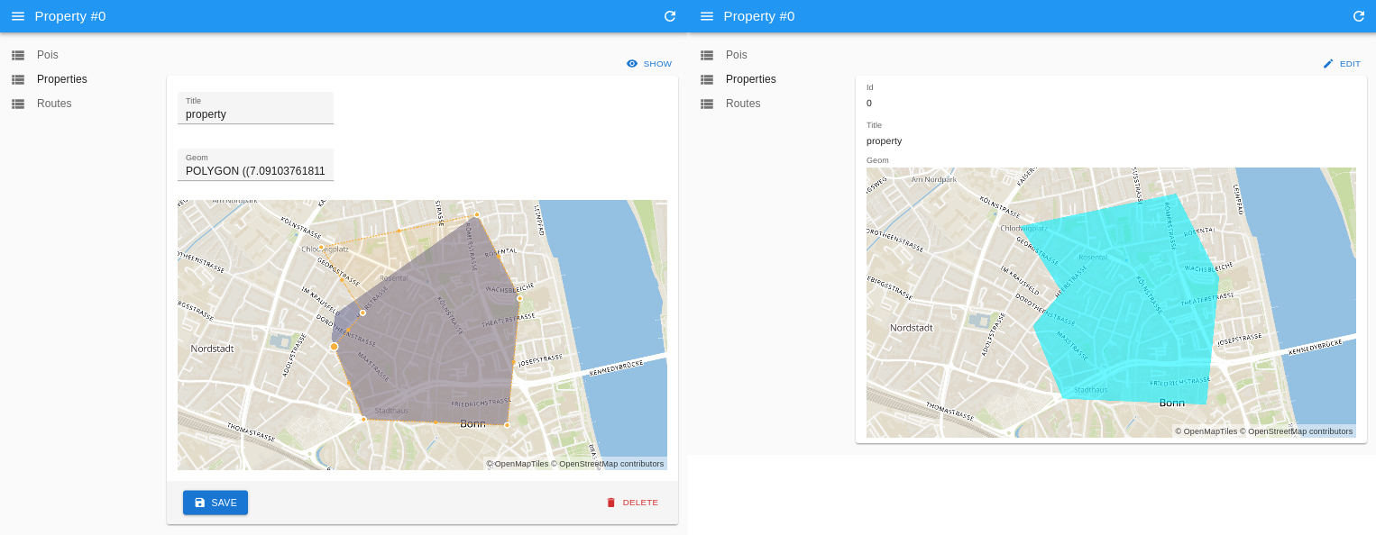
RaGeospatialInput & RaGeospatialShow used to edit a polygon geometry in a react-admin application.
|
|
13
|
+
|
|
14
|
+
## Demos
|
|
15
|
+
|
|
16
|
+
- [react admin & mapcomponents Demo](https://cioddi.github.io/mc-react-admin-apps/react-admin-demo)
|
|
17
|
+
- [webGIS Demo (embeddedMap: false)](https://cioddi.github.io/mc-react-admin-apps/webgis-demo)
|
|
18
|
+
|
|
19
|
+
## Installation
|
|
20
|
+
|
|
21
|
+
```bash
|
|
22
|
+
yarn add @mapcomponents/ra-geospatial
|
|
23
|
+
```
|
|
24
|
+
|
|
25
|
+
## Exports
|
|
26
|
+
|
|
27
|
+
### RaGeospatialInput
|
|
28
|
+
|
|
29
|
+
Input component to edit or create geospatial data.
|
|
30
|
+
|
|
31
|
+
### RaGeospatialShow
|
|
32
|
+
|
|
33
|
+
Show component to display geospatial data.
|
|
34
|
+
|
|
35
|
+
#### Props
|
|
36
|
+
|
|
37
|
+
- **embeddedMap**: boolean (default: false) - If true, the map will be embedded in the component. If false, the component will not create it's own MapContext and add a MapLibreMap component but instead expect a MapContext and a MapLibreMap component to be present in the parent component.
|
|
38
|
+
|
|
39
|
+
## Examples
|
|
40
|
+
|
|
41
|
+
```JSX
|
|
42
|
+
import {
|
|
43
|
+
RaGeospatialInput,
|
|
44
|
+
RaGeospatialShow,
|
|
45
|
+
} from "@mapcomponents/ra-geospatial";
|
|
46
|
+
|
|
47
|
+
export const PoiEdit = () => (
|
|
48
|
+
<Edit>
|
|
49
|
+
<SimpleForm>
|
|
50
|
+
<TextInput source="title" />
|
|
51
|
+
<TextInput source="geom" />
|
|
52
|
+
<RaGeospatialInput source="geom" />
|
|
53
|
+
</SimpleForm>
|
|
54
|
+
</Edit>
|
|
55
|
+
);
|
|
56
|
+
export const PoiCreate = () => (
|
|
57
|
+
<Create>
|
|
58
|
+
<SimpleForm>
|
|
59
|
+
<TextInput source="title" />
|
|
60
|
+
<TextInput source="geom" />
|
|
61
|
+
<RaGeospatialInput source="geom" />
|
|
62
|
+
</SimpleForm>
|
|
63
|
+
</Create>
|
|
64
|
+
);
|
|
4
65
|
|
|
66
|
+
export const PoiShow = () => (
|
|
67
|
+
<Show>
|
|
68
|
+
<SimpleShowLayout>
|
|
69
|
+
<TextField source="id" />
|
|
70
|
+
<TextField source="title" />
|
|
71
|
+
<RaGeospatialShow source="geom" />
|
|
72
|
+
</SimpleShowLayout>
|
|
73
|
+
</Show>
|
|
74
|
+
);
|
|
75
|
+
```
|
|
Binary file
|
package/dist/index.esm.js
CHANGED
|
@@ -18,6 +18,8 @@ LOSS OF USE, DATA OR PROFITS, WHETHER IN AN ACTION OF CONTRACT, NEGLIGENCE OR
|
|
|
18
18
|
OTHER TORTIOUS ACTION, ARISING OUT OF OR IN CONNECTION WITH THE USE OR
|
|
19
19
|
PERFORMANCE OF THIS SOFTWARE.
|
|
20
20
|
***************************************************************************** */
|
|
21
|
+
/* global Reflect, Promise */
|
|
22
|
+
|
|
21
23
|
|
|
22
24
|
function __rest(s, e) {
|
|
23
25
|
var t = {};
|
|
@@ -42,7 +44,7 @@ function GeospatialInputMap(props) {
|
|
|
42
44
|
useEffect(() => {
|
|
43
45
|
if (typeof record === "undefined" || !record[source])
|
|
44
46
|
return;
|
|
45
|
-
|
|
47
|
+
const _geoJson = {
|
|
46
48
|
type: "Feature",
|
|
47
49
|
properties: {},
|
|
48
50
|
geometry: parse(record[source]),
|
|
@@ -71,7 +73,7 @@ function GeospatialInputMap(props) {
|
|
|
71
73
|
"circle-stroke-width": 3,
|
|
72
74
|
"circle-opacity": 0.8,
|
|
73
75
|
}, type: "circle", insertBeforeLayer: "gl-draw-polygon-fill-inactive.cold" })),
|
|
74
|
-
React.createElement(MlFeatureEditor, { mapId: props === null || props === void 0 ? void 0 : props.mapId, geojson: geojson, mode: geojson ? "
|
|
76
|
+
React.createElement(MlFeatureEditor, { mapId: props === null || props === void 0 ? void 0 : props.mapId, geojson: geojson, mode: geojson ? "simple_select" : "draw_point", onChange: (_geojson) => {
|
|
75
77
|
if (typeof _geojson[0] !== "undefined") {
|
|
76
78
|
onChange(stringify(_geojson[0]));
|
|
77
79
|
}
|
|
@@ -81,7 +83,7 @@ function GeospatialInputMap(props) {
|
|
|
81
83
|
"fill-color": "#6f6f96",
|
|
82
84
|
"fill-opacity": 0.6,
|
|
83
85
|
}, type: "fill", insertBeforeLayer: "gl-draw-polygon-fill-inactive.cold" })),
|
|
84
|
-
React.createElement(MlFeatureEditor, { mapId: props === null || props === void 0 ? void 0 : props.mapId, geojson: geojson, mode: geojson ? "
|
|
86
|
+
React.createElement(MlFeatureEditor, { mapId: props === null || props === void 0 ? void 0 : props.mapId, geojson: geojson, mode: geojson ? "simple_select" : "draw_polygon", onChange: (_geojson) => {
|
|
85
87
|
if (typeof _geojson[0] !== "undefined") {
|
|
86
88
|
onChange(stringify(_geojson[0]));
|
|
87
89
|
}
|
|
@@ -92,7 +94,7 @@ function GeospatialInputMap(props) {
|
|
|
92
94
|
"line-color": "#6f6f96",
|
|
93
95
|
"line-opacity": 0.6,
|
|
94
96
|
}, type: "line", insertBeforeLayer: "gl-draw-polygon-fill-inactive.cold" })),
|
|
95
|
-
React.createElement(MlFeatureEditor, { mapId: props === null || props === void 0 ? void 0 : props.mapId, geojson: geojson, mode: geojson ? "
|
|
97
|
+
React.createElement(MlFeatureEditor, { mapId: props === null || props === void 0 ? void 0 : props.mapId, geojson: geojson, mode: geojson ? "simple_select" : "draw_line_string", onChange: (_geojson) => {
|
|
96
98
|
if (typeof _geojson[0] !== "undefined") {
|
|
97
99
|
onChange(stringify(_geojson[0]));
|
|
98
100
|
}
|
package/dist/index.esm.js.map
CHANGED
|
@@ -1 +1 @@
|
|
|
1
|
-
{"version":3,"file":"index.esm.js","sources":[],"sourcesContent":[],"names":[],"mappings":"
|
|
1
|
+
{"version":3,"file":"index.esm.js","sources":[],"sourcesContent":[],"names":[],"mappings":";;;;;;;;;;;;;;;;;;;;;;;;;;;;;;;;;;;;;;;;;;;;;;;;;;;;;;;;;;;;;;;;;;;;;;;;;;;;;;;;;;;;;;;;;;;;;;;;;;;;;;;;;;;;;;;;;;;;;;;;;;;;;;;;;;;;;;;;;;;;;;;;;;;;;;;;;;;;;"}
|
package/package.json
CHANGED
|
@@ -1,42 +1,43 @@
|
|
|
1
1
|
{
|
|
2
|
-
|
|
3
|
-
|
|
4
|
-
|
|
5
|
-
|
|
6
|
-
|
|
7
|
-
|
|
8
|
-
|
|
9
|
-
|
|
10
|
-
|
|
11
|
-
|
|
12
|
-
|
|
13
|
-
|
|
14
|
-
|
|
15
|
-
|
|
16
|
-
|
|
17
|
-
|
|
18
|
-
|
|
19
|
-
|
|
20
|
-
|
|
21
|
-
|
|
22
|
-
|
|
23
|
-
|
|
24
|
-
|
|
25
|
-
|
|
26
|
-
|
|
27
|
-
|
|
28
|
-
|
|
29
|
-
|
|
30
|
-
|
|
31
|
-
|
|
32
|
-
|
|
33
|
-
|
|
34
|
-
|
|
35
|
-
|
|
36
|
-
|
|
37
|
-
|
|
38
|
-
|
|
39
|
-
|
|
40
|
-
|
|
41
|
-
|
|
2
|
+
"name": "@mapcomponents/ra-geospatial",
|
|
3
|
+
"version": "1.5.3",
|
|
4
|
+
"description": "",
|
|
5
|
+
"private": false,
|
|
6
|
+
"main": "index.js",
|
|
7
|
+
"license": "MIT",
|
|
8
|
+
"module": "dist/index.esm.js",
|
|
9
|
+
"source": "src/index.ts",
|
|
10
|
+
"types": "dist/index.d.ts",
|
|
11
|
+
"type": "module",
|
|
12
|
+
"scripts": {
|
|
13
|
+
"build": "rollup -c",
|
|
14
|
+
"test": "echo \"Error: no test specified\" && exit 1"
|
|
15
|
+
},
|
|
16
|
+
"author": "",
|
|
17
|
+
"dependencies": {
|
|
18
|
+
"@turf/turf": "^6.5.0",
|
|
19
|
+
"maplibre-gl": "^2.4.0"
|
|
20
|
+
},
|
|
21
|
+
"devDependencies": {
|
|
22
|
+
"@babel/core": "^7.20.12",
|
|
23
|
+
"@mapcomponents/react-maplibre": "^0.1.69",
|
|
24
|
+
"@rollup/plugin-alias": "^4.0.3",
|
|
25
|
+
"@rollup/plugin-babel": "^6.0.3",
|
|
26
|
+
"@rollup/plugin-commonjs": "^24.0.1",
|
|
27
|
+
"@rollup/plugin-node-resolve": "^15.0.1",
|
|
28
|
+
"@rollup/plugin-url": "^8.0.1",
|
|
29
|
+
"@turf/helpers": "^6.5.0",
|
|
30
|
+
"@types/wellknown": "^0.5.4",
|
|
31
|
+
"react": "^18.2.0",
|
|
32
|
+
"react-admin": "^4.7.2",
|
|
33
|
+
"rollup": "^3.12.0",
|
|
34
|
+
"rollup-plugin-delete": "^2.0.0",
|
|
35
|
+
"rollup-plugin-import-css": "^3.1.0",
|
|
36
|
+
"rollup-plugin-peer-deps-external": "^2.2.4",
|
|
37
|
+
"rollup-plugin-postcss": "^4.0.2",
|
|
38
|
+
"rollup-plugin-typescript2": "^0.34.1",
|
|
39
|
+
"typescript": "^4.9.5",
|
|
40
|
+
"wellknown": "^0.5.0"
|
|
41
|
+
},
|
|
42
|
+
"gitHead": "8570f4d4c3bd5e74a14d80c456a5d7a2039ee285"
|
|
42
43
|
}
|
|
@@ -1,20 +1,18 @@
|
|
|
1
|
-
import React, {
|
|
1
|
+
import React, { useEffect, useState } from "react";
|
|
2
2
|
import { InputProps, useInput, useRecordContext } from "react-admin";
|
|
3
3
|
import {
|
|
4
|
-
|
|
5
|
-
|
|
6
|
-
|
|
7
|
-
GeoJSONFeature,
|
|
8
|
-
GeoJSONPoint,
|
|
4
|
+
GeoJSONGeometry,
|
|
5
|
+
parse as wellknownParse,
|
|
6
|
+
stringify as wellknownStringify
|
|
9
7
|
} from "wellknown";
|
|
10
8
|
import {
|
|
11
|
-
|
|
12
|
-
|
|
13
|
-
|
|
14
|
-
|
|
9
|
+
MapLibreMap,
|
|
10
|
+
MlFeatureEditor,
|
|
11
|
+
MlGeoJsonLayer,
|
|
12
|
+
useMap
|
|
15
13
|
} from "@mapcomponents/react-maplibre";
|
|
16
14
|
import { LngLatLike } from "maplibre-gl";
|
|
17
|
-
import {
|
|
15
|
+
import { centroid, feature } from "@turf/turf";
|
|
18
16
|
import { Feature } from "@turf/helpers";
|
|
19
17
|
|
|
20
18
|
export interface GeospatialInputMapProps extends InputProps<any> {
|
|
@@ -41,7 +39,7 @@ function GeospatialInputMap(props: GeospatialInputMapProps) {
|
|
|
41
39
|
useEffect(() => {
|
|
42
40
|
if (typeof record === "undefined" || !record[source]) return;
|
|
43
41
|
|
|
44
|
-
|
|
42
|
+
const _geoJson = {
|
|
45
43
|
type: "Feature",
|
|
46
44
|
properties: {},
|
|
47
45
|
geometry: wellknownParse(record[source]),
|
|
@@ -106,7 +104,7 @@ function GeospatialInputMap(props: GeospatialInputMapProps) {
|
|
|
106
104
|
<MlFeatureEditor
|
|
107
105
|
mapId={props?.mapId}
|
|
108
106
|
geojson={geojson as typeof feature}
|
|
109
|
-
mode={geojson ? "
|
|
107
|
+
mode={geojson ? "simple_select": "draw_point"}
|
|
110
108
|
onChange={(_geojson) => {
|
|
111
109
|
if (typeof _geojson[0] !== "undefined") {
|
|
112
110
|
onChange(wellknownStringify(_geojson[0] as GeoJSONGeometry));
|
|
@@ -133,7 +131,7 @@ function GeospatialInputMap(props: GeospatialInputMapProps) {
|
|
|
133
131
|
<MlFeatureEditor
|
|
134
132
|
mapId={props?.mapId}
|
|
135
133
|
geojson={geojson as typeof feature}
|
|
136
|
-
mode={geojson ? "
|
|
134
|
+
mode={geojson ? "simple_select": "draw_polygon"}
|
|
137
135
|
onChange={(_geojson) => {
|
|
138
136
|
if (typeof _geojson[0] !== "undefined") {
|
|
139
137
|
onChange(wellknownStringify(_geojson[0] as GeoJSONGeometry));
|
|
@@ -161,7 +159,7 @@ function GeospatialInputMap(props: GeospatialInputMapProps) {
|
|
|
161
159
|
<MlFeatureEditor
|
|
162
160
|
mapId={props?.mapId}
|
|
163
161
|
geojson={geojson as typeof feature}
|
|
164
|
-
mode={geojson ? "
|
|
162
|
+
mode={geojson ? "simple_select": "draw_line_string"}
|
|
165
163
|
onChange={(_geojson) => {
|
|
166
164
|
if (typeof _geojson[0] !== "undefined") {
|
|
167
165
|
onChange(wellknownStringify(_geojson[0] as GeoJSONGeometry));
|