@arcgis/map-components 5.2.0-next.168 → 5.2.0-next.169
This diff represents the content of publicly available package versions that have been released to one of the supported registries. The information contained in this diff is provided for informational purposes only and reflects changes between package versions as they appear in their respective public registries.
- package/dist/cdn/{OP3MZHXU.js → 3YACO47M.js} +1 -1
- package/dist/cdn/42V6ISWG.js +2 -0
- package/dist/cdn/5VOAPFZ5.js +2 -0
- package/dist/cdn/6ZMVEWJQ.js +2 -0
- package/dist/cdn/{OQPX2UPC.js → AFY6JQ77.js} +1 -1
- package/dist/cdn/{VHM26W3Y.js → AW5FFER6.js} +1 -1
- package/dist/cdn/{NY6QZ4MA.js → ODY56P7R.js} +1 -1
- package/dist/cdn/OOCIGOT6.js +2 -0
- package/dist/cdn/{MZ47CPKO.js → RDBCKSUZ.js} +1 -1
- package/dist/cdn/{7XO4NAD5.js → WC5ZQ5SQ.js} +1 -1
- package/dist/cdn/index.js +1 -1
- package/dist/chunks/screenLocation.js +10 -10
- package/dist/components/arcgis-area-measurement-3d/customElement.d.ts +2 -1
- package/dist/components/arcgis-basemap-layer-list/customElement.d.ts +7 -7
- package/dist/components/arcgis-basemap-layer-list-next/customElement.d.ts +4 -4
- package/dist/components/arcgis-bookmarks/customElement.d.ts +1 -0
- package/dist/components/arcgis-bookmarks/types.d.ts +2 -2
- package/dist/components/arcgis-building-explorer/customElement.d.ts +5 -5
- package/dist/components/arcgis-catalog-layer-list/customElement.d.ts +4 -4
- package/dist/components/arcgis-catalog-layer-list-next/customElement.d.ts +2 -2
- package/dist/components/arcgis-daylight/customElement.d.ts +4 -4
- package/dist/components/arcgis-direct-line-measurement-3d/customElement.d.ts +4 -4
- package/dist/components/arcgis-directions/customElement.d.ts +4 -4
- package/dist/components/arcgis-editor/customElement.d.ts +19 -2
- package/dist/components/arcgis-expand/customElement.d.ts +2 -1
- package/dist/components/arcgis-feature-form/customElement.d.ts +7 -7
- package/dist/components/arcgis-feature-table/customElement.d.ts +25 -25
- package/dist/components/arcgis-features/customElement.d.ts +5 -5
- package/dist/components/arcgis-features-next/customElement.d.ts +4 -4
- package/dist/components/arcgis-features-next/customElement.js +27 -26
- package/dist/components/arcgis-grid-controls/customElement.d.ts +1 -1
- package/dist/components/arcgis-layer-list/customElement.d.ts +2 -2
- package/dist/components/arcgis-layer-list-next/customElement.d.ts +6 -6
- package/dist/components/arcgis-legend/customElement.d.ts +1 -1
- package/dist/components/arcgis-line-of-sight/customElement.d.ts +2 -2
- package/dist/components/arcgis-link-chart/customElement.d.ts +6 -6
- package/dist/components/arcgis-map/customElement.d.ts +13 -17
- package/dist/components/arcgis-oriented-imagery-viewer/customElement.d.ts +0 -1
- package/dist/components/arcgis-oriented-imagery-viewer-non-panoramic-viewer/customElement.js +6 -5
- package/dist/components/arcgis-oriented-imagery-viewer-panoramic-viewer/customElement.js +19 -18
- package/dist/components/arcgis-popup/customElement.d.ts +8 -7
- package/dist/components/arcgis-presentation/customElement.d.ts +5 -5
- package/dist/components/arcgis-presentation/customElement.js +74 -75
- package/dist/components/arcgis-print/customElement.d.ts +1 -1
- package/dist/components/arcgis-scale-range-slider/customElement.d.ts +4 -4
- package/dist/components/arcgis-scene/customElement.d.ts +10 -13
- package/dist/components/arcgis-search/customElement.d.ts +4 -4
- package/dist/components/arcgis-selection-list/customElement.d.ts +2 -2
- package/dist/components/arcgis-selection-toolbar/customElement.d.ts +6 -6
- package/dist/components/arcgis-sketch/SketchComponentViewModel.d.ts +1 -1
- package/dist/components/arcgis-sketch/customElement.d.ts +20 -2
- package/dist/components/arcgis-sketch/customElement.js +18 -11
- package/dist/components/arcgis-slice/customElement.d.ts +2 -2
- package/dist/components/arcgis-slider-binary-color-size-legacy/customElement.d.ts +4 -3
- package/dist/components/arcgis-slider-classed-color-legacy/customElement.d.ts +2 -2
- package/dist/components/arcgis-slider-classed-size-legacy/customElement.d.ts +3 -3
- package/dist/components/arcgis-slider-color-legacy/customElement.d.ts +3 -3
- package/dist/components/arcgis-slider-color-size-legacy/customElement.d.ts +5 -4
- package/dist/components/arcgis-slider-heatmap-legacy/customElement.d.ts +2 -2
- package/dist/components/arcgis-slider-opacity-legacy/customElement.d.ts +2 -2
- package/dist/components/arcgis-slider-scale-range/customElement.d.ts +4 -4
- package/dist/components/arcgis-slider-size-legacy/customElement.d.ts +3 -3
- package/dist/components/arcgis-table-list-next/customElement.js +5 -5
- package/dist/components/arcgis-time-slider/customElement.d.ts +6 -5
- package/dist/components/arcgis-track/customElement.d.ts +4 -4
- package/dist/components/arcgis-utility-network-associations/customElement.d.ts +1 -1
- package/dist/components/arcgis-utility-network-trace-analysis/customElement.d.ts +1 -1
- package/dist/components/arcgis-utility-network-trace-analysis/types.d.ts +272 -9
- package/dist/components/arcgis-utility-network-trace-configuration-picker/customElement.d.ts +1 -1
- package/dist/components/arcgis-utility-network-trace-configuration-picker/customElement.js +25 -33
- package/dist/components/arcgis-utility-network-trace-locations/customElement.d.ts +1 -1
- package/dist/components/arcgis-value-picker-legacy/customElement.d.ts +14 -16
- package/dist/components/arcgis-video/customElement.d.ts +1 -1
- package/dist/components/arcgis-volume-measurement/customElement.d.ts +2 -2
- package/dist/components/arcgis-weather/customElement.d.ts +1 -1
- package/dist/components/slider-legacy/types.d.ts +2 -3
- package/dist/docs/api.json +1 -1
- package/dist/docs/docs.json +1 -1
- package/dist/docs/vscode.html-custom-data.json +1 -1
- package/dist/docs/web-types.json +1 -1
- package/package.json +6 -6
- package/dist/cdn/2IAD3DI5.js +0 -2
- package/dist/cdn/67UW6MJM.js +0 -2
- package/dist/cdn/C6T7AQOJ.js +0 -2
- package/dist/cdn/CL5JQN4B.js +0 -2
|
@@ -12,7 +12,7 @@ import type { Action as Action } from "@esri/calcite-components/components/calci
|
|
|
12
12
|
|
|
13
13
|
/**
|
|
14
14
|
* The selection toolbar component can be used to modify selected features on a provided [MapView](/references/core/views/MapView/) or [SceneView](/references/core/views/SceneView/). It provides an interface for performing [selection operations](/references/core/views/selection/SelectionOperation/) such as adding, removing, or replacing selected features.
|
|
15
|
-
* This component can be used in conjunction with other components
|
|
15
|
+
* This component can be used in conjunction with other components, such as [arcgis-selection-list](https://developers.arcgis.com/javascript/latest/references/map-components/components/arcgis-selection-list/) and [arcgis-feature-table](https://developers.arcgis.com/javascript/latest/references/map-components/components/arcgis-feature-table/).
|
|
16
16
|
*
|
|
17
17
|
* @since 5.2
|
|
18
18
|
*/
|
|
@@ -332,7 +332,7 @@ export abstract class ArcgisSelectionToolbar extends LitElement {
|
|
|
332
332
|
*/
|
|
333
333
|
get state(): "active" | "disabled" | "ready";
|
|
334
334
|
/**
|
|
335
|
-
* Indicates whether results from new [selection operations](/references/core/views/selection/SelectionOperation/) are automatically synchronized with the associated [selection manager](/references/core/views/SelectionManager/). When set to `
|
|
335
|
+
* Indicates whether results from new [selection operations](/references/core/views/selection/SelectionOperation/) are not automatically synchronized with the associated [selection manager](/references/core/views/SelectionManager/). When set to `true`, events emitted by the selection-toolbar will still include the updated selection results, but the associated [selection manager](/references/core/views/SelectionManager/) will not be updated when the [selection operation](/references/core/views/selection/SelectionOperation/) completes.
|
|
336
336
|
*
|
|
337
337
|
* @default false
|
|
338
338
|
* @since 5.2
|
|
@@ -449,9 +449,9 @@ export abstract class ArcgisSelectionToolbar extends LitElement {
|
|
|
449
449
|
* @since 5.2
|
|
450
450
|
* @example
|
|
451
451
|
* ```js
|
|
452
|
-
* const toolbar = document.querySelector("
|
|
452
|
+
* const toolbar = document.querySelector("arcgis-selection-toolbar");
|
|
453
453
|
* toolbar.addEventListener("arcgisBeforeActivate", (event) => {
|
|
454
|
-
* const { toolName } = event.detail;
|
|
454
|
+
* const { toolName } = event.detail.detail;
|
|
455
455
|
* console.log("Starting selection tool:", toolName);
|
|
456
456
|
* });
|
|
457
457
|
* ```
|
|
@@ -473,7 +473,7 @@ export abstract class ArcgisSelectionToolbar extends LitElement {
|
|
|
473
473
|
* @since 5.2
|
|
474
474
|
* @example
|
|
475
475
|
* ```js
|
|
476
|
-
* const toolbar = document.querySelector("
|
|
476
|
+
* const toolbar = document.querySelector("arcgis-selection-toolbar");
|
|
477
477
|
* toolbar.addEventListener("arcgisComplete", (event) => {
|
|
478
478
|
* const { aborted, selection, operationType, toolName } = event.detail;
|
|
479
479
|
* console.log("Selection complete:", {
|
|
@@ -498,7 +498,7 @@ export abstract class ArcgisSelectionToolbar extends LitElement {
|
|
|
498
498
|
* @since 5.2
|
|
499
499
|
* @example
|
|
500
500
|
* ```js
|
|
501
|
-
* const toolbar = document.querySelector("
|
|
501
|
+
* const toolbar = document.querySelector("arcgis-selection-toolbar");
|
|
502
502
|
* toolbar.addEventListener("arcgisSelectionChange", (event) => {
|
|
503
503
|
* const { added, removed, operationType } = event.detail;
|
|
504
504
|
* console.log("Selection changed:", {
|
|
@@ -74,7 +74,7 @@ export class SketchComponentViewModel extends Accessor {
|
|
|
74
74
|
export type ViewLike = Pick<MapViewOrSceneView, "focus" | "type">;
|
|
75
75
|
|
|
76
76
|
export type SketchViewModelLike = EventedAccessor
|
|
77
|
-
& Pick<SketchViewModel, "@eventTypes" | "activeCreateToolDrawMode" | "activePluginConfigurations" | "activeTool" | "cancel" | "canRedo" | "canUndo" | "complete" | "create" | "creationMode" | "delete" | "duplicate" | "effectiveAvailablePlugins" | "firstPluginWithSwappableLeaf" | "geometrySimplificationInProgress" | "layer" | "multiplePluginsActive" | "redo" | "replaceLeaf" | "rootPlugins" | "state" | "toolTransitionInProgress" | "undo" | "update" | "updateGraphics" | "updateOnGraphicClick">;
|
|
77
|
+
& Pick<SketchViewModel, "@eventTypes" | "activeCreateToolDrawMode" | "activePluginConfigurations" | "activeTool" | "cancel" | "canRedo" | "canUndo" | "complete" | "create" | "creationMode" | "defaultUpdateOptions" | "delete" | "duplicate" | "effectiveAvailablePlugins" | "firstPluginWithSwappableLeaf" | "geometrySimplificationInProgress" | "layer" | "multiplePluginsActive" | "redo" | "replaceLeaf" | "rootPlugins" | "state" | "toolTransitionInProgress" | "undo" | "update" | "updateGraphics" | "updateOnGraphicClick">;
|
|
78
78
|
|
|
79
79
|
export type SelectionViewModelLike = EventedAccessor
|
|
80
80
|
& Pick<SelectionToolbarViewModel, "@eventTypes" | "cancel" | "sources" | "view">
|
|
@@ -496,6 +496,7 @@ export abstract class ArcgisSketch extends LitElement {
|
|
|
496
496
|
accessor hideSinglePluginBackButton: boolean;
|
|
497
497
|
/**
|
|
498
498
|
* Indicates whether to hide the snapping controls portion of the settings menu.
|
|
499
|
+
* This property is preserved but ignored while [useViewOptions](https://developers.arcgis.com/javascript/latest/references/map-components/components/arcgis-sketch/#useViewOptions) is `true`.
|
|
499
500
|
*
|
|
500
501
|
* @default false
|
|
501
502
|
* @since 5.0
|
|
@@ -504,11 +505,14 @@ export abstract class ArcgisSketch extends LitElement {
|
|
|
504
505
|
/**
|
|
505
506
|
* Indicates whether to hide the `enabledToggle` (Enable snapping). This toggles
|
|
506
507
|
* the [SnappingOptions#enabled](https://developers.arcgis.com/javascript/latest/references/core/views/interactive/options/SnappingOptions/#enabled) property.
|
|
508
|
+
*
|
|
509
|
+
* This property is preserved but ignored while [useViewOptions](https://developers.arcgis.com/javascript/latest/references/map-components/components/arcgis-sketch/#useViewOptions) is `true`.
|
|
510
|
+
*
|
|
507
511
|
* > [!WARNING]
|
|
508
512
|
* >
|
|
509
513
|
* > **Note**
|
|
510
514
|
* >
|
|
511
|
-
* > It is recommended to set `
|
|
515
|
+
* > It is recommended to set `snappingOptions.enabled` to `true` if `hideSnappingControlsElementsEnabledToggle` is set to `true`.
|
|
512
516
|
* > This is because `selfEnabledToggle` and `featureEnabledToggle` require snapping globally to be enabled in order to be interactive. Otherwise, these toggles will not be responsive.
|
|
513
517
|
*
|
|
514
518
|
* @default false
|
|
@@ -518,6 +522,7 @@ export abstract class ArcgisSketch extends LitElement {
|
|
|
518
522
|
/**
|
|
519
523
|
* Indicates whether to hide the `featureEnabledToggle` (Feature to feature). This toggles
|
|
520
524
|
* the [SnappingOptions#featureEnabled](https://developers.arcgis.com/javascript/latest/references/core/views/interactive/options/SnappingOptions/#featureEnabled) property.
|
|
525
|
+
* This property is preserved but ignored while [useViewOptions](https://developers.arcgis.com/javascript/latest/references/map-components/components/arcgis-sketch/#useViewOptions) is `true`.
|
|
521
526
|
*
|
|
522
527
|
* @default false
|
|
523
528
|
* @since 5.0
|
|
@@ -525,6 +530,7 @@ export abstract class ArcgisSketch extends LitElement {
|
|
|
525
530
|
accessor hideSnappingControlsElementsFeatureEnabledToggle: boolean;
|
|
526
531
|
/**
|
|
527
532
|
* Indicates whether to hide the `gridControls` (configuration of the snapping grid).
|
|
533
|
+
* This property is preserved but ignored while [useViewOptions](https://developers.arcgis.com/javascript/latest/references/map-components/components/arcgis-sketch/#useViewOptions) is `true`.
|
|
528
534
|
*
|
|
529
535
|
* @default false
|
|
530
536
|
* @since 5.1
|
|
@@ -532,6 +538,7 @@ export abstract class ArcgisSketch extends LitElement {
|
|
|
532
538
|
accessor hideSnappingControlsElementsGridControls: boolean;
|
|
533
539
|
/**
|
|
534
540
|
* Indicates whether to hide the `colorSelection` within the snapping grid controls.
|
|
541
|
+
* This property is preserved but ignored while [useViewOptions](https://developers.arcgis.com/javascript/latest/references/map-components/components/arcgis-sketch/#useViewOptions) is `true`.
|
|
535
542
|
*
|
|
536
543
|
* @default false
|
|
537
544
|
* @since 5.1
|
|
@@ -539,6 +546,7 @@ export abstract class ArcgisSketch extends LitElement {
|
|
|
539
546
|
accessor hideSnappingControlsElementsGridControlsElementsColorSelection: boolean;
|
|
540
547
|
/**
|
|
541
548
|
* Indicates whether to hide the `dynamicScaleToggle` within the snapping grid controls.
|
|
549
|
+
* This property is preserved but ignored while [useViewOptions](https://developers.arcgis.com/javascript/latest/references/map-components/components/arcgis-sketch/#useViewOptions) is `true`.
|
|
542
550
|
*
|
|
543
551
|
* @default false
|
|
544
552
|
* @since 5.1
|
|
@@ -546,6 +554,7 @@ export abstract class ArcgisSketch extends LitElement {
|
|
|
546
554
|
accessor hideSnappingControlsElementsGridControlsElementsDynamicScaleToggle: boolean;
|
|
547
555
|
/**
|
|
548
556
|
* Indicates whether to hide the `lineIntervalInput` within the snapping grid controls.
|
|
557
|
+
* This property is preserved but ignored while [useViewOptions](https://developers.arcgis.com/javascript/latest/references/map-components/components/arcgis-sketch/#useViewOptions) is `true`.
|
|
549
558
|
*
|
|
550
559
|
* @default false
|
|
551
560
|
* @since 5.1
|
|
@@ -553,6 +562,7 @@ export abstract class ArcgisSketch extends LitElement {
|
|
|
553
562
|
accessor hideSnappingControlsElementsGridControlsElementsLineIntervalInput: boolean;
|
|
554
563
|
/**
|
|
555
564
|
* Indicates whether to hide the `numericInputs` within the snapping grid controls.
|
|
565
|
+
* This property is preserved but ignored while [useViewOptions](https://developers.arcgis.com/javascript/latest/references/map-components/components/arcgis-sketch/#useViewOptions) is `true`.
|
|
556
566
|
*
|
|
557
567
|
* @default false
|
|
558
568
|
* @since 5.1
|
|
@@ -560,6 +570,7 @@ export abstract class ArcgisSketch extends LitElement {
|
|
|
560
570
|
accessor hideSnappingControlsElementsGridControlsElementsNumericInputs: boolean;
|
|
561
571
|
/**
|
|
562
572
|
* Indicates whether to hide the `outOfScaleWarning` within the snapping grid controls.
|
|
573
|
+
* This property is preserved but ignored while [useViewOptions](https://developers.arcgis.com/javascript/latest/references/map-components/components/arcgis-sketch/#useViewOptions) is `true`.
|
|
563
574
|
*
|
|
564
575
|
* @default false
|
|
565
576
|
* @since 5.1
|
|
@@ -567,6 +578,7 @@ export abstract class ArcgisSketch extends LitElement {
|
|
|
567
578
|
accessor hideSnappingControlsElementsGridControlsElementsOutOfScaleWarning: boolean;
|
|
568
579
|
/**
|
|
569
580
|
* Indicates whether to hide the `placementButtons` within the snapping grid controls.
|
|
581
|
+
* This property is preserved but ignored while [useViewOptions](https://developers.arcgis.com/javascript/latest/references/map-components/components/arcgis-sketch/#useViewOptions) is `true`.
|
|
570
582
|
*
|
|
571
583
|
* @default false
|
|
572
584
|
* @since 5.1
|
|
@@ -574,6 +586,7 @@ export abstract class ArcgisSketch extends LitElement {
|
|
|
574
586
|
accessor hideSnappingControlsElementsGridControlsElementsPlacementButtons: boolean;
|
|
575
587
|
/**
|
|
576
588
|
* Indicates whether to hide the `rotateWithMapToggle` within the snapping grid controls.
|
|
589
|
+
* This property is preserved but ignored while [useViewOptions](https://developers.arcgis.com/javascript/latest/references/map-components/components/arcgis-sketch/#useViewOptions) is `true`.
|
|
577
590
|
*
|
|
578
591
|
* @default false
|
|
579
592
|
* @since 5.1
|
|
@@ -581,6 +594,7 @@ export abstract class ArcgisSketch extends LitElement {
|
|
|
581
594
|
accessor hideSnappingControlsElementsGridControlsElementsRotateWithMapToggle: boolean;
|
|
582
595
|
/**
|
|
583
596
|
* Indicates whether to hide the `gridEnabledToggle` (snap-to-grid).
|
|
597
|
+
* This property is preserved but ignored while [useViewOptions](https://developers.arcgis.com/javascript/latest/references/map-components/components/arcgis-sketch/#useViewOptions) is `true`.
|
|
584
598
|
*
|
|
585
599
|
* @default false
|
|
586
600
|
* @since 5.1
|
|
@@ -588,6 +602,7 @@ export abstract class ArcgisSketch extends LitElement {
|
|
|
588
602
|
accessor hideSnappingControlsElementsGridEnabledToggle: boolean;
|
|
589
603
|
/**
|
|
590
604
|
* Indicates whether to hide the [FeatureSnappingLayerSource](https://developers.arcgis.com/javascript/latest/references/core/views/interactive/snapping/FeatureSnappingLayerSource/) layerList. The layerlist provides the available layer sources supported for snapping.
|
|
605
|
+
* This property is preserved but ignored while [useViewOptions](https://developers.arcgis.com/javascript/latest/references/map-components/components/arcgis-sketch/#useViewOptions) is `true`.
|
|
591
606
|
*
|
|
592
607
|
* @default false
|
|
593
608
|
* @since 5.0
|
|
@@ -596,6 +611,7 @@ export abstract class ArcgisSketch extends LitElement {
|
|
|
596
611
|
/**
|
|
597
612
|
* Indicates whether to hide the `selfEnabledToggle` (Geometry guides). This toggles
|
|
598
613
|
* the [SnappingOptions#selfEnabled](https://developers.arcgis.com/javascript/latest/references/core/views/interactive/options/SnappingOptions/#selfEnabled) property.
|
|
614
|
+
* This property is preserved but ignored while [useViewOptions](https://developers.arcgis.com/javascript/latest/references/map-components/components/arcgis-sketch/#useViewOptions) is `true`.
|
|
599
615
|
*
|
|
600
616
|
* @default false
|
|
601
617
|
* @since 5.0
|
|
@@ -603,6 +619,7 @@ export abstract class ArcgisSketch extends LitElement {
|
|
|
603
619
|
accessor hideSnappingControlsElementsSelfEnabledToggle: boolean;
|
|
604
620
|
/**
|
|
605
621
|
* Indicates whether to hide the tooltips toggle.
|
|
622
|
+
* This property is preserved but ignored while [useViewOptions](https://developers.arcgis.com/javascript/latest/references/map-components/components/arcgis-sketch/#useViewOptions) is `true`.
|
|
606
623
|
*
|
|
607
624
|
* @default false
|
|
608
625
|
* @since 5.0
|
|
@@ -760,6 +777,7 @@ export abstract class ArcgisSketch extends LitElement {
|
|
|
760
777
|
accessor showCreateToolsText: boolean;
|
|
761
778
|
/**
|
|
762
779
|
* Indicates whether to display the header.
|
|
780
|
+
* This property is preserved but ignored while [useViewOptions](https://developers.arcgis.com/javascript/latest/references/map-components/components/arcgis-sketch/#useViewOptions) is `true`.
|
|
763
781
|
*
|
|
764
782
|
* @default false
|
|
765
783
|
* @since 5.0
|
|
@@ -850,7 +868,7 @@ export abstract class ArcgisSketch extends LitElement {
|
|
|
850
868
|
* When this property is `true`:
|
|
851
869
|
*
|
|
852
870
|
* - Snapping and tooltip options are inherited from the view. The component's [snappingOptions](https://developers.arcgis.com/javascript/latest/references/map-components/components/arcgis-sketch/#snappingOptions) and [tooltipOptions](https://developers.arcgis.com/javascript/latest/references/map-components/components/arcgis-sketch/#tooltipOptions) are preserved but ignored.
|
|
853
|
-
* - Snapping controls and the tooltip toggle are hidden from the component's Settings menu.
|
|
871
|
+
* - Snapping controls and the tooltip toggle are hidden from the component's Settings menu. Their visibility properties (e.g. [hideSnappingControlsElementsGridControls](https://developers.arcgis.com/javascript/latest/references/map-components/components/arcgis-sketch/#hideSnappingControlsElementsGridControls)) are preserved but ignored.
|
|
854
872
|
* - Units set through [valueOptions](https://developers.arcgis.com/javascript/latest/references/map-components/components/arcgis-sketch/#valueOptions) override the corresponding units on the view, such as length or area, without changing the view's options. Setting a unit to `null` or `undefined` restores inheritance for that measurement type.
|
|
855
873
|
*
|
|
856
874
|
* When `false`, the component uses its own snapping, tooltip, and unit options instead.
|
|
@@ -11,7 +11,7 @@ import { watch as f, on as ie, whenOnce as oe } from "@arcgis/core/core/reactive
|
|
|
11
11
|
import { u as se } from "../../chunks/useT9n.js";
|
|
12
12
|
import { m as ne } from "../../chunks/useViewModel.js";
|
|
13
13
|
import { V as _ } from "../../chunks/visible-element.js";
|
|
14
|
-
import { createRef as
|
|
14
|
+
import { createRef as O, ref as M } from "lit/directives/ref.js";
|
|
15
15
|
import le from "@arcgis/core/widgets/Sketch/SketchViewModel.js";
|
|
16
16
|
import { S as re } from "../../chunks/resources.js";
|
|
17
17
|
import { getOrCreateMapValue as F, createReactiveMap as ae } from "@arcgis/core/applications/Components/featureUtils.js";
|
|
@@ -136,7 +136,14 @@ let a = class extends ce {
|
|
|
136
136
|
{ initial: !0, sync: !0 }
|
|
137
137
|
),
|
|
138
138
|
this.selectionViewModel.on("complete", ({ selection: i }) => {
|
|
139
|
-
|
|
139
|
+
const { sketchViewModel: e } = this;
|
|
140
|
+
if (i.length && e) {
|
|
141
|
+
const { defaultUpdateOptions: t } = e, { tool: o } = t;
|
|
142
|
+
this.update(i, {
|
|
143
|
+
...t,
|
|
144
|
+
tool: i.length > 1 && o === "reshape" ? "transform" : o
|
|
145
|
+
});
|
|
146
|
+
}
|
|
140
147
|
}),
|
|
141
148
|
// Cancel active tool when selection activates
|
|
142
149
|
f(
|
|
@@ -778,8 +785,8 @@ class Ae extends J {
|
|
|
778
785
|
this.#y();
|
|
779
786
|
return;
|
|
780
787
|
}
|
|
781
|
-
const t = this.component.layout, o =
|
|
782
|
-
content:
|
|
788
|
+
const t = this.component.layout, o = Oe({
|
|
789
|
+
content: Le(e),
|
|
783
790
|
gap: ke,
|
|
784
791
|
layout: t,
|
|
785
792
|
position: e.position,
|
|
@@ -806,7 +813,7 @@ class Ae extends J {
|
|
|
806
813
|
this.#t.disconnect(), this.#p?.(), this.#p = void 0, this.#e.disconnect(), this.#i.disconnect(), this.#l = void 0, this.#s = void 0, this.#h = [], this.#n?.removeEventListener("slotchange", this.#u), this.#n = void 0, this.#r = void 0, this.#a = void 0, this.#d = void 0, this.#g = void 0;
|
|
807
814
|
}
|
|
808
815
|
}
|
|
809
|
-
function
|
|
816
|
+
function Oe({
|
|
810
817
|
content: i,
|
|
811
818
|
gap: e,
|
|
812
819
|
layout: t,
|
|
@@ -815,12 +822,12 @@ function Le({
|
|
|
815
822
|
toolbarBounds: c,
|
|
816
823
|
viewBounds: d
|
|
817
824
|
}) {
|
|
818
|
-
const r =
|
|
825
|
+
const r = L(d, t), n = L(c, t), u = z(o, t), g = u ? n.start - r.start : r.end - n.end;
|
|
819
826
|
let l = 0, v = !1;
|
|
820
827
|
for (const b of i) {
|
|
821
828
|
if (z(b.position, t) === u)
|
|
822
829
|
continue;
|
|
823
|
-
const C =
|
|
830
|
+
const C = L(b.bounds, t);
|
|
824
831
|
if (!(C.crossStart < n.crossEnd && C.crossEnd > n.crossStart))
|
|
825
832
|
continue;
|
|
826
833
|
const E = u ? r.end - C.start : C.end - r.start;
|
|
@@ -829,13 +836,13 @@ function Le({
|
|
|
829
836
|
const m = v ? e : 0;
|
|
830
837
|
return Math.max(0, r.length - Math.max(0, g) - s - l - m);
|
|
831
838
|
}
|
|
832
|
-
function
|
|
839
|
+
function L(i, e) {
|
|
833
840
|
return e === "horizontal" ? { start: i.left, end: i.right, length: i.width, crossStart: i.top, crossEnd: i.bottom } : { start: i.top, end: i.bottom, length: i.height, crossStart: i.left, crossEnd: i.right };
|
|
834
841
|
}
|
|
835
842
|
function z(i, e) {
|
|
836
843
|
return e === "horizontal" ? i.endsWith("left") : i.startsWith("top");
|
|
837
844
|
}
|
|
838
|
-
function
|
|
845
|
+
function Le(i) {
|
|
839
846
|
return i.content.flatMap((e) => {
|
|
840
847
|
if (e.assignedSlot === i.assignedSlot)
|
|
841
848
|
return [];
|
|
@@ -875,7 +882,7 @@ const Re = ne((i) => new le({
|
|
|
875
882
|
}));
|
|
876
883
|
class Ve extends ee {
|
|
877
884
|
constructor() {
|
|
878
|
-
super(), this.#t = new a(), this.#l =
|
|
885
|
+
super(), this.#t = new a(), this.#l = O(), this.#s = new Ae(this), this.#n = O(), this._defaultGraphicsLayer = null, this._messages = se(), this.test = {
|
|
879
886
|
componentViewModel: this.#t
|
|
880
887
|
}, this._groupLayoutPriorityOverrides = /* @__PURE__ */ new Map(), this._contextualToolLocation = "separate", this._refMap = ae(), this.viewModel = Re(this), this.view = this.viewModel.view, this.autoDestroyDisabled = !1, this.createGraphic = this.viewModel.createGraphic, this.creationMode = this.viewModel.creationMode, this.defaultCreateOptions = this.viewModel.defaultCreateOptions, this.defaultGraphicsLayerDisabled = !1, this.defaultUpdateOptions = this.viewModel.defaultUpdateOptions, this.geometrySimplificationInProgress = this.viewModel.geometrySimplificationInProgress, this.icon = "pencil", this.label = this._messages?.componentLabel, this.labelOptions = this.viewModel.labelOptions, this.layer = this.viewModel.layer, this.layout = "horizontal", this.pointSymbol = this.viewModel.pointSymbol, this.polygonSymbol = this.viewModel.polygonSymbol, this.polylineSymbol = this.viewModel.polylineSymbol, this.activeFillSymbol = this.viewModel.activeFillSymbol, this.activeLineSymbol = this.viewModel.activeLineSymbol, this.activeVertexSymbol = this.viewModel.activeVertexSymbol, this.activeCreateToolDrawMode = this.viewModel.activeCreateToolDrawMode, this.visualScale = "m", this.snappingOptions = this.viewModel.snappingOptions, this.textSymbol = this.viewModel.textSymbol, this.toolbarKind = "floating", this.tooltipOptions = this.viewModel.tooltipOptions, this.useViewOptions = this.viewModel.useViewOptions, this.valueOptions = this.viewModel.valueOptions, this.useLegacyCreateTools = this.viewModel.useLegacyCreateTools, this.updateOnGraphicClickDisabled = this.viewModel.updateOnGraphicClick, this.updateGraphics = this.viewModel.updateGraphics, this.activeTooltip = this.viewModel.activeTooltip, this.arcgisCreate = S(() => this.viewModel, "create"), this.arcgisDelete = S(() => this.viewModel, "delete"), this.arcgisDuplicate = S(() => this.viewModel, "duplicate"), this.arcgisPropertyChange = Q()("activeTool", "geometrySimplificationInProgress", "state"), this.arcgisReady = te(), this.arcgisRedo = S(() => this.viewModel, "redo"), this.arcgisUndo = S(() => this.viewModel, "undo"), this.arcgisUpdate = S(() => this.viewModel, "update"), X(["slot"], () => {
|
|
881
888
|
this.requestUpdate();
|
|
@@ -1267,7 +1274,7 @@ class Ve extends ee {
|
|
|
1267
1274
|
}
|
|
1268
1275
|
}
|
|
1269
1276
|
_renderCommand({ active: e, afterCreate: t, afterRemoved: o, afterUpdate: s, appearance: c, icon: d, disabled: r, id: n, kind: u, labelKey: g, labelParameters: l, loading: v, tooltipKey: m, iconFlipRTL: b, onClick: C, refKey: P, textEnabled: E, renderAsAction: K }) {
|
|
1270
|
-
const { _messages: G, _refMap: H, layout: $ } = this, k = B(g, G), A = k === void 0 ? g : l ? j(k, l) : k, R = G?.[m] ?? A, V = P ? F(H, P,
|
|
1277
|
+
const { _messages: G, _refMap: H, layout: $ } = this, k = B(g, G), A = k === void 0 ? g : l ? j(k, l) : k, R = G?.[m] ?? A, V = P ? F(H, P, O) : this.#n, x = { afterCreate: t, afterRemoved: o, afterUpdate: s };
|
|
1271
1278
|
return K ? y`<arcgis-toolbar-action .active=${e} .appearance=${c} .disabled=${r} .icon=${d} .iconFlipRtl=${b} id=${n ?? D} .kind=${u} .loading=${v} .labelText=${$ === "horizontal" ? A : ""} .textEnabled=${E} .tooltipText=${$ === "horizontal" && E ? "" : R} @arcgisToolbarItemSelected=${C} ${W(x)} ${M(V)}></arcgis-toolbar-action>` : y`<arcgis-toolbar-item .active=${e} .disabled=${r} .icon=${d} id=${n ?? D} .iconFlipRtl=${b} .labelText=${A} .tooltipText=${R} @arcgisItemSelected=${C} ${W(x)} ${M(V)}></arcgis-toolbar-item>`;
|
|
1272
1279
|
}
|
|
1273
1280
|
}
|
|
@@ -27,7 +27,7 @@ import type { Icon as Icon } from "@esri/calcite-components/components/calcite-i
|
|
|
27
27
|
* can be set or retrieved using the [shape](https://developers.arcgis.com/javascript/latest/references/map-components/components/arcgis-slice/#shape) property.
|
|
28
28
|
*
|
|
29
29
|
* Once the slice plane is applied, layers can be excluded from the slicing. For example, by excluding the sublayers which include
|
|
30
|
-
* columns and floor slabs, the inner structure of a building can investigated.
|
|
30
|
+
* columns and floor slabs, the inner structure of a building can be investigated.
|
|
31
31
|
*
|
|
32
32
|
* [](https://developers.arcgis.com/javascript/latest/sample-code/building-scene-layer-slice/index.html)
|
|
33
33
|
*
|
|
@@ -166,7 +166,7 @@ export abstract class ArcgisSlice extends LitElement {
|
|
|
166
166
|
accessor autoDestroyDisabled: boolean;
|
|
167
167
|
/**
|
|
168
168
|
* Add layers to this collection to exclude them from the slice. Layers that
|
|
169
|
-
* are draped on the ground surface are not affected by this property
|
|
169
|
+
* are draped on the ground surface are not affected by this property.
|
|
170
170
|
*/
|
|
171
171
|
accessor excludedLayers: Collection<SliceableLayer>;
|
|
172
172
|
/**
|
|
@@ -30,7 +30,7 @@ import type { BinaryColorSizeSliderStyle } from "@arcgis/core/widgets/smartMappi
|
|
|
30
30
|
* const univariateColorSizeRendererCreator = await import(
|
|
31
31
|
* "@arcgis/core/smartMapping/renderers/univariateColorSize.js"
|
|
32
32
|
* );
|
|
33
|
-
* const viewElement = document.querySelector("arcgis-map")
|
|
33
|
+
* const viewElement = document.querySelector("arcgis-map");
|
|
34
34
|
* const binaryColorSizeSlider = document.querySelector("arcgis-slider-binary-color-size-legacy");
|
|
35
35
|
*
|
|
36
36
|
* const featureLayer = new FeatureLayer({
|
|
@@ -60,7 +60,7 @@ import type { BinaryColorSizeSliderStyle } from "@arcgis/core/widgets/smartMappi
|
|
|
60
60
|
* ```
|
|
61
61
|
*
|
|
62
62
|
* This slider should be used to update an above and below (diverging) visualization in a layer's renderer.
|
|
63
|
-
* It is the responsibility of the app developer to set up event listeners
|
|
63
|
+
* It is the responsibility of the app developer to set up event listeners that update the size variable of the appropriate renderer.
|
|
64
64
|
*
|
|
65
65
|
* ```js
|
|
66
66
|
* const updateRendererFromSlider = async () => {
|
|
@@ -308,6 +308,7 @@ export abstract class ArcgisSliderBinaryColorSizeLegacy extends LitElement {
|
|
|
308
308
|
* @example
|
|
309
309
|
* ```js
|
|
310
310
|
* binaryColorSizeSlider.stops = [
|
|
311
|
+
* { value: 0, size: 30 },
|
|
311
312
|
* { value: 8, size: 7 },
|
|
312
313
|
* { value: 15, size: 3 },
|
|
313
314
|
* { value: 40, size: 17 },
|
|
@@ -404,7 +405,7 @@ export abstract class ArcgisSliderBinaryColorSizeLegacy extends LitElement {
|
|
|
404
405
|
* @returns Returns the updated renderer.
|
|
405
406
|
* @example
|
|
406
407
|
* ```js
|
|
407
|
-
* const updatedRenderer = await binaryColorSizeSlider.updateRenderer(featureLayer.renderer
|
|
408
|
+
* const updatedRenderer = await binaryColorSizeSlider.updateRenderer(featureLayer.renderer);
|
|
408
409
|
* featureLayer.renderer = updatedRenderer;
|
|
409
410
|
* ```
|
|
410
411
|
*/
|
|
@@ -30,8 +30,8 @@ import type { LabelFormatFunction, InputParseFunction } from "@arcgis/core/widge
|
|
|
30
30
|
*
|
|
31
31
|
* ```js
|
|
32
32
|
* const colorRendererCreator = await import("@arcgis/core/smartMapping/renderers/color.js");
|
|
33
|
-
* const viewElement = document.querySelector("arcgis-map")
|
|
34
|
-
* const classedColorSlider = document.querySelector("arcgis-slider-classed-color-legacy")
|
|
33
|
+
* const viewElement = document.querySelector("arcgis-map");
|
|
34
|
+
* const classedColorSlider = document.querySelector("arcgis-slider-classed-color-legacy");
|
|
35
35
|
*
|
|
36
36
|
* const featureLayer = new FeatureLayer({
|
|
37
37
|
* url: "https://services.arcgis.com/P3ePLMYs2RVChkJx/arcgis/rest/services/ACS_Poverty_by_Age_Boundaries/FeatureServer/1",
|
|
@@ -30,8 +30,8 @@ import type { ClassedSizeSliderStyle } from "@arcgis/core/widgets/smartMapping/C
|
|
|
30
30
|
*
|
|
31
31
|
* ```js
|
|
32
32
|
* const sizeRendererCreator = await import("@arcgis/core/smartMapping/renderers/size.js");
|
|
33
|
-
* const viewElement = document.querySelector("arcgis-map")
|
|
34
|
-
* const classedSizeSlider = document.querySelector("arcgis-slider-classed-size-legacy")
|
|
33
|
+
* const viewElement = document.querySelector("arcgis-map");
|
|
34
|
+
* const classedSizeSlider = document.querySelector("arcgis-slider-classed-size-legacy");
|
|
35
35
|
*
|
|
36
36
|
* const featureLayer = new FeatureLayer({
|
|
37
37
|
* url: "https://services.arcgis.com/P3ePLMYs2RVChkJx/arcgis/rest/services/ACS_Median_Income_by_Race_and_Age_Selp_Emp_Boundaries/FeatureServer/1",
|
|
@@ -69,7 +69,7 @@ import type { ClassedSizeSliderStyle } from "@arcgis/core/widgets/smartMapping/C
|
|
|
69
69
|
* if (!renderer || !("classBreakInfos" in renderer) || !renderer.classBreakInfos?.[0]) {
|
|
70
70
|
* return;
|
|
71
71
|
* }
|
|
72
|
-
* renderer.classBreakInfos =
|
|
72
|
+
* renderer.classBreakInfos = await classedSizeSlider.updateClassBreakInfos(renderer.classBreakInfos);
|
|
73
73
|
* featureLayer.renderer = renderer;
|
|
74
74
|
* };
|
|
75
75
|
*
|
|
@@ -29,8 +29,8 @@ import type { LabelFormatFunction, InputParseFunction } from "@arcgis/core/widge
|
|
|
29
29
|
*
|
|
30
30
|
* ```js
|
|
31
31
|
* const colorRendererCreator = await import("@arcgis/core/smartMapping/renderers/color.js");
|
|
32
|
-
* const viewElement = document.querySelector("arcgis-map")
|
|
33
|
-
* const colorSlider = document.querySelector("arcgis-slider-color-legacy")
|
|
32
|
+
* const viewElement = document.querySelector("arcgis-map");
|
|
33
|
+
* const colorSlider = document.querySelector("arcgis-slider-color-legacy");
|
|
34
34
|
*
|
|
35
35
|
* const featureLayer = new FeatureLayer({
|
|
36
36
|
* url: "https://services.arcgis.com/P3ePLMYs2RVChkJx/arcgis/rest/services/ACS_Poverty_by_Age_Boundaries/FeatureServer/1",
|
|
@@ -39,7 +39,7 @@ import type { LabelFormatFunction, InputParseFunction } from "@arcgis/core/widge
|
|
|
39
39
|
* await viewElement.viewOnReady();
|
|
40
40
|
* viewElement.map?.add(featureLayer);
|
|
41
41
|
*
|
|
42
|
-
* const params
|
|
42
|
+
* const params = {
|
|
43
43
|
* layer: featureLayer,
|
|
44
44
|
* field: "B17020_calc_pctPovE",
|
|
45
45
|
* view: viewElement.view,
|
|
@@ -41,8 +41,8 @@ import type { LabelFormatFunction, InputParseFunction } from "@arcgis/core/widge
|
|
|
41
41
|
*
|
|
42
42
|
* ```js
|
|
43
43
|
* const colorAndSizeRendererCreator = await import("@arcgis/core/smartMapping/renderers/univariateColorSize.js");
|
|
44
|
-
* const viewElement = document.querySelector("arcgis-map")
|
|
45
|
-
* const colorSizeSlider = document.querySelector("arcgis-slider-color-size-legacy")
|
|
44
|
+
* const viewElement = document.querySelector("arcgis-map");
|
|
45
|
+
* const colorSizeSlider = document.querySelector("arcgis-slider-color-size-legacy");
|
|
46
46
|
*
|
|
47
47
|
* const featureLayer = new FeatureLayer({
|
|
48
48
|
* url: "https://services.arcgis.com/P3ePLMYs2RVChkJx/arcgis/rest/services/ACS_Poverty_by_Age_Boundaries/FeatureServer/1",
|
|
@@ -80,7 +80,7 @@ import type { LabelFormatFunction, InputParseFunction } from "@arcgis/core/widge
|
|
|
80
80
|
* return;
|
|
81
81
|
* }
|
|
82
82
|
* renderer.visualVariables = colorSizeSlider.updateVisualVariables(
|
|
83
|
-
* renderer.visualVariables
|
|
83
|
+
* renderer.visualVariables,
|
|
84
84
|
* );
|
|
85
85
|
* featureLayer.renderer = renderer;
|
|
86
86
|
* };
|
|
@@ -264,6 +264,7 @@ export abstract class ArcgisSliderColorSizeLegacy extends LitElement {
|
|
|
264
264
|
* @example
|
|
265
265
|
* ```js
|
|
266
266
|
* colorSizeSlider.min = -150;
|
|
267
|
+
* ```
|
|
267
268
|
*/
|
|
268
269
|
accessor min: number;
|
|
269
270
|
/**
|
|
@@ -447,7 +448,7 @@ export abstract class ArcgisSliderColorSizeLegacy extends LitElement {
|
|
|
447
448
|
* @example
|
|
448
449
|
* ```js
|
|
449
450
|
* const renderer = featureLayer?.renderer?.clone();
|
|
450
|
-
* renderer.visualVariables = colorSizeSlider.updateVisualVariables(renderer.visualVariables
|
|
451
|
+
* renderer.visualVariables = colorSizeSlider.updateVisualVariables(renderer.visualVariables);
|
|
451
452
|
* featureLayer.renderer = renderer;
|
|
452
453
|
* ```
|
|
453
454
|
*/
|
|
@@ -20,8 +20,8 @@ import type { SliderState } from "../slider-legacy/types.js";
|
|
|
20
20
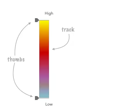
|
* 
|
|
21
21
|
*
|
|
22
22
|
* ```js
|
|
23
|
-
* const viewElement = document.querySelector("arcgis-map")
|
|
24
|
-
* const heatmapSlider = document.querySelector("arcgis-slider-heatmap-legacy")
|
|
23
|
+
* const viewElement = document.querySelector("arcgis-map");
|
|
24
|
+
* const heatmapSlider = document.querySelector("arcgis-slider-heatmap-legacy");
|
|
25
25
|
*
|
|
26
26
|
* const layer = new CSVLayer({
|
|
27
27
|
* url: "https://earthquake.usgs.gov/earthquakes/feed/v1.0/summary/2.5_week.csv",
|
|
@@ -31,8 +31,8 @@ import type { OpacitySliderStyle } from "@arcgis/core/widgets/smartMapping/Opaci
|
|
|
31
31
|
*
|
|
32
32
|
* ```js
|
|
33
33
|
* const opacityVariableCreator = await import("@arcgis/core/smartMapping/renderers/opacity.js");
|
|
34
|
-
* const viewElement = document.querySelector("arcgis-map")
|
|
35
|
-
* const opacitySlider = document.querySelector("arcgis-slider-opacity-legacy")
|
|
34
|
+
* const viewElement = document.querySelector("arcgis-map");
|
|
35
|
+
* const opacitySlider = document.querySelector("arcgis-slider-opacity-legacy");
|
|
36
36
|
*
|
|
37
37
|
* const featureLayer = new FeatureLayer({
|
|
38
38
|
* url: "https://services.arcgis.com/P3ePLMYs2RVChkJx/ArcGIS/rest/services/USA_Census_2020_DHC_Total_Population/FeatureServer/2",
|
|
@@ -10,7 +10,7 @@ import type { ArcgisReferenceElement, IconName } from "../types.js";
|
|
|
10
10
|
import type { T9nMeta } from "@arcgis/lumina/controllers";
|
|
11
11
|
|
|
12
12
|
/**
|
|
13
|
-
* The supported lowercase [ISO 3166-1 alpha-2 code](https://en.wikipedia.org/wiki/List_of_ISO_3166_country_codes)region codes for scale preview thumbnails.
|
|
13
|
+
* The supported lowercase [ISO 3166-1 alpha-2 code](https://en.wikipedia.org/wiki/List_of_ISO_3166_country_codes) region codes for scale preview thumbnails.
|
|
14
14
|
* The [region](https://developers.arcgis.com/javascript/latest/references/map-components/components/arcgis-slider-scale-range/#region) property also accepts uppercase versions of these codes.
|
|
15
15
|
*
|
|
16
16
|
* @since 5.2
|
|
@@ -50,19 +50,19 @@ export abstract class ArcgisSliderScaleRange extends LitElement {
|
|
|
50
50
|
*/
|
|
51
51
|
accessor disabled: boolean;
|
|
52
52
|
/**
|
|
53
|
-
* Indicates whether the maximum scale dropdown menu is
|
|
53
|
+
* Indicates whether the maximum scale dropdown menu is hidden. Default value is `false`.
|
|
54
54
|
*
|
|
55
55
|
* @default false
|
|
56
56
|
*/
|
|
57
57
|
accessor hideMaxScaleMenu: boolean | undefined;
|
|
58
58
|
/**
|
|
59
|
-
* Indicates whether the minimum scale dropdown menu is
|
|
59
|
+
* Indicates whether the minimum scale dropdown menu is hidden. Default value is `false`.
|
|
60
60
|
*
|
|
61
61
|
* @default false
|
|
62
62
|
*/
|
|
63
63
|
accessor hideMinScaleMenu: boolean | undefined;
|
|
64
64
|
/**
|
|
65
|
-
* Indicates whether the preview thumbnail of the scale is
|
|
65
|
+
* Indicates whether the preview thumbnail of the scale is hidden.
|
|
66
66
|
* Default value is `false`.
|
|
67
67
|
*
|
|
68
68
|
* @default false
|
|
@@ -31,8 +31,8 @@ import type { SizeSliderStyle } from "@arcgis/core/widgets/smartMapping/SizeSlid
|
|
|
31
31
|
*
|
|
32
32
|
* ```js
|
|
33
33
|
* const sizeRendererCreator = await import("@arcgis/core/smartMapping/renderers/size.js");
|
|
34
|
-
* const viewElement = document.querySelector("arcgis-map")
|
|
35
|
-
* const sizeSlider = document.querySelector("arcgis-slider-size-legacy")
|
|
34
|
+
* const viewElement = document.querySelector("arcgis-map");
|
|
35
|
+
* const sizeSlider = document.querySelector("arcgis-slider-size-legacy");
|
|
36
36
|
*
|
|
37
37
|
* const featureLayer = new FeatureLayer({
|
|
38
38
|
* url: "https://services.arcgis.com/P3ePLMYs2RVChkJx/arcgis/rest/services/USA_Major_Cities_/FeatureServer/0",
|
|
@@ -382,7 +382,7 @@ export abstract class ArcgisSliderSizeLegacy extends LitElement {
|
|
|
382
382
|
*
|
|
383
383
|
* This is particularly useful for Size visual variables that have a set
|
|
384
384
|
* [minDataValue](https://developers.arcgis.com/javascript/latest/references/core/renderers/visualVariables/SizeVariable/#minDataValue) and
|
|
385
|
-
* [maxDataValue](https://developers.arcgis.com/javascript/latest/references/core/renderers/visualVariables/SizeVariable/#
|
|
385
|
+
* [maxDataValue](https://developers.arcgis.com/javascript/latest/references/core/renderers/visualVariables/SizeVariable/#maxDataValue).
|
|
386
386
|
* This method will properly reconstruct the variable to set on the renderer so it matches the stops on the slider.
|
|
387
387
|
*
|
|
388
388
|
* @param sizeVariable - The size visual variable
|
|
@@ -1,8 +1,8 @@
|
|
|
1
1
|
/* COPYRIGHT Esri - https://js.arcgis.com/5.2/LICENSE.txt */
|
|
2
2
|
import { c as C } from "../../chunks/runtime.js";
|
|
3
|
-
import { repeat as
|
|
3
|
+
import { repeat as $ } from "lit/directives/repeat.js";
|
|
4
4
|
import { keyed as _ } from "lit/directives/keyed.js";
|
|
5
|
-
import
|
|
5
|
+
import M from "@arcgis/core/core/Collection.js";
|
|
6
6
|
import { watch as I, on as v } from "@arcgis/core/core/reactiveUtils.js";
|
|
7
7
|
import L from "@arcgis/core/layerList/TableListModel.js";
|
|
8
8
|
import { LitElement as E, createEvent as c, safeClassMap as b, nothing as F } from "@arcgis/lumina";
|
|
@@ -34,7 +34,7 @@ class z extends E {
|
|
|
34
34
|
this._selectedDragItemLayerUid = e;
|
|
35
35
|
}, this._onTriggerAction = (e, t) => {
|
|
36
36
|
this.triggerAction(e, t);
|
|
37
|
-
}, this.autoDestroyDisabled = !1, this.closed = !1, this.collapsed = !1, this.dragEnabled = !1, this.filterPlaceholder = "", this.filterText = "", this.headingLevel = 2, this.hideNoFilterResultsNotice = !1, this.hideNoItemsNotice = !1, this.hideStatusIndicators = !1, this.icon = "table", this.listItemCreatedFunction = this.viewModel.listItemCreatedFunction, this.listModeDisabled = this.viewModel.listModeDisabled, this.map = this.viewModel.map, this.minDragEnabledItems = B, this.minFilterItems = R, this.selectedItems = new
|
|
37
|
+
}, this.autoDestroyDisabled = !1, this.closed = !1, this.collapsed = !1, this.dragEnabled = !1, this.filterPlaceholder = "", this.filterText = "", this.headingLevel = 2, this.hideNoFilterResultsNotice = !1, this.hideNoItemsNotice = !1, this.hideStatusIndicators = !1, this.icon = "table", this.listItemCreatedFunction = this.viewModel.listItemCreatedFunction, this.listModeDisabled = this.viewModel.listModeDisabled, this.map = this.viewModel.map, this.minDragEnabledItems = B, this.minFilterItems = R, this.selectedItems = new M(), this.selectionMode = "none", this.showCloseButton = !1, this.showCollapseButton = !1, this.showErrors = !1, this.showFilter = !1, this.showHeading = !1, this.showTemporaryTableIndicators = !1, this.tables = this.viewModel.tables, this.arcgisClose = c(), this.arcgisFilterChange = c(), this.arcgisPropertyChange = T()("state"), this.arcgisReady = c(), this.arcgisSelectedItemsChange = c(), this.arcgisTableItemsChanged = c(), this.arcgisTriggerAction = D(() => this.viewModel, "trigger-action");
|
|
38
38
|
}
|
|
39
39
|
static {
|
|
40
40
|
this.properties = { _visibleItems: 16, _openedPanelItems: 16, _dragEnabled: 16, _filterEnabled: 16, autoDestroyDisabled: 5, closed: 5, collapsed: 7, dragEnabled: 5, filterPlaceholder: 1, filterPredicate: 0, filterText: 1, headingLevel: 9, hideNoFilterResultsNotice: 5, hideNoItemsNotice: 5, hideStatusIndicators: 5, icon: 1, label: 1, listItemCanGiveFunction: 0, listItemCanReceiveFunction: 0, listItemCreatedFunction: 0, listModeDisabled: 5, map: 0, messageOverrides: 0, minDragEnabledItems: 9, minFilterItems: 9, referenceElement: 1, selectedItems: 0, selectionMode: 1, showCloseButton: 5, showCollapseButton: 5, showErrors: 5, showFilter: 5, showHeading: 5, showTemporaryTableIndicators: 5, state: 32, tableItems: 32, tables: 0, view: 0 };
|
|
@@ -129,7 +129,7 @@ class z extends E {
|
|
|
129
129
|
return;
|
|
130
130
|
this._lastDragDetail = e, this._selectedDragItemLayerUid = l.value;
|
|
131
131
|
const d = Array.from(s.children).filter((n) => n?.matches("calcite-list-item")).map((n) => n.value.layer?.uid ?? "");
|
|
132
|
-
this._sortTablesToIds(this.
|
|
132
|
+
this._sortTablesToIds(this.map?.tables, d);
|
|
133
133
|
}
|
|
134
134
|
_handleCalciteListChange(e) {
|
|
135
135
|
const { selectionMode: t, selectedItems: i } = this;
|
|
@@ -155,7 +155,7 @@ class z extends E {
|
|
|
155
155
|
return this.hideNoItemsNotice ? null : o`<div class=${b(w.itemMessage)}><calcite-notice icon=information kind=info open width=full>${this._renderNoItemsMessage()}</calcite-notice></div>`;
|
|
156
156
|
}
|
|
157
157
|
_renderPanelFlowItems() {
|
|
158
|
-
return
|
|
158
|
+
return $(this._openedPanelItems.toArray(), (e) => e.uid, (e, t) => {
|
|
159
159
|
const { panel: i, title: s } = e, l = () => this._handlePanelFlowItemBack(i);
|
|
160
160
|
return o`<calcite-flow-item .description=${s} .heading=${i.title} .headingLevel=${this.headingLevel} .selected=${t === this._openedPanelItems.length - 1} @calciteFlowItemBack=${(a) => {
|
|
161
161
|
a.preventDefault(), l();
|
|
@@ -61,7 +61,8 @@ export abstract class ArcgisTimeSlider extends LitElement {
|
|
|
61
61
|
* // check what action user clicked on and respond accordingly.
|
|
62
62
|
* timeSlider.on("trigger-action", (event) => {
|
|
63
63
|
* const quake = new Date(Date.UTC(2011, 3, 11, 8, 16, 12));
|
|
64
|
-
* const oneMonthLater = new Date(quake.getTime())
|
|
64
|
+
* const oneMonthLater = new Date(quake.getTime());
|
|
65
|
+
* oneMonthLater.setMonth(oneMonthLater.getMonth() + 1);
|
|
65
66
|
* switch(event.action.id) {
|
|
66
67
|
* case "quake":
|
|
67
68
|
* timeSlider.timeExtent = {
|
|
@@ -168,7 +169,7 @@ export abstract class ArcgisTimeSlider extends LitElement {
|
|
|
168
169
|
* Possible values are listed below:
|
|
169
170
|
* | Value | Description |
|
|
170
171
|
* | --- | --- |
|
|
171
|
-
* | auto | Automatically uses the "compact" layout when the component width is less than 858 pixels. Otherwise the "wide" layout
|
|
172
|
+
* | auto | Automatically uses the "compact" layout when the component width is less than 858 pixels. Otherwise the "wide" layout is used. |
|
|
172
173
|
* | compact | Component elements are oriented vertically. This layout is better suited to narrower widths. |
|
|
173
174
|
* | wide | Component elements are oriented laterally. This thinner design is better suited to wide applications. |
|
|
174
175
|
*
|
|
@@ -256,7 +257,7 @@ export abstract class ArcgisTimeSlider extends LitElement {
|
|
|
256
257
|
* // Display the current state of the view model.
|
|
257
258
|
* switch (timeSlider.viewModel.state) {
|
|
258
259
|
* case "disabled":
|
|
259
|
-
* console.log("The view is not ready or some
|
|
260
|
+
* console.log("The view is not ready or some properties are not set.");
|
|
260
261
|
* break;
|
|
261
262
|
* case "ready":
|
|
262
263
|
* console.log("The time slider is ready for use.");
|
|
@@ -276,7 +277,7 @@ export abstract class ArcgisTimeSlider extends LitElement {
|
|
|
276
277
|
* timeSlider.stops = null;
|
|
277
278
|
* ```
|
|
278
279
|
*
|
|
279
|
-
* To define regularly spaced stops,
|
|
280
|
+
* To define regularly spaced stops, pass an object with `interval` and `timeExtent` properties
|
|
280
281
|
* with types [TimeInterval](https://developers.arcgis.com/javascript/latest/references/core/time/TimeInterval/) and [TimeExtent](https://developers.arcgis.com/javascript/latest/references/core/time/TimeExtent/) respectively.
|
|
281
282
|
* The [timeExtent](https://developers.arcgis.com/javascript/latest/references/core/widgets/TimeSlider/#timeExtent) property is optional and used to confine stops to a certain date range.
|
|
282
283
|
* This property is useful to commence stops on a specific day of the week or month.
|
|
@@ -370,7 +371,7 @@ export abstract class ArcgisTimeSlider extends LitElement {
|
|
|
370
371
|
* labelElement.classList.add("custom-labels");
|
|
371
372
|
* }
|
|
372
373
|
* }]
|
|
373
|
-
* };
|
|
374
|
+
* });
|
|
374
375
|
* @example
|
|
375
376
|
* // this CSS goes with the snippet above.
|
|
376
377
|
* #timeSlider .custom-ticks {
|