@arcgis/map-components 5.1.0-next.2 → 5.1.0-next.21
This diff represents the content of publicly available package versions that have been released to one of the supported registries. The information contained in this diff is provided for informational purposes only and reflects changes between package versions as they appear in their respective public registries.
- package/README.md +1 -1
- package/dist/cdn/{RCWZGU5T.js → 255MJSL7.js} +1 -1
- package/dist/cdn/25C2WYON.js +2 -0
- package/dist/cdn/{BUE7MOVD.js → 2632C726.js} +1 -1
- package/dist/cdn/2AYGSNEO.js +2 -0
- package/dist/cdn/{HH6BDERO.js → 2F4VMURG.js} +1 -1
- package/dist/cdn/2ID4LW4Y.js +2 -0
- package/dist/cdn/{YFUI4F5L.js → 2LRWWFCA.js} +1 -1
- package/dist/cdn/2XOP6ODR.js +2 -0
- package/dist/cdn/{YZ5ZVEPC.js → 2ZPMEF52.js} +1 -1
- package/dist/cdn/{UM2FDZJJ.js → 36FHKW25.js} +1 -1
- package/dist/cdn/{KYOYYCFY.js → 3IBLMFG2.js} +1 -1
- package/dist/cdn/{GKW3DDEQ.js → 3KOO4QMQ.js} +1 -1
- package/dist/cdn/{64OEHFBZ.js → 3O62Y4XU.js} +1 -1
- package/dist/cdn/3OVSVCGF.js +2 -0
- package/dist/cdn/45DIIV4Z.js +2 -0
- package/dist/cdn/{5PRNT4KD.js → 4723UCGJ.js} +1 -1
- package/dist/cdn/{JFDN4YD7.js → 4E76WGF2.js} +1 -1
- package/dist/cdn/{NIUIKBRD.js → 4GMSBMTS.js} +1 -1
- package/dist/cdn/{M65HMJZA.js → 4IATWN2B.js} +1 -1
- package/dist/cdn/{3FSARSVN.js → 4JCY4NHX.js} +1 -1
- package/dist/cdn/{KAXJKSFB.js → 4JLBYQRJ.js} +1 -1
- package/dist/cdn/4S2ZIUO2.js +2 -0
- package/dist/cdn/{DTVW3MYT.js → 4X3QNLL2.js} +1 -1
- package/dist/cdn/{63P5VYGP.js → 5EEHZIM7.js} +1 -1
- package/dist/cdn/{EENOVGOS.js → 5H2OW6X5.js} +1 -1
- package/dist/cdn/5LIIGBMB.js +2 -0
- package/dist/cdn/{KNAUIRT6.js → 63HF2QYP.js} +1 -1
- package/dist/cdn/{EYW7YQF6.js → 63N5ERFL.js} +1 -1
- package/dist/cdn/6HVUFH5B.js +2 -0
- package/dist/cdn/{TUW6NLYY.js → 6IUWB6ML.js} +1 -1
- package/dist/cdn/{ZURN5EZI.js → 6QW2EUPX.js} +1 -1
- package/dist/cdn/{BEXRPBHT.js → 6RKD6GFP.js} +1 -1
- package/dist/cdn/{UAO23YMW.js → 6XQPM3XF.js} +1 -1
- package/dist/cdn/6YZHULFG.js +2 -0
- package/dist/cdn/{I5QTPPFJ.js → 7CFAFS3P.js} +1 -1
- package/dist/cdn/{UVCYUIKZ.js → 7D3Z55D3.js} +1 -1
- package/dist/cdn/{2XSXH4TM.js → 7SCKZLOG.js} +1 -1
- package/dist/cdn/{7ZAVSDBZ.js → 7SLU4JV4.js} +1 -1
- package/dist/cdn/7WLTT4K3.js +2 -0
- package/dist/cdn/{GHFKQEFW.js → A5JTB4SB.js} +1 -1
- package/dist/cdn/{WW6L6XX4.js → AEDEEK6H.js} +1 -1
- package/dist/cdn/AN7CPHB7.js +2 -0
- package/dist/cdn/{FJJVAOBW.js → AOYK64AS.js} +1 -1
- package/dist/cdn/{TSPKG2WN.js → ATG3WC6M.js} +2 -2
- package/dist/cdn/{RP5SO6BA.js → AWONSBWA.js} +1 -1
- package/dist/cdn/{UKNKW6MH.js → B4UXMUWZ.js} +1 -1
- package/dist/cdn/{HK6EWWUB.js → BM2JTRBY.js} +1 -1
- package/dist/cdn/{PMQLTMQ4.js → BN6DAJ2Q.js} +1 -1
- package/dist/cdn/BOM3XB6A.js +2 -0
- package/dist/cdn/BQRJK2MF.js +2 -0
- package/dist/cdn/{5RGFRTJS.js → BSOU3YSC.js} +1 -1
- package/dist/cdn/{62WRVJ3U.js → BUUMJJ3W.js} +1 -1
- package/dist/cdn/{M4L5EDRB.js → BX6WWIAY.js} +1 -1
- package/dist/cdn/{MQ6HO6LA.js → C3MVYUAO.js} +1 -1
- package/dist/cdn/C4FXVPMR.js +2 -0
- package/dist/cdn/{6ZNO34O5.js → CCKYOWZO.js} +1 -1
- package/dist/cdn/{3YA25S2J.js → CMI4ZWGU.js} +1 -1
- package/dist/cdn/COSZXJ2Q.js +2 -0
- package/dist/cdn/{PISCYSA5.js → CQZVPPYJ.js} +1 -1
- package/dist/cdn/{2EJ4XRH4.js → CUNZDZ3C.js} +1 -1
- package/dist/cdn/CWODI2VY.js +2 -0
- package/dist/cdn/D27YXH3W.js +2 -0
- package/dist/cdn/{R4V6HGJH.js → D3NPU6MI.js} +1 -1
- package/dist/cdn/DDYVX52H.js +2 -0
- package/dist/cdn/DEJGWX76.js +2 -0
- package/dist/cdn/{CC53K2CR.js → DG7CXNOU.js} +1 -1
- package/dist/cdn/DY3ERISU.js +2 -0
- package/dist/cdn/E44RUDE7.js +2 -0
- package/dist/cdn/{TCG6VGIB.js → ELIGNLIF.js} +1 -1
- package/dist/cdn/{EQCNO3G4.js → EM6YZ3JD.js} +1 -1
- package/dist/cdn/EQ4FEO75.js +2 -0
- package/dist/cdn/EQPJBPD5.js +2 -0
- package/dist/cdn/EVC4MXIZ.js +2 -0
- package/dist/cdn/{KHM3S4Q6.js → F2JFRFTT.js} +1 -1
- package/dist/cdn/F7S63XRR.js +2 -0
- package/dist/cdn/{AJHRJ5EA.js → FDCE7TCR.js} +1 -1
- package/dist/cdn/{EVRFMTMV.js → FNJ3HMEN.js} +1 -1
- package/dist/cdn/FTAYHPMM.js +2 -0
- package/dist/cdn/{OKXZJQ2B.js → FTQ4FNZO.js} +1 -1
- package/dist/cdn/{H6ILOF27.js → FUXY5EKO.js} +1 -1
- package/dist/cdn/FZDIAVC4.js +2 -0
- package/dist/cdn/G7QZJNAC.js +2 -0
- package/dist/cdn/{EX22SAPL.js → GF4QAY6O.js} +1 -1
- package/dist/cdn/{556MC5SF.js → GHVLDDZ3.js} +1 -1
- package/dist/cdn/{WTMMFDEH.js → GIAAX7SI.js} +1 -1
- package/dist/cdn/GXBHOVJY.js +2 -0
- package/dist/cdn/{KY4FMFIC.js → GZ3XKDIF.js} +1 -1
- package/dist/cdn/HDL76VD5.js +2 -0
- package/dist/cdn/{J7ZNOOZ4.js → HEAH7MYD.js} +1 -1
- package/dist/cdn/{QLPUP6A3.js → HHJN3Q6G.js} +1 -1
- package/dist/cdn/{GNGZFV2C.js → HVKFQS3R.js} +1 -1
- package/dist/cdn/{37TNG76C.js → HZOWV5JG.js} +1 -1
- package/dist/cdn/{LG4PZVHS.js → I46QTMEJ.js} +1 -1
- package/dist/cdn/{3XMPN66U.js → I6EE4PLM.js} +1 -1
- package/dist/cdn/{NGKNECON.js → ILVKM7IB.js} +1 -1
- package/dist/cdn/{F4HWT5H3.js → IM47JQ76.js} +1 -1
- package/dist/cdn/{ORH27QWU.js → IOYNCKBD.js} +1 -1
- package/dist/cdn/IQPGSWSL.js +2 -0
- package/dist/cdn/{QVMTO5BV.js → IUFWY6SY.js} +1 -1
- package/dist/cdn/IW7IOW5D.js +2 -0
- package/dist/cdn/{FQGKKJL7.js → IX5YLGNO.js} +1 -1
- package/dist/cdn/{UKKUFJLL.js → J275QP5E.js} +1 -1
- package/dist/cdn/{OCEXQCFT.js → JEFKCKHC.js} +1 -1
- package/dist/cdn/JSD5CN5Q.js +2 -0
- package/dist/cdn/{4EAZ4PIQ.js → JUVPY4PW.js} +1 -1
- package/dist/cdn/{K27JJT2P.js → JWGHJITH.js} +1 -1
- package/dist/cdn/JXUAJ4MS.js +2 -0
- package/dist/cdn/{32K266S4.js → L5EGJLC4.js} +1 -1
- package/dist/cdn/{C4DJABUI.js → LA34IEDJ.js} +1 -1
- package/dist/cdn/LB32PLWG.js +2 -0
- package/dist/cdn/{42UR6TXZ.js → LJLCKW5C.js} +1 -1
- package/dist/cdn/{C7YN3AZA.js → LQNM7YK2.js} +1 -1
- package/dist/cdn/{2VC2VUTP.js → MIXNJBCA.js} +1 -1
- package/dist/cdn/{ZVTPU2MO.js → MR4WJFX6.js} +1 -1
- package/dist/cdn/{FC6W37TT.js → MSWQUZSG.js} +1 -1
- package/dist/cdn/{GYTQDFSL.js → MWS2QVII.js} +1 -1
- package/dist/cdn/{X26CF5AU.js → NFEIF3A6.js} +1 -1
- package/dist/cdn/{7YLXQNEC.js → NHBPPRG2.js} +1 -1
- package/dist/cdn/NHMOFXEE.js +2 -0
- package/dist/cdn/{52GXKBGP.js → NLRKDVIJ.js} +1 -1
- package/dist/cdn/NPEA453T.js +2 -0
- package/dist/cdn/{HO4JUZ6N.js → NQ3Z6LXI.js} +1 -1
- package/dist/cdn/NWWJHV2L.js +2 -0
- package/dist/cdn/{E2JLZZFR.js → O2BAIE3M.js} +1 -1
- package/dist/cdn/OKXFUFPW.js +2 -0
- package/dist/cdn/OSIWX2OH.js +2 -0
- package/dist/cdn/{JTFZMNCO.js → PI6UQWTD.js} +1 -1
- package/dist/cdn/{SZ5MNKOW.js → PPQASHMO.js} +1 -1
- package/dist/cdn/{ZD25GJYW.js → PR47Q75I.js} +1 -1
- package/dist/cdn/{AP2IFWYH.js → PX63EYUH.js} +1 -1
- package/dist/cdn/{MAGJWMWM.js → PXJQJ6MY.js} +1 -1
- package/dist/cdn/PZC5TBXA.js +2 -0
- package/dist/cdn/{3PQT2S7Z.js → QEXDU6P7.js} +1 -1
- package/dist/cdn/{4363SIKC.js → QHSQUBMZ.js} +1 -1
- package/dist/cdn/QUXORNHT.js +2 -0
- package/dist/cdn/R7BJHEHH.js +2 -0
- package/dist/cdn/{XRP25NGI.js → RG5JFGHQ.js} +1 -1
- package/dist/cdn/{WJ5HD2YN.js → RMGBO7V2.js} +1 -1
- package/dist/cdn/S4I3X6AX.js +2 -0
- package/dist/cdn/{CIUAWIL5.js → S4NUCPRQ.js} +2 -2
- package/dist/cdn/{NRV7VFJ7.js → SVRZWJDO.js} +1 -1
- package/dist/cdn/{WOV3LB6K.js → TE3F7O3C.js} +1 -1
- package/dist/cdn/{YC6JWXOW.js → TFKBGMV2.js} +1 -1
- package/dist/cdn/TK4IQ72L.js +2 -0
- package/dist/cdn/TKFT2JL7.js +2 -0
- package/dist/cdn/TKK5PRP5.js +2 -0
- package/dist/cdn/{NWK2WHZF.js → TMXUHRLR.js} +1 -1
- package/dist/cdn/{JBJ5NQTI.js → UH33CM5U.js} +1 -1
- package/dist/cdn/UNY32K3R.js +2 -0
- package/dist/cdn/{3DO7PVNW.js → VD6EJLFO.js} +1 -1
- package/dist/cdn/VYAUH7PN.js +2 -0
- package/dist/cdn/{OSPWEZQJ.js → W5E542JG.js} +1 -1
- package/dist/cdn/W5T5EBL3.js +2 -0
- package/dist/cdn/{NZAO2BVV.js → WHGU6HOR.js} +1 -1
- package/dist/cdn/{TPOLS4YM.js → WPWBOKOR.js} +1 -1
- package/dist/cdn/{WGWNMYUH.js → WZDTXSRM.js} +1 -1
- package/dist/cdn/{XMZSFKKO.js → X4AA7QDM.js} +1 -1
- package/dist/cdn/{JLK664TB.js → X5NCN674.js} +1 -1
- package/dist/cdn/{FARFUCNU.js → XEOTORJP.js} +1 -1
- package/dist/cdn/{ILPNFQWH.js → XW72RT5D.js} +1 -1
- package/dist/cdn/Y33DXW66.js +2 -0
- package/dist/cdn/{YC423DBS.js → Y4JTATJ2.js} +1 -1
- package/dist/cdn/{ZHINQNZ2.js → Y6IN6NEC.js} +1 -1
- package/dist/cdn/{J55YUTPM.js → Y6W27QLR.js} +1 -1
- package/dist/cdn/{BGOWWLCQ.js → YC562S5E.js} +1 -1
- package/dist/cdn/{AFU3S7KW.js → YC5JACID.js} +1 -1
- package/dist/cdn/{T2ZF4XIZ.js → ZERLO6VI.js} +1 -1
- package/dist/cdn/assets/elevation-profile/t9n/messages.en.json +1 -1
- package/dist/cdn/assets/utility-network-trace-inputs/t9n/messages.en.json +1 -1
- package/dist/cdn/index.js +1 -1
- package/dist/cdn/main.css +1 -1
- package/dist/chunks/AnalysisViewModel.js +106 -99
- package/dist/chunks/esri-main.js +1 -1
- package/dist/chunks/feature-utils.js +73 -73
- package/dist/chunks/layer-utils.js +33 -16
- package/dist/chunks/measurementUtils.js +45 -22
- package/dist/chunks/slots.js +20 -20
- package/dist/chunks/time-utils.js +24 -22
- package/dist/chunks/useArcgisViewReadyError.js +7 -7
- package/dist/components/arcgis-area-measurement-2d/customElement.d.ts +19 -11
- package/dist/components/arcgis-area-measurement-2d/customElement.js +100 -91
- package/dist/components/arcgis-area-measurement-2d/types.d.ts +1 -0
- package/dist/components/arcgis-area-measurement-3d/customElement.d.ts +27 -25
- package/dist/components/arcgis-area-measurement-3d/customElement.js +73 -94
- package/dist/components/arcgis-area-measurement-3d/types.d.ts +1 -0
- package/dist/components/arcgis-attachments/customElement.d.ts +5 -6
- package/dist/components/arcgis-basemap-gallery/customElement.d.ts +4 -5
- package/dist/components/arcgis-basemap-gallery-item/customElement.js +16 -16
- package/dist/components/arcgis-basemap-layer-list/customElement.d.ts +127 -100
- package/dist/components/arcgis-basemap-toggle/customElement.d.ts +6 -6
- package/dist/components/arcgis-bookmarks/customElement.d.ts +12 -17
- package/dist/components/arcgis-bookmarks/types.d.ts +14 -7
- package/dist/components/arcgis-building-explorer/customElement.d.ts +16 -75
- package/dist/components/arcgis-building-explorer/customElement.js +3 -3
- package/dist/components/arcgis-catalog-layer-list/customElement.d.ts +121 -74
- package/dist/components/arcgis-clipboard/customElement.d.ts +3 -3
- package/dist/components/arcgis-compass/customElement.d.ts +2 -3
- package/dist/components/arcgis-coordinate-conversion/customElement.d.ts +14 -16
- package/dist/components/arcgis-daylight/customElement.d.ts +31 -32
- package/dist/components/arcgis-daylight/customElement.js +202 -200
- package/dist/components/arcgis-daylight/types.d.ts +1 -0
- package/dist/components/arcgis-direct-line-measurement-3d/customElement.d.ts +24 -22
- package/dist/components/arcgis-direct-line-measurement-3d/customElement.js +79 -100
- package/dist/components/arcgis-direct-line-measurement-3d/types.d.ts +1 -0
- package/dist/components/arcgis-directional-pad/customElement.d.ts +2 -4
- package/dist/components/arcgis-directions/customElement.d.ts +60 -14
- package/dist/components/arcgis-directions/customElement.js +28 -6
- package/dist/components/arcgis-distance-measurement-2d/customElement.d.ts +23 -11
- package/dist/components/arcgis-distance-measurement-2d/customElement.js +95 -86
- package/dist/components/arcgis-distance-measurement-2d/types.d.ts +1 -0
- package/dist/components/arcgis-editor/customElement.d.ts +27 -19
- package/dist/components/arcgis-editor/customElement.js +3 -3
- package/dist/components/arcgis-elevation-profile/customElement.d.ts +30 -29
- package/dist/components/arcgis-elevation-profile/customElement.js +100 -111
- package/dist/components/arcgis-elevation-profile-settings/customElement.js +22 -22
- package/dist/components/arcgis-elevation-profile-statistics/customElement.js +25 -31
- package/dist/components/arcgis-expand/customElement.d.ts +6 -7
- package/dist/components/arcgis-expand/types.d.ts +1 -0
- package/dist/components/arcgis-feature/customElement.d.ts +38 -39
- package/dist/components/arcgis-feature/customElement.js +39 -39
- package/dist/components/arcgis-feature-expression/customElement.js +23 -26
- package/dist/components/arcgis-feature-fields/customElement.js +28 -27
- package/dist/components/arcgis-feature-form/customElement.d.ts +32 -14
- package/dist/components/arcgis-feature-form/customElement.js +2 -2
- package/dist/components/arcgis-feature-image/customElement.d.ts +5 -5
- package/dist/components/arcgis-feature-relationship/customElement.js +13 -13
- package/dist/components/arcgis-feature-table/customElement.d.ts +183 -89
- package/dist/components/arcgis-feature-table/customElement.js +47 -31
- package/dist/components/arcgis-feature-templates-legacy/customElement.d.ts +126 -0
- package/dist/components/{arcgis-feature-templates → arcgis-feature-templates-legacy}/customElement.js +4 -4
- package/dist/components/arcgis-feature-title/customElement.d.ts +3 -3
- package/dist/components/arcgis-feature-utility-network-association-list/customElement.js +11 -8
- package/dist/components/arcgis-feature-utility-network-associations/customElement.js +62 -62
- package/dist/components/arcgis-features/customElement.d.ts +66 -70
- package/dist/components/arcgis-features/customElement.js +49 -49
- package/dist/components/arcgis-floor-filter/customElement.d.ts +12 -15
- package/dist/components/arcgis-floor-filter/customElement.js +1 -1
- package/dist/components/arcgis-fullscreen/customElement.d.ts +1 -1
- package/dist/components/arcgis-grid-controls/customElement.d.ts +10 -10
- package/dist/components/arcgis-histogram-range-slider/customElement.d.ts +36 -37
- package/dist/components/arcgis-home/customElement.d.ts +8 -10
- package/dist/components/arcgis-layer-list/customElement.d.ts +51 -54
- package/dist/components/arcgis-legend/customElement.d.ts +42 -43
- package/dist/components/arcgis-legend-classic-element/customElement.js +22 -24
- package/dist/components/arcgis-line-of-sight/customElement.d.ts +16 -14
- package/dist/components/arcgis-link-chart/customElement.d.ts +61 -71
- package/dist/components/arcgis-link-chart/customElement.js +15 -15
- package/dist/components/arcgis-link-chart-layout-switcher/customElement.d.ts +3 -5
- package/dist/components/arcgis-link-chart-layout-switcher/types.d.ts +1 -0
- package/dist/components/arcgis-link-chart-nonspatial-visibility-toggle/customElement.d.ts +9 -9
- package/dist/components/arcgis-link-chart-nonspatial-visibility-toggle/customElement.js +13 -13
- package/dist/components/arcgis-link-chart-nonspatial-visibility-toggle/types.d.ts +3 -0
- package/dist/components/arcgis-locate/customElement.d.ts +3 -4
- package/dist/components/arcgis-map/customElement.d.ts +174 -184
- package/dist/components/arcgis-map/customElement.js +11 -11
- package/dist/components/arcgis-measurement/customElement.d.ts +4 -5
- package/dist/components/arcgis-multi-feature-form/customElement.d.ts +9 -11
- package/dist/components/arcgis-navigation-toggle/customElement.d.ts +7 -12
- package/dist/components/arcgis-navigation-toggle/customElement.js +9 -6
- package/dist/components/arcgis-navigation-toggle/types.d.ts +1 -0
- package/dist/components/arcgis-oriented-imagery-viewer/customElement.d.ts +10 -3
- package/dist/components/arcgis-oriented-imagery-viewer/customElement.js +2 -2
- package/dist/components/arcgis-paste/ClipboardMove.d.ts +6 -3
- package/dist/components/arcgis-paste/PasteViewModel.d.ts +28 -16
- package/dist/components/arcgis-paste/commands/PasteCommand.d.ts +267 -123
- package/dist/components/arcgis-paste/commands/PasteCustomCommand.d.ts +117 -116
- package/dist/components/arcgis-paste/customElement.d.ts +5 -5
- package/dist/components/arcgis-paste/customElement.js +57 -54
- package/dist/components/arcgis-paste/index.js +1 -1
- package/dist/components/arcgis-popup/customElement.d.ts +67 -70
- package/dist/components/arcgis-popup/customElement.js +121 -119
- package/dist/components/arcgis-popup/types.d.ts +2 -2
- package/dist/components/arcgis-presentation/PresentationViewModel.d.ts +4 -3
- package/dist/components/arcgis-presentation/customElement.d.ts +1 -1
- package/dist/components/arcgis-print/customElement.d.ts +51 -31
- package/dist/components/arcgis-print/customElement.js +7 -7
- package/dist/components/arcgis-print-layout-advanced-options/customElement.js +7 -7
- package/dist/components/arcgis-print-layout-panel/customElement.js +6 -6
- package/dist/components/arcgis-print-main-panel/customElement.js +7 -7
- package/dist/components/arcgis-print-out-spatial-reference-input/customElement.js +1 -1
- package/dist/components/arcgis-reverse-geocode-list/customElement.d.ts +14 -2
- package/dist/components/arcgis-reverse-geocode-list/customElement.js +38 -41
- package/dist/components/arcgis-scale-bar/customElement.d.ts +3 -7
- package/dist/components/arcgis-scale-bar/customElement.js +7 -7
- package/dist/components/arcgis-scale-bar/types.d.ts +5 -0
- package/dist/components/arcgis-scale-range-slider/customElement.d.ts +7 -8
- package/dist/components/arcgis-scene/customElement.d.ts +185 -200
- package/dist/components/arcgis-scene/customElement.js +14 -14
- package/dist/components/arcgis-search/customElement.d.ts +63 -59
- package/dist/components/arcgis-search/customElement.js +19 -18
- package/dist/components/arcgis-search/types.d.ts +1 -0
- package/dist/components/arcgis-shadow-cast/customElement.d.ts +84 -40
- package/dist/components/arcgis-sketch/customElement.d.ts +57 -39
- package/dist/components/arcgis-sketch/customElement.js +20 -8
- package/dist/components/arcgis-slice/customElement.d.ts +26 -26
- package/dist/components/arcgis-slice/customElement.js +6 -6
- package/dist/components/arcgis-slice/types.d.ts +4 -0
- package/dist/components/arcgis-slider-binary-color-size-legacy/customElement.d.ts +128 -97
- package/dist/components/arcgis-slider-binary-color-size-legacy/customElement.js +6 -6
- package/dist/components/arcgis-slider-classed-color-legacy/customElement.d.ts +53 -59
- package/dist/components/arcgis-slider-classed-color-legacy/customElement.js +1 -1
- package/dist/components/arcgis-slider-classed-size-legacy/customElement.d.ts +55 -62
- package/dist/components/arcgis-slider-classed-size-legacy/customElement.js +1 -1
- package/dist/components/arcgis-slider-color-legacy/customElement.d.ts +112 -100
- package/dist/components/arcgis-slider-color-legacy/customElement.js +8 -8
- package/dist/components/arcgis-slider-color-size-legacy/customElement.d.ts +154 -99
- package/dist/components/arcgis-slider-color-size-legacy/customElement.js +6 -6
- package/dist/components/arcgis-slider-heatmap-legacy/customElement.d.ts +14 -17
- package/dist/components/arcgis-slider-heatmap-legacy/customElement.js +1 -1
- package/dist/components/arcgis-slider-opacity-legacy/customElement.d.ts +75 -93
- package/dist/components/arcgis-slider-opacity-legacy/customElement.js +1 -1
- package/dist/components/arcgis-slider-size-legacy/customElement.d.ts +85 -104
- package/dist/components/arcgis-slider-size-legacy/customElement.js +1 -1
- package/dist/components/arcgis-snapping-controls/customElement.d.ts +1 -2
- package/dist/components/arcgis-swipe/customElement.d.ts +11 -11
- package/dist/components/arcgis-table-list/customElement.d.ts +116 -81
- package/dist/components/arcgis-time-of-day-slider/customElement.d.ts +1 -0
- package/dist/components/arcgis-time-of-day-slider/customElement.js +11 -11
- package/dist/components/arcgis-time-slider/customElement.d.ts +23 -26
- package/dist/components/arcgis-time-slider/customElement.js +1 -1
- package/dist/components/arcgis-time-zone-label/customElement.d.ts +19 -33
- package/dist/components/arcgis-time-zone-label/customElement.js +19 -58
- package/dist/components/arcgis-time-zone-label/index.js +0 -1
- package/dist/components/arcgis-time-zone-label/types.d.ts +1 -0
- package/dist/components/arcgis-track/customElement.d.ts +6 -7
- package/dist/components/arcgis-utility-network-aggregated-geometry/customElement.d.ts +15 -2
- package/dist/components/arcgis-utility-network-aggregated-geometry/customElement.js +7 -7
- package/dist/components/arcgis-utility-network-associations/customElement.d.ts +5 -6
- package/dist/components/arcgis-utility-network-trace/customElement.d.ts +11 -8
- package/dist/components/arcgis-utility-network-trace/customElement.js +1 -1
- package/dist/components/arcgis-utility-network-trace-analysis/customElement.d.ts +86 -29
- package/dist/components/arcgis-utility-network-trace-analysis/customElement.js +65 -59
- package/dist/components/arcgis-utility-network-trace-analysis/index.js +1 -1
- package/dist/components/arcgis-utility-network-trace-analysis/types.d.ts +1 -0
- package/dist/components/arcgis-utility-network-trace-inputs/customElement.d.ts +18 -6
- package/dist/components/arcgis-utility-network-trace-inputs/customElement.js +93 -64
- package/dist/components/arcgis-utility-network-trace-location/customElement.d.ts +10 -3
- package/dist/components/arcgis-utility-network-trace-location/customElement.js +96 -91
- package/dist/components/arcgis-utility-network-trace-location-list/customElement.js +2 -2
- package/dist/components/arcgis-utility-network-trace-results/customElement.d.ts +17 -2
- package/dist/components/arcgis-utility-network-trace-results/customElement.js +96 -75
- package/dist/components/arcgis-utility-network-trace-results/index.js +2 -1
- package/dist/components/arcgis-utility-network-validate-topology/customElement.d.ts +1 -2
- package/dist/components/arcgis-value-picker-legacy/customElement.d.ts +51 -53
- package/dist/components/arcgis-value-picker-legacy/customElement.js +1 -1
- package/dist/components/arcgis-version-management/customElement.d.ts +7 -21
- package/dist/components/arcgis-version-management/types.d.ts +15 -0
- package/dist/components/arcgis-video/customElement.d.ts +12 -12
- package/dist/components/arcgis-video-player/customElement.d.ts +6 -6
- package/dist/components/arcgis-video-player/customElement.js +2 -2
- package/dist/components/arcgis-volume-measurement/customElement.d.ts +45 -41
- package/dist/components/arcgis-volume-measurement/customElement.js +171 -171
- package/dist/components/arcgis-volume-measurement/index.js +1 -1
- package/dist/components/arcgis-volume-measurement/types.d.ts +1 -0
- package/dist/components/arcgis-weather/customElement.d.ts +17 -18
- package/dist/components/arcgis-zoom/customElement.d.ts +8 -7
- package/dist/components/arcgis-zoom/types.d.ts +3 -0
- package/dist/components/types.d.ts +58 -1
- package/dist/docs/api.json +1 -1
- package/dist/docs/docs.json +1 -1
- package/dist/docs/vscode.html-custom-data.json +1 -1
- package/dist/docs/web-types.json +1 -1
- package/dist/index.d.ts +13 -35
- package/dist/loader.js +36 -36
- package/dist/types/lumina.d.ts +36 -58
- package/dist/types/preact.d.ts +37 -63
- package/dist/types/react.d.ts +38 -68
- package/dist/types/stencil.d.ts +36 -58
- package/package.json +4 -4
- package/dist/cdn/22LNBUKE.js +0 -2
- package/dist/cdn/23UYZVTW.js +0 -2
- package/dist/cdn/3GZCJE62.js +0 -2
- package/dist/cdn/4TURMTXA.js +0 -2
- package/dist/cdn/55QGHI47.js +0 -2
- package/dist/cdn/7UR4M6PN.js +0 -2
- package/dist/cdn/A4UJ53JS.js +0 -2
- package/dist/cdn/AGYDL2DX.js +0 -2
- package/dist/cdn/B5XR4LXQ.js +0 -2
- package/dist/cdn/CKNH5OMJ.js +0 -2
- package/dist/cdn/DOLELC6W.js +0 -2
- package/dist/cdn/E7FLH54K.js +0 -2
- package/dist/cdn/EL62JS5C.js +0 -2
- package/dist/cdn/EYNKJZG3.js +0 -2
- package/dist/cdn/F2TXAMXM.js +0 -2
- package/dist/cdn/FEQLUSM2.js +0 -2
- package/dist/cdn/HNHCO4OD.js +0 -2
- package/dist/cdn/HR2OOT3F.js +0 -2
- package/dist/cdn/I2MQQXVU.js +0 -2
- package/dist/cdn/IDDSHZVB.js +0 -2
- package/dist/cdn/JDZWJLJX.js +0 -2
- package/dist/cdn/KECAR2NZ.js +0 -2
- package/dist/cdn/KEFY4XPI.js +0 -2
- package/dist/cdn/KXF2562U.js +0 -2
- package/dist/cdn/LHEP4QSS.js +0 -2
- package/dist/cdn/LZFDWRYI.js +0 -2
- package/dist/cdn/M7VTEC3S.js +0 -2
- package/dist/cdn/MSMDSEFM.js +0 -2
- package/dist/cdn/MW73TE2N.js +0 -2
- package/dist/cdn/MWBGBBXT.js +0 -2
- package/dist/cdn/NVACRYY6.js +0 -2
- package/dist/cdn/NZ5M5SVG.js +0 -2
- package/dist/cdn/PNDLNFML.js +0 -2
- package/dist/cdn/RJ76OXB6.js +0 -2
- package/dist/cdn/S4XGBADW.js +0 -2
- package/dist/cdn/S6G6XXTM.js +0 -2
- package/dist/cdn/SKW7HQZ6.js +0 -2
- package/dist/cdn/SRSYUCVL.js +0 -2
- package/dist/cdn/TM5C2P2F.js +0 -2
- package/dist/cdn/U3LH3AZH.js +0 -2
- package/dist/cdn/UTH3SGAS.js +0 -2
- package/dist/cdn/VJMMA6UX.js +0 -2
- package/dist/cdn/W2E5L6DS.js +0 -2
- package/dist/cdn/WGXSSEAL.js +0 -2
- package/dist/cdn/X6OVNOLQ.js +0 -2
- package/dist/cdn/X7YUU7TS.js +0 -2
- package/dist/cdn/XO6U6OVM.js +0 -2
- package/dist/cdn/Y53D5YAC.js +0 -2
- package/dist/cdn/YKTB6AFH.js +0 -2
- package/dist/cdn/YWQGP6MB.js +0 -2
- package/dist/cdn/ZMLRDNKR.js +0 -2
- package/dist/cdn/ZUTQE3OX.js +0 -2
- package/dist/components/arcgis-building-discipline-tree/customElement.d.ts +0 -14
- package/dist/components/arcgis-building-explorer/building-filter/BuildingLevel.d.ts +0 -20
- package/dist/components/arcgis-building-explorer/building-filter/BuildingNumericFilterViewModel.d.ts +0 -93
- package/dist/components/arcgis-building-explorer/building-filter/BuildingPhase.d.ts +0 -24
- package/dist/components/arcgis-building-explorer/support/types.d.ts +0 -11
- package/dist/components/arcgis-building-level-item/customElement.d.ts +0 -25
- package/dist/components/arcgis-building-level-item/index.d.ts +0 -1
- package/dist/components/arcgis-building-level-picker/customElement.d.ts +0 -20
- package/dist/components/arcgis-building-level-picker/index.d.ts +0 -1
- package/dist/components/arcgis-building-phase-picker/customElement.d.ts +0 -19
- package/dist/components/arcgis-building-phase-picker/index.d.ts +0 -1
- package/dist/components/arcgis-daylight/daylight-utils.d.ts +0 -8
- package/dist/components/arcgis-expand/ExpandViewModel.d.ts +0 -44
- package/dist/components/arcgis-feature-templates/customElement.d.ts +0 -215
- package/dist/components/arcgis-feature-templates/index.d.ts +0 -1
- package/dist/components/arcgis-slice/SliceViewModel.d.ts +0 -4
- package/dist/components/support/goTo.d.ts +0 -37
- package/dist/controllers/useArcgisLoadError.d.ts +0 -9
- package/dist/support/heading.d.ts +0 -1
- package/dist/support/measurementUtils.d.ts +0 -1
- package/dist/utils/action-utils.d.ts +0 -3
- package/dist/utils/component-utils.d.ts +0 -5
- /package/dist/cdn/{UQ7E33T4.js → 2SQUOXWG.js} +0 -0
- /package/dist/cdn/{KAJ3U6DP.js → 3GVHNIXM.js} +0 -0
- /package/dist/cdn/{E2KWMQKQ.js → 3NF4UU3S.js} +0 -0
- /package/dist/cdn/{PHF2XKSK.js → 43UMYTXQ.js} +0 -0
- /package/dist/cdn/{CHDRBZNL.js → 47T624VO.js} +0 -0
- /package/dist/cdn/{X5H6ZUFX.js → 4NBXFFTY.js} +0 -0
- /package/dist/cdn/{DDI363AI.js → 5IPPKC3M.js} +0 -0
- /package/dist/cdn/{LCXF3AKY.js → 6JUTQDKC.js} +0 -0
- /package/dist/cdn/{YMU5IPMP.js → 6QPD32WT.js} +0 -0
- /package/dist/cdn/{M6TJN2I5.js → 7LEGS7EX.js} +0 -0
- /package/dist/cdn/{ORP3ZND2.js → AQG5RIV3.js} +0 -0
- /package/dist/cdn/{W5XM52J7.js → B3I4OKDQ.js} +0 -0
- /package/dist/cdn/{RCD5UKTW.js → BFHBS4MR.js} +0 -0
- /package/dist/cdn/{CRR65TKV.js → D3X7R3GD.js} +0 -0
- /package/dist/cdn/{7FMJZURP.js → DYC6OHKG.js} +0 -0
- /package/dist/cdn/{5OB4E5PR.js → DZG4EA6U.js} +0 -0
- /package/dist/cdn/{W5B5LTGN.js → ELF2SE5K.js} +0 -0
- /package/dist/cdn/{UVZZX6YP.js → FHSXSYA6.js} +0 -0
- /package/dist/cdn/{BQIH5T3S.js → FRWY77LH.js} +0 -0
- /package/dist/cdn/{ZFFBK3VO.js → FYVM32GJ.js} +0 -0
- /package/dist/cdn/{B7IYR676.js → GVW4OIR5.js} +0 -0
- /package/dist/cdn/{FPD3STSJ.js → H6LWU2FC.js} +0 -0
- /package/dist/cdn/{DEOCASGG.js → HEBLEJCT.js} +0 -0
- /package/dist/cdn/{OSRAPPNR.js → IDITPQDC.js} +0 -0
- /package/dist/cdn/{DWZIXPJ4.js → J3F5FPMC.js} +0 -0
- /package/dist/cdn/{YP3JKXC4.js → JMZA4GQB.js} +0 -0
- /package/dist/cdn/{JDPQMOEW.js → JPDYVHUZ.js} +0 -0
- /package/dist/cdn/{PUOWH3YL.js → KNFAPO3C.js} +0 -0
- /package/dist/cdn/{W2Q7NWBG.js → LEC4CIVO.js} +0 -0
- /package/dist/cdn/{JMDNJPNT.js → NCTWDKYG.js} +0 -0
- /package/dist/cdn/{RDW2NJPR.js → PDCUZMSB.js} +0 -0
- /package/dist/cdn/{76ESM6B2.js → RJTABGPK.js} +0 -0
- /package/dist/cdn/{2ZL4CF6P.js → SPXZXKMH.js} +0 -0
- /package/dist/cdn/{HZTWWEVM.js → TRPYDMNK.js} +0 -0
- /package/dist/cdn/{YHVFARHN.js → UYDFCELQ.js} +0 -0
- /package/dist/cdn/{55VMVXRK.js → V2D4QTRR.js} +0 -0
- /package/dist/cdn/{QAXR4LT6.js → WBZEEY5N.js} +0 -0
- /package/dist/cdn/{YDJGMRV3.js → WG5RPCHL.js} +0 -0
- /package/dist/cdn/{ZLIZCBGT.js → WL4J6REN.js} +0 -0
- /package/dist/cdn/{GB42YXHR.js → XJQRAKJ6.js} +0 -0
- /package/dist/cdn/{L4WRYSKZ.js → YGJ7NPDT.js} +0 -0
- /package/dist/cdn/{V3M37NHT.js → ZJ36DBTH.js} +0 -0
- /package/dist/components/{arcgis-building-discipline-tree → arcgis-feature-templates-legacy}/index.d.ts +0 -0
- /package/dist/components/{arcgis-feature-templates → arcgis-feature-templates-legacy}/index.js +0 -0
- /package/dist/components/arcgis-locate/{LocateViewModel.d.ts → types.d.ts} +0 -0
- /package/dist/components/arcgis-weather/{WeatherViewModel.d.ts → types.d.ts} +0 -0
|
@@ -1,9 +1,8 @@
|
|
|
1
1
|
/// <reference path="../../index.d.ts" />
|
|
2
2
|
import type Color from "@arcgis/core/Color.js";
|
|
3
3
|
import type { PublicLitElement as LitElement } from "@arcgis/lumina";
|
|
4
|
-
import type { ArcgisReferenceElement } from "
|
|
5
|
-
import type {
|
|
6
|
-
import type { ColorLike } from "@arcgis/core/Color";
|
|
4
|
+
import type { ArcgisReferenceElement, IconName } from "../types.js";
|
|
5
|
+
import type { ColorLike } from "@arcgis/core/Color.js";
|
|
7
6
|
import type { BarCreatedFunction, DataLineCreatedFunction, DataLineInfos } from "@arcgis/core/widgets/Histogram/types.js";
|
|
8
7
|
import type { HistogramBin } from "@arcgis/core/smartMapping/statistics/types.js";
|
|
9
8
|
import type { Icon } from "@esri/calcite-components/components/calcite-icon";
|
|
@@ -26,9 +25,9 @@ export abstract class ArcgisHistogramRangeSlider extends LitElement {
|
|
|
26
25
|
/**
|
|
27
26
|
* The statistical average of the data in the histogram. You would typically
|
|
28
27
|
* get this value from the `avg` property of
|
|
29
|
-
* [SummaryStatisticsResult](https://developers.arcgis.com/javascript/latest/
|
|
28
|
+
* [SummaryStatisticsResult](https://developers.arcgis.com/javascript/latest/references/core/smartMapping/statistics/types/#SummaryStatisticsResult),
|
|
30
29
|
* which is the result of the
|
|
31
|
-
* [summaryStatistics](https://developers.arcgis.com/javascript/latest/
|
|
30
|
+
* [summaryStatistics](https://developers.arcgis.com/javascript/latest/references/core/smartMapping/statistics/summaryStatistics/) function.
|
|
32
31
|
*
|
|
33
32
|
* When set, this value will render on the histogram with a line and an average symbol.
|
|
34
33
|
*
|
|
@@ -61,7 +60,7 @@ export abstract class ArcgisHistogramRangeSlider extends LitElement {
|
|
|
61
60
|
/**
|
|
62
61
|
* An array of objects representing each bin in the histogram. This
|
|
63
62
|
* information is typically returned from the
|
|
64
|
-
* [histogram](https://developers.arcgis.com/javascript/latest/
|
|
63
|
+
* [histogram](https://developers.arcgis.com/javascript/latest/references/core/smartMapping/statistics/histogram/) function.
|
|
65
64
|
*
|
|
66
65
|
* @example
|
|
67
66
|
* // sets the bins of the histogram from the bins in the histogram() result
|
|
@@ -81,7 +80,7 @@ export abstract class ArcgisHistogramRangeSlider extends LitElement {
|
|
|
81
80
|
accessor bins: Array<HistogramBin> | null | undefined;
|
|
82
81
|
/**
|
|
83
82
|
* Function that fires each time a data line is created.
|
|
84
|
-
* You can use this to style individual [dataLines](https://developers.arcgis.com/javascript/latest/
|
|
83
|
+
* You can use this to style individual [dataLines](https://developers.arcgis.com/javascript/latest/references/core/widgets/HistogramRangeSlider/#dataLines) on the data axis.
|
|
85
84
|
*
|
|
86
85
|
* @example
|
|
87
86
|
* histogram.dataLineCreatedFunction = function (lineElement, labelElement) {
|
|
@@ -122,15 +121,15 @@ export abstract class ArcgisHistogramRangeSlider extends LitElement {
|
|
|
122
121
|
accessor dataLines: Array<DataLineInfos> | null | undefined;
|
|
123
122
|
/**
|
|
124
123
|
* Sets the color of the histogram bars that are excluded based on the specified
|
|
125
|
-
* [rangeType](https://developers.arcgis.com/javascript/latest/
|
|
124
|
+
* [rangeType](https://developers.arcgis.com/javascript/latest/references/core/widgets/HistogramRangeSlider/#rangeType). For example, when a rangeType of `between` is used,
|
|
126
125
|
* all bars **not** between the slider thumbs will be rendered with the color set here.
|
|
127
126
|
*
|
|
128
127
|
* To change the style of histogram bars representing included data based on the
|
|
129
|
-
* [rangeType](https://developers.arcgis.com/javascript/latest/
|
|
128
|
+
* [rangeType](https://developers.arcgis.com/javascript/latest/references/core/widgets/HistogramRangeSlider/#rangeType), use the [includedBarColor](https://developers.arcgis.com/javascript/latest/references/core/widgets/HistogramRangeSlider/#includedBarColor) property.
|
|
130
129
|
*
|
|
131
130
|
* @default "#d7e5f0"
|
|
132
|
-
* @see [includedBarColor](https://developers.arcgis.com/javascript/latest/
|
|
133
|
-
* @see [rangeType](https://developers.arcgis.com/javascript/latest/
|
|
131
|
+
* @see [includedBarColor](https://developers.arcgis.com/javascript/latest/references/core/widgets/HistogramRangeSlider/#includedBarColor)
|
|
132
|
+
* @see [rangeType](https://developers.arcgis.com/javascript/latest/references/core/widgets/HistogramRangeSlider/#rangeType)
|
|
134
133
|
* @example slider.excludedBarColor = "black";
|
|
135
134
|
*/
|
|
136
135
|
get excludedBarColor(): Color;
|
|
@@ -147,15 +146,15 @@ export abstract class ArcgisHistogramRangeSlider extends LitElement {
|
|
|
147
146
|
set icon(value: IconName);
|
|
148
147
|
/**
|
|
149
148
|
* Sets the color of the histogram bars that are included in the specified
|
|
150
|
-
* [rangeType](https://developers.arcgis.com/javascript/latest/
|
|
149
|
+
* [rangeType](https://developers.arcgis.com/javascript/latest/references/core/widgets/HistogramRangeSlider/#rangeType). For example, when a rangeType of `between` is used,
|
|
151
150
|
* all bars between the slider thumbs will be rendered with the color set here.
|
|
152
151
|
*
|
|
153
152
|
* To change the style of histogram bars representing excluded data based on the
|
|
154
|
-
* [rangeType](https://developers.arcgis.com/javascript/latest/
|
|
153
|
+
* [rangeType](https://developers.arcgis.com/javascript/latest/references/core/widgets/HistogramRangeSlider/#rangeType), use the [excludedBarColor](https://developers.arcgis.com/javascript/latest/references/core/widgets/HistogramRangeSlider/#excludedBarColor) property.
|
|
155
154
|
*
|
|
156
155
|
* @default "#599dd4"
|
|
157
|
-
* @see [excludedBarColor](https://developers.arcgis.com/javascript/latest/
|
|
158
|
-
* @see [rangeType](https://developers.arcgis.com/javascript/latest/
|
|
156
|
+
* @see [excludedBarColor](https://developers.arcgis.com/javascript/latest/references/core/widgets/HistogramRangeSlider/#excludedBarColor)
|
|
157
|
+
* @see [rangeType](https://developers.arcgis.com/javascript/latest/references/core/widgets/HistogramRangeSlider/#rangeType)
|
|
159
158
|
* @example slider.includedBarColor = "green";
|
|
160
159
|
*/
|
|
161
160
|
get includedBarColor(): Color;
|
|
@@ -172,10 +171,10 @@ export abstract class ArcgisHistogramRangeSlider extends LitElement {
|
|
|
172
171
|
* By default labels are formatted in the following way:
|
|
173
172
|
*
|
|
174
173
|
* - When the data range is less than `10` (`(max - min) < 10`), labels
|
|
175
|
-
* are rounded based on the value set in the [precision](https://developers.arcgis.com/javascript/latest/
|
|
176
|
-
* - When the data range is larger than `10`, [HistogramRangeSliderViewModel#labels](https://developers.arcgis.com/javascript/latest/
|
|
174
|
+
* are rounded based on the value set in the [precision](https://developers.arcgis.com/javascript/latest/references/core/widgets/HistogramRangeSlider/#precision) property.
|
|
175
|
+
* - When the data range is larger than `10`, [HistogramRangeSliderViewModel#labels](https://developers.arcgis.com/javascript/latest/references/core/widgets/HistogramRangeSlider/HistogramRangeSliderViewModel/#labels) display with a precision of
|
|
177
176
|
* no more than two decimal places, though actual slider thumb values will maintain the
|
|
178
|
-
* precision specified in [precision](https://developers.arcgis.com/javascript/latest/
|
|
177
|
+
* precision specified in [precision](https://developers.arcgis.com/javascript/latest/references/core/widgets/HistogramRangeSlider/#precision).
|
|
179
178
|
*
|
|
180
179
|
* Use this property to override the behavior defined above.
|
|
181
180
|
*
|
|
@@ -195,18 +194,18 @@ export abstract class ArcgisHistogramRangeSlider extends LitElement {
|
|
|
195
194
|
accessor labelFormatFunction: LabelFormatFunction;
|
|
196
195
|
/**
|
|
197
196
|
* The maximum value or upper bound of the slider. If the largest
|
|
198
|
-
* slider [value](https://developers.arcgis.com/javascript/latest/
|
|
197
|
+
* slider [value](https://developers.arcgis.com/javascript/latest/references/core/widgets/HistogramRangeSlider/#values) _in the constructor_ is greater than the `maxValue` set in
|
|
199
198
|
* this property, then the `maxValue` will update to match the largest
|
|
200
|
-
* slider [value](https://developers.arcgis.com/javascript/latest/
|
|
199
|
+
* slider [value](https://developers.arcgis.com/javascript/latest/references/core/widgets/HistogramRangeSlider/#values).
|
|
201
200
|
*
|
|
202
201
|
* @example slider.max = 150;
|
|
203
202
|
*/
|
|
204
203
|
accessor max: number | null | undefined;
|
|
205
204
|
/**
|
|
206
205
|
* The minimum value or lower bound of the slider. If the smallest
|
|
207
|
-
* slider [value](https://developers.arcgis.com/javascript/latest/
|
|
206
|
+
* slider [value](https://developers.arcgis.com/javascript/latest/references/core/widgets/HistogramRangeSlider/#values) _in the constructor_ is greater than the `minValue` set in
|
|
208
207
|
* this property, then the `minValue` will update to match the smallest
|
|
209
|
-
* slider [value](https://developers.arcgis.com/javascript/latest/
|
|
208
|
+
* slider [value](https://developers.arcgis.com/javascript/latest/references/core/widgets/HistogramRangeSlider/#values).
|
|
210
209
|
*
|
|
211
210
|
* @example slider.min = -150;
|
|
212
211
|
*/
|
|
@@ -215,10 +214,10 @@ export abstract class ArcgisHistogramRangeSlider extends LitElement {
|
|
|
215
214
|
* Defines how slider thumb values should be rounded. This number indicates the number
|
|
216
215
|
* of decimal places slider thumb values should round to when they have been moved.
|
|
217
216
|
*
|
|
218
|
-
* This value also indicates the precision of thumb [HistogramRangeSliderViewModel#labels](https://developers.arcgis.com/javascript/latest/
|
|
219
|
-
* ([max](https://developers.arcgis.com/javascript/latest/
|
|
217
|
+
* This value also indicates the precision of thumb [HistogramRangeSliderViewModel#labels](https://developers.arcgis.com/javascript/latest/references/core/widgets/HistogramRangeSlider/HistogramRangeSliderViewModel/#labels) when the data range
|
|
218
|
+
* ([max](https://developers.arcgis.com/javascript/latest/references/core/widgets/HistogramRangeSlider/#max) - [min](https://developers.arcgis.com/javascript/latest/references/core/widgets/HistogramRangeSlider/#min)) is less than `10`.
|
|
220
219
|
*
|
|
221
|
-
* When the data range is larger than `10`, [HistogramRangeSliderViewModel#labels](https://developers.arcgis.com/javascript/latest/
|
|
220
|
+
* When the data range is larger than `10`, [HistogramRangeSliderViewModel#labels](https://developers.arcgis.com/javascript/latest/references/core/widgets/HistogramRangeSlider/HistogramRangeSliderViewModel/#labels) display with a precision of
|
|
222
221
|
* no more than two decimal places, though actual slider thumb values will maintain the
|
|
223
222
|
* precision specified in this property.
|
|
224
223
|
*
|
|
@@ -241,8 +240,8 @@ export abstract class ArcgisHistogramRangeSlider extends LitElement {
|
|
|
241
240
|
* this property, the precision of that thumb value will be maintained until the thumb
|
|
242
241
|
* is moved by the user. At that point, the value will be rounded according to the indicated precision.
|
|
243
242
|
*
|
|
244
|
-
* Keep in mind this property rounds thumb [values](https://developers.arcgis.com/javascript/latest/
|
|
245
|
-
* for formatting purposes. To format thumb `labels`, use the [labelFormatFunction](https://developers.arcgis.com/javascript/latest/
|
|
243
|
+
* Keep in mind this property rounds thumb [values](https://developers.arcgis.com/javascript/latest/references/core/widgets/HistogramRangeSlider/#values) and shouldn't be used exclusively
|
|
244
|
+
* for formatting purposes. To format thumb `labels`, use the [labelFormatFunction](https://developers.arcgis.com/javascript/latest/references/core/widgets/HistogramRangeSlider/#labelFormatFunction)
|
|
246
245
|
* property.
|
|
247
246
|
*
|
|
248
247
|
* @default 4
|
|
@@ -252,17 +251,17 @@ export abstract class ArcgisHistogramRangeSlider extends LitElement {
|
|
|
252
251
|
/**
|
|
253
252
|
* Indicates how the histogram bins should be rendered as the user slides the thumbs. By default,
|
|
254
253
|
* blue bars indicate data bins included in the range. Gray bars indicate data bins excluded from
|
|
255
|
-
* the range. These colors can be customized with the [includedBarColor](https://developers.arcgis.com/javascript/latest/
|
|
256
|
-
* [excludedBarColor](https://developers.arcgis.com/javascript/latest/
|
|
254
|
+
* the range. These colors can be customized with the [includedBarColor](https://developers.arcgis.com/javascript/latest/references/core/widgets/HistogramRangeSlider/#includedBarColor) and
|
|
255
|
+
* [excludedBarColor](https://developers.arcgis.com/javascript/latest/references/core/widgets/HistogramRangeSlider/#includedBarColor) properties.
|
|
257
256
|
*
|
|
258
|
-
* This property also determines the SQL where clause generated in [generateWhereClause()](https://developers.arcgis.com/javascript/latest/
|
|
259
|
-
* for filtering purposes. The value set here determines the number of [values](https://developers.arcgis.com/javascript/latest/
|
|
257
|
+
* This property also determines the SQL where clause generated in [generateWhereClause()](https://developers.arcgis.com/javascript/latest/references/core/widgets/HistogramRangeSlider/#generateWhereClause)
|
|
258
|
+
* for filtering purposes. The value set here determines the number of [values](https://developers.arcgis.com/javascript/latest/references/core/widgets/HistogramRangeSlider/#values)
|
|
260
259
|
* allowed on the slider.
|
|
261
260
|
*
|
|
262
261
|
* See the table below for a description and requirements of all possible values. `value1` refers to
|
|
263
262
|
* the value of the first thumb position. `value2` refers to the value of the final thumb position, if applicable.
|
|
264
263
|
*
|
|
265
|
-
* Possible Value | Number of [values](https://developers.arcgis.com/javascript/latest/
|
|
264
|
+
* Possible Value | Number of [values](https://developers.arcgis.com/javascript/latest/references/core/widgets/HistogramRangeSlider/#values) | [Where clause](https://developers.arcgis.com/javascript/latest/references/core/widgets/HistogramRangeSlider/#generateWhereClause)
|
|
266
265
|
* ---------------|----------------------------|----------------------
|
|
267
266
|
* equal | 1 | `${field} = ${value1}`
|
|
268
267
|
* not-equal | 1 | `${field} <> ${value1}`
|
|
@@ -273,8 +272,8 @@ export abstract class ArcgisHistogramRangeSlider extends LitElement {
|
|
|
273
272
|
* between | 2 | `${field} BETWEEN ${value1} AND ${value2}`
|
|
274
273
|
* not-between | 2 | `${field} NOT BETWEEN ${value1} AND ${value2}`
|
|
275
274
|
*
|
|
276
|
-
* @see [values](https://developers.arcgis.com/javascript/latest/
|
|
277
|
-
* @see [generateWhereClause()](https://developers.arcgis.com/javascript/latest/
|
|
275
|
+
* @see [values](https://developers.arcgis.com/javascript/latest/references/core/widgets/HistogramRangeSlider/#values)
|
|
276
|
+
* @see [generateWhereClause()](https://developers.arcgis.com/javascript/latest/references/core/widgets/HistogramRangeSlider/#generateWhereClause)
|
|
278
277
|
* @example
|
|
279
278
|
* // renders the histogram so that all bins between
|
|
280
279
|
* // the two handles are shaded with a blue color
|
|
@@ -295,7 +294,7 @@ export abstract class ArcgisHistogramRangeSlider extends LitElement {
|
|
|
295
294
|
accessor referenceElement: ArcgisReferenceElement | string | undefined;
|
|
296
295
|
/**
|
|
297
296
|
* Indicates the standard deviation of the dataset.
|
|
298
|
-
* When set, computed [dataLines](https://developers.arcgis.com/javascript/latest/
|
|
297
|
+
* When set, computed [dataLines](https://developers.arcgis.com/javascript/latest/references/core/widgets/HistogramRangeSlider/#dataLines) will render on the histogram
|
|
299
298
|
* at the location of the given standard deviation
|
|
300
299
|
* above and below the `average`.
|
|
301
300
|
*
|
|
@@ -316,9 +315,9 @@ export abstract class ArcgisHistogramRangeSlider extends LitElement {
|
|
|
316
315
|
get state(): SliderViewModelState;
|
|
317
316
|
/**
|
|
318
317
|
* An array of either one or two numbers representing thumb positions on the slider.
|
|
319
|
-
* The number of values that should be indicated here depends on the associated [rangeType](https://developers.arcgis.com/javascript/latest/
|
|
318
|
+
* The number of values that should be indicated here depends on the associated [rangeType](https://developers.arcgis.com/javascript/latest/references/core/widgets/HistogramRangeSlider/#rangeType).
|
|
320
319
|
*
|
|
321
|
-
* @see [rangeType](https://developers.arcgis.com/javascript/latest/
|
|
320
|
+
* @see [rangeType](https://developers.arcgis.com/javascript/latest/references/core/widgets/HistogramRangeSlider/#rangeType)
|
|
322
321
|
* @example
|
|
323
322
|
* const slider = new HistogramRangeSlider({
|
|
324
323
|
* min: 20,
|
|
@@ -1,17 +1,15 @@
|
|
|
1
1
|
/// <reference path="../../index.d.ts" />
|
|
2
2
|
import type Viewpoint from "@arcgis/core/Viewpoint.js";
|
|
3
|
-
import type MapView from "@arcgis/core/views/MapView";
|
|
4
|
-
import type SceneView from "@arcgis/core/views/SceneView";
|
|
3
|
+
import type MapView from "@arcgis/core/views/MapView.js";
|
|
4
|
+
import type SceneView from "@arcgis/core/views/SceneView.js";
|
|
5
5
|
import type { PublicLitElement as LitElement } from "@arcgis/lumina";
|
|
6
|
-
import type { ArcgisReferenceElement } from "
|
|
7
|
-
import type { IconName } from "../../utils/action-utils.js";
|
|
8
|
-
import type { GoToOverride } from "../support/goTo.js";
|
|
6
|
+
import type { ArcgisReferenceElement, IconName, GoToOverride } from "../types.js";
|
|
9
7
|
import type { T9nMeta } from "@arcgis/lumina/controllers";
|
|
10
8
|
import type { Button as Button } from "@esri/calcite-components/components/calcite-button";
|
|
11
9
|
|
|
12
10
|
/**
|
|
13
11
|
* The Home component is a button that navigates back to the
|
|
14
|
-
* initial [Viewpoint](https://developers.arcgis.com/javascript/latest/
|
|
12
|
+
* initial [Viewpoint](https://developers.arcgis.com/javascript/latest/references/core/Viewpoint/)
|
|
15
13
|
* or a previously defined `viewpoint`.
|
|
16
14
|
*
|
|
17
15
|
* @since 4.28
|
|
@@ -96,23 +94,23 @@ export abstract class ArcgisHome extends LitElement {
|
|
|
96
94
|
*/
|
|
97
95
|
accessor view: MapView | SceneView | undefined;
|
|
98
96
|
/**
|
|
99
|
-
* The [Viewpoint](https://developers.arcgis.com/javascript/latest/
|
|
97
|
+
* The [Viewpoint](https://developers.arcgis.com/javascript/latest/references/core/Viewpoint/)
|
|
100
98
|
* to go to when going "home".
|
|
101
99
|
* The initial value is determined in a few different ways:
|
|
102
100
|
*
|
|
103
101
|
* If no `referenceElement` is provided, the value is `null`.
|
|
104
|
-
* Once the `referenceElement` is ready, the initial viewpoint value is the user-defined [Viewpoint](https://developers.arcgis.com/javascript/latest/
|
|
102
|
+
* Once the `referenceElement` is ready, the initial viewpoint value is the user-defined [Viewpoint](https://developers.arcgis.com/javascript/latest/references/core/Viewpoint/).
|
|
105
103
|
*
|
|
106
104
|
* @example
|
|
107
105
|
* ```js
|
|
108
106
|
* // Create viewpoint centered on extent of a polygon geometry
|
|
109
107
|
*
|
|
110
|
-
* let
|
|
108
|
+
* let viewpoint = new Viewpoint({
|
|
111
109
|
* targetGeometry: geom.extent
|
|
112
110
|
* });
|
|
113
111
|
*
|
|
114
112
|
* // Sets the Home's viewpoint to that Viewpoint
|
|
115
|
-
* home.viewpoint =
|
|
113
|
+
* home.viewpoint = viewpoint;
|
|
116
114
|
* ```
|
|
117
115
|
*/
|
|
118
116
|
accessor viewpoint: null | undefined | Viewpoint;
|
|
@@ -1,16 +1,13 @@
|
|
|
1
1
|
/// <reference path="../../index.d.ts" />
|
|
2
|
-
import type ListItem from "@arcgis/core/widgets/LayerList/ListItem";
|
|
3
|
-
import type ActionToggle from "@arcgis/core/support/actions/ActionToggle";
|
|
4
|
-
import type ActionButton from "@arcgis/core/support/actions/ActionButton";
|
|
5
|
-
import type TableList from "@arcgis/core/widgets/TableList";
|
|
6
|
-
import type Collection from "@arcgis/core/core/Collection";
|
|
7
|
-
import type CatalogLayerList from "@arcgis/core/widgets/CatalogLayerList";
|
|
8
|
-
import type Collection2 from "@arcgis/core/core/Collection.js";
|
|
9
|
-
import type ListItem2 from "@arcgis/core/widgets/LayerList/ListItem.js";
|
|
2
|
+
import type ListItem from "@arcgis/core/widgets/LayerList/ListItem.js";
|
|
3
|
+
import type ActionToggle from "@arcgis/core/support/actions/ActionToggle.js";
|
|
4
|
+
import type ActionButton from "@arcgis/core/support/actions/ActionButton.js";
|
|
5
|
+
import type TableList from "@arcgis/core/widgets/TableList.js";
|
|
6
|
+
import type Collection from "@arcgis/core/core/Collection.js";
|
|
7
|
+
import type CatalogLayerList from "@arcgis/core/widgets/CatalogLayerList.js";
|
|
10
8
|
import type { PublicLitElement as LitElement } from "@arcgis/lumina";
|
|
11
|
-
import type { ArcgisReferenceElement } from "
|
|
12
|
-
import type {
|
|
13
|
-
import type { LayerListViewModelTriggerActionEvent } from "@arcgis/core/widgets/LayerList/LayerListViewModel";
|
|
9
|
+
import type { ArcgisReferenceElement, IconName } from "../types.js";
|
|
10
|
+
import type { LayerListViewModelTriggerActionEvent } from "@arcgis/core/widgets/LayerList/LayerListViewModel.js";
|
|
14
11
|
import type { MapViewOrSceneView } from "@arcgis/core/views/MapViewOrSceneView.js";
|
|
15
12
|
import type { CatalogLayerListProperties } from "@arcgis/core/widgets/CatalogLayerList.js";
|
|
16
13
|
import type { FilterPredicate, ListItemModifier, State, VisibilityAppearance } from "@arcgis/core/widgets/LayerList/types.js";
|
|
@@ -21,15 +18,15 @@ import type { FlowLayer } from "@arcgis/core/widgets/LayerList.js";
|
|
|
21
18
|
|
|
22
19
|
/**
|
|
23
20
|
* The Layer List provides a way to display a list of layers and switch on/off their visibility.
|
|
24
|
-
* The [listItemCreatedFunction](https://developers.arcgis.com/javascript/latest/references/map-components/components/arcgis-layer-list/#listItemCreatedFunction) and the [ListItem](https://developers.arcgis.com/javascript/latest/
|
|
21
|
+
* The [listItemCreatedFunction](https://developers.arcgis.com/javascript/latest/references/map-components/components/arcgis-layer-list/#listItemCreatedFunction) and the [ListItem](https://developers.arcgis.com/javascript/latest/references/core/widgets/LayerList/ListItem/) API provides access to each layer's properties, allows
|
|
25
22
|
* the developer to configure actions related to the layer, and allows the developer to add content to the item related to the layer.
|
|
26
23
|
*
|
|
27
24
|
* > **Notes**
|
|
28
25
|
* >
|
|
29
|
-
* > - The Layer List does not emit an event when the visibility of a layer changes. To respond to layer visibility changes, watch the [visible](https://developers.arcgis.com/javascript/latest/
|
|
30
|
-
* > - To hide layers in the map from the Layer List, you must set the [listMode](https://developers.arcgis.com/javascript/latest/
|
|
31
|
-
* > - When a [KnowledgeGraphLayer](https://developers.arcgis.com/javascript/latest/
|
|
32
|
-
* > - When a [CatalogLayer](https://developers.arcgis.com/javascript/latest/
|
|
26
|
+
* > - The Layer List does not emit an event when the visibility of a layer changes. To respond to layer visibility changes, watch the [visible](https://developers.arcgis.com/javascript/latest/references/core/layers/Layer/#visible) property of layers in the [allLayers](https://developers.arcgis.com/javascript/latest/references/core/Map/#allLayers) property with [reactiveUtils](https://developers.arcgis.com/javascript/latest/references/core/core/reactiveUtils/).
|
|
27
|
+
* > - To hide layers in the map from the Layer List, you must set the [listMode](https://developers.arcgis.com/javascript/latest/references/core/layers/Layer/#listMode) property on the desired layers to `hide`.
|
|
28
|
+
* > - When a [KnowledgeGraphLayer](https://developers.arcgis.com/javascript/latest/references/core/layers/KnowledgeGraphLayer/) is present in the map, the Layer List will display the [tables](https://developers.arcgis.com/javascript/latest/references/core/layers/KnowledgeGraphLayer/#tables) as a [tableList](https://developers.arcgis.com/javascript/latest/references/map-components/components/arcgis-layer-list/#tableList) ListItem.
|
|
29
|
+
* > - When a [CatalogLayer](https://developers.arcgis.com/javascript/latest/references/core/layers/CatalogLayer/) is present in the map, the Layer List will display the [dynamicGroupLayer](https://developers.arcgis.com/javascript/latest/references/core/layers/CatalogLayer/#dynamicGroupLayer) in a [catalogLayerList](https://developers.arcgis.com/javascript/latest/references/map-components/components/arcgis-layer-list/#catalogLayerList) ListItem.
|
|
33
30
|
*
|
|
34
31
|
* > **Keyboard Navigation**
|
|
35
32
|
* >
|
|
@@ -51,13 +48,13 @@ export abstract class ArcgisLayerList extends LitElement {
|
|
|
51
48
|
/** The CatalogLayerList that displays a catalog layer's dynamic group layer. */
|
|
52
49
|
get catalogLayerList(): CatalogLayerList | null | undefined;
|
|
53
50
|
/**
|
|
54
|
-
* [CatalogLayer](https://developers.arcgis.com/javascript/latest/
|
|
55
|
-
* Catalog layers will display their [CatalogLayer#dynamicGroupLayer](https://developers.arcgis.com/javascript/latest/
|
|
51
|
+
* [CatalogLayer](https://developers.arcgis.com/javascript/latest/references/core/layers/CatalogLayer/) specific properties.
|
|
52
|
+
* Catalog layers will display their [CatalogLayer#dynamicGroupLayer](https://developers.arcgis.com/javascript/latest/references/core/layers/CatalogLayer/#dynamicGroupLayer) as an expandable [catalogLayerList](https://developers.arcgis.com/javascript/latest/references/core/widgets/LayerList/#catalogLayerList) in the LayerList component.
|
|
56
53
|
* This list item will only be displayed when catalog layers with dynamic group layers are loaded in the map.
|
|
57
|
-
* These are the properties that are used to configure the [catalogLayerList](https://developers.arcgis.com/javascript/latest/
|
|
54
|
+
* These are the properties that are used to configure the [catalogLayerList](https://developers.arcgis.com/javascript/latest/references/core/widgets/LayerList/#catalogLayerList).
|
|
58
55
|
*
|
|
59
56
|
* @since 4.30
|
|
60
|
-
* @see [catalogLayerList](https://developers.arcgis.com/javascript/latest/
|
|
57
|
+
* @see [catalogLayerList](https://developers.arcgis.com/javascript/latest/references/core/widgets/LayerList/#catalogLayerList)
|
|
61
58
|
* @example
|
|
62
59
|
* ```js
|
|
63
60
|
* layerListElement.catalogOptions = {
|
|
@@ -102,13 +99,13 @@ export abstract class ArcgisLayerList extends LitElement {
|
|
|
102
99
|
*/
|
|
103
100
|
accessor collapsed: boolean;
|
|
104
101
|
/**
|
|
105
|
-
* Indicates whether [list items](https://developers.arcgis.com/javascript/latest/
|
|
106
|
-
* MapImageLayer [MapImageLayer#sublayers](https://developers.arcgis.com/javascript/latest/
|
|
107
|
-
* Drag won't be enabled until the number of list items is equal to or greater than than the value set set in [minDragEnabledItems](https://developers.arcgis.com/javascript/latest/
|
|
102
|
+
* Indicates whether [list items](https://developers.arcgis.com/javascript/latest/references/core/widgets/LayerList/ListItem/) may be reordered within the list by dragging and dropping.
|
|
103
|
+
* MapImageLayer [MapImageLayer#sublayers](https://developers.arcgis.com/javascript/latest/references/core/layers/MapImageLayer/#sublayers) can be reordered only within their parent MapImageLayer and can not be dragged out as a separate layer.
|
|
104
|
+
* Drag won't be enabled until the number of list items is equal to or greater than than the value set set in [minDragEnabledItems](https://developers.arcgis.com/javascript/latest/references/core/widgets/LayerList/#minDragEnabledItems).
|
|
108
105
|
*
|
|
109
106
|
* @default false
|
|
110
107
|
* @since 4.29
|
|
111
|
-
* @see [minDragEnabledItems](https://developers.arcgis.com/javascript/latest/
|
|
108
|
+
* @see [minDragEnabledItems](https://developers.arcgis.com/javascript/latest/references/core/widgets/LayerList/#minDragEnabledItems)
|
|
112
109
|
* @example
|
|
113
110
|
* ```js
|
|
114
111
|
* layerListElement.dragEnabled = true;
|
|
@@ -116,7 +113,7 @@ export abstract class ArcgisLayerList extends LitElement {
|
|
|
116
113
|
*/
|
|
117
114
|
accessor dragEnabled: boolean;
|
|
118
115
|
/**
|
|
119
|
-
* Placeholder text used in the filter input if [visibleElements.filter](https://developers.arcgis.com/javascript/latest/
|
|
116
|
+
* Placeholder text used in the filter input if [visibleElements.filter](https://developers.arcgis.com/javascript/latest/references/core/widgets/LayerList/#visibleElements) is true.
|
|
120
117
|
*
|
|
121
118
|
* @default ""
|
|
122
119
|
* @since 4.29
|
|
@@ -128,7 +125,7 @@ export abstract class ArcgisLayerList extends LitElement {
|
|
|
128
125
|
*/
|
|
129
126
|
accessor filterPlaceholder: string;
|
|
130
127
|
/**
|
|
131
|
-
* Specifies a function to handle filtering [list items](https://developers.arcgis.com/javascript/latest/
|
|
128
|
+
* Specifies a function to handle filtering [list items](https://developers.arcgis.com/javascript/latest/references/core/widgets/LayerList/ListItem/).
|
|
132
129
|
*
|
|
133
130
|
* @since 4.32
|
|
134
131
|
* @example
|
|
@@ -138,7 +135,7 @@ export abstract class ArcgisLayerList extends LitElement {
|
|
|
138
135
|
*/
|
|
139
136
|
accessor filterPredicate: FilterPredicate | null | undefined;
|
|
140
137
|
/**
|
|
141
|
-
* The value of the filter input if [visibleElements.filter](https://developers.arcgis.com/javascript/latest/
|
|
138
|
+
* The value of the filter input if [visibleElements.filter](https://developers.arcgis.com/javascript/latest/references/core/widgets/LayerList/#visibleElements) is true.
|
|
142
139
|
*
|
|
143
140
|
* @default ""
|
|
144
141
|
* @since 4.29
|
|
@@ -168,7 +165,7 @@ export abstract class ArcgisLayerList extends LitElement {
|
|
|
168
165
|
*/
|
|
169
166
|
accessor headingLevel: HeadingLevel;
|
|
170
167
|
/**
|
|
171
|
-
* Indicates whether to display the [LayerList#catalogLayerList](https://developers.arcgis.com/javascript/latest/
|
|
168
|
+
* Indicates whether to display the [LayerList#catalogLayerList](https://developers.arcgis.com/javascript/latest/references/core/widgets/LayerList/#catalogLayerList).
|
|
172
169
|
*
|
|
173
170
|
* @default false
|
|
174
171
|
* @since 5.0
|
|
@@ -192,14 +189,14 @@ export abstract class ArcgisLayerList extends LitElement {
|
|
|
192
189
|
get icon(): Icon["icon"];
|
|
193
190
|
set icon(value: IconName);
|
|
194
191
|
/**
|
|
195
|
-
* [KnowledgeGraphLayer](https://developers.arcgis.com/javascript/latest/
|
|
196
|
-
* Knowledge graph layers will display [KnowledgeGraphLayer#tables](https://developers.arcgis.com/javascript/latest/
|
|
197
|
-
* as an expandable [tableList](https://developers.arcgis.com/javascript/latest/
|
|
192
|
+
* [KnowledgeGraphLayer](https://developers.arcgis.com/javascript/latest/references/core/layers/KnowledgeGraphLayer/) specific properties.
|
|
193
|
+
* Knowledge graph layers will display [KnowledgeGraphLayer#tables](https://developers.arcgis.com/javascript/latest/references/core/layers/KnowledgeGraphLayer/#tables)
|
|
194
|
+
* as an expandable [tableList](https://developers.arcgis.com/javascript/latest/references/core/widgets/LayerList/#tableList) in the LayerList component.
|
|
198
195
|
* This tables list item will only be displayed when knowledge graph layers with tables are loaded in the map.
|
|
199
|
-
* These are the properties that are used to configure the [tableList](https://developers.arcgis.com/javascript/latest/
|
|
196
|
+
* These are the properties that are used to configure the [tableList](https://developers.arcgis.com/javascript/latest/references/core/widgets/LayerList/#tableList).
|
|
200
197
|
*
|
|
201
198
|
* @since 4.30
|
|
202
|
-
* @see [tableList](https://developers.arcgis.com/javascript/latest/
|
|
199
|
+
* @see [tableList](https://developers.arcgis.com/javascript/latest/references/core/widgets/LayerList/#tableList)
|
|
203
200
|
* @example
|
|
204
201
|
* ```js
|
|
205
202
|
* layerListElement.knowledgeGraphOptions = {
|
|
@@ -238,10 +235,10 @@ export abstract class ArcgisLayerList extends LitElement {
|
|
|
238
235
|
*/
|
|
239
236
|
accessor label: string;
|
|
240
237
|
/**
|
|
241
|
-
* A function that executes each time a [ListItem](https://developers.arcgis.com/javascript/latest/
|
|
238
|
+
* A function that executes each time a [ListItem](https://developers.arcgis.com/javascript/latest/references/core/widgets/LayerList/ListItem/) is created.
|
|
242
239
|
* Use this function to add actions and panels to list items, and to override
|
|
243
240
|
* the default settings of a list item. Actions can be added to list items
|
|
244
|
-
* using the [ListItem#actionsSections](https://developers.arcgis.com/javascript/latest/
|
|
241
|
+
* using the [ListItem#actionsSections](https://developers.arcgis.com/javascript/latest/references/core/widgets/LayerList/ListItem/#actionsSections)
|
|
245
242
|
* property of the ListItem.
|
|
246
243
|
*
|
|
247
244
|
* @since 4.4
|
|
@@ -275,11 +272,11 @@ export abstract class ArcgisLayerList extends LitElement {
|
|
|
275
272
|
*/
|
|
276
273
|
accessor listItemCreatedFunction: ListItemModifier | null | undefined;
|
|
277
274
|
/**
|
|
278
|
-
* The minimum number of list items required to enable drag and drop reordering with [dragEnabled](https://developers.arcgis.com/javascript/latest/
|
|
275
|
+
* The minimum number of list items required to enable drag and drop reordering with [dragEnabled](https://developers.arcgis.com/javascript/latest/references/core/widgets/LayerList/#dragEnabled).
|
|
279
276
|
*
|
|
280
277
|
* @default 2
|
|
281
278
|
* @since 4.29
|
|
282
|
-
* @see [dragEnabled](https://developers.arcgis.com/javascript/latest/
|
|
279
|
+
* @see [dragEnabled](https://developers.arcgis.com/javascript/latest/references/core/widgets/LayerList/#dragEnabled)
|
|
283
280
|
* @example
|
|
284
281
|
* ```js
|
|
285
282
|
* layerListElement.dragEnabled = true;
|
|
@@ -288,7 +285,7 @@ export abstract class ArcgisLayerList extends LitElement {
|
|
|
288
285
|
*/
|
|
289
286
|
accessor minDragEnabledItems: number;
|
|
290
287
|
/**
|
|
291
|
-
* The minimum number of list items required to display the [visibleElements.filter](https://developers.arcgis.com/javascript/latest/
|
|
288
|
+
* The minimum number of list items required to display the [visibleElements.filter](https://developers.arcgis.com/javascript/latest/references/core/widgets/LayerList/LayerListVisibleElements/) input box.
|
|
292
289
|
*
|
|
293
290
|
* @default 10
|
|
294
291
|
* @since 4.29
|
|
@@ -301,22 +298,22 @@ export abstract class ArcgisLayerList extends LitElement {
|
|
|
301
298
|
*/
|
|
302
299
|
accessor minFilterItems: number;
|
|
303
300
|
/**
|
|
304
|
-
* A collection of [Layer](https://developers.arcgis.com/javascript/latest/
|
|
305
|
-
* in a [catalogLayerList](https://developers.arcgis.com/javascript/latest/
|
|
301
|
+
* A collection of [Layer](https://developers.arcgis.com/javascript/latest/references/core/layers/Layer/)s that are opened
|
|
302
|
+
* in a [catalogLayerList](https://developers.arcgis.com/javascript/latest/references/core/widgets/LayerList/#catalogLayerList) or [tableList](https://developers.arcgis.com/javascript/latest/references/core/widgets/LayerList/#tableList) flow item.
|
|
306
303
|
* This property is useful for backing out of the catalog layer list or table list
|
|
307
304
|
* programmatically to the parent layer list.
|
|
308
305
|
*
|
|
309
306
|
* @default []
|
|
310
307
|
* @since 4.31
|
|
311
|
-
* @see [catalogLayerList](https://developers.arcgis.com/javascript/latest/
|
|
312
|
-
* @see [tableList](https://developers.arcgis.com/javascript/latest/
|
|
308
|
+
* @see [catalogLayerList](https://developers.arcgis.com/javascript/latest/references/core/widgets/LayerList/#catalogLayerList)
|
|
309
|
+
* @see [tableList](https://developers.arcgis.com/javascript/latest/references/core/widgets/LayerList/#tableList)
|
|
313
310
|
* @example
|
|
314
311
|
* ```js
|
|
315
312
|
* // back out of the catalog layer list to the main layer list
|
|
316
313
|
* layerListElement.openedLayers.pop();
|
|
317
314
|
* ```
|
|
318
315
|
*/
|
|
319
|
-
get openedLayers():
|
|
316
|
+
get openedLayers(): Collection<FlowLayer>;
|
|
320
317
|
/** A collection of ListItems representing operational layers. */
|
|
321
318
|
get operationalItems(): Collection<ListItem>;
|
|
322
319
|
/**
|
|
@@ -326,15 +323,15 @@ export abstract class ArcgisLayerList extends LitElement {
|
|
|
326
323
|
*/
|
|
327
324
|
accessor referenceElement: ArcgisReferenceElement | string | undefined;
|
|
328
325
|
/**
|
|
329
|
-
* A collection of selected [ListItem](https://developers.arcgis.com/javascript/latest/
|
|
326
|
+
* A collection of selected [ListItem](https://developers.arcgis.com/javascript/latest/references/core/widgets/LayerList/ListItem/)s representing operational layers
|
|
330
327
|
* selected by the user.
|
|
331
328
|
*
|
|
332
|
-
* @see [selectionMode](https://developers.arcgis.com/javascript/latest/
|
|
329
|
+
* @see [selectionMode](https://developers.arcgis.com/javascript/latest/references/core/widgets/LayerList/#selectionMode)
|
|
333
330
|
*/
|
|
334
|
-
accessor selectedItems:
|
|
331
|
+
accessor selectedItems: Collection<ListItem>;
|
|
335
332
|
/**
|
|
336
333
|
* Specifies the selection mode.
|
|
337
|
-
* Selected items are available in the [selectedItems](https://developers.arcgis.com/javascript/latest/
|
|
334
|
+
* Selected items are available in the [selectedItems](https://developers.arcgis.com/javascript/latest/references/core/widgets/LayerList/#selectedItems) property.
|
|
338
335
|
*
|
|
339
336
|
* | Value | Description |
|
|
340
337
|
* | ----- | ----------- |
|
|
@@ -345,13 +342,13 @@ export abstract class ArcgisLayerList extends LitElement {
|
|
|
345
342
|
*
|
|
346
343
|
* @default "none"
|
|
347
344
|
* @since 4.29
|
|
348
|
-
* @see [selectedItems](https://developers.arcgis.com/javascript/latest/
|
|
345
|
+
* @see [selectedItems](https://developers.arcgis.com/javascript/latest/references/core/widgets/LayerList/#selectedItems)
|
|
349
346
|
* @example
|
|
350
347
|
* ```js
|
|
351
348
|
* layerListElement.selectionMode = "multiple";
|
|
352
349
|
* ```
|
|
353
350
|
*/
|
|
354
|
-
accessor selectionMode: "
|
|
351
|
+
accessor selectionMode: "multiple" | "single" | "none" | "single-persist";
|
|
355
352
|
/**
|
|
356
353
|
* Indicates whether to display a close button in the header.
|
|
357
354
|
*
|
|
@@ -374,21 +371,21 @@ export abstract class ArcgisLayerList extends LitElement {
|
|
|
374
371
|
*/
|
|
375
372
|
accessor showErrors: boolean;
|
|
376
373
|
/**
|
|
377
|
-
* Indicates whether to display a filter input box when then number of list items is equal to or greater than the value set in [LayerList#minFilterItems](https://developers.arcgis.com/javascript/latest/
|
|
374
|
+
* Indicates whether to display a filter input box when then number of list items is equal to or greater than the value set in [LayerList#minFilterItems](https://developers.arcgis.com/javascript/latest/references/core/widgets/LayerList/#minFilterItems), allowing users to filter layers by their title.
|
|
378
375
|
*
|
|
379
376
|
* @default false
|
|
380
377
|
* @since 5.0
|
|
381
378
|
*/
|
|
382
379
|
accessor showFilter: boolean;
|
|
383
380
|
/**
|
|
384
|
-
* Indicates whether to display the layer list heading. The heading text is "Layer List". The heading level can be set with the [LayerList#headingLevel](https://developers.arcgis.com/javascript/latest/
|
|
381
|
+
* Indicates whether to display the layer list heading. The heading text is "Layer List". The heading level can be set with the [LayerList#headingLevel](https://developers.arcgis.com/javascript/latest/references/core/widgets/LayerList/#headingLevel).
|
|
385
382
|
*
|
|
386
383
|
* @default false
|
|
387
384
|
* @since 5.0
|
|
388
385
|
*/
|
|
389
386
|
accessor showHeading: boolean;
|
|
390
387
|
/**
|
|
391
|
-
* Indicates whether temporary layer indicators will be displayed for layers with [Layer#persistenceEnabled](https://developers.arcgis.com/javascript/latest/
|
|
388
|
+
* Indicates whether temporary layer indicators will be displayed for layers with [Layer#persistenceEnabled](https://developers.arcgis.com/javascript/latest/references/core/layers/Layer/#persistenceEnabled) set to `false`. A [temporary icon](https://developers.arcgis.com/calcite-design-system/icons/?icon=temporary&library=Calcite%20UI&query=temporary) will be displayed on the near side of the layer title.
|
|
392
389
|
*
|
|
393
390
|
* @default false
|
|
394
391
|
* @since 5.0
|
|
@@ -412,8 +409,8 @@ export abstract class ArcgisLayerList extends LitElement {
|
|
|
412
409
|
*
|
|
413
410
|
* | Value | Description | Example |
|
|
414
411
|
* | ----- | ----------- | ------- |
|
|
415
|
-
* | default | Displays view icons on the far side. Icons are hidden except on hover or if they have keyboard focus. See [view-visible](https://developers.arcgis.com/calcite-design-system/icons/?icon=view-visible&library=Calcite%20UI&query=view) and [view-hide](https://developers.arcgis.com/calcite-design-system/icons/?icon=view-hide&library=Calcite%20UI&query=view) calcite icons. |  and [square](https://developers.arcgis.com/calcite-design-system/icons/?icon=square&library=Calcite%20UI&query=square) calcite icons. |  and [view-hide](https://developers.arcgis.com/calcite-design-system/icons/?icon=view-hide&library=Calcite%20UI&query=view) calcite icons. | 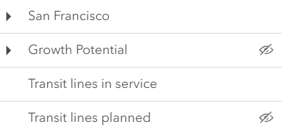 |
|
|
413
|
+
* | checkbox | Displays checkbox icons on the near side. See [check-square-f](https://developers.arcgis.com/calcite-design-system/icons/?icon=check-square-f&library=Calcite%20UI&query=check) and [square](https://developers.arcgis.com/calcite-design-system/icons/?icon=square&library=Calcite%20UI&query=square) calcite icons. | 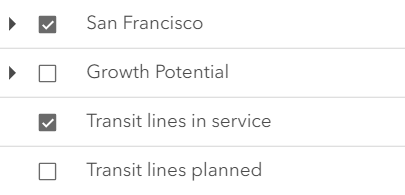 |
|
|
417
414
|
*
|
|
418
415
|
* @default "default"
|
|
419
416
|
* @since 4.29
|