dotted-map 0.1.0__tar.gz
This diff represents the content of publicly available package versions that have been released to one of the supported registries. The information contained in this diff is provided for informational purposes only and reflects changes between package versions as they appear in their respective public registries.
- dotted_map-0.1.0/.github/workflows/release.yml +24 -0
- dotted_map-0.1.0/.github/workflows/tests.yml +38 -0
- dotted_map-0.1.0/.gitignore +13 -0
- dotted_map-0.1.0/.readthedocs.yaml +19 -0
- dotted_map-0.1.0/CHANGELOG.md +9 -0
- dotted_map-0.1.0/CITATION.cff +41 -0
- dotted_map-0.1.0/LICENSE +28 -0
- dotted_map-0.1.0/PKG-INFO +85 -0
- dotted_map-0.1.0/README.md +60 -0
- dotted_map-0.1.0/docs/_static/custom.css +6 -0
- dotted_map-0.1.0/docs/_static/world.png +0 -0
- dotted_map-0.1.0/docs/api.rst +38 -0
- dotted_map-0.1.0/docs/conf.py +147 -0
- dotted_map-0.1.0/docs/guide.rst +342 -0
- dotted_map-0.1.0/docs/implementation.rst +99 -0
- dotted_map-0.1.0/docs/index.rst +62 -0
- dotted_map-0.1.0/docs/regions.rst +33 -0
- dotted_map-0.1.0/pyproject.toml +63 -0
- dotted_map-0.1.0/src/dotted_map/__init__.py +26 -0
- dotted_map-0.1.0/src/dotted_map/__main__.py +5 -0
- dotted_map-0.1.0/src/dotted_map/cli.py +274 -0
- dotted_map-0.1.0/src/dotted_map/core.py +589 -0
- dotted_map-0.1.0/src/dotted_map/data/countries.geojson.gz +0 -0
- dotted_map-0.1.0/src/dotted_map/data/land.geojson.gz +0 -0
- dotted_map-0.1.0/src/dotted_map/export.py +50 -0
- dotted_map-0.1.0/src/dotted_map/py.typed +0 -0
- dotted_map-0.1.0/src/dotted_map/regions.py +159 -0
- dotted_map-0.1.0/tests/test_cli.py +124 -0
- dotted_map-0.1.0/tests/test_export.py +68 -0
- dotted_map-0.1.0/tests/test_map.py +255 -0
- dotted_map-0.1.0/tests/test_regions.py +62 -0
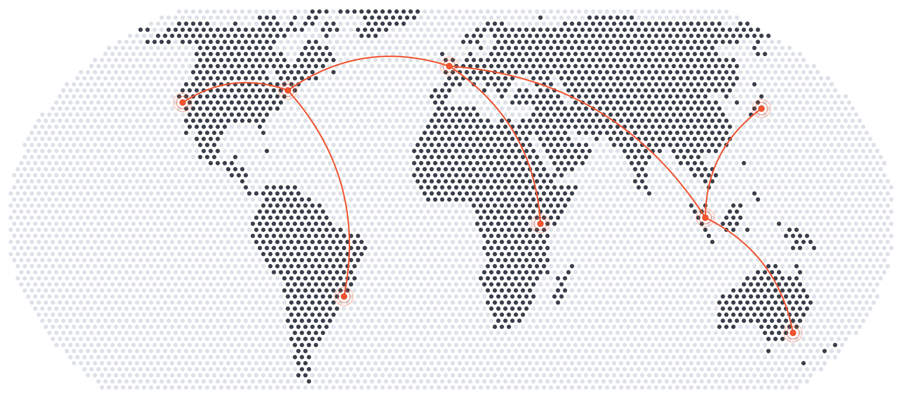
- dotted_map-0.1.0/tools/make_data.py +80 -0
- dotted_map-0.1.0/tools/showcase.py +38 -0
- dotted_map-0.1.0/uv.lock +1730 -0
|
@@ -0,0 +1,24 @@
|
|
|
1
|
+
# Publishes a release to PyPI when a tag such as v0.2.0 is pushed, by trusted
|
|
2
|
+
# publishing (no token is stored): on PyPI, the project's publisher is this
|
|
3
|
+
# repository, this workflow (release.yml) and the environment "pypi".
|
|
4
|
+
name: Release
|
|
5
|
+
|
|
6
|
+
on:
|
|
7
|
+
push:
|
|
8
|
+
tags: ["v*"]
|
|
9
|
+
|
|
10
|
+
jobs:
|
|
11
|
+
publish:
|
|
12
|
+
runs-on: ubuntu-latest
|
|
13
|
+
environment: pypi
|
|
14
|
+
permissions:
|
|
15
|
+
contents: read
|
|
16
|
+
id-token: write
|
|
17
|
+
steps:
|
|
18
|
+
- uses: actions/checkout@v7
|
|
19
|
+
- uses: astral-sh/setup-uv@68559e99cc807c1eb7e9238fd43a15bba460eec2 # v10.3.3
|
|
20
|
+
- name: The tag matches the version in pyproject.toml
|
|
21
|
+
run: test "v$(uv version --short)" = "$GITHUB_REF_NAME"
|
|
22
|
+
- run: uv run --locked pytest
|
|
23
|
+
- run: uv build
|
|
24
|
+
- run: uv publish --trusted-publishing always
|
|
@@ -0,0 +1,38 @@
|
|
|
1
|
+
name: Tests
|
|
2
|
+
|
|
3
|
+
on:
|
|
4
|
+
push:
|
|
5
|
+
pull_request:
|
|
6
|
+
|
|
7
|
+
jobs:
|
|
8
|
+
test:
|
|
9
|
+
runs-on: ubuntu-latest
|
|
10
|
+
strategy:
|
|
11
|
+
matrix:
|
|
12
|
+
python: ["3.10", "3.11", "3.12", "3.13", "3.14", "3.15"]
|
|
13
|
+
steps:
|
|
14
|
+
- uses: actions/checkout@v7
|
|
15
|
+
# rsvg-convert, and the Cairo library that CairoSVG needs, so that
|
|
16
|
+
# both converters are tested.
|
|
17
|
+
- run: sudo apt-get update && sudo apt-get install -y librsvg2-bin
|
|
18
|
+
- uses: astral-sh/setup-uv@68559e99cc807c1eb7e9238fd43a15bba460eec2 # v10.3.3
|
|
19
|
+
- run: uv run --locked --python ${{ matrix.python }} pytest
|
|
20
|
+
|
|
21
|
+
oldest:
|
|
22
|
+
# The oldest versions of the dependencies that pyproject.toml allows.
|
|
23
|
+
runs-on: ubuntu-latest
|
|
24
|
+
steps:
|
|
25
|
+
- uses: actions/checkout@v7
|
|
26
|
+
- uses: astral-sh/setup-uv@68559e99cc807c1eb7e9238fd43a15bba460eec2 # v10.3.3
|
|
27
|
+
- run: uv venv --python 3.10
|
|
28
|
+
# A block scalar, because ":all: " would end a plain YAML value.
|
|
29
|
+
- run: |
|
|
30
|
+
uv pip install --resolution lowest-direct --only-binary :all: -e . "pytest>=8"
|
|
31
|
+
- run: .venv/bin/python -m pytest tests
|
|
32
|
+
|
|
33
|
+
docs:
|
|
34
|
+
runs-on: ubuntu-latest
|
|
35
|
+
steps:
|
|
36
|
+
- uses: actions/checkout@v7
|
|
37
|
+
- uses: astral-sh/setup-uv@68559e99cc807c1eb7e9238fd43a15bba460eec2 # v10.3.3
|
|
38
|
+
- run: uv run --locked --python 3.14 --group docs sphinx-build -W --keep-going -b html docs docs/_build/html
|
|
@@ -0,0 +1,19 @@
|
|
|
1
|
+
# How Read the Docs builds the documentation at
|
|
2
|
+
# https://dotted-map.readthedocs.io/ (see
|
|
3
|
+
# https://docs.readthedocs.com/platform/stable/config-file/v2.html).
|
|
4
|
+
version: 2
|
|
5
|
+
|
|
6
|
+
build:
|
|
7
|
+
os: ubuntu-24.04
|
|
8
|
+
tools:
|
|
9
|
+
python: "3.14"
|
|
10
|
+
jobs:
|
|
11
|
+
# dotted-map with the docs dependency group of pyproject.toml, which
|
|
12
|
+
# needs pip 25.1 or later.
|
|
13
|
+
install:
|
|
14
|
+
- python -m pip install --upgrade pip
|
|
15
|
+
- python -m pip install . --group docs
|
|
16
|
+
|
|
17
|
+
sphinx:
|
|
18
|
+
configuration: docs/conf.py
|
|
19
|
+
fail_on_warning: true
|
|
@@ -0,0 +1,9 @@
|
|
|
1
|
+
# Changelog
|
|
2
|
+
|
|
3
|
+
## 0.1.0 (2026-11-15)
|
|
4
|
+
|
|
5
|
+
The first release: dotted maps of any area, in any projection, framed on,
|
|
6
|
+
highlighted by or restricted to countries, continents and subregions, with
|
|
7
|
+
pins and curved routes, drawn as SVG, PNG, PDF or JSON from Python or the
|
|
8
|
+
command line. It replaces the code of the scipython.com post
|
|
9
|
+
[Making a map out of dots](https://scipython.com/blog/making-a-map-out-of-dots/).
|
|
@@ -0,0 +1,41 @@
|
|
|
1
|
+
cff-version: 1.2.0
|
|
2
|
+
message: If you use this software, please cite it as below.
|
|
3
|
+
type: software
|
|
4
|
+
title: dotted-map
|
|
5
|
+
abstract: >-
|
|
6
|
+
Draw maps on which land is a regular lattice of dots, as SVG, PNG and PDF
|
|
7
|
+
images for graphic design and infographics.
|
|
8
|
+
authors:
|
|
9
|
+
- given-names: Christian
|
|
10
|
+
family-names: Hill
|
|
11
|
+
license: BSD-3-Clause
|
|
12
|
+
repository-code: "https://github.com/xnx/dotted-map"
|
|
13
|
+
url: "https://dotted-map.readthedocs.io"
|
|
14
|
+
keywords:
|
|
15
|
+
- cartography
|
|
16
|
+
- dotted map
|
|
17
|
+
- graphic design
|
|
18
|
+
- halftone
|
|
19
|
+
- map projection
|
|
20
|
+
references:
|
|
21
|
+
- type: data
|
|
22
|
+
title: Natural Earth
|
|
23
|
+
url: "https://www.naturalearthdata.com"
|
|
24
|
+
version: 5.1.2
|
|
25
|
+
authors:
|
|
26
|
+
- name: Natural Earth
|
|
27
|
+
- type: article
|
|
28
|
+
title: The Equal Earth map projection
|
|
29
|
+
authors:
|
|
30
|
+
- given-names: Bojan
|
|
31
|
+
family-names: Šavrič
|
|
32
|
+
- given-names: Tom
|
|
33
|
+
family-names: Patterson
|
|
34
|
+
- given-names: Bernhard
|
|
35
|
+
family-names: Jenny
|
|
36
|
+
journal: International Journal of Geographical Information Science
|
|
37
|
+
volume: 33
|
|
38
|
+
issue: 3
|
|
39
|
+
start: 454
|
|
40
|
+
year: 2019
|
|
41
|
+
doi: 10.1080/13658816.2018.1504949
|
dotted_map-0.1.0/LICENSE
ADDED
|
@@ -0,0 +1,28 @@
|
|
|
1
|
+
BSD 3-Clause License
|
|
2
|
+
|
|
3
|
+
Copyright (c) 2026, Christian Hill
|
|
4
|
+
|
|
5
|
+
Redistribution and use in source and binary forms, with or without
|
|
6
|
+
modification, are permitted provided that the following conditions are met:
|
|
7
|
+
|
|
8
|
+
1. Redistributions of source code must retain the above copyright notice, this
|
|
9
|
+
list of conditions and the following disclaimer.
|
|
10
|
+
|
|
11
|
+
2. Redistributions in binary form must reproduce the above copyright notice,
|
|
12
|
+
this list of conditions and the following disclaimer in the documentation
|
|
13
|
+
and/or other materials provided with the distribution.
|
|
14
|
+
|
|
15
|
+
3. Neither the name of the copyright holder nor the names of its
|
|
16
|
+
contributors may be used to endorse or promote products derived from
|
|
17
|
+
this software without specific prior written permission.
|
|
18
|
+
|
|
19
|
+
THIS SOFTWARE IS PROVIDED BY THE COPYRIGHT HOLDERS AND CONTRIBUTORS "AS IS"
|
|
20
|
+
AND ANY EXPRESS OR IMPLIED WARRANTIES, INCLUDING, BUT NOT LIMITED TO, THE
|
|
21
|
+
IMPLIED WARRANTIES OF MERCHANTABILITY AND FITNESS FOR A PARTICULAR PURPOSE ARE
|
|
22
|
+
DISCLAIMED. IN NO EVENT SHALL THE COPYRIGHT HOLDER OR CONTRIBUTORS BE LIABLE
|
|
23
|
+
FOR ANY DIRECT, INDIRECT, INCIDENTAL, SPECIAL, EXEMPLARY, OR CONSEQUENTIAL
|
|
24
|
+
DAMAGES (INCLUDING, BUT NOT LIMITED TO, PROCUREMENT OF SUBSTITUTE GOODS OR
|
|
25
|
+
SERVICES; LOSS OF USE, DATA, OR PROFITS; OR BUSINESS INTERRUPTION) HOWEVER
|
|
26
|
+
CAUSED AND ON ANY THEORY OF LIABILITY, WHETHER IN CONTRACT, STRICT LIABILITY,
|
|
27
|
+
OR TORT (INCLUDING NEGLIGENCE OR OTHERWISE) ARISING IN ANY WAY OUT OF THE USE
|
|
28
|
+
OF THIS SOFTWARE, EVEN IF ADVISED OF THE POSSIBILITY OF SUCH DAMAGE.
|
|
@@ -0,0 +1,85 @@
|
|
|
1
|
+
Metadata-Version: 2.5
|
|
2
|
+
Name: dotted-map
|
|
3
|
+
Version: 0.1.0
|
|
4
|
+
Summary: Draw maps on which land is a regular lattice of dots, as SVG, PNG or PDF images
|
|
5
|
+
Project-URL: Documentation, https://dotted-map.readthedocs.io
|
|
6
|
+
Project-URL: Repository, https://github.com/xnx/dotted-map
|
|
7
|
+
Project-URL: Issues, https://github.com/xnx/dotted-map/issues
|
|
8
|
+
Project-URL: Changelog, https://github.com/xnx/dotted-map/blob/main/CHANGELOG.md
|
|
9
|
+
Author: Christian Hill
|
|
10
|
+
License-Expression: BSD-3-Clause
|
|
11
|
+
License-File: LICENSE
|
|
12
|
+
Keywords: cartography,dots,graphic design,halftone,map,svg
|
|
13
|
+
Classifier: Intended Audience :: Science/Research
|
|
14
|
+
Classifier: Programming Language :: Python :: 3
|
|
15
|
+
Classifier: Topic :: Multimedia :: Graphics
|
|
16
|
+
Classifier: Topic :: Scientific/Engineering :: GIS
|
|
17
|
+
Classifier: Topic :: Scientific/Engineering :: Visualization
|
|
18
|
+
Requires-Python: >=3.10
|
|
19
|
+
Requires-Dist: numpy>=1.24
|
|
20
|
+
Requires-Dist: pyproj>=3.6
|
|
21
|
+
Requires-Dist: shapely>=2.0
|
|
22
|
+
Provides-Extra: cairo
|
|
23
|
+
Requires-Dist: cairosvg>=2.7; extra == 'cairo'
|
|
24
|
+
Description-Content-Type: text/markdown
|
|
25
|
+
|
|
26
|
+
# dotted-map
|
|
27
|
+
|
|
28
|
+
[](https://pypi.org/project/dotted-map/)
|
|
29
|
+
[](https://pypi.org/project/dotted-map/)
|
|
30
|
+
[](https://github.com/xnx/dotted-map/actions/workflows/tests.yml)
|
|
31
|
+
[](https://dotted-map.readthedocs.io/en/stable/)
|
|
32
|
+
|
|
33
|
+
Draw maps on which land is a regular lattice of dots, as SVG, PNG and PDF
|
|
34
|
+
images for graphic design and infographics.
|
|
35
|
+
|
|
36
|
+
|
|
37
|
+
|
|
38
|
+
The maps are drawn in an equal-area projection, or any other that
|
|
39
|
+
[PROJ](https://proj.org) supports, with coastlines found from the fraction of
|
|
40
|
+
each dot's cell that is land. The land and country outlines of
|
|
41
|
+
[Natural Earth](https://www.naturalearthdata.com) are built in, so a country,
|
|
42
|
+
continent or subregion can be named to frame the map, to highlight it or to
|
|
43
|
+
draw it alone. The documentation is at https://dotted-map.readthedocs.io.
|
|
44
|
+
|
|
45
|
+
## Command line
|
|
46
|
+
|
|
47
|
+
```console
|
|
48
|
+
$ dotted-map -o world.svg
|
|
49
|
+
$ dotted-map --region France --highlight 'France=#0055a4' --colour '#c5cad3' -o france.png
|
|
50
|
+
$ dotted-map --region Italy --only Italy --shape hexagon --halftone -o italy.pdf
|
|
51
|
+
$ dotted-map --region GBR IRL --pin London=-0.13,51.51 --pin Dublin=-6.26,53.35 --arc London Dublin -o uk.svg
|
|
52
|
+
$ dotted-map --projection '+proj=ortho +lon_0=-30 +lat_0=30' --sea '#dde1e8' -o globe.svg
|
|
53
|
+
$ dotted-map --list-regions
|
|
54
|
+
```
|
|
55
|
+
|
|
56
|
+
## Python
|
|
57
|
+
|
|
58
|
+
```python
|
|
59
|
+
from dotted_map import DottedMap
|
|
60
|
+
|
|
61
|
+
m = DottedMap(region="Japan", width=600, spacing=8)
|
|
62
|
+
m.add_pin(139.69, 35.69) # Tokyo.
|
|
63
|
+
m.save("japan.svg", colour="#bc002d", sea="#dde1e8", halftone=True)
|
|
64
|
+
|
|
65
|
+
data = m.to_dict() # Every dot, for use elsewhere.
|
|
66
|
+
```
|
|
67
|
+
|
|
68
|
+
Colours and sizes can be functions of longitude and latitude, for maps of
|
|
69
|
+
data.
|
|
70
|
+
|
|
71
|
+
## Installation
|
|
72
|
+
|
|
73
|
+
```console
|
|
74
|
+
$ pip install dotted-map
|
|
75
|
+
```
|
|
76
|
+
|
|
77
|
+
The dotted-map package needs Python 3.10 or later, NumPy, pyproj and Shapely.
|
|
78
|
+
PNG and PDF output also needs [CairoSVG](https://cairosvg.org)
|
|
79
|
+
(`pip install "dotted-map[cairo]"`) or the `rsvg-convert` program of
|
|
80
|
+
[librsvg](https://gitlab.gnome.org/GNOME/librsvg).
|
|
81
|
+
|
|
82
|
+
## Licence
|
|
83
|
+
|
|
84
|
+
BSD-3-Clause. The land and country outlines are made from Natural Earth's
|
|
85
|
+
1:50m data, which is in the public domain.
|
|
@@ -0,0 +1,60 @@
|
|
|
1
|
+
# dotted-map
|
|
2
|
+
|
|
3
|
+
[](https://pypi.org/project/dotted-map/)
|
|
4
|
+
[](https://pypi.org/project/dotted-map/)
|
|
5
|
+
[](https://github.com/xnx/dotted-map/actions/workflows/tests.yml)
|
|
6
|
+
[](https://dotted-map.readthedocs.io/en/stable/)
|
|
7
|
+
|
|
8
|
+
Draw maps on which land is a regular lattice of dots, as SVG, PNG and PDF
|
|
9
|
+
images for graphic design and infographics.
|
|
10
|
+
|
|
11
|
+

|
|
12
|
+
|
|
13
|
+
The maps are drawn in an equal-area projection, or any other that
|
|
14
|
+
[PROJ](https://proj.org) supports, with coastlines found from the fraction of
|
|
15
|
+
each dot's cell that is land. The land and country outlines of
|
|
16
|
+
[Natural Earth](https://www.naturalearthdata.com) are built in, so a country,
|
|
17
|
+
continent or subregion can be named to frame the map, to highlight it or to
|
|
18
|
+
draw it alone. The documentation is at https://dotted-map.readthedocs.io.
|
|
19
|
+
|
|
20
|
+
## Command line
|
|
21
|
+
|
|
22
|
+
```console
|
|
23
|
+
$ dotted-map -o world.svg
|
|
24
|
+
$ dotted-map --region France --highlight 'France=#0055a4' --colour '#c5cad3' -o france.png
|
|
25
|
+
$ dotted-map --region Italy --only Italy --shape hexagon --halftone -o italy.pdf
|
|
26
|
+
$ dotted-map --region GBR IRL --pin London=-0.13,51.51 --pin Dublin=-6.26,53.35 --arc London Dublin -o uk.svg
|
|
27
|
+
$ dotted-map --projection '+proj=ortho +lon_0=-30 +lat_0=30' --sea '#dde1e8' -o globe.svg
|
|
28
|
+
$ dotted-map --list-regions
|
|
29
|
+
```
|
|
30
|
+
|
|
31
|
+
## Python
|
|
32
|
+
|
|
33
|
+
```python
|
|
34
|
+
from dotted_map import DottedMap
|
|
35
|
+
|
|
36
|
+
m = DottedMap(region="Japan", width=600, spacing=8)
|
|
37
|
+
m.add_pin(139.69, 35.69) # Tokyo.
|
|
38
|
+
m.save("japan.svg", colour="#bc002d", sea="#dde1e8", halftone=True)
|
|
39
|
+
|
|
40
|
+
data = m.to_dict() # Every dot, for use elsewhere.
|
|
41
|
+
```
|
|
42
|
+
|
|
43
|
+
Colours and sizes can be functions of longitude and latitude, for maps of
|
|
44
|
+
data.
|
|
45
|
+
|
|
46
|
+
## Installation
|
|
47
|
+
|
|
48
|
+
```console
|
|
49
|
+
$ pip install dotted-map
|
|
50
|
+
```
|
|
51
|
+
|
|
52
|
+
The dotted-map package needs Python 3.10 or later, NumPy, pyproj and Shapely.
|
|
53
|
+
PNG and PDF output also needs [CairoSVG](https://cairosvg.org)
|
|
54
|
+
(`pip install "dotted-map[cairo]"`) or the `rsvg-convert` program of
|
|
55
|
+
[librsvg](https://gitlab.gnome.org/GNOME/librsvg).
|
|
56
|
+
|
|
57
|
+
## Licence
|
|
58
|
+
|
|
59
|
+
BSD-3-Clause. The land and country outlines are made from Natural Earth's
|
|
60
|
+
1:50m data, which is in the public domain.
|
|
Binary file
|
|
@@ -0,0 +1,38 @@
|
|
|
1
|
+
*************
|
|
2
|
+
API reference
|
|
3
|
+
*************
|
|
4
|
+
|
|
5
|
+
These names can be imported from ``dotted_map``.
|
|
6
|
+
|
|
7
|
+
.. currentmodule:: dotted_map
|
|
8
|
+
|
|
9
|
+
Maps
|
|
10
|
+
====
|
|
11
|
+
|
|
12
|
+
.. autoclass:: DottedMap
|
|
13
|
+
:members: svg, save, to_dict, add_pin, add_arc, nearest, lonlat_to_px,
|
|
14
|
+
px_to_lonlat
|
|
15
|
+
|
|
16
|
+
.. autofunction:: auto_projection
|
|
17
|
+
|
|
18
|
+
.. data:: WORLD
|
|
19
|
+
|
|
20
|
+
The extent of the whole world, ``(-180, 180, -90, 90)``.
|
|
21
|
+
|
|
22
|
+
Regions and land
|
|
23
|
+
================
|
|
24
|
+
|
|
25
|
+
.. autofunction:: region
|
|
26
|
+
|
|
27
|
+
.. autofunction:: countries
|
|
28
|
+
|
|
29
|
+
.. autoclass:: Country
|
|
30
|
+
|
|
31
|
+
.. autofunction:: land
|
|
32
|
+
|
|
33
|
+
.. autofunction:: read_geojson
|
|
34
|
+
|
|
35
|
+
Errors
|
|
36
|
+
======
|
|
37
|
+
|
|
38
|
+
.. autoexception:: ExportError
|
|
@@ -0,0 +1,147 @@
|
|
|
1
|
+
# conf.py
|
|
2
|
+
# Configuration for the Sphinx documentation of dotted-map.
|
|
3
|
+
#
|
|
4
|
+
# SPDX-License-Identifier: BSD-3-Clause
|
|
5
|
+
|
|
6
|
+
import contextlib
|
|
7
|
+
import io
|
|
8
|
+
import os
|
|
9
|
+
import shlex
|
|
10
|
+
import sys
|
|
11
|
+
from pathlib import Path
|
|
12
|
+
|
|
13
|
+
from docutils import nodes
|
|
14
|
+
from docutils.parsers.rst import directives
|
|
15
|
+
from docutils.statemachine import StringList
|
|
16
|
+
from sphinx.util.docutils import SphinxDirective
|
|
17
|
+
|
|
18
|
+
import dotted_map
|
|
19
|
+
from dotted_map.cli import main
|
|
20
|
+
|
|
21
|
+
project = "dotted-map"
|
|
22
|
+
author = "Christian Hill"
|
|
23
|
+
copyright = "2026, Christian Hill"
|
|
24
|
+
release = dotted_map.__version__
|
|
25
|
+
version = ".".join(release.split(".")[:2])
|
|
26
|
+
|
|
27
|
+
extensions = ["sphinx.ext.autodoc", "sphinx.ext.napoleon"]
|
|
28
|
+
autodoc_member_order = "bysource"
|
|
29
|
+
napoleon_numpy_docstring = False
|
|
30
|
+
default_role = "py:obj"
|
|
31
|
+
exclude_patterns = ["_build"]
|
|
32
|
+
|
|
33
|
+
html_theme = "furo"
|
|
34
|
+
html_title = f"dotted-map {release}"
|
|
35
|
+
html_static_path = ["_static"]
|
|
36
|
+
html_css_files = ["custom.css"]
|
|
37
|
+
|
|
38
|
+
# The pictures, the table of regions and the command-line help are made by
|
|
39
|
+
# the package itself whenever the documentation is built, so that they
|
|
40
|
+
# always match the code.
|
|
41
|
+
GENERATED = Path(__file__).parent / "_generated"
|
|
42
|
+
GENERATED.mkdir(exist_ok=True)
|
|
43
|
+
|
|
44
|
+
|
|
45
|
+
def _write(name, text):
|
|
46
|
+
(GENERATED / name).write_text(text, encoding="utf-8")
|
|
47
|
+
|
|
48
|
+
|
|
49
|
+
class _Example(SphinxDirective):
|
|
50
|
+
"""Show an example and the picture it draws, as name.svg.
|
|
51
|
+
|
|
52
|
+
The content is run, so the picture always matches it."""
|
|
53
|
+
|
|
54
|
+
required_arguments = 1
|
|
55
|
+
has_content = True
|
|
56
|
+
option_spec = {"alt": directives.unchanged_required}
|
|
57
|
+
|
|
58
|
+
def run(self):
|
|
59
|
+
name = self.arguments[0]
|
|
60
|
+
lines = [line.rstrip() for line in self.content]
|
|
61
|
+
self.draw(name, lines)
|
|
62
|
+
if not (GENERATED / f"{name}.svg").exists():
|
|
63
|
+
raise self.error(f"the example did not write {name}.svg")
|
|
64
|
+
rst = [f".. code-block:: {self.language}", ""]
|
|
65
|
+
rst += [" " + line for line in self.display(name, lines)]
|
|
66
|
+
rst += ["", f".. image:: /_generated/{name}.svg",
|
|
67
|
+
" :class: dotted-map-example",
|
|
68
|
+
f" :alt: {self.options['alt']}", ""]
|
|
69
|
+
node = nodes.container()
|
|
70
|
+
self.state.nested_parse(StringList(rst), self.content_offset, node)
|
|
71
|
+
return node.children
|
|
72
|
+
|
|
73
|
+
|
|
74
|
+
class CommandExample(_Example):
|
|
75
|
+
"""A dotted-map command; the content is its arguments, apart from -o.
|
|
76
|
+
|
|
77
|
+
.. dotted-map:: italy
|
|
78
|
+
:alt: Italy, drawn in green hexagons.
|
|
79
|
+
|
|
80
|
+
--region Italy --only Italy --shape hexagon --colour '#009246'
|
|
81
|
+
"""
|
|
82
|
+
|
|
83
|
+
language = "console"
|
|
84
|
+
|
|
85
|
+
def draw(self, name, lines):
|
|
86
|
+
args = shlex.split(" ".join(line.rstrip("\\") for line in lines))
|
|
87
|
+
with contextlib.redirect_stderr(io.StringIO()) as messages:
|
|
88
|
+
status = main([*args, "-o", str(GENERATED / f"{name}.svg")])
|
|
89
|
+
if status:
|
|
90
|
+
raise self.error(f"dotted-map exited with status {status}: "
|
|
91
|
+
f"{messages.getvalue()}")
|
|
92
|
+
|
|
93
|
+
def display(self, name, lines):
|
|
94
|
+
lines = [f"$ dotted-map {lines[0]}"] + [f" {line.lstrip()}"
|
|
95
|
+
for line in lines[1:]]
|
|
96
|
+
lines[-1] += f" -o {name}.svg"
|
|
97
|
+
return lines
|
|
98
|
+
|
|
99
|
+
|
|
100
|
+
class PythonExample(_Example):
|
|
101
|
+
"""Python code that saves a map as name.svg."""
|
|
102
|
+
|
|
103
|
+
language = "python"
|
|
104
|
+
|
|
105
|
+
def draw(self, name, lines):
|
|
106
|
+
with contextlib.chdir(GENERATED):
|
|
107
|
+
exec("\n".join(lines), {"__name__": "example"})
|
|
108
|
+
|
|
109
|
+
def display(self, name, lines):
|
|
110
|
+
return lines
|
|
111
|
+
|
|
112
|
+
|
|
113
|
+
def setup(app):
|
|
114
|
+
app.add_directive("dotted-map", CommandExample)
|
|
115
|
+
app.add_directive("dotted-map-python", PythonExample)
|
|
116
|
+
|
|
117
|
+
|
|
118
|
+
# The picture on the front page, which is also in the README.
|
|
119
|
+
sys.path.insert(0, str(Path(__file__).parent.parent / "tools"))
|
|
120
|
+
from showcase import STYLE, world # noqa: E402
|
|
121
|
+
|
|
122
|
+
_write("world.svg", world().svg(**STYLE))
|
|
123
|
+
|
|
124
|
+
# The table of the countries that can be named.
|
|
125
|
+
_rows = [".. list-table::", " :header-rows: 1", "",
|
|
126
|
+
" * - Code", " - ISO alpha-2", " - Name",
|
|
127
|
+
" - Continent", " - Subregion"]
|
|
128
|
+
for _c in dotted_map.countries():
|
|
129
|
+
_rows += [f" * - ``{_c.code}``",
|
|
130
|
+
f" - ``{_c.iso_a2}``" if _c.iso_a2 else " -",
|
|
131
|
+
f" - {_c.name}", f" - {_c.continent}",
|
|
132
|
+
f" - {_c.subregion}"]
|
|
133
|
+
_write("countries.inc", "\n".join(_rows) + "\n")
|
|
134
|
+
_write("groups.inc", "\n".join([
|
|
135
|
+
"**Continents:** " + ", ".join(sorted(
|
|
136
|
+
{c.continent for c in dotted_map.countries()})) + ".",
|
|
137
|
+
"",
|
|
138
|
+
"**Subregions:** " + ", ".join(sorted(
|
|
139
|
+
{c.subregion for c in dotted_map.countries()})) + ".", ""]))
|
|
140
|
+
|
|
141
|
+
# The command-line help.
|
|
142
|
+
os.environ["COLUMNS"] = "79"
|
|
143
|
+
os.environ["NO_COLOR"] = "1"
|
|
144
|
+
_help = io.StringIO()
|
|
145
|
+
with contextlib.redirect_stdout(_help), contextlib.suppress(SystemExit):
|
|
146
|
+
main(["--help"])
|
|
147
|
+
_write("help.txt", _help.getvalue())
|