volt-osmaps 0.1.0 → 0.1.5
This diff represents the content of publicly available package versions that have been released to one of the supported registries. The information contained in this diff is provided for informational purposes only and reflects changes between package versions as they appear in their respective public registries.
- checksums.yaml +4 -4
- data/README.md +23 -3
- data/app/osmaps/controllers/main_controller.rb +6 -2
- data/app/osmaps/controllers/marker_controller.rb +12 -0
- data/app/osmaps/controllers/polygon_controller.rb +12 -0
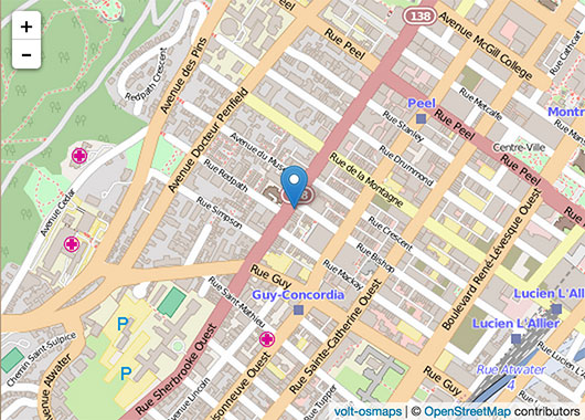
- data/app/osmaps/example.jpg +0 -0
- data/app/osmaps/views/main/index.html +1 -1
- data/app/osmaps/views/marker/index.html +3 -0
- data/app/osmaps/views/polygon/index.html +3 -0
- data/lib/volt/osmaps/version.rb +1 -1
- metadata +7 -2
checksums.yaml
CHANGED
|
@@ -1,7 +1,7 @@
|
|
|
1
1
|
---
|
|
2
2
|
SHA1:
|
|
3
|
-
metadata.gz:
|
|
4
|
-
data.tar.gz:
|
|
3
|
+
metadata.gz: 5172d71483306b4b43330eae6db44286c051221a
|
|
4
|
+
data.tar.gz: 303016bdb6da60edd5be61f484a6924f8979d3da
|
|
5
5
|
SHA512:
|
|
6
|
-
metadata.gz:
|
|
7
|
-
data.tar.gz:
|
|
6
|
+
metadata.gz: 78a4e37ab30534bbc3b74e84a7e8bb8931cea53778875b2ac1948dbad38363941e6b64a8a206c96b65fe937b427f2649a4a9a59026d5cf3569eb6a92e3a7ddd1
|
|
7
|
+
data.tar.gz: cd58a559f1ba0f2b6fac19adead8667253a607a9ea79eb1d0f69ddb51c3512bb3939e9847d820428c3edfc6fcb11a7c2f14d328db6a124e2b20beb17f2ce3669
|
data/README.md
CHANGED
|
@@ -18,13 +18,33 @@ Or install it yourself as:
|
|
|
18
18
|
|
|
19
19
|
## Usage
|
|
20
20
|
|
|
21
|
+
### Map
|
|
22
|
+
|
|
21
23
|
Typical Usage to add a map with a marker:
|
|
22
24
|
|
|
23
|
-
<:osmaps height="380px" latitude="{{ latitude }}" longitude="{{ longitude }}"
|
|
25
|
+
<:osmaps height="380px" latitude="{{ latitude }}" longitude="{{ longitude }}" />
|
|
26
|
+
|
|
27
|
+
Options
|
|
28
|
+
* title to show a marker at the center of the map. On click, a popup will show title
|
|
29
|
+
* zoom is a numeric option. Default is 15
|
|
30
|
+
|
|
31
|
+
With the option title given, it will show a map as such:
|
|
32
|
+
|
|
33
|
+
|
|
34
|
+
|
|
35
|
+
You will need a geocoder if you only have a street address instead of the latitude, longitude coordinates.
|
|
36
|
+
|
|
37
|
+
### Adding a marker
|
|
38
|
+
|
|
39
|
+
After you have set a <:osmaps />, you can add markers and polygons:
|
|
40
|
+
|
|
41
|
+
<:osmaps:marker latitude="{{ latitude }}" longitude="{{ longitude }}" title="{{ title }}"/>
|
|
42
|
+
|
|
43
|
+
### Polygon
|
|
24
44
|
|
|
25
|
-
|
|
45
|
+
An array of lat,long coordinates will draw a polygon layer on the map. For example:
|
|
26
46
|
|
|
27
|
-
|
|
47
|
+
<:osmaps:polygon LatLongArray="[[51.509, -0.08],[51.503, -0.06],[51.51, -0.047]]" />
|
|
28
48
|
|
|
29
49
|
## Contributing
|
|
30
50
|
|
|
@@ -3,10 +3,14 @@ module Osmaps
|
|
|
3
3
|
def index
|
|
4
4
|
end
|
|
5
5
|
|
|
6
|
-
def map(latitude, longitude,
|
|
6
|
+
def map(latitude, longitude, opts = {})
|
|
7
7
|
`var osmUrl = 'http://{s}.tile.openstreetmap.org/{z}/{x}/{y}.png',osmAttrib = '© <a href="http://openstreetmap.org/copyright">OpenStreetMap</a> contributors',osm = L.tileLayer(osmUrl, {maxZoom: 18, attribution: osmAttrib});`
|
|
8
|
+
zoom = opts[:zoom] || 15
|
|
8
9
|
`var map = L.map('osmaps').setView([latitude, longitude], 15).addLayer(osm);`
|
|
9
|
-
|
|
10
|
+
if opts[:title]
|
|
11
|
+
`L.marker([ latitude, longitude]).addTo(map).bindPopup(title);`
|
|
12
|
+
end
|
|
13
|
+
`L.control.scale( {imperial: false} )`
|
|
10
14
|
return nil
|
|
11
15
|
end
|
|
12
16
|
|
|
Binary file
|
data/lib/volt/osmaps/version.rb
CHANGED
metadata
CHANGED
|
@@ -1,14 +1,14 @@
|
|
|
1
1
|
--- !ruby/object:Gem::Specification
|
|
2
2
|
name: volt-osmaps
|
|
3
3
|
version: !ruby/object:Gem::Version
|
|
4
|
-
version: 0.1.
|
|
4
|
+
version: 0.1.5
|
|
5
5
|
platform: ruby
|
|
6
6
|
authors:
|
|
7
7
|
- heri
|
|
8
8
|
autorequire:
|
|
9
9
|
bindir: bin
|
|
10
10
|
cert_chain: []
|
|
11
|
-
date: 2015-09-
|
|
11
|
+
date: 2015-09-21 00:00:00.000000000 Z
|
|
12
12
|
dependencies:
|
|
13
13
|
- !ruby/object:Gem::Dependency
|
|
14
14
|
name: volt
|
|
@@ -218,7 +218,12 @@ files:
|
|
|
218
218
|
- app/osmaps/config/initializers/boot.rb
|
|
219
219
|
- app/osmaps/config/routes.rb
|
|
220
220
|
- app/osmaps/controllers/main_controller.rb
|
|
221
|
+
- app/osmaps/controllers/marker_controller.rb
|
|
222
|
+
- app/osmaps/controllers/polygon_controller.rb
|
|
223
|
+
- app/osmaps/example.jpg
|
|
221
224
|
- app/osmaps/views/main/index.html
|
|
225
|
+
- app/osmaps/views/marker/index.html
|
|
226
|
+
- app/osmaps/views/polygon/index.html
|
|
222
227
|
- lib/volt/osmaps.rb
|
|
223
228
|
- lib/volt/osmaps/version.rb
|
|
224
229
|
- spec/dummy/.gitignore
|